Maps of the United States

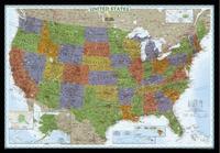
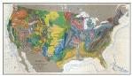
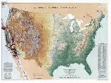
We stock a huge selection of USA Maps, from 6-foot USA wall maps to specialty maps of the states to city street maps. The links below will take you to various types of maps of the USA that we carry.

Would you like recommendations? Just call or e-mail us - our experienced staff can offer recommendations for just about any type of map that you might want.

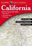
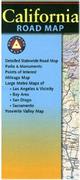
  • U.S. State Maps - a listing of all of our city street maps and road maps for each state.


USA Wall Maps

 
USA National
&
Regional Folded Travel Maps

  • USA Wall Maps by National Geographic. Classic and colorful wall maps from National Geographic.
  • USA Wall Map by Imus Geographic. An attractive new style of physical/political road map.
  • USA Wall Map by Michelin. Classic wall map by this famous map maker.
  • USA Wall Maps by Interarts/Magna Carta. Printed on waterproof, tear-resistant tyvek(r)
  • USA Wall Maps by Rand McNally. Classic wall maps by this iconic map publisher.
  • USA Wall Map by Dino's Maps. Colorful kids' maps of the USA.
  • USA Wall Map by Raven Maps. Colorful physical maps of the USA.
  • USA Railroad Maps.
  • North America Wall Maps.

  • USA Distomap
  • Folded road maps of the entire USA. Includes maps of the entire USA by Michelin, Rand McNally, and Hema.
  • Regional maps of the USA by Rand McNally
  • Regional maps of the USA by Michelin
  • Regional maps of the USA by Reise
  • Regional maps of the USA by Hallwag
  • Regional maps of the USA by Hema
  • Regional motorcyle maps of the USA by MadMaps


USA Road Atlases
&
State Road Atlases


State-by-State Road
&
City Map Listings

  • Road Atlases - road atlases of the USA.
  • DeLorme Road Atlases - road atlases of the various states. The best!
 

  • U.S. State Maps - a listing of all of our city and road maps and guides for each state.

 
USA Topographic Maps


USA Digital Maps

  • USGS Topographic Maps. USGS topographic maps of the entire USA.
  • U.S. Forest Service Maps. Hiking/topographic maps of the National Forests.

  • Digital topographic maps for each state in the USA from National Geographic/Trails Illustrated/TOPO!.
  • Digital regional road maps by Reise Know-How


USA Long Distance Hiking
&
Cycling Trails


USA National Park Maps

USA Long Distance Hiking Trails Maps & Guides

  • Appalachian Trail Guides & Maps. Maps of the Appalachians and Lake Superior.
  • Blue Ridge Parkway Maps.
  • Continental Divide Trail & Great Divide Trail Guides & Maps.
  • Pacific Crest Trail guides and maps.

USA Cycling Maps & Guides

  • North America & USA Cycling Guidebooks.
  • Adventure Cycling Association. Long distance bike routes and mountain biking trail maps for many parts of the USA.
  • American Bike Trails Maps. Road, bike trail, and mountain bike routes for several midwestern states.

  • Earthwalk Press Hiking Maps. Waterproof maps covering the western National Parks and natural areas.
  • Tom Harrison Hiking Maps. Waterproof hiking maps for California: Sierra Nevada, state parks, desert areas, and southern California hiking areas.
  • Trails Illustrated/National Geographic Maps National Park & Recreation Series. Waterproof hiking, mountain biking, skiing, and other series.
  • U.S.G.S. National Park Topographic Maps.
  • Canadian National Park Topographic Maps.
  • Geologic Maps of the National Parks.

 
USA Specialty Maps


USA Historical Maps

  • NPR Map. Great map that shows the locations, frequencies and call signs of NPR stations throughout the USA.
  • Baseball Map. Great maps that show the locations of all of the minor and major league parks.
  • Universities & Colleges Map. Shows the locations of all the universities and colleges in the USA.
  • USA Air Travel Map.
  • Wine Maps for California, Oregon and Washington.
  • Lake-Bottom & River Fishing Maps. - lake bottom maps by Fishing Hot Spots, Fish-n-Map, Kingfisher, and A.I.D. Maps.
  • Bicycling Maps of the USA and Europe.
  • 3-D Bird's-Eye Views of USA cities from MapPoster and Spaceshots, including the popular WTC Manhattan poster.
  • USA Brewpubs Maps. Map series showing locations of brewpubs throughout the USA
  • Maps of Dinosaur Locaties in the USA.
  • Maps of the Missions of the western USA
  • Maps of the Volcanoes of the western USA

  • Historic Maps of the USA. - reproductions of historic maps from 300 years of US history, from a 1702 world map to maps of WWII.
  • Civil War Battlefield Maps. - a new series of civil war maps with information overprinted on topographic maps.
  • Mid-Atlantic Shipwreck Charts. Shipwreck charts for South Carolina to New Jersey.
  • Maps of US Indian Lands & Indian History.

 
USA Thematic Maps


USA Earthquake
&
Seismicity Maps

  • United States Thematic Maps - geology and geophysical maps of the USA and major regions.
 

  • United States Earthquake & Seismicity maps - shows locations of earthquakes and faults in various states.


State-by-state Map Listings

USA Regional Listings
  • For Guam and other US possessions in the Pacific please see our International listings.
States & Territories.
  • Alabama
  • Alaska
  • Arizona
  • Arkansas
  • California
  • Colorado
  • Connecticut
  • Delaware
  • District of Columbia
  • Florida
  • Georgia
  • Hawaii
  • Idaho
  • Illinois
  • Indiana
  • Iowa
  • Kansas
  • Kentucky
  • Louisiana
  • Maine
  • Maryland
  • Massachusetts
  • Michigan
  • Minnesota
  • Mississippi
  • Missouri
  • Montana
  • Nebraska
  • Nevada
  • New Hampshire
  • New Jersey
  • New Mexico
  • New York
  • North Carolina
  • North Dakota
  • Ohio
  • Oklahoma
  • Oregon
  • Pennsylvania
  • Puerto Rico
  • Rhode Island
  • South Carolina
  • South Dakota
  • Tennessee
  • Texas
  • Utah
  • Vermont
  • Virginia
  • Washington
  • West Virginia
  • Wisconsin
  • Wyoming


United States Digital Road Maps


Digital topographic maps
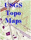
USGS Topo Maps on CD-Rom. All 1:24,000 topos for a given state in a single cd-rom package!
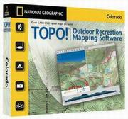
  • Topo! Digital Topographic Maps of States and Regions. Trails Illustrated/National Geographic Maps offers superb detailed digital 1:24,000 topo maps on cd-rom with numerous add-on features for hiking, etc. Click on the link to the left for the complete listings.

  •  

    New England digital mapDownloadable digital maps!
    New England Digital Road Map. 1:600,000. Reise Know-How. This map combines topographic mapping with road and tourist detail. The road information is clear and elevation is shown using contours, spot heights and altitude shading. The map shows six different types of roads, highlighting scenic routes, places of interest, archaeological sites, monasteries, monuments, police stations, railroads, and viewpoints.

    Digital versions available for immediate download! Digital versions are available for Compe-GPS, Fugawi, OziExplorer, and Touratech-Quo Vadis, for use with a PocketPC or a PC and a GPS.

    NOTE: You must own/buy the basic GPS software program for any of these packages - they do not come with run-time software.
    Ordering New England for Compe-GPS62-20955-5CImmediate download digital version for Compe-GPS.$21.99
    Ordering New England for Fugawi62-20955-5FImmediate download digital version for Fugawi.$21.99
    Ordering New England for Oziexplorer62-20955-5OImmediate download digital version for OziExplorer.$21.99
    Ordering New England for TouratechQV62-20955-5TImmediate download digital version for Touratech QV. $21.99


    Northwest USA digital map
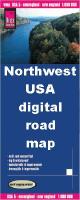
Downloadable digital maps!
    Northwest USA Digital Road Map. 1:750,000. Reise Know-How. This map combines topographic mapping with road and tourist detail. The road information is clear and elevation is shown using contours, spot heights and altitude shading. The map shows six different types of roads, highlighting scenic routes, places of interest, archaeological sites, monasteries, monuments, police stations, railroads, and viewpoints.

    Digital versions available for immediate download! Digital versions are available for Compe-GPS, Fugawi, OziExplorer, and Touratech, for use with a PocketPC or a PC and a GPS.

    NOTE: You must own/buy the basic GPS software program for any of these packages - they do not come with run-time software.
    Ordering NW USA for Compe-GPS62-20955-1CImmediate download digital version for Compe-GPS.$21.99
    Ordering NW USA for Fugawi62-20955-1FImmediate download digital version for Fugawi.$21.99
    Ordering NW USA for Oziexplorer62-20955-1OImmediate download digital version for OziExplorer.$21.99
    Ordering NW USA for PathAway62-20955-1TImmediate download digital version for Touratech.$21.99


    image


    © Copyright 2025 East View Companies, Inc.
    5130 Industrial Street, Suite 100, Maple Plain, MN 55359-8005
    All Rights Reserved
    For more information please Contact Us