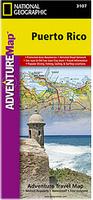
Puerto Rico Travel Map. Scale 1:125,000. National Geographic Maps. The Puerto Rico map contains detailed topographic information, plus useful traveling tips, and regional information. The front includes two inset maps of San Juan. National parks and preserves are clearly marked. With latitude/longitude tick marks and a UTM grid. Printed on waterproof, tear-resistant material, and contains the navigation aids necessary for backcountry use with GPS or compass. Base cartography by Reise Know-How. Size is 27 x 39".
Sample detail of the Puerto Rico travel map
$11.99
63-03907
1 sheet, folded
Puerto Rico & U.S. Virgin Islands Road Map. 1:190,000 / 1:50,000. ITMB. A physical relief/road map with altitude tinting and spot heights to show elevation. The road network is shown, including roads, tracks, railroads and ferry routes. Points of interest such as national parks, protected areas, urban areas and military reserves are shown. Symbols are used to denote tourist information offices, points of interest, hospitals, public beaches, golf courses and snorkelling areas.
Small inset maps are included for San Juan, Viejo San Juan Mayaguez, Arecibo, Aguadilla and Ponce. The map has a 7.5' latitude-longitude grid. Map size is 99 x 69 cm.
$11.95
63-03902
1 sheet, folded.
Puerto Rico Road Map & San Juan City Map. MetroData, 2011. This map has a detailed map for the San Juan Metropolitan area - including state & local highways, as well as local roads and streets, and points of interest. A detailed Old San Juan map with clearly identified points of interest. The reverse has a smaller map of Puerto Rico, which shows all state and local highways in Puerto Rico, along with clearly identified rivers, lakes, national parks, points of interest, airports, and more. This side also contains a list of suggested places to have fun around the Island, including showing the location on the map and including website references where available.
This side also has inset city-center maps for the cities of Aguadilla, Arecibo, Caguas, Carolina, Mayaguez and Ponce. Full color, size is 25 x 38 inches unfolded.
We stock all USGS topographic maps of Puerto Rico at all available scales.
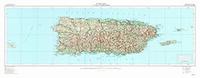
Puerto Rico 1:250,000 Topographic Maps. 1:250,000. NGA/NIMA (JOG series). This two-sheet map, produced by the US Military, gives better and more current detail than the single sheet map above.
$24.00
67-10581-NE1908
JOG 1:250,000 topo NE-19-08. San Juan, Puerto Rico.
$24.00
67-10581-NE2005
JOG 1:250,000 topo NE-20-05. Fajarado, Pierto Rico.
Puerto Rico Wall Map
Puerto Rico Topographic Map. 1:250,000. USGS. These maps are flat wall maps, more attractive than the two-sheet map listed below.
$11.95
PR-0049
Puerto Rico Contoured topographic map. 1:240,000. 1952. 24 x 66 inches.
$11.95
PR-0052
Base map. 1:240,000.
$19.95
63-0350L
1:240,000 Topographic map, laminated
Puerto Rico Antique-style Wall Map. 33 x 19".
With four million people living on 3,515 square miles, Puerto Rico has a population density of almost eleven hundred people per square mile. Residents live on a lush island with rain forests, mountain ranges, and broad white beaches. The capital city, San Juan, is a favorite of US tourists and foreign investors. Puerto Rico's economy, once dependent on sugar and coffee, is now based on manufacturing. Food processing, electrical equipment and tourism are major industries.
$25.00
63-0347
1 sheet, rolled.
$275.00
63-0347D
Deluxe frame
$224.99
63-0347S
Standard frame
Puerto Rico Geological Maps
Puerto Rico Metallogenic Map. 1:240,000. 1973. USGS (I-721). With 6-page explanatory booklet. Map size is 83 x 133 cm.


 Waterproof!
 Sample detail of the Puerto Rico travel map


 Caribbean N.F. map coverage
 Thumbnail of the front of the map.
 Thumbnail of the reverse of the map
 Detail from the map.
 Thumbnail of the front of the Puerto Rico Fish card.
 Thumbnail of the reverse of the Puerto Rico Fish card.


 Puerto Rico Flags