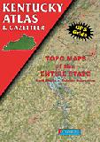
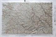
Kentucky Topographic Atlas & Gazetteer. DeLorme. Excellent atlas using USGS topographic maps. Ideal for hikers or backroad enthusiasts.
A sample from the Maine atlas.
$29.95
62-6948
Atlas
Kentucky Road Maps - Paper Maps.
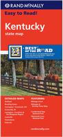
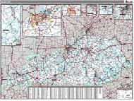
Kentucky Road Map - Paper Map. Rand McNally. Rand McNally's Easy To Read State Folded Map is a must-have for anyone traveling in and around Kentucky, offering unbeatable accuracy and reliability at a great price. The map shows all Interstate, U.S., state, and county highways, along with clearly indicated parks, points of interest, airports, county boundaries, and streets. The map includes inset city maps of Ashland, Bowling Green, Covington/Cincinnati, OH; Cumberland Gap National Park, Evansville, IN; Lexington/Frankfort & the Bluegrass Region, Louisville, Mammoth Cave National Park, Owensboro, and Paducah. Map size is 28 x 40 inches unfolded.
$7.99
62-6990
1 sheet, folded.
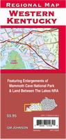
Western Kentucky Road Map - Paper Map. GM Johnson. A detailed road map of western half of Kentucky, covering west of Interstate 65. Coverage includes Mammoth Cave National Park, Land Between the Lakes NRA, etc.
$6.95
62-69909
1 sheet, folded.
Kentucky Road Maps - Laminated Maps.
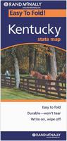
Laminated Kentucky Easyfinder™ Road Map - Laminated Map. Rand McNally. The durable and convenient Kentucky EasyToFold state map will take all the wear and tear your journey can dish out. The heavy-duty laminated design allows you to mark your route, make notes, then wipe the surface clean for further use. Map size is 18 x 17 inches unfolded.
$9.99
62-69902
1 sheet, folded.
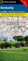
Waterproof Kentucky Destination Road Map - Laminated Map. National Geographic Maps. The front side is an easy-to-read road map with insets of: - Covington, KY / Cincinnati, OH - Land Between the Lakes - Owensboro - Bowling Green - Frankfort The back includes: - Maps and information for Louisville and Lexington - Points of interest - Information for Mammoth Cave National Park - Scenic drive - Park Service sites for Kentucky.
Thumbnail of the front of the Kentucky map. Sample detail of the Kentucky map.
Ashland, KY & Huntington, WV city map. (Universal).
$6.95
62-6992B
Bowling Green Street Map. Includes Warren County. (GM Johnson).
$5.95
62-6992ELI
Elizabethtown, Radcliff, Bardstown, and Vine Grove. Includes Hardin County and Nelson County. (GM Johnson).
$5.95
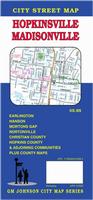
62-6992HOP
Hopkinsville & Madisonville city map. Includes Christian and Hopkins Counties. (GM Johnson). Includes Earlington, Hanson, Mortons Gap, Christian County, and Hopkins County.
$6.99
62-6992LO
Louisville City Map. (Rand McNally).
$5.99
62-6992LOU
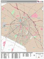
Louisville City Map. (Universal). This full-color street map of Louisville, KY includes: Anchorage, Douglas Hills, Glenview, Graymoor-Devondale, Hurstbourne, Indian Hills, Jeffersontown, Lyndon, Middletown, Shively, and St. Mathews; and features: Airports, Block Numbers, Colleges and Universities, Golf Courses, Parks and Rec Areas, Places of Interest, and ZIP Codes.
$6.95
62-6992PA
Paducah and Land Between the Lakes Street Map. (GM Johnson). Also includes Benton, Fulton, South Fulton, Mayfield, and Murray, plus McCracken County.
Kentucky City Maps - Laminated Maps.
Laminated Louisville City Map - Laminated. Universal Map. The Louisville, Kentucky Laminated Map by Kappa Map Group is a full-color, easy-to-fold, write on, and wipe off laminated map. Including: Street Detail Inset of Downtown Louisville. Featuring: Airports, Colleges & Universities, Golf Courses, Hospitals, Parks & Rec Areas, Places of Interest & ZIP Codes.
$8.95
62-6992LV
1 sheet, folded.
Kentucky City Wall Maps
Kentucky City Wall Maps.
When it comes to general planning, defining delivery areas, planning direct marketing and delivering products, our city wall maps are perfect to get the detailed information you need.
These maps offer clear mapping by showing all major streets and roads and many of the smaller streets, but leaving out the smallest streets. If you want a clear map for easy planning, then these are the maps for you; if you want a map showing every little back alley, these are not for you.
We offer wall maps for Bowling Green, Lexington, Louisville, and Owensboro.
Click here to order and to see sample images, prices, sizes, and mounting options.
Kentucky Bicycling Maps. Kentucky has three excellent long-distance trails that traverse the state - the TransAmerica Cycling Trail that goes east-west across Kentucky; the Great Rivers South Cycling Trail that crosses the western corner of Kentucky; and the Underground Railroad Cycling Trail that runs along the western and northern Kentucky border.
(KY/TN) Big South Fork N.R.A. map. #241. 1:42,500 & 1:22,500.
$14.95
63-2100-234
Mammoth Cave N.P. #234. 1:35,000.
$14.95
63-2100-793
(KY/VA) Clinch Ranger District. 1:75,000.
Mammoth Cave Topographic Map. 1:24,000. USGS.
$12.95
62-6975
1 sheet, flat.
Kentucky Wall Maps.
Kentucky State and County Wall Maps. Intelligent Direct.
We offer state and county wall maps for all of the USA. The maps come in sizes from 24 x 36 to 108 x 144 inches. They are available in variety of mounting and framing options. The maps are ideal for business applications, sales territory, delivery planning, direct mail targeting and hundreds of other applications.
Click here to order county wall maps and to see sample images, descriptions, and prices.
Click here to order state wall maps and to see sample images, descriptions, and prices.
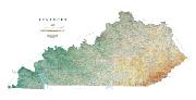
Kentucky Raven Shaded Relief Map. 1:500,000. Raven Maps. From the Ohio River and Bluegrass Region in the north to the Cumberland Plateau with its Pine and Black Mountains and west to the rocky ridges tunnelled with underground caves, Kentucky is a state of diverse geography. Elevations are represented by color, and this, in combination with our relief shading technique, gives the map a 3-dimensional look. Size is 29 x 58".
Thumbnail of the map. Sample of the detail.
New title! Kentucky Bourbon Map. Vinmap. Along with locations of the Commonwealth's famed bourbon distilleries, descriptive notes about the spirit are included as well as frontier trails, state parks, hydrography and even some geology, all overlain on a gorgeous hill shade background. Map size is 24" x 36". Available printed on paper or on canvas for a more artisan, textured finish.
Sample detail of the Kentucky Bourbon Map Thumbnail image of the Kentucky Bourbon Map


 A sample from the Maine atlas.
 Laminated
 Waterproof
 Thumbnail of the front of the Kentucky map.
 Sample detail of the Kentucky map.
 Sample from the Hopkinsville street map
 Sample from the Lousiville street map
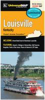 Laminated
 Sample detail from the Lexington wall map.

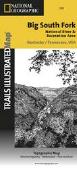
 Big South Fork map coverage
 Thumbnail of the front of the map.
 Thumbnail of the reverse of the map
 Detail from the map.
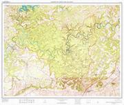
 Kentucky State and County Wall Maps. Intelligent Direct.
 Thumbnail of the map.
 Sample of the detail.
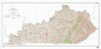
 Sample detail from the Kentucky topographic map.
 Image of the Kentucky topographic map.
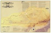 New title!
 Sample detail of the Kentucky Bourbon Map
 Thumbnail image of the Kentucky Bourbon Map
 Kentucky Flags