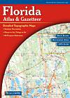
Florida Atlas and Gazetteer. 1:126,000. DeLorme.
Rely on a DeLorme Atlas & Gazetteer for the utmost in trip planning and backcountry access. Contains topographic maps with unbeatable detail, plus gazetteer information on great places to go and things to do. Atlas size is 11 x 15½", 160 pages.
Sample detail #1 from the Florida atlas Sample detail #2 from the Florida atlas
$24.95
62-6148
Atlas
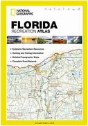
Florida Recreation Atlas. 1:200,000. National Geographic Maps.
National Geographic's Georgia Recreation Atlas is an ideal recreation resource and contains accurate, detailed topographic maps with private and public land boundaries, a complete road network, valuable recreation information and extensive cross-referenced lists and charts for campgrounds, lakes, parks, attractions and more. State Game Management Unit maps and fish species lists will appeal to the sportsman while detailed primary road networks will be of great interest to motorcyclists, RVers, and those simply touring the state.
Sample detail #1 from the Florida recreation atlas Sample detail #2 from the Florida recreation atlas
Florida Travel Atlas. Kappa.
The Florida Travel Atlas is a full-color street atlas, including street-detail insets of: Amelia Island, Bradenton Beach, Cape Canaveral, Clearwater, Clearwater Beach, Cocoa Beach, Daytona Beach, Fernandina Beach, Fort Lauderdale, Fort Myers, Fort Myers Beach, Fort Walton Beach, Gainesville, Holmes Beach, Jacksonville, Key West, Lakeland, Melbourne, Miami, Naples, Ocala, Orlando, Panama City, Pensacola, St Augustine, St Petersburg, Sanibel, Sarasota, Sea World, Tallahassee, Tampa, Universal Studios, Vero Beach, Walt Disney World, and West Palm Beach; and features: Airports, Colleges and Universities, detailed Attractions, Golf Courses, a Mileage Chart, Military Reservations, Museums, Parks and Rec Areas, and Places of Interest. 8.5 x 11 inches, spiral-bound.
$21.99
62-61891
Atlas
Florida Road Maps - Paper Maps
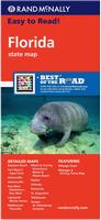
Florida Road Map. Rand McNally.
A larger map with bigger type size makes this state map Easy-to-Read. When you are traveling by car and you need to navigate the state of Florida, you'll want to have with you this Rand McNally Florida Travel Map, loaded with up-to-date and easy-to-ready detail for the entire state. Includes inset city maps of Daytona Beach, Fort Myers/Cape Coral, Gainesville, Jacksonville, Key West, Downtown Key West, Lakeland/Winter Haven, Melbourne/Titusville, Miami & Vicinity, Downtown Miami & Miami Beach, Naples, Orlando, Pensacola, St. Augustine, and Tallahassee. Map size is 28 x 40 inches unfolded.
Sample detail #1 from the Florida road map Sample detail #2 from the Florida road map
$7.99
62-6190
1 sheet, folded
Florida Road Map. Universal Map.
The Florida fold map is a full-color, regional map, including: Cape Coral, Clearwater, Dyatona Beach, Fort Lauderdale, Fort Myers, Gainesville, Jacksonville, Key West, Miami, Miami Beach, Orlando, Pensacola, St Augustine, St Petersburg, Tallahassee, Tampa, and West Palm Beach; and features: Airports, Attractions, Campgronds, Florida Facts, Interstate Exit Numbers, Latitude and Longitude information, a Mileage Chart, Parks and Rec Areas, and Places of Interest.
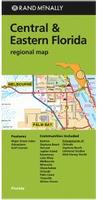
Central & Eastern Florida Road Map. Rand McNally.
Detailed road map of central and eastern Florida, featuring shopping malls, schools, points of interest, and fully indexed. Communities covered include Bartow, Daytona Beach, Deland, Jupiter Island, Kissimmee, Lake Mary, Melbourne, Mineola, Okeechobee, Orlando, Palm Coast, Titusville, and Winter Haven. Map size is 28 x 40 inches unfolded.
Central Florida & Orlando road map. 1:12,500 & 1:400,000.
$10.95
62-61912
Miami & South Florida road map.Waterproof. 1:12,500 & 1:400,000.
$9.95
62-6192FK
Florida Keys road map. 1:120,000.
Florida Road Maps - Laminated/Waterproof Maps
Waterproof! Florida Road Map. Reise Know-How.
Detailed road map covering all of Florida. Printed on waterproof, tear-resistant synthetic paper.
$15.99
62-20953-10
1 sheet, folded.
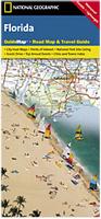
Waterproof! Florida Guide Map. National Geographic Maps.
The front side is an easy-to-read road map with insets of: - Pensacola - Jacksonville - Panama City - Tampa / St. Petersburg area - Miami area - Daytona Beach - Tallahassee - Gainesville - Fort Myers / Cape Coral The back includes: - Points of interest - Scenic drive - Information for Miami / Miami Beach, Orlando, and Key West - Information on Everglades National Park - Park Service sites in Florida. Map size is 18 x 25 inches unfolded.
Front of the Florida Guidemap Reverse of the Florida Guidemap Sample detail from the Florida Guidemap
$7.95
62-61903-10
1 sheet, folded.
Waterproof! Florida Easy-to-Fold® Road Map - Laminated. Rand McNally.
The durable and convenient Florida EasyFinder® will take all the wear and tear your journey can dish out. The laminated design allows you to mark your route, make notes, then wipe the surface clean for further use. Map size is 18 x 17 inches unfolded, ideal for using in a car.
Sample detail from the Florida laminated road map Front of the Florida laminated road map
$9.99
62-61905
1 sheet, folded.
Laminated Florida Travel Map. 1:1,200,000. Borch.
Laminated road map of Florida. Includes insets of Key West (1:20,000), Miami Downtown (1:20,000), South Miami Beach (1:20,000), Walt Disney World (1:65,000), Orlando & Region (1:200,000), Tampa bay area (1:300,000). Legend in 5 languages, including English. Climate charts show the average daily temperatures, humidity, hours of sunshine and precipitation for each month.
Front of the Florida travel map Reverse of the Florida travel map Sample detail from the Florida travel map
$9.95
62-61916
1 sheet, folded.
Laminated Florida Regional Travel Maps - Laminated. Universal Maps.
These four regional maps offer coverage of most of Florida. These regional maps of Florida are durably laminated and contain extensive coverage. Laminated maps are easy to fold, write on, and wipe off.
These maps feature Airports, Colleges and Universities, Golf Courses, Parks and Rec Areas, Places of Interest, and ZIP Codes
East Central Florida road map. Coverage includes the Counties of: Brevard, Flagler, Indian River, and Volusia; and a street-detail inset of Daytona Beach.
$9.99
62-61921SWF
Southwest Florida road map. Coverage includes: street detail insets of the Fort Myers, Fort Myers Beach, Marco Island, and Naples.
$9.99
62-61921WCF
West Central Florida road map. Coverage includes street-detail insets of: the Clearwater Beaches area, Downtown St. Petersburg, Downtown Tampa, and the Sarasota Beaches area.
Laminated Georgia & Northeast Florida Coast Road Map - laminated. ADC.
This map of the Georgia and Northeast Florida coasts is durably laminated and contains extensive coverage. Laminated maps are easy to fold, write on, and wipe off. Coverage includes: Brunswick, Jekyll Island, St. Simons Island, and Tybee Island, in Georgia; and Atlantic Beach, Amelia Island, Fernandina Beach, Flagler Beach, Jacksonville Beach, Palm Coast, and St. Augustine Beach, in Florida; and features: Airports, Beaches, Colleges and Universities, Golf Courses, Islands, Parks and Rec Areas, Places of Interest, and ZIP Codes.
$8.99
62-62906
1 sheet, folded.
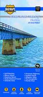
Scenic Road Trips Map of Florida - 25 Great Rides. Mad Maps.
Designed for motorcyclists, but also ideal for car drivers, the Mad Maps scenic road trip maps offer scenic routes and things to do and see in the area. If you are looking for things to do in Florida, look no more. Our local MAD scouts traveled from the Florida Panhandle down to the Florida Keys to highlight the best scenic drives. They also found great places to eat, stop and see. You'll definitely know you're in Florida when hanging out at Everglades National Park/Shark Valley, John Pennekamp Coral Reef, Alafia River State Park or Alexander Springs Recreational Area.
Sample detail from the Florida scenic road trips map
$14.95
62-20918-FL
1 sheet, folded
Florida City Maps - Paper Maps
Miami & Orlando City Maps - Paper Maps
Miami Popout® Street Map. Popout.
Ideal for light travel and tourism, this Miami travel map features: Award-winning PopOut Design, a lot of info in a portable, easy self-folding map. Pocket Size, it conveniently fits in a pocket or purse. Outstanding Mapping: striking graphics and recognizable icons. Updated to assure accuracy and reliability. Comprehensive and Concise Indexing to easily locate streets, places of interest and travel info.
$6.95
62-6192MP
1 sheet, folded
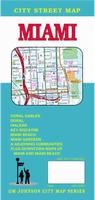
Miami City Map. GM Johnson.
Detailed street map of Miami. Includes coverage of Miami Beach, Coral Gables, Doral, Key Biscayne, and surrounding communities.
$5.95
62-6192MIC
1 sheet, folded.
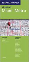
Miami Metro Street Map. Rand McNally.
Communities covered include Coral Gables, Doral, Florida City, Hialeah, Homestead, Key Biscayne, Miami Beach, Miami Gardens, Miami Springs, North Bay Village, Opa-Locka, Palmetto Bay, Pinecrest, and Sweetwater. Map size is 28 x 40 inches unfolded.
$6.99
62-6192MG
1 sheet, folded
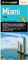
Miami Street Map. Universal Map.
This full-color street map of Miami, FL includes: Aventura, Coral Gables, Hialeah, Key Biscayne, Miami Beach, Miami Gardens, Miami Shores, Miami Springs, North Miami Beach, Opa-Locka, Pinecrest, Surfside, and West Miami; and features: Airports, Block Numbers, Colleges and Universities, Golf Courses, Hospitals, Marinas, Parks and Rec Areas, Places of Interest, and ZIP Codes. Map size is 27 x 39 inches unfolded.
$7.99
62-6192MH
1 sheet, folded.
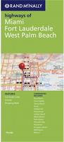
Miami, Fort Lauderdale and Palm Beach Highways Street Map. Rand McNally.
This map covers the Miami region - a larger area covered, but slightly less detail than the Miami street maps. Communities covered include Boca Raton, Coral Gables, Delray Beach, Doral, Hollywood, Homestead, Jupiter Island, Miami Beach, Palm Beach, Palmetto Bay, Plantation, Pompano Beach, Wellington, and Weston. Map size is 28 x 40 inches unfolded.
$6.99
62-6192MI
1 sheet, folded.
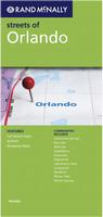
Orlando Street Map. Rand McNally.
Detailed street map of Orlando. Communities covered include Altamonte Springs, Bay Lake, Belle Isle, Casselberry, Eatonville, Edgewood, Lake Buena Vista, Longwood, Maitland, Winter Park, Winter Springs. Map size is 28 x 40 inches unfolded.
$6.99
62-6192O
1 sheet, folded
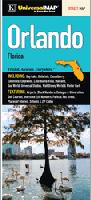
Orlando Street Map. Universal Map.
This full-color street map of Orlando, FL includes: Bay Lake, Belle Isle, Casselberry, Eatonville, Edgewood, Lake Buena Vista, Maitland, Sea World, Universal Studios, Walt Disney World, and Winter Park; and features: Airports, Block Numbers, Colleges and Universities, Golf Courses, Interstate Exit Numbers, Parks and Rec Areas, Places of Interest, Schools, and ZIP Codes. Map size is 27 x 39 inches unfolded.
$7.99
62-6192ORL
1 sheet, folded.
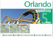
Orlando Popout® Street Map. Popout.
Explore Florida's playground, Orlando, with the help of this genuinely pocket-sized map. Small in size yet big on detail, this compact, dependable map will ensure you don't miss a thing.
Includes 2 PopOut maps - a detailed street map of Orlando as well as Downtown Disney, DisneyWorld, Epcot Centre and Universal Studios
Additional maps show Disney's Animal Kingdom and SeaWorld
Ingenious, self-folding map is small enough to fit in your pocket yet offers extensive coverage of the city and parks in an easy-to-use format
Thorough street index is also featured and cross-referenced to the map so you can easily find your destination
Key places of interest are listed offering you advice on the best things to see
$6.95
62-6192OW
1 sheet, folded.
Florida City Maps (other than Miami & Orlando) - Paper Maps
Florida City Maps - Paper. These are folded paper road and street maps. Laminated city maps are above and spiral-bound street atlases are below.
Sample detail from the West Palm Beach map
$4.95
62-6192AV
Avon Park & Highland County city street map. (Universal Map).
$6.95
62-6192BO
Boca Raton city map. (GM Johnson).
Cape Coral city map, with Sanibel Island - covered on the Ft. Myer map 62-6192FM.
Clearwater City map - covered on the Tampa/St. Petersburg map 62-6192TS.
$4.95
62-6192CO
Cocoa Beach/Space Coast map. (GM Johnson).
$7.99
62-6192DAY
Daytona Beach City map. (Universal Map).
$5.95
62-6192DEL
Deltona, DeLand, west Volusia County street map. (GM Johnson).
$4.95
62-6192DI
Dixie, Gilchrist, Levy County street map. (Universal Map). Now out of print - limited stock left.
Englewood city map - covered on 62-6192VE Venice/Englewood below.
$7.99
62-6192FL
Florida Keys map. (Dolph).
$6.99
62-6192FB
Fort Lauderdale street map. (Rand McNally).
$5.95
62-6192FLA
Fort Lauderdale street map. (GM Johnson).
$6.99
62-6192FM
Fort Myers - Lee County map, with Lehigh Acres, Cape Coral. (Rand McNally).
$5.95
62-6192FO
Ft. Pierce and Port St. Lucie city map. (Map Supply).
$4.95
62-6192FP
Ft. Pierce and Vero Beach city map. (Rand McNally).
$5.95
62-6192OCA
Gainesville & Ocala City Map. (GM Johnson).
$6.99
62-6192J
Jacksonville/Duvall City map. (Rand McNally).
$5.95
62-6192KIS
Kissimmee City Map. (GM Johnson).
$5.95
62-6192LB
Lakeland and Winter Haven Street Map. (GM Johnson).
$6.99
62-6192NAP
Naples City Map. (GM Johnson).
Ocala city map - covered on the Gainesville/Ocala map 62-6192OCA above.
$7.99
62-6192PE
Pensacola City Map. (Universal).
Port St. Lucie city map - covered on the Ft. Pierce/Port St. Lucie map 62-6192FO above.
$5.95
62-6192PT
Port Charlotte and Punta Gorda Street Map. (GM Johnson).
$4.95
62-6192SC
Santa Rosa City Map. 1:44,000. (Universal Map).
$4.95
62-6192SE
Seminole County street map. (Universal Map). Now out of print - limited stock left.
$5.95
62-6192STAU
St. Augustine and Palm Coast City map. (GM Johnson).
$6.95
62-6192SPE
St. Petersburg and Clearwater Street Map. (GM Johnson).
$5.95
62-6192SU
Stuart city & Martin County street map. (GM Johnson).
$6.95
62-6192TAL
Tallahassee city map. (GM Johnson).
$5.99
62-6192TAM
Tampa & St. Petersburg City Map. (Universal Map).
$6.95
62-6192TAMP
Tampa & St. Petersburg City Map. (GM Johnson).
$6.99
62-6192TS
Tampa & St. Petersburg City Map. (Rand McNally).
$5.95
62-6192VEN
Venice and Englewood Street Map. (GM Johnson).
$5.95
62-6192VER
Vero Beach, Sebastian, Fort Pierce, Port St. Lucie city map. (GM Johnson).
$6.95
62-6192WES
West Palm Beach City Map. (GM Johnson).
Florida City Street Maps - Laminated
Miami & Orlando Street Maps - Laminated
Laminated Miami Street Map - laminated. 1:15,000. Borch.
Our soft-laminated folded map of Miami shows Miami Downtown 1:15,000, Miami Beach 1:15,000, Coconut Grove 1:15,000, Greater Miami 1:350,000, Southern Florida 1:500,000, Coral Gables 1:30,000, Public Transportation Miami, Top 30 Sights, USA administrative & time zones. Borch Maps are easy to fold, durable and water-repellent with a wipeable surface. Borch Maps show hotels, museums, monuments, markets, public transport, top sights and points of interest, useful statistics, conversion charts for temperatures, weights and measurements, climate charts showing temperatures, sunshine hours, precipitation and humidity, overview maps, time zones, and much more...
Sample detail from the Miami MapEasy map
$9.95
62-6192MIA
1 sheet, folded
Laminated Miami Streetsmart® Map - laminated. Van Dam.
VanDam's best selling Miami StreetSmart maps all of Miami's attractions, neighborhoods, museums, hotels, beaches and more at an immensely legible scale with 3D buildings. Includes maps of Downtown Miami, South Beach, Wynwood Arts & Design Districts and Dade County. This sexy laminated city map package refolds easily to 4" x 9" (24" x 9" open) and snuggly fits into your pocket.
Sample detail from the Miami Streetsmart® map Front & reverse of the Miami Streetsmart® map
$7.95
62-61921MI
1 sheet, folded.
Laminated Miami Street Map - laminated. Redmap.
The essential map to the best of Miami. Highlighting South Beach, Downtown, Key Biscayne, Coconut Grove and Coral Gables. With the best restaurants, hip hotels and the hottest beaches. Great shopping in charming stores along Lincoln Road and Collins Avenue and the posh Bal Harbour Shopping Center. There's also historic Little Havana, the Art Deco Historic District, the Miami Art Museum and James Deering's fantastic Vizcaya. Map size is 9 x 24 inches unfolded.
Sample detail from the Miami Redmap map
$9.95
62-61921MA
1 sheet, folded.
Laminated Miami MapEasy® Street Map. MapEasy.
Explore the Art Deco masterpieces of South Beach with us, stroll through the charming neighborhood of Coconut Grove and it's many boutiques and restaurants, or take a drive down to the Everglades. If you're looking for more fun, why not visit Key West? Come along with us as we explore this southernmost point in the US, and see where Hemingway lived and worked, or do some shopping on Duval Street. The Miami/Key West Guidemap includes detailed sections for South Beach, Downtown, Coconut Grove, Greater Miami and Key West.
Sample detail from the Miami MapEasy map
$7.95
62-6192ME
1 sheet, folded
Laminated Miami - South Beach to Aventura City Streets Map - laminated. Universal Map.
The map is the easiest to read on the market and immediately puts the city at your fingertips. Top attractions for both adults and their kids are clearly marked and each attraction is accompanied by an iconic photograph and salient information. Stunning cartography provides essential travel and reference information for both locals and tourists. Accurate, portable, and durable, City Streets is the only map you need to navigate the big city.
Now out print - limited stock left.
$7.99
62-61921MIA
1 sheet, folded.
Laminated Miami & The Keys Destination Street Map - waterproof. National Geographic Maps.
In addition to the easy-to-read map on the front, the back includes: - Regional map - Points of interest - Metrorail and Metromover maps - Airport diagrams for Miami International and Ft. Lauderdale/Hollywood International airports - Information and map of the Florida Keys and Key West - Inset map of the Miami area - Inset map and information about the Everglades - Multi-language legend. Map size is 18 x 27 inches unfolded.
Sample detail from the Miami Destination map Front of the Miami Destination map Reverse of the Miami Destination map
Laminated Orlando Streetsmart® Map - laminated. Van Dam.
VanDam's best selling Orlando StreetSmart maps all of Orlando's attractions, neighborhoods, museums, hotels, resorts and more at an immensely legible scale with 3D buildings. This sexy laminated city map package refolds easily to 4" x 9" (24" x 9" open) and snuggly fits into your pocket.
Sample detail from the Orlando Streetsmart® map Front & reverse of the Orlando Streetsmart® map
$7.95
62-61921OR
1 sheet, folded.
Waterproof Orlando MapEasy Street Map - waterproof. Orlando is one of the most popular tourist destinations in the world! And with good reason...there is more to do here than almost anywhere else on the planet! No other GuideMap offers you the depth of information about the varied attractions in Orlando other than MapEasy.
Sample detail #1 from the Orlando MapEasy map Sample detail #2 from the Orlando MapEasy map
$7.95
62-6192OE
1 sheet, folded.
Laminated Orlando Street Map - laminated. Borch.
Our soft-laminated folded map of Orlando in the 10th edition shows: Orlando Downtown 1:11,000, Central Florida 1:1 200,000, Orlando and Region 1:200,000, Walt Disney World 1:25,000, International Drive Area 1:25,000, Top 30 Sights, USA administrative and time zones. Borch Maps are easy to fold, durable and water-repellent with a wipeable surface. Borch Maps show hotels, museums, monuments, markets, public transport, top sights and points of interest, useful statistics, conversion charts for temperatures, weights and measurements, climate charts showing temperatures, sunshine hours, precipitation and humidity, overview maps, time zones, and much more...
Sample detail from the Orlando Streetsmart® map Front of the Orlando street map Reverse of the Orlando street map
$8.95
62-6192OX
1 sheet, folded.
Laminated Florida City Maps - other than Miami and Orlando
Florida City Laminated Street Maps, other than Miami and Orlando.
$8.95
62-61921BRA
Bradenton laminated map. (Universal Map).
$8.95
62-61921JA
Jacksonville laminated street map. (American Map).
$8.95
62-61921PE
Pensacola City Map. (Universal Map). Laminated. Now out print - limited stock left.
Florida City Wall Maps
Florida City Wall Maps.
When it comes to general planning, defining delivery areas, planning direct marketing and delivering products, our city wall maps are perfect to get the detailed information you need.
These maps offer clear mapping by showing all major streets and roads and many of the smaller streets, but leaving out the smallest streets. If you want a clear map for easy planning, then these are the maps for you; if you want a map showing every little back alley, these are not for you.
We offer wall maps for Boca Raton, Boynton Beach, Bradenton, Brandon, Cape Coral, Carol City, Clearwater, Coconut Creek, Coral Gables, Coral Springs, Davie, Daytona Beach, Deerfield Beach, Delray Beach, Deltona, Doral,
Fort Lauderdale, Fort Myers, Gainesville, Hialeah, Hollywood, Homestead, Jacksonville, Jupiter, Key West, Kissimmee, Lakeland, Largo, Lauderhill, Lehigh Acres, Margate, Melbourne, Miami, Miami Beach, Miami Gardens,
Miramar, North Miami, North Port, Ocala, Orlando, Palm Bay, Palm Beach Gardens, Palm Coast, Palm Harbor, Pembroke Pines, Pensacola, Pinellas Park, Plantation, Pompano Beach, Port Charlotte, Port Orange, Port St. Lucie,
Sanford, Sarasota, Spring Hill, St. Augustine, St. Petersburg, Sunrise, Tallahassee, Tamarac, Tampa, Town 'n' Country, Wellington, West Palm Beach, and Weston.
Click here to see sample images, prices, sizes, and mounting options.
Florida Recreation Maps
Florida Bicycling Maps. Florida is crossed by two very popular long-distance cycling trails. These include the east-west Southern Tier Transcontinental Cycling Trail and the north-south Atlantic Coast Cycling Trail.
Click here for our complete US Forest Service maps list.
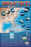
A great gift for the shark enthusiast! Shark Attack Poster of the Atlantic Ocean and the Gulf of Mexico. Sealake Products. This fascinating, educational print shows the locations of over 300 shark attacks in the Atlantic and Gulf of Mexico from 1905 to the present. 35 hair-raising encounters
are detailed, including the 1916 attacks in New Jersey. Plus, you'll learn interesting facts about the 12 types of sharks blamed for the attacks. Also, an actual size tooth from each of the three most dangerous sharks is shown. Size is 24 x 36". Available rolled/flat, either as plain paper or laminated.
Recommended! Florida Lighthouses Map. Bella Terra Publishing. 1:275,000.
The illustrated map and guide to all Florida lighthouses. All standing and "lost" lighthouses in Florida are located on a detailed state map. History and description of each lighthouse. Directions to each light or best viewing spots. 33 original watercolor illustrations. Directory of lighthouse cruises, sightseeing flights and island ferries. Lighthouse and maritime museums listed and located on map. True tales of Florida lighthouses. Paper, 36" x 24", folded to 4" x 9", printed two sides.
Image of the entire Florida Lighthouses map. Sample detail from the Florida Lighthouses map.
$6.95
62-61917
1 sheet, folded.
$12.95
62-61917L
1 sheet, laminated.
Florida Everglades National Park Map. 1:55,000 & 1:100,000. Trails Illustrated/National Geographic Maps #243. This two-sided map includes the Key Largo, Everglades City, Chokoloskee, Everglades National Park, portions of Big Cypress National Preserve, Fakahatchee Strand State Preserve, Cape Romano Ten Thousand Islands Aquatic Preserve, Shark Valley Tram Road, Old Ingraham highway and campsite, North Nest Key, West Lake Canoe Trail, Snake Bight Trail, backcountry campsites, beach sites, ground sites, and chickees, and detailed insets of Flamingo, Whitewater Bay, Pineland Trails of the Long Pine Key area, and Nine Mile Pond. The map also shows the entire Wilderness Waterway, from the Gulf Coast Visitor Center near Everglades City to its terminus beyond the Flamingo Visitor Center. Includes UTM grids for use with your GPS unit.
Florida Hiking Map Index Image of the front of the map.
$14.95
63-2100-243
1 sheet, folded.
(GA/FL) Okefenokee National Wildlife Refuge hiking map. 1:63,360. National Geographic Maps.
Waterproof and tear-resistant
Clearly marked trails for hiking, biking, horseback riding, and more
Detailed topography and clearly defined, color-coded boundaries of state parks, national recreation areas, wilderness areas, marine sanctuaries and wildlife refuges
Hundreds of points-of-interest, including scenic viewpoints, campgrounds, boat launches and canoe carry downs, swimming areas, fishing access points, and more
UTM and Latitude/Longitude grid, as well as selected waypoints and a scale bar for easy and accurate navigation.
Florida Keys Guide & Dive Map. Franko's Maps.
This beautiful map describes and shows the locations of numerous points of interest in the Florida Keys, and also has descriptions and shows the locations of the numerous snorkeling and scuba diving sites. Side One shows the whole island chain, and Side Two shows close-ups of Key West, the John Pennekamp State Park area, and Dry Tortugas National Park.
Sample detail of the Florida Keys guide map. Front of the Florida Keys guide map. Reverse of the Florida Keys guide map.
$7.99
62-6176
1 sheet, folded.
Florida Wall Maps
Florida State and County Wall Maps. Intelligent Direct.
We offer state and county wall maps for all of the USA. The maps come in sizes from 24 x 36 to 108 x 144 inches. They are available in variety of mounting and framing options. The maps are ideal for business applications, sales territory, delivery planning, direct mail targeting and hundreds of other applications.
Click here to order county wall maps and to see sample images, descriptions, and prices.
Click here to order state wall maps and to see sample images, descriptions, and prices.
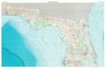
Florida Wall Map. 1" = 10 miles. Universal Map.
The map shows all state and federal highways, cities and towns, major airports, state universities, state and national parks, major secondary roads, major waterways, and military installations. Size is 54 x 60". Laminated.
Thumbnail of the map. Sample of the detail.
$219.00
62-61505L
Each, rolled
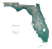
Florida Raven Shaded Relief Map. 1:500,000. Raven Maps. The Florida Uplands, running through the Panhandle in the northwest, give way to the meeting of the East Gulf and Atlantic Coastal Plains. The subtle variations in the elevation (the highest point in the state is 345') are shown in shades of green. The Big Cypress Swamp, The Everglades, and The Florida Keys mark this state as one of the most unique in the nation. Elevations are represented by color, and this, in combination with our relief shading technique, gives the map a 3-dimensional look. Size is 44 x 48".
Thumbnail of the map. Sample of the detail.
Florida Topographic map. 1:500,000 and 1:750,000. USGS. Single-sheet map of Florida showing county boundaries, road network, waterways, and much more.
$12.95
62-6150
Florida Topographic map. 1:500,000. 1991. USGS. Double-sided, north Florida on one side, south Florida on the reverse. Map size is 44" x 60".
$34.99
62-6150L
Topographic map, laminated.
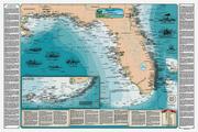
Florida Shipwreck chart. Sealake Products. This stunning chart shows the location of over 1000 shipwrecks from Florida to the Mississipi Delta. Hundreds of hours went into making this chart. Shown in great detail are the the Florida coastline, the Keys, reefs, lighthouses, and water depth contours. Stories of how 37 of the most interesting and famous shipwrecks occurred, including the story about a shrimp boat that was sunk by a shark and the ocean liner that burned so intensely that the water around her boiled! Detailed pen and ink drawings illustrate the tragic sinkings of eight ships. The parchment at the bottom of the chart also includes information About the Treasure Fleets, the Civil War, The Bermuda Triangle, the U-boats and more!
The chart is 36" X 24"; a perfect size for framing with our frame made from naturally weathered, salvaged wood.
Thumbnail of the entire chart.
$14.99
62-6184
Florida Shipwreck Chart - paper.
$24.95
62-6184L
Florida Shipwreck Chart - laminated.
$199.95
62-6184F
Florida Shipwreck Chart - framed.
Florida Keys Shipwreck chart. Sealake Products. This beautiful chart shows the location of over 500 shipwrecks from Soldier Key to the Dry Tortugas by type of ship and year sunk. Hundreds of hours went into making this chart.
Shown in great detail are the Keys, reefs, lighthouses, and water depth contours. The Florida Keys extend to the Dry Tortugas, and the unique inset shows the Marquesas Keys to the Dry Tortugas, a first for charts of this kind. Stories of how 33 of the most interesting and famous shipwrecks occurred, including the Atocha, Valbanerra, El Capitana, and Spiegel Grove. Pen and ink drawings illustrate the tragic sinkings of six ships.
The parchment at the bottom of the chart tells of the 1622 and 1733 fleets, the Search for the Atocha, the U-boats, the Wreckers, Deadly Hurricanes, the Lighthouses, Key West, and the Dry Tortugas.
The chart is 36" X 24"; a perfect size for framing with our frame made from naturally weathered, salvaged wood.
Thumbnail of the entire chart. Sample #1 of the detail of the chart Sample #2 of the detail of the chart
$14.99
62-6183
Florida Keys Shipwreck Chart - paper.
$19.99
62-6183L
Florida Keys Shipwreck Chart - laminated.
$199.99
62-6183F
Florida Keys Shipwreck Chart - framed.
Florida Keys Lighthouses chart. Sealake Products. This beautiful chart shows the location of the nine remaining lighthouses of the Florida Keys along with reefs and water depth contours. A unique inset of the Marquesas Keys to the Dry Tortugas is also included as well as information about the infamous "Quicksands."
Each Lighthouse is beautifully captured in a pen and ink drawing which includes a unique nautical scene. Interesting facts about the lighthouse are also presented. The chart is 36" X 24"; a perfect size for framing with a standard size or custom frame.
Thumbnail of the entire chart. Sample #1 of the detail of the chart Sample #2 of the detail of the chart
$14.95
62-6185
Florida Lighthouses Chart - paper.
$24.95
62-6185L
Florida Lighthouses Chart - laminated.
$199.99
62-6185F
Florida Lighthouses Chart - framed.
Recommended! Florida Lighthouses Map. Bella Terra Publishing.
The illustrated map and guide to all Florida lighthouses. All standing and "lost" lighthouses in Florida are located on a detailed state map. History and description of each lighthouse. Directions to each light or best viewing spots. 33 original watercolor illustrations. Directory of lighthouse cruises, sightseeing flights and island ferries. Lighthouse and maritime museums listed and located on map. True tales of Florida lighthouses. Paper, 36" x 24", folded to 4" x 9", printed two sides.
Image of the entire Florida Lighthouses map. Sample detail from the Florida Lighthouses map.
$6.95
62-61917
1 sheet, folded.
$12.95
62-61917L
1 sheet, laminated.
Florida Antique-style Wall Map. 33 x 25".
"The Sunshine State" stretches five hundred miles from the Georgia and Alabama borders to Key West, the southernmost point in the United States. Its 65,576 square miles are home to fifteen million people, the fourth largest in population among the states. It boasts the oldest city in America, St. Augustine, as well as the nation's most popular tourist attraction, Disney World. Florida is a haven for retirees, tourists, and the site of the Everglades National Park. Miami is the largest city and the capital is Tallahassee.
$25.00
62-6147
1 sheet, rolled.
$275.00
62-6147D
Deluxe frame
$224.99
62-6147S
Standard frame
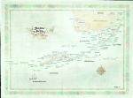
Florida Keys Antique-style Wall Map. 33 x 25".
"The Sunshine State" stretches five hundred miles from the Georgia and Alabama borders to Key West, the southernmost point in the United States. Its 65,576 square miles are home to fifteen million people, the fourth largest in population among the states. It boasts the oldest city in America, St. Augustine, as well as the nation's most popular tourist attraction, Disney World. Florida is a haven for retirees, tourists, and the site of the Everglades National Park. Miami is the largest city and the capital is Tallahassee.
$25.00
62-61471
1 sheet, rolled.
$275.00
62-61471D
Deluxe frame
$224.99
62-61471S
Standard frame
Florida Geology Maps
Florida Seismicity Map. 1:1,000,000. 1979. USGS (MF-1056). Map size is 84 x 99 cm.


 Sample detail #1 from the Florida atlas
 Sample detail #2 from the Florida atlas
 Sample detail #1 from the Florida recreation atlas
 Sample detail #2 from the Florida recreation atlas
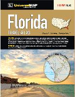
 Sample detail #1 from the Florida road map
 Sample detail #2 from the Florida road map
 Sample detail #1 from the Florida road map
 Sample detail #1 from the Florida road map
 Sample detail #1 from the Central Florida & Orlando road map
 Sample detail #1 from the Central Florida & Orlando road map
 Sample detail from the South Florida & Miami road map
 Sample detail from the Florida Keys road map
 Waterproof!

 Waterproof!
 Front of the Florida Guidemap
 Reverse of the Florida Guidemap
 Sample detail from the Florida Guidemap
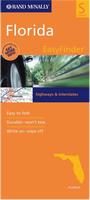 Waterproof!
 Sample detail from the Florida laminated road map
 Front of the Florida laminated road map
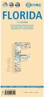 Laminated
 Front of the Florida travel map
 Reverse of the Florida travel map
 Sample detail from the Florida travel map
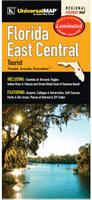 Laminated
 Sample detail from the East-central Florida road map
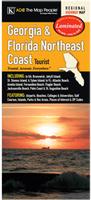 Laminated
 Sample detail from the Florida scenic road trips map
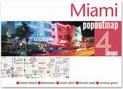
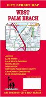
 Sample detail from the West Palm Beach map
 Laminated
 Sample detail from the Miami MapEasy map
 Laminated
 Sample detail from the Miami Streetsmart® map
 Front & reverse of the Miami Streetsmart® map
 Laminated
 Sample detail from the Miami Redmap map
 Laminated
 Sample detail from the Miami MapEasy map
 Laminated
 Laminated
 Sample detail from the Miami Destination map
 Front of the Miami Destination map
 Reverse of the Miami Destination map
 Laminated
 Sample detail from the Orlando Destination map
 Front of the Orlando Destination map
 Reverse of the Orlando Destination map
 Laminated
 Sample detail from the Orlando Streetsmart® map
 Front & reverse of the Orlando Streetsmart® map
 Waterproof
 Sample detail #1 from the Orlando MapEasy map
 Sample detail #2 from the Orlando MapEasy map
 Laminated
 Sample detail from the Orlando Streetsmart® map
 Front of the Orlando street map
 Reverse of the Orlando street map
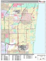

 A great gift for the shark enthusiast!
 Image of the entire poster
 Sample of the map detail, covering Florida.
 Sample of the Great White Shark text.
 Sample of the text describing the attacks.
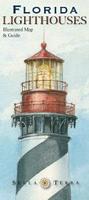 Recommended!
 Image of the entire Florida Lighthouses map.
 Sample detail from the Florida Lighthouses map.
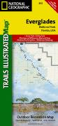
 Florida Hiking Map Index
  Image of the front of the map.
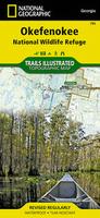
 Sample detail from the Okefenokee hiking map
 Image of the front of the Okefenokee hiking map
 Image of the reverse of the Okefenokee hiking map
 Front of the Florida fish card.
 Reverse of the Florida fish card.
 Sample detail of the Florida fish card.
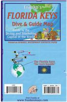 Waterproof
 Sample detail of the Florida Keys guide map.
 Front of the Florida Keys guide map.
 Reverse of the Florida Keys guide map.
 Florida State and County Wall Maps. Intelligent Direct.

 Thumbnail of the map.
 Sample of the detail.
 Thumbnail of the map.
 Sample of the detail.
 Thumbnail of the entire chart.
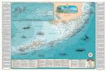
 Thumbnail of the entire chart.
 Sample #1 of the detail of the chart
 Sample #2 of the detail of the chart
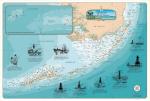
 Thumbnail of the entire chart.
 Sample #1 of the detail of the chart
 Sample #2 of the detail of the chart
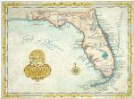


 Florida Flags