California Bicycling Maps. California has two long-distance trail that traverses the state north/south - the famous Pacific Coast Cycling Trail and the new Sierra/Cascades Cycling Trail. It also has two east/west trails that cross the state; the Western Express and the Southern Tier trails. In addition there are countless back roads that are begging for a leisurely ride through the Wine Country, Gold Country, or through the desert.
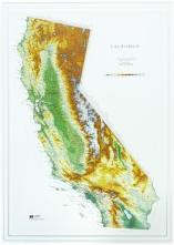
California Raised Relief Maps. We have a great raised relief map of the state of California as well as several 1:250,000 sectional raised relief maps that cover much of California.
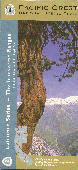
California Section of Pacific Crest Trail - Hiking Maps and Guidebooks
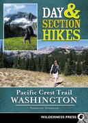
Day & Section Hikes Pacific Crest Trail: Northern California. Wilderness Press. Many hikers dream of walking the entire length of the famed Pacific Crest Trail (2,650 miles from Canada to Mexico). But time, jobs, and other obligations get in the way. This new guide makes it easy to explore the most memorable stretches of the route in Northern California. While not intended for thru-hiking reference, the handy format and concise information makes this book a perfect companion for short trips on the PCT. Trips range from one day to multi-day adventures along the trail. Each trip is shown on a map and has an elevation profile, depicting all the ups and downs, with GPS coordinates given for trailheads. Includes a comprehensive ratings system (for scenery, trail condition, difficulty, and solitude), information on water sources, links to continuing trails, and other vital details. This title contains 32 trips in Northern California.
Half Moon Bay to Cupertino Bay Area Trail Map. 1:25,000. This two-sided map covers in detail the many regional parks in the hills above Woodside, Palo Alto, Portola Valley, Los Altos, and Cupertino. Besides full coverage of hiking trails, nearly all local roads are shown so that hikers can find their way to all available trailheads. For example, the map shows back entrances to Rancho San Antonio County Park that aren't shown on the official map. It also shows how the trails of neighboring parks connect to each other, making it much easaier to plan (for example) a hike from Palo Alto to Skyline Ridge that crosses through Arastradero, Foothills, Los Trancos, and Skyline Ridge preserves. 26 x 39" unfolded.
$9.95
62-56872-HU
Humboldt Redwoods State Park map. 1:25,000. This map covers all of Humboldt Redwoods State Park as well as three small neighboring parks: John B. Dewitt Redwoods State Natural Reserve, Benbow Lake State Recreation Area, and Richardson Grove State Park. A 1:500,000 scale map of the North Coast is also included. 26 x 39 inches unfolded.
$10.99
62-56728
Mount Diablo Hiking Map. 1:25,000. This waterproof map includes Mount Diablo, Morgan Territory, Black Diamond Mines, and the Los Vaqueros Watershed. Map size is 27 x 39", printed on waterproof plastic, full color on both sides..
$6.95
62-56872-MU
Muir Woods National Monument map. 1:12,500. 17 x 22 inches unfolded.
$6.95
62-56872-PO
Portola Redwoods State Park & Pescadero Creek County Park map. 1:25,000. 2008. This is the only trail map that shows the interconnected trail systems of Portola and Pescadero parks on a single sheet. The entire Pescadero park complex including Sam McDonald County Park, Memorial County Park, and Heritage Grove are shown. Three Skyline Ridge parks are also included: Long Ridge, Upper Stevens Creek, and Skyline Ridge. 19 x 28 inches unfolded.
$10.95
62-56872-REN
Redwood National Park North map. 1:25,000. This map plus its southern companion map covers all of Redwood National and State Parks, including Jedediah Smith Redwoods State Park, Del Norte Redwoods State Park, Prairie Creek Redwoods State Park, and Redwood National Park. It is the only commercially-available map to include the approximately 50 miles of new multi-use trails in the Mill Creek Watershed of Del Norte Redwoods State Park. 25 x 39 inches unfolded.
$10.95
62-56872-RES
Redwood National Park South map. 1:25,000. This map plus its northern companion map covers all of Redwood National and State Parks, including Jedediah Smith Redwoods State Park, Del Norte Redwoods State Park, Prairie Creek Redwoods State Park, and Redwood National Park. It is the only commercially-available map to include the approximately 50 miles of new multi-use trails in the Mill Creek Watershed of Del Norte Redwoods State Park. 25 x 39 inches unfolded.
$6.95
62-56872-SL
San Lorenzo Valley Trail Map. 1:25,000. This trail map includes Henry Cowell Redwoods State Park, Fall Creek, Pogonip, Quail Hollow Ranch Park, and Bonny Doon Ecological Reserve. Trails and dirt roads were drawn from newly-acquired GPS data with a resolution of about 250 feet and overlaid on USGS topography data. Map size is 17 x 22 inches unfolded.
Bay Area Trail - Big Basin and Castle Rock Hiking Map. 1:25,000. Redwood Hikes Press. Two new maps that cover part of the Bay Area Trail. This double-sided map covers the Santa Cruz Mountains from the outskirts of Saratoga and Los Gatos to the Pacific coastline around Point Ano Nuevo. Castle Rock, Big Basin, Portola, Butano, and Ano Nuevo State Parks are fully covered, as are many regional parks of the South Skyline Boulevard area, such as Fremont Older Open Space Preserve, Upper Stevens Creek County Park, Sanborn County Park, and El Sereno Open Space Preserve.
All official hiking trails were drawn from newly-acquired GPS data with a resolution of about 250 feet. Trail mileages are marked and most streets are labeled. To help you keep track of your location, the map shows the locations of memorial grove markers, footbridges, panoramic viewpoints, and stairs. The map also covers the complete Skyline-to-the-Sea Trail. ISBN 9781934127216.
Sample detail from the Big Basin and Castle Rock hiking map Front of the Big Basin and Castle Rock hiking map Revers of the Big Basin and Castle Rock hiking map Sketch map of area covered by Big Basin and Castle Rock map
$10.95
62-56872-BIG
1 sheet, folded.
Bay Area Trail - Carquinez Straits & Berkeley Hills Hiking Map. 1:25,000. Redwood Hikes Press. This trail map covers the northern section of the East Bay hills. It's currently the only comprehensive trail map of this region. One side includes Tilden and Wildcat Regional Parks, San Pablo and Briones Reservoir, and Briones Regional Park. The other side has the Carquinez Strait area, including Crockett Hills Regional Park, Carquinez Strait Regional Park, the Muir Heritage Land Trust properties, and the northern EBMUD watershed. Size is 26 x 39 inches unfolded. ISBN 9781934127193.
Sample detail from the Carquinez Straits maphiking map Front of the Carquinez Straits maphiking map Revers of the Carquinez Straits maphiking map
$7.95
62-56872-CAR
1 sheet, folded.
Sequoia and Kings Canyon National Parks - Generals Highway Hiking Map. 1:25,000. Redwood Hikes Press. This map covers the most popular day hiking areas of Sequoia and Kings Canyon National Parks. One side shows the northern half of the Generals Highway including Grant Grove and Redwood Mountain; the other side shows the southern half including the Lodgepole and Giant Forest area, Alta Peak, and Bearpaw Meadow. There's also a map showing the floor of Kings Canyon, including Cedar Grove and Roads' End. No other map shows all these areas at this level of detail.
The more remote areas like Mineral King, the Atwell and Garfield Groves, and the Eastern Sierra trailheads are not included on this map. Size is 27 x 39 inches unfolded. ISBN 9781934127223.
Sample detail from the Generals Highway hiking map Front of the Generals Highway hiking map Revers of the Generals Highway hiking map
$7.95
62-56872-SE
1 sheet, folded.
California Hiking Maps
California Road and Recreation Map. 1:1,318,821. Benchmark Maps. Benchmark's California Road Map is the ideal portable planning tool and GPS companion for fast statewide travel. It's the only California road map that benefits from Benchmark's extensive field-checking, proven accuracy and cartographic excellence. Beautiful shaded-relief road map of California is on one side including mileage chart and insets for Napa & Sonoma Coast, Redwood Coast, Lake Tahoe, Yosemite Valley to Tioga Pass, Palm Springs, Monterey and Santa Barbara Coast. The reverse side shows the urban regions of Los Angeles, San Francisco, Sacramento and San Diego.
Sample detail from the California recreation map.
$7.95
62-56916
1 sheet, folded
Highway 395 Road and Recreation Map. 1:213,220. Benchmark Maps. This excellent detailed regional map shows all the information for the popular Highway 395 route along the Eastern Sierras.
Sample detail from the Highway 395 recreation map.
$5.95
62-5692HI
1 sheet, folded
Santa Ynez Valley Hiking Map. Franko's Maps. Franko's Guide Map of the Santa Ynez Valley is the ultimate guide to the Santa Ynez Valley and surrounding area, with loads of information on everything there is to see and do from wine tasting to bicycling to fishing. Side One of Franko's Guide Map of the Santa Ynez Valley shows the Santa Ynez Valley including the towns of Los Olivos, Solvang, Buellton, and Santa Ynez, and close-ups of the towns of Solvang and Los Olivos. Side Two of Franko's Guide Map of the Santa Ynez Valley shows the Santa Barbara Wine Country from Santa Barbara to Santa Maria including Lompoc and the Foxen Canyon Wine Trail. Side Two also features a close-up of the popular Lake Cachuma and information on fishing, boating, and camping around this beautiful lake. Printed on waterproof and tear-resistant synthetic paper, map size is 26.5 x 18.5 inches.
Detail from the Santa Ynez map Detail from the Santa Ynez map Image of the entire Santa Ynez map Image of the reverse side of the Santa Ynez map
$7.99
62-56739
1 sheet, folded.
Southern California Surfing, Diving, and Hiking Maps
Santa Catalina Hiking/Diving Map. Franko's Maps. Side 1 shows Franko's Map of Santa Catalina Island featuring the most amazing, beautiful and perfectly accurate shaded relief of the Island, with it's surrounding waters depicted in descending hues of ocean blues to indicate actual ocean bathymetry and depth contours. Shaded relief accuracy is derived from USGS digital elevation models, as interpreted by ArcView, a geographic computer program from ESRI. The ocean depth contours are a direct trace of the local NOAA charts, and thus, in addition to being beautiful, are also accurate. Catalina Island's miles of dirt roads are shown criss-crossing the island interior and along it's coast, with mileages indicated. Printed on waterproof and tear-resistant synthetic paper.
Detail from the Catalina Island map Image of the entire Catalina Island map Image of the reverse side of the Catalina Island map
$7.99
62-56738
1 sheet, folded.
Waterproof. Anza-Borrego Desert State Park hiking map. 1:72,000. Earthwalk Press. An excellent hiking map of this popular state park near San Diego.
$9.95
62-2408
1 sheet, folded.
California Hiking Maps by National Geographic/Trails Illustrated
Santa Monica Mtns. National Recreation Area. #253. 1:40,000.
$14.95
63-2100-205
Sequoia/Kings Canyon N.P. #205. 1:80,000.
$14.95
63-2100-206
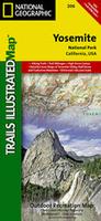
Yosemite N.P. #206. 1:80,000 & 1:40,000.
Sierra Nevada Hiking Maps
Sierra Nevada Road Map. 1:500,000. Imus Geographics. From Lassen Volcanic National Park through the High Sierra to Tehachapi Pass, this map displays the entire Sierra Nevada in a continuous sweep of dramatic mountain landscape. Size is 30 x 50 inches, folded. Note that the flat and laminated maps are printed on heavier poster-weight paper.
Sierra Nevada map sample Image of the entire Sierra Nevada map
$9.95
62-56726
1 sheet, folded.
$29.95
62-56726R
1 sheet, flat.
$39.95
62-56726L
1 sheet, laminated.
California Gold Country. Actual. This artist's rendition shows the foothills of the Sierra Nevada and the locations of recreation and historic sites. A second map shows the main roads in the area. In my opinion this map is a good idea that needs a little finishing polish; the road map covers the main roads, but not the backroads which make exploring the Gold Country so much fun and the artist's rendition of the terrain just doesn't capture the vertical relief in the area. A new map by the same group is due shortly for the Columbia River Gorge - hopefully it will show more detail.
Sample #1 Sample #2
$4.95
62-5684
1 sheet, folded
Yosemite Hiking Maps and Yosemite Wall Maps
Yosemite Road and Recreation Map. 1:1,318,821. Benchmark Maps. This map includes a regional map of the surrounding area, with special enlargements of the Park and Yosemite Valley on the reverse. Every rock and crag is beautifully mapped, with points of interest listed and described.
Sample detail from the Yosemite recreation map.
$5.95
62-5692YO
1 sheet, folded
Yosemite National Park Detailed Regional Maps. 1:40,000. National Geographic Maps/Trails Illustrated. These Trails Illustrated/National Geographic maps offer enhanced detail of Yosemite National Park. These maps meet the demand of hikers wanting to travel the more remote trails and off-trail back country. Waterproof, tear-resistant, these are the best and most current maps available for Yosemite National Park.
Thumbnail of the front of the map. Thumbnail of the reverse of the map Detail from the map.
$11.95
63-2100-306
Yosemite National Park Southwest - Yosemite Valley & Wawona.
$11.95
63-2100-307
Yosemite National Park Northwest - Hetch Hetchy Reservoir.
$11.95
63-2100-308
Yosemite National Park Northeast - Tuolumne Meadows and Hoover Wilderness.
$11.95
63-2100-309
Yosemite National Park Southeast - Ansel Adams Wilderness.
$32.95
63-2100-PYOS
Yosemite N.P. Sectional Map Pack - discounted. 1:40,000. Includes 63-2100-306 Yosemite Valley & Wawona, 63-2100-307 Hetch Hetchy Reservoir, 63-2100-308 Tuolumne Meadows, and 63-2100-309 Ansel Adams Wilderness maps.
Hiking maps of Yosemite National Park. Rufus Graphics. Rufus Graphics produces three maps of the most popular sections of Yosemite National Park; Tuolumne Meadows, Wawona & Mariposa Grove, and Yosemite Valley. The three maps all have a detailed map of the main area of interest on the front showing roads, trails, elevation, picnic areas, campsite, and much more. The reverse shows detailed tourist information including information on wildlife, flora, natural history, camping and much more. Published in cooperation with the Yosemite Conservancy and the Yosemite Association.
Yosemite Valley Hiking Map. 1:24,000 - 1:350,000. Gecko Maps. This attractive map includes three inset maps; on one side is detailed a 1:24,000 topographic hiking map of the main Yosemite Valley showing hiking trails, tourist facilities, etc. On the reverse is a 1:350,000 overview map of the Yosemite National Park, a panoramic map of Yosemite Valley, and a panoramic map of the back side of Half Dome. Bilingual.
Sample of the Yosemite Valley Panorama map Sample of the Valley topographic hiking map Sample of the National Park overview map
$12.95
62-56743
1 sheet, folded.
Lake Tahoe Hiking Maps
Lake Tahoe Basin & Tahoe National Forest Maps. 1:63,360. National Geographic Maps/Trails Illustrated. Detailed waterproof, tear-resistant double-sided topographic hiking maps. Trails are classified by use - hiking, horse and hike, mountain bike, shared use, or motorized - and includes a trail chart showing trail name, location, and allowed use. Trail mileage, private land designation, and information on general regulations, safety, Desolation Wilderness, camping, fishing, and snow parks round out the usefulness of this map. It also includes bathymetric shading of Lake Tahoe. Size is approximately 25 x 38".
Thumbnail of the front of the Lake Tahoe Basin map. Thumbnail of the reverse of the Lake Tahoe Basin map Map detail from the Lake Tahoe Basin map. Map detail from the Yuba River map.
$14.95
63-2100-803
Lake Tahoe Basin Map. #803. 1:63,360.
$14.95
63-2100-804
Yuba & America Rivers Map, Tahoe National Forest. #804. 1:63,360.
$14.95
63-2100-805
Sierra Buttes & Donner Region Map. #805. 1:63,360.
Waterproof! Lake Tahoe Basin Trail Map. 1:62,000. Adventure Maps. The Lake Tahoe, California Mountain Biking and Hiking Adventure Trail Map is a waterproof, topographic map that includes a route guide covering trails throughout the Lake Tahoe Basin, Truckee, Donner Summit, Desolation Wilderness, Granite Chief Wilderness, Mt. Rose Wilderness and Hope Valley. This also includes detailed map and route descriptions for mountain bike trails, hiking trails, horseback riding trails and nordic/cross-country skiing trails in the Lake Tahoe Basin and Truckee.
In addition to its popular downhill ski resorts and deep blue waters, the Lake Tahoe Basin is renowned for having some of the best mountain biking, hiking, horseback riding and cross-country skiing terrain in the world. The alpine climate, forested slopes, granite peaks and abundant lakes and streams create a spectacular outdoor recreation destination for all abilities. This trail map displays, describes and rates the majority of the trails and other routes in the Lake Tahoe area in a clear and concise format. Size is 27 x 39 inches.
Sample detail from the Lake Tahoe hiking map.
$11.99
62-56729-LT
1 sheet, folded
Waterproof! Lake Tahoe Water Trail Map. 1:48,000. Adventure Maps. The Lake Tahoe Water Trail Map & Guide is a waterproof, topographic map that includes detailed paddling and boating information for Lake Tahoe and Fallen Leaf Lake.
The Lake Tahoe Water Trail Map & Guide was developed to create a unique paddling opportunity and provide visitors with an ecologically sustainable alternative for recreating in this wonderful place. It is designed to help plan custom paddling and boating adventures along the shores of Lake Tahoe. It can also be very useful to power boaters and fisherman for navigating this large body of water.
This map combines a highly detailed topographical map of the Lake Tahoe, including GPS coordinates and Lat/Long grids, with a detailed table of near-shore services around the lake. Color coded numbers on the map correspond to description lines in the information table to help in all phases of planning your paddling or boating itinerary. Each description line provides necessary information about a specific site (phone numbers, reservation information, available amenities, etc. Size is 27 x 39 inches.
Sample detail from the Lake Tahoe hiking map.
$11.99
62-56729-LW
1 sheet, folded
California Hiking Maps by Tom Harrison Maps
Tom Harrison produces a series of excellent hiking maps for various California hiking regions. He bases his maps on USGS topographic maps, upon which he adds information on hiking and trails. All maps have latitude-longitude markings and UTM grid as well. The maps are printed on "Polyart" synthetic paper. The maps are folded to 4" x 9" size.
Index map showing coverage of each map Sample from the Lake Tahoe map. Enlarged to show the detail.
Sierra Nevada & Sierra Nevada High Country Maps - John Muir Trail, Yosemite Valley, Sequoia - Kings Canyon
Golden Trout Wilderness hiking map. 1:63,360. 80 foot contours.
$9.95
62-5693HB
Half Dome Hiking/Topographic hiking map. 1:31,680 (one inch = 1/2 mile). Glacier Point-Yosemite Creek and Tenaya Lake-Little Yosemite Valley. 80 ft. contours.
$12.95
62-5693HE
Hetch Hetchy Trail hiking map. 1:63,360. Detailed shaded-relief topographic map of the Hetch Hetchy region, including Lake Vernon, Laurel Lake, Lake Eleanor, Cherry Lake, Pate Valley, White Wolf, Kibbie Lake, and Rancheria Falls.
$9.95
62-5693HO
Hoover Wilderness hiking map. 1:63,360. Detailed shaded-relief topographic map of the Hoover Wilderness region, including North Yosemite boundary, Bridgeport, Leavitt Meadows, Twin Lakes, Lundy Lake, Virginia Lakes, Green Creek, Buckeye Creek, and Matterhorn Peak. .
$8.95
62-5693KE
Kearsarge Pass - Rae Lakes Loop hiking map. Includes trails in Sequoia/Kings Canyon N.P, including Paradise Valley, Vidette Meadow, Charlotte Lake, Onion Valley, Bubbs Creek. ISBN 1-877689-84-X.
$9.95
62-5693KI
Kings Canyon High Country hiking map.1:63,360. Covers the area from Bubbs Creek to Wanda Lake and includes Mt. Pinchot, Marion Peak, and Mt. Goddard. Contour interval is 80 feet.
$9.95
62-5693MB
Mammoth High Country hiking map.1:63,360. Covers the area from Mono Lake to Cascade Valley, including Devils Postpile, Mammoth Mountain, and McGhee Creek. Contour interval is 80 feet.
$8.95
62-5693MI
Mineral King hiking map. Includes trails in Sequoia/Kings Canyon N.P., including Bearpaw Meadow, Franklin Pass, Little Five Lakes, Hockett Meadow, High Sierra Trail, Funston Meadow, Silver City, Chagoopa Plateau.
$9.95
62-5693MO
Mono Divide High Country hiking map.1:63,360. Covers the area from Wanda Lake to Cascade VAlley, including Florence Lake and Lake Edison. Contour interval is 80 feet.
$8.95
62-5693MN
Mono Lake hiking map. 1:63,360. 80 foot contours.
$9.95
62-5693MT
Mt. Whitney High Country hiking map. 1:63,360. Covers the area from Mineral King to Bubbs Creek and includes Mt. Whitney, Triple Divide Peak, and Giant Forest. Contour interval is 80 feet.
$9.95
62-5693WH
Mt. Whitney Zone hiking map. 1:31,680. 80 foot contours.
$9.95
62-5693PA
The Palisades hiking map. 1:31,680. Detailed shaded-relief topographic map of the Palisades area of the Central Sierra. Covers Palisade Basin, North Palisades, Mt. Sill, Mt. Jepson, Mt. Winchell, Big Pine Lakes, Thunderbolt Peak, Norman Clyde Glacier, Middle Palisade Glacier.
$9.95
62-5693SE
Sequoia/Kings Canyon Recreation hiking map. 1:125,000. Includes the surrounding portions of Sierra, Sequoia, and Inyo National Forests. Contour interval is 200 feet.
$12.99
62-5693SIE
Sierra National Forest hiking map. 1:158,000.
$9.95
62-5693TU
Tuolomne Meadows hiking map. 1:42,240. Detailed shaded-relief topographic map of the Tuolumne Meadows area of the Yosemite National Park. Covers May Lake, Tenaya Lake, Merced Lake, Elizabeth Lake, Glen Aulin, Sunrise, Vogelsang, and Waterwheel Falls.
$9.95
62-5693YO
Yosemite High Country hiking map.1:63,360. Includes the surrounding areas of Sierra, Stanislaus, and Inyo National Forests. Contour interval is 80 feet.
$9.95
62-5693YP
Yosemite Natl.Park hiking map. 1:125,000. Includes the surrounding areas of Sierra, Stanislaus, and Inyo National Forests. Contour interval is 200 feet.
$10.95
62-5693YQ
Yosemite Valley hiking map. 1:24,000. Unique legend panel with five languages - English, Spanish, French, German, and Japanese. Contour interval is 40 feet.
Front view of the map Detail of the map.
San Francisco Bay Area Hiking Maps
$4.95
62-5693AN
Angel Island & Alcatraz Island hiking map. 1:12,000. Covers Alcatraz, the famous prison island in San Francisco Bay, as well as the often overlooked Angel Island.
$5.95
62-5693BE
Bear Valley Day Hikes hiking map. 1:18,000.
$8.95
62-5693BH
Big Rock Ridge & Indian Valley hiking map. 1:18,000.
$8.95
62-5693DI
Dipsea & Mountain Play hiking map. 1:15,840.
$5.95
62-5693FI
Five Brooks Day Hikes hiking map. 1:18,000.
$5.95
62-5693LI
Limantour Day Hikes hiking map. 1:18,000.
$5.95
62-5693MD
Mt. Burdell - Olompali Day Hikes hiking map. 1:18,000.
Pine Mountain hiking map. 1:24,000. Covers Audubon Canyon Ranch, French Ranch, Roy's Redwoods, Cascade Canyon, Loma Alta, and White Hill.
$9.95
62-5693PR
Pt. Reyes N.S hiking map. 1:48,000. This is the only shaded-relief, topographic map ever produced of the Seashore. Covers all hiking and biking trails, plus trails in Samuel P. Taylor and Tomales Bay State Parks. Contour interval is 80 feet. New series, printed on Polyart, with lat-long and UTM.
$5.95
62-5693PN
Point Reyes North hiking map. 1:67,320.
$5.95
62-5693PS
Point Reyes South hiking map. 1:67,320.
$8.95
62-5693SR
San Rafael & Central Marin County hiking map. 1:24,000.
Death Valley Recreation hiking map. 1:250,000. Covers the entire Death Valley region, including the new expanded boundaries.
$9.95
62-5693JO
Joshua Tree Recreation hiking map. 1:125,000. This is the only topographic map ever produced showing the entire park on a single sheet. Contour interval is 50 meters; elevations in both meters and feet.
$9.95
62-5693MM
Mojave National Preserve hiking map. 1:250,000. The only topographic map available for teh newest member of the National Park system in California. Contour interval is 200 feet.
$9.95
62-5693SD
San Diego Backcountry: Anza-Borrego hiking map. 1:125,000. Covers the entire Anza-Borrego Desert as well as a portion of the Cleveland National Forest. Contour interval is 200 feet, with elevations in both meters and feet. Printed on Polyart, with lat-long and UTM.
Northern California Area Hiking Maps
$9.95
62-5693DE
Desolation Wilderness hiking map. 1:42,240. One of the most popular day-hiking and backpacking areas in the Lake Tahoe area. Contour interval is 40 feet.
$9.95
62-5693LT
Lake Tahoe Recreation hiking map. 1:71,280. Includes the route of the Lake Tahoe Rim Trail. The only topographic map that shows all of Lake Tahoe on a single sheet. 80 foot contours.
$9.95
62-5693MS
Mt. Shasta Wilderness hiking map. 1:63,360. The only shaded-relief map ever produced of this beautiful mountain. Contour interval is 80 feet.
Southern California Area Hiking Maps
$9.95
62-5693AF
Angeles Front Country hiking map. 1:63,360. Covers the portion of the San Gabriel Mountains between Placerita Canyon Park and Chilao Campground. Contour interval is 80 feet, with elevations in meters and feet.
$9.95
62-5693AH
Angeles High Country hiking map. 1:63,360. Covers the San Gabriel Mountains from just east of Chlao to Lytle Creek. Contour interval is 80 feet; elevations in meters and feet.
$9.95
62-5693CU
Cuyamaca Rancho State Park hiking map. 1:31,680. This is a beautiful State Park in San Diego County that is very popular with hikers, mountain bikers, and equestians. Contour intervalis 40 feet.
$9.95
62-5693MA
Malibu Creek State Park. 1:31,680. (Tom Harrison). ;
$9.95
62-5693BB
Mt. Baldy hiking map. Cucamonga Wilderness. 1:31,680 (one inch = 1/2 mile). 80 ft. contours.
$8.95
62-5693MW
Mt. Wilson hiking map. 1:31,680. 80 foot contours.
$9.95
62-5693PM
Pt. Mugu State Park. 1:31,680. (Tom Harrison).
$9.95
62-5693SG
San Gorgonio Wilderness hiking map. 1:42,520. Covers the entire Wilderness area with Trail mileages and trail camps shown. Contour interval is 80 feet.
$9.95
62-5693SJ
San Jacinto Wilderness hiking map. 1:42,240. Covers both the State Park and National Forest wilderness areas. Contour interval is 80 feet.
$9.95
62-5693SH
Sespe Wilderness hiking map. 1:63,360 (1 inch = 1 miles). 100 ft. contours.
$9.95
62-5693TO
Topanga State Park. 1:31,680. (Tom Harrison). ;
$8.95
62-5693VE
Verdugo Mountains Parks & Open Space hiking map. 1:24,000. Covers Brand Park, Henderson Canyon, Stough Park, La Tuna Canyon, Wildwood Canyon Park, Beaudry North & South Motorways, Brand Motorway, Chandler Motorway, Hostetter Motorway, Las Flores Motorway, and Verdugo Motorway.
$8.95
62-5693ZU
Zuma-Trancas Canyons. 1:31,680. (Tom Harrison). ;
Hiking maps for California's National Parks, National Forests, State Parks, and popular trails hiking map.
Waterproof. Lassen Volcanic National Monument hiking map. 1:48,000. Earthwalk Press. A great hiking map of this active volcanic area in northern California. Lassen last erupted in 1915-1917, leaving a classic volcanic terrain for hiking and investigation. While the landscape has recovered, the peak is still spectacular and the trails around the base and lower slopes are well worth the trip.
$9.95
62-2410
1 sheet, folded.
Waterproof Whiskeytown - Shasta - Trinity Hiking Map. 1:50,000. Earthwalk Press. A good waterproof map of this overlooked but superb hiking area in northern California. Great trout fishing, remote trails - a good alternative to the Sierran foothills with fewer people.
$3.95
62-2425
1 sheet, folded.
Kern River Sierra Topographic Map. 1:62,500. Extremeline, 2011. The map features the hiking and mountain biking trails, rock climbing spots, whitwater launches and named rapids, giant sequoia groves, winter trailheads, water sports, fishing and hunting access, and other recreational opportunities in the Kern River Valley and Southern Sierra region.
Ranging from 10,000 feet to 2,000 feet in elevation, the rugged and diverse land of the Kern River Sierra encompasses the Giant Sequoia National Monument, Camp Nelson, Black Rock Station and the Kern Plateau, Kennedy Meadows, Kernville, Lake Isabella, Keyesville, Greenhorn Mountains, Piute Mountains, the North Fork and South Fork of the Kern River, and much of the Domeland, Southern Sierra, and Golden Trout Wilderness. Double-sided map, size is 32 x 28 inches unfolded.
Sample detail from Kern River Sierra topographic map.
Mount Diablo Hiking Map. 1:25,000. Redwood Hikes Press, 2015. ISBN 9781934127278.
This waterproof map includes Mount Diablo, Morgan Territory, Black Diamond Mines, and the Los Vaqueros Watershed. Map size is 27 x 39", printed on waterproof plastic, full color on both sides.
Sample detail of the Mt. Diablo map
$10.99
62-56728
1 sheet, folded.
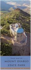
Waterproof, new edition. Trail Map of Mount Diablo State Park. Mt. Diablo Interpretive Association, 2009. The Mount Diablo Trail Map is a detailed topographic map printed on water resistant paper and is a "must have" for all visitors to the park. The casual visitor who is simply interested in picnic areas and roads as well as the serious hiker who wants to explore the mountains back country will find all the details they need on this one map. This is the most detailed, up to date map of the park.
All 187 trails in the park are clearly shown and adjoining trails that lead into the park have also been included. Trails suitable for bicyclists and equestrians are marked and those hiking with GPS will be pleased with the detailed elevation and UTM (Universal Transverse Mercator) grid provided.
The back of the map welcomes you to the mountain with general information, park rules and specific information about the mountains natural history and points of interest.
Sample detail of the Mt. Diablo State Park hiking map
$12.99
62-56735
1 sheet, folded.
King Range National Conservation Area - The Lost Coast hiking map. Scale approx. 1:64,000. BLM. The map covers all of the King Range NCA, from north of Punta Gorda Lighthouse to south of Shelter Cove/Seal Rock. The front of the map has a detailed topographic map showing the topography of the King Range area of Northern California. Hiking and horse trails, camping information, park facilities, and other information are noted on the map. The front also has summaries of the 10 most popular trails in the NCA. The reverse side has information on the main features of the area and suggestions for things to do and see.
Sample detail from Kern River Sierra topographic map.
$8.99
62-56747
1 sheet, folded.
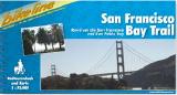
San Francisco Bay Trail Cycling Atlas. 1:75,000 + city maps. Bikeline/Esterbauer. 120 pages. The San Francisco Bay Trail is a pleasant combination of history workshop and bicycle tourism, of cultural enjoyment and charming flora and fauna. It traverses downtown San Francisco as well as the "San Francisco National Wildlife Refuge" and leads through almost 100 parks or protected reserve lands. In English.
Index map of the route covered. Sample of a map page Sample of the route descriptions
$23.95
66-2279-SFB
S.F. Bay Area guide/map.
San Francisco Bay Recreation Map. Franko's Maps. Complete Map and Guide to the Greater San Francisco Bay, from the Wine Country in the north to San Jose in the south. It includes close up views of Sausalito, Angel Island. Treasure Island, Alcatraz, Alameda, Oakland and Berkeley. This the site of the 2013 America's Cup Race and thus the map shows all of the marinas, fishing piers, and yacht harbors on the Bay. This is not a detailed street map of San Francisco city, but this is a great map for those wanting to get out of Sasn Francisco to the wine country, the East Bay and UC Berkeley, Stanford University, or Half Moon Bay.
The reverse side has more detailed coverage of the central part of the Bay, from Tiburon to Oakland.
Sample detail from regional side of the San Francisco Bay area map. Sample detail from detailed side of the San Francisco Bay area map.
$9.99
62-5687-SFB
1 sheet, folded.
Napa & Sonoma Area Maps
Sonoma Valley Trails Map. 1:30,000. Map Adventure. Explore the most beautiful and historic parks in Sonoma County - experience first hand the mountains and valleys that make up wine country.
The map covers:
Sonoma Valley & Carneros Trails Map. 1:30,000. Map Adventure. Explore the most beautiful and historic parks in Sonoma Valley and the Carneros region. The map shows bikeways, suggested day trips, index to wineries, and street index.
Areas covered:
Napa & Sonoma City Maps maps. Various publishers. These are city street maps, not wine maps. Please click here for a superb collection of wine maps for California.
$7.95
62-5682-04
Napa & Sonoma wine country map. Popular hand drawn map showing wineries, vineyards, shopping, etc. On waterproof paper. (MapEasy).
$4.95
62-5682-03
Napa & Lake County Winery Locations. (Compass). A detailed black and white street map of the area.
$5.95
62-5692NAP
Napa & the Wineries city map. (GM Johnson).
USGS Benchmark Paperweights, Lapel Pins, and Zipper Pulls
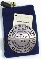
Mt. Whitney benchmark paperweight & lapel pin. Geo-Situ. Whether you're a climber, hiker, geography buff, or armchair traveler, you'll love to collect or give these unique bench mark paperweights that celebrate the spirit of exploration, athletic challenge, and personal achievement. Cast in pewter these summit marker paperweights are exact replicas of official USGS benchmark markers. Please click the "sample" button below to see an enlargement of the paperweight. Each marker has a soft felt pad on the bottom so these can be used on glass, wood, or any surface. Supplied in a soft fleece drawstring pouch, 3¼" diameter.
Larger image of the Mt. Whitney paperweight.
$59.95
62-5697WH
Paperweight.
$9.95
67-9515
1" lapel pin.
Mt. Whitney benchmark magnet. Geo-Situ. Whether you're a climber, hiker, geography buff, or armchair traveler, you'll love to collect or give these unique bench mark magnets that celebrate the spirit of exploration, athletic challenge, and personal achievement. These smaller replicas of the benchmark paperweights are ideal as inexpensive gifts or as refrigerator magnets or office note magnets for yourself.
$10.95
62-5697WHM
Magnet.
Additional benchmark paperweights for California locations. Geo-Situ.
$59.95
62-5697BAD
Badwater Basin, Death Valley paperweight.
$59.95
62-5697BA
Mt. Baldy paperweight.
$59.95
62-5697CL
Clouds Rest, Yosemite paperweight.
$59.95
62-5697EL
El Capitan paperweight.
$59.95
62-5697GL
Glacier Point, Yosemite paperweight.
$59.95
62-5697HA
Half Dome paperweight.
$59.95
62-5697JO
Joshua Tree paperweight.
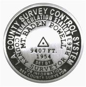
$39.99
62-5697BP
Mt. Baden Powell paperweight.
$59.95
62-5697LA
Mt. Langley paperweight.
$59.95
62-5697LB
Mt. Lassen paperweight.
$59.95
62-5697SH
Mt. Shasta paperweight.
$59.95
62-5697TA
Mt. Tamalpais paperweight.
$59.95
62-5697SG
San Gorgonio paperweight.
$59.95
62-5697SJ
San Jacinto paperweight.
$59.95
62-5697TP
Telescope Peak, Death Valley paperweight.
$59.95
62-5697W
White Mtn. paperweight.
Additional Benchmark lapel pins for California locations. Geo-Situ. These lapel pins are 1" diameter replicas of famouse benchmarks and are ideal companions to the 3" benchmark paperweights listed above. Made of pewter and with a clutch back.
$11.95
62-5697BPL
Baden Powell lapel pin.
$11.95
62-5697BADL
Badwater Basin lapel pin.
$11.95
62-5697CLL
Clouds Rest lapel pin.
$11.95
62-5697ELL
El Capitan GNIS lapel pin.
$11.95
62-5697GLL
Glacier Point lapel pin.
$11.95
62-5697HAL
Half Dome GNIS lapel pin.
$11.95
62-5697BAL
Mt. Baldy lapel pin.
$11.95
62-5697LAL
Mt. Langley lapel pin.
$11.95
62-5697LBL
Mt. Lassen lapel pin.
$11.95
62-5697SHL
Mt. Shasta lapel pin.
$11.95
62-5697TAL
Mt. Tamalpais lapel pin.
$9.95
67-9515
Mt. Whitney lapel pin.
$11.95
62-5697SGL
San Gorgonio lapel pin.
$11.95
62-5697SJL
San Jacinto lapel pin.
$11.95
62-5697TPL
Telescope Peak lapel pin.
$11.95
62-5697WL
White Mountain lapel pin.
Benchmark Magnets. 1-1/4-inch diameter benchmark magnets. Cast in fine pewter.
$12.95
62-5697CLM
Clouds Rest, Yosemite National Park, CA magnet. 9,926 ft.
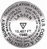
$11.95
62-5697LBZ
Mt. Lassen, Lassen Volcanic National Park, AZ magnet. 10,457 ft.
$10.95
62-5697WHM
Mt. Whitney, Yosemite National Park, CA magnet. 14,494 ft.


 Sample from the Transverse Ranges map
 Coverage of the Southern California map.
 Coverage of the Transverse Ranges map.
 Coverage of the Southern Sierra Nevada map.
 Coverage of the Central Sierra Nevada map.
 Image of the front of the Half Moon Bay hiking map
 Sample detail of the Half Moon Bay hiking map
 Sample detail of the Mt. Diablo map
 Sample detail of the Muir Woods hiking map
 Image of the front of the Muir Woods hiking map
 Image of the reverse of the Muir Woods hiking map
 Image of the front of the Redwoods National Park hiking map
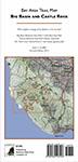
 Sample detail from the Big Basin and Castle Rock hiking map
 Front of the Big Basin and Castle Rock hiking map
 Revers of the Big Basin and Castle Rock hiking map
 Sketch map of area covered by Big Basin and Castle Rock map
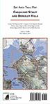
 Sample detail from the Carquinez Straits maphiking map
 Front of the Carquinez Straits maphiking map
 Revers of the Carquinez Straits maphiking map
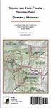
 Sample detail from the Generals Highway hiking map
 Front of the Generals Highway hiking map
 Revers of the Generals Highway hiking map
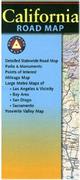
 Sample detail from the California recreation map.
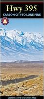
 Sample detail from the Highway 395 recreation map.
 Detail from the Santa Ynez map
 Detail from the Santa Ynez map
 Image of the entire Santa Ynez map
 Image of the reverse side of the Santa Ynez map
 Detail from the Santa Barbara Surfing map
 Front of the Santa Barbara Surfing map
 Reverse of the Santa Barbara Surfing map
 Detail from the Catalina Island map
 Image of the entire Catalina Island map
 Image of the reverse side of the Catalina Island map
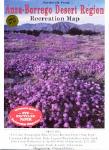 Waterproof.
 California Hiking Map Index
  Map detail from the Yosemite N.P. map.
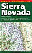
 Sierra Nevada map sample
 Image of the entire Sierra Nevada map
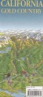
 Sample #1
 Sample #2
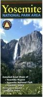
 Sample detail from the Yosemite recreation map.
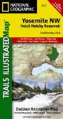
 Thumbnail of the front of the map.
 Thumbnail of the reverse of the map
 Detail from the map.
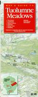
 Map detail from the Tuolumne Meadows district map.
 Front of the Tuolumne Meadows district map.
 Reverse of the Tuolumne Meadows district map.
 Map detail from the Wawona and the Mariposa Grove district map.
 Front of the Wawona and the Mariposa Grove district map.
 Reverse of the Wawona and the Mariposa Grove district map.
 Map detail from the Yosemite Valley district map.
 Front of the Yosemite Valley district map.
 Reverse of the Yosemite Valley district map.
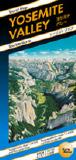
 Sample of the Yosemite Valley Panorama map
 Sample of the Valley topographic hiking map
 Sample of the National Park overview map
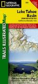
 Thumbnail of the front of the Lake Tahoe Basin map.
 Thumbnail of the reverse of the Lake Tahoe Basin map
 Map detail from the Lake Tahoe Basin map.
 Map detail from the Yuba River map.
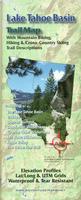 Waterproof!
 Sample detail from the Lake Tahoe hiking map.
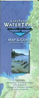 Waterproof!
 Sample detail from the Lake Tahoe hiking map.
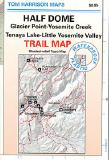
 Index map showing coverage of each map
 Sample from the Lake Tahoe map.
 Enlarged to show the detail.
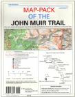
 Index showing coverage of the maps in this pack
 Legend of the map.
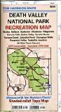


 Front view of the map
 Detail of the map.
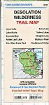
 Front view of the Death Valley map
 Sample detail of the Death Valley map.
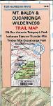


 Waterproof.
 Waterproof
 Sample detail from Kern River Sierra topographic map.
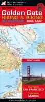 Waterproof!
 Index showing coverage of both maps.
 Golden Gate map - sample detail.
 Golden Gate map - front side of the map.
 Golden Gate map - reverse of the map.
 Mt. Tam. map - sample detail.
 Mt. Tam map - front side of the map.
 Mt. Tam map - reverse side of the map.
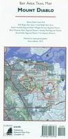
 Waterproof, new edition.
 Sample detail of the Mt. Diablo State Park hiking map
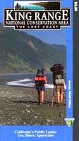
 Index map of the route covered.
 Sample of a map page
 Sample of the route descriptions
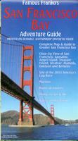
 Sample detail from regional side of the San Francisco Bay area map.
 Sample detail from detailed side of the San Francisco Bay area map.
 Image of the front of the Sonoma Valley Trails map
 Image of the reverse of the Sonoma Valley Trails map
 Image of the front of the Carneros Trails map
 Image of the reverse of the Carneros Trails map

 Larger image of the Mt. Whitney paperweight.