|
|
New Hampshire Road and Recreation Atlases.
New Hampshire Road Maps - Paper Maps
New Hampshire Road Maps - Laminated Maps
New Hampshire City Maps - Paper Maps
New Hampshire City Maps - Laminated Maps
New Hampshire City, County, and State Business Wall Maps
We offer wall maps for Concord, Mancheester, and Nashua.
Click here to order city wall maps and to see sample images, prices, sizes, and mounting options.
We offer state and county wall maps for all of the USA. The maps come in sizes from 24 x 36 to 108 x 144 inches. They are available in variety of mounting and framing options. The maps are ideal for business applications, sales territory, delivery planning, direct mail targeting and hundreds of other applications. Click here to order county wall maps and to see sample images, prices, sizes, and mounting options. Click here to order state wall maps and to see sample images, prices, sizes, and mounting options.
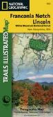
New Hampshire Recreation Maps.
 Sample from the 3rd edition map. Sample from the 3rd edition map.
New Hampshire Wall Maps
We offer state and county wall maps for all of the USA. The maps come in sizes from 24 x 36 to 108 x 144 inches. They are available in variety of mounting and framing options. The maps are ideal for business applications, sales territory, delivery planning, direct mail targeting and hundreds of other applications. Click here to order county wall maps and to see sample images, descriptions, and prices. Click here to order state wall maps and to see sample images, descriptions, and prices.
New Hampshire Geology and Thematic Maps.New Hampshire Geologic Map. 1:250,000. 1955. NH DRED. This map is now out of print and we have only 1 copy left.
New Hampshire and Vermont Seismicity Map. 1:1,000,000. 1980. USGS (MF-1261). Map size is 61 x 76 cm.
New Hampshire Geologic Quadrangle Maps. 1:62,500. NHDES.
New Hampshire Flags.
|
||||||||||||||||||||||||||||||||||||||||||||||||||||||||||||||||||||||||||||||||||||||||||||||||||||||||||||||||||||||||||||||||||||||||||||||||||||||||||||||||||||||
 New Hampshire Maps
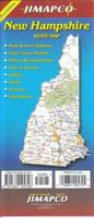


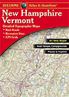
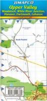
 Sample detail from the New Hampshire/Vermont atlas

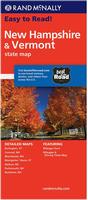 New Hampshire Road Map. Rand McNally.
 Laminated
 Sample detail #1 from the New Hampshire road map.
 Sample detail #2 from the New Hampshire road map.
 Laminated
 Laminated
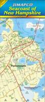
 Sample detail #1 from the New Hampshire Seacoast road map.
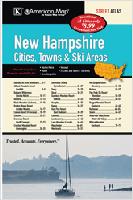 New Hampshire Cities & Towns Atlas. American Map.
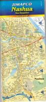
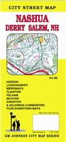 New Hampshire City Maps. Various publishers.
 Laminated
 Laminated
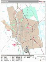
 Sample detail from the Manchester wall map.
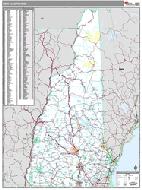 New Hampshire County and State Wall Maps.

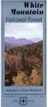
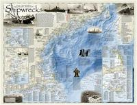
 Image of the Shipwrecks of the Northeast USA map
 Sample of the Shipwrecks of the Northeast USA map
 New Hampshire map coverages
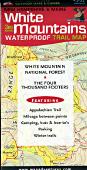
 Thumbnail of the front of the map.
 Thumbnail of the reverse of the map
 Detail from the map.
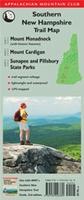 Waterproof!
 Samples of the southern New Hampshire Trail Map
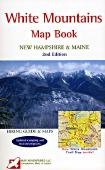
 Thumbnail of the map.
 Sample of the detail.
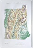
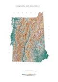
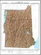 New Hampshire Shaded Relief Map. 1:500,000. 1972. USGS. This map also covers Vermont. The map measures 56 x 71 cm.
 Sample detail of the map.
 Image of the New Hampshire map.
 New Hampshire Flags