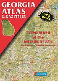
Georgia Atlas and Gazetteer. 1:250,000. DeLorme.
Excellent road atlas with topographic maps and gazetteer, pages of outdoor recreation information on campgrounds, state and local parks, trails, and much more.
$29.95
62-6248
Atlas
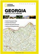
Georgia Recreation Atlas. 1:125,000. National Geographic Maps.
National Geographic's Georgia Recreation Atlas is an ideal recreation resource and contains accurate, detailed topographic maps with private and public land boundaries, a complete road network, valuable recreation information and extensive cross-referenced lists and charts for campgrounds, lakes, parks, attractions and more. State Game Management Unit maps and fish species lists will appeal to the sportsman while detailed primary road networks will be of great interest to motorcyclists, RVers, and those simply touring the state.
Sample
$24.95
62-62485
Atlas
Georgia Road Maps - Paper Maps
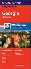
Georgia Road Map. Rand McNally.
This folded road map has clearly labeled Interstate, U.S., state, and county highways; indications of parks, points of interest, airports, county boundaries, and more;
a mileage and driving times map; and a detailed index. The map includes detailed inset maps of Albany, Athens, Atlanta & Vicinity, Downtown Atlanta, Augusta, Brunswick, Columbus, Macon, and Savannah. Map size unfolded is 28 x 40 inches.
Sample detail of the Georgia Road Map
$7.99
62-6290
1 sheet, folded.
Central Georgia Regional Road Map. ADC.
The Central Georgia State fold map is a full-color, regional map, including: 51 counties, Airports, Interstate Exit Numbers, Historic Sites, a Mileage Chart, Military Reservations, National Forests, Places of Interest, and State Parks.
$7.99
62-62907-CE
1 sheet, folded.
Georgia Road Maps - Laminated Maps
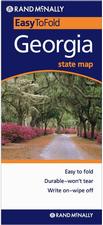
Laminated Georgia Easyfinder® Road Map - laminated. Rand McNally.
This handy map with heavy-duty lamination allows you to write on, wipe off. It is durable and tear resistant; folds to display individual map sections;
has full-color maps with enhanced cartography; has clearly indicated highways, county boundaries, points of interest, and more; and has a quick-reference legend and city index. Size is 18 x 17 inches unfolded.
Sample detail of the Georgia Road Map
$9.99
62-62902
1 sheet, folded.
Waterproof Georgia Destination Road Map - waterproof. National Geographic Maps.
The front side is an easy-to-read road map with insets of: - Athens - Augusta - Albany - Savannah - Brunswick / Jekyll Island - Columbus - Macon The back includes: - Points of interest - Information and map of Atlanta - Information for Okefenokee National Wildlife Refuge and Swamp Park - Scenic drive - Park Service sites in Georgia. Approx. 4 x 9 inches folded, 17¾ x 24¾ inches unfolded.
Sample detail of the Georgia Road Map
$9.95
62-62904
1 sheet, folded.
Laminated Georgia Road Map - Laminated. ADC. Laminated road map with city/town index. Very similar to 62-62902 above.
$8.95
62-62909
1 sheet, folded.
Atlanta City Maps.
Atlanta City Maps - Paper.
Atlanta Central City Map. Map Supply.
Detailed large street map, fully indexed. Also Includes: Avondale Estates, Chamblee, Clarkston, College Park, Decatur, Doraville, East Point, Forest Park, Hapeville, Lake City and Smyrna.
$4.95
62-6292ATC
1 sheet, folded.
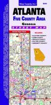
Atlanta 5-County City Map. Map Supply.
This detailed map covers both Atlanta and the 5 surrounding counties. The map includes Clayton County, Cobb County, Dekalb County, Fulton County and Gwinnett County. Also Includes Cities Of: Acworth, Alpharetta, Austell, Avondale Estates, Berkeley Lake, Chamblee, Clarkston, College Park, Decatur, Doralville, Duluth, East Point, Fairburn, Forest Park, Hapeville, Jonesboro, Kennesaw, Lake City, Lilburn, Lithonia, Marietta, Morrow, Mountain Park, Norcross, Palmetto, Pine Lake, Riverdale, Powder Springs, Roswell, Smyrna, Stone Mountain, Suwanee and Union City.
$5.95
62-6292ATL
1 sheet, folded.
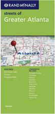
Greater Atlanta City Map. Rand McNally.
This street map covers the Greater Atlanta area, including Avondale Estates, Chamblee, Decatur, Doraville, East Point, Forest Park, Hapeville, Marietta, Morrow, Smyrna, Stockbridge, and Union City. The map shows one-way streets;
indications of county boundaries, schools, shopping malls, parks, golf courses, hospitals, airports, and points of interest; has an easy-to-use legend; and a detailed street index.
$6.99
62-6292AV
1 sheet, folded.
Atlanta Street Map. ADC.
This full-color street map of Atlanta, GA includes: Avondale Estates, Chamblee, Clarkston, Decatur, Doraville, East Point, and Hapeville; and features: Airports, Block Numbers, Colleges and Universities, Golf Courses, Hospitals, Parks and Rec Areas, Places of Interest, Schools, and ZIP Codes.
$5.99
62-6292ATV
1 sheet, folded.
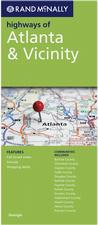
Highways of Atlanta & Vicinity City Map. Rand McNally.
Rand McNally's folded map featuring the highways of Atlanta and vicinity is a must-have for anyone traveling in and around this part of the state, offering unbeatable accuracy and reliability at a great price. Our trusted cartography shows all Interstate, state, and county highways, along with clearly indicated points of interest, airports, county boundaries, and more.
$6.99
62-6292AR
1 sheet, folded.
Atlanta Popout Map. Compass/Popout Maps.
Explore the glorious city of Atlanta with the help of this genuinely pocket-sized map. Small in size yet big on detail, this compact, dependable map will ensure you don't miss a thing.
Includes 2 PopOut maps: an overview map of Greater Atlanta and a detailed street by street plan of the Downtown area
Additional locator maps include Buckhead and Midtown/Virginia Highland, and a MARTA transit map
Ingenious, self-folding map is small enough to fit in your pocket yet offers extensive coverage of the city in an easy-to-use format
Thorough street index is also featured and cross-referenced to the map so you can easily find your destination
Key places of interest are listed offering you advice on the best things to see
$6.95
62-6292AO
1 sheet, folded.
Atlanta City Maps - Waterproof.
Laminated Atlanta City Map - Laminated. ADC.
This map of the Atlanta, GA area is durably laminated and contains extensive coverage. Laminated maps are easy to fold, write on, and wipe off. Coverage includes: a street-detail inset of the Buckhead area and Downtown Atlanta; and features: Airports, Colleges and Universities, Golf Courses, Hospitals, Parks and Rec Areas, Places of Interest, and ZIP Codes.
Now out of print - limited stock left.
$8.99
62-62921AS
1 sheet, folded.
Laminated Atlanta Streetsmart® Map - Laminated. VanDam.
VanDam's award winning "Atlanta StreetSmart" maps all of Atlantaland's attractions, neighborhoods, museums, hotels and more at an immensely legible scale with 3D buildings. Includes Downtown Atlanta detail and MARTA Rail System map.
This sexy laminated city map package refolds easily to 4" x 9" (24" x 9" open) and snuggly fits into your pocket.
Sample detail from the Atlanta Streetsmart map
$7.95
62-62921AT
1 sheet, folded.
Laminated Atlanta Unfolds Map - Laminated. VanDam.
VanDam's award winning Atlanta Unfolds maps all of Atlantaland's attractions, neighborhoods, museums, hotels and more at an immensely legible scale with 3D buildings. Includes Downtown Atlanta detail and MARTA Rail System map.
This compact map package refolds easily to 3" x 7.25" (8.5" x 11" open) and fits in your shirt pocket. Complete street index makes navigating the city easy.
Sample detail from the Atlanta Streetsmart map
Albany, Americus, Tifton, Bainbridge Street Map. (GM Johnson).
$5.95
62-6292ATH
Athens and Gainesville city map. (GM Johnson).
$5.99
62-6292AS
Athens Street Map. 2010. Includes map of Univ. of Georgia, downtown Athens, and more. (Seeger).
$5.95
62-6292AUGU
Augusta (GA) and Aiken (SC) city map. (GM Johnson).
$5.95
62-6292JE
Brunswick, St. Simons Island, Jekyll Island, and Glynn County, street map. (Map Supply) 1600641369.
$5.95
62-6292COL
Columbus, GA and Phenix City (AL) city map. (GM Johnson).
$5.99
62-6292CN
Columbus City map. (ADC).
$4.95
62-6292COV
Covington City map. (Universal Map).
$4.95
62-6292DB
Dalton & Whitfield County street map. (Map Supply).
$5.95
62-6292GAI
Gainesville & Hall County street map. (GM Johnson). Includes Clermont, Lula, Oakwood, and adjoining communities.
$5.95
62-6292JE
Jekyll Island, Brunswick, St. Simons Island, and Glynn County, street map. (Map Supply).
$5.99
62-6292NEW
Newnan and Lagrange City Map. (Universal Map).
$4.95
62-6292ROM
Rome, Cartersville, Calhoun city map. (GM Johnson).
$6.95
62-6292SAV
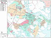
Savannah and Chatham County street map. (Map Supply).
$4.95
62-6292VAL
Valdosta, Thomasville, Moultrie City Map. (GM Johnson).
Other Georgia City Maps - Laminated.
Atlanta laminated maps are listed higher up this page.
Laminated Georgia City Maps - Laminated.
$7.95
62-62921SA
Savannah Tuffy Map. (Map Supply).
Georgia City & County Street Atlases.
Atlanta Metropolitan Area Atlas. ADC. Covers 8 counties. Most detailed atlas of Atlanta & area currently available.
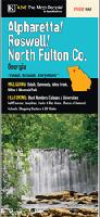
The atlas covers Alpharetta, Austell, Chamblee, College Park, Decatur, Duluth, Dunwoody, East Point, Fairburn, Forest Park, Johns Creek, Kennesaw, Lake City, Lilburn, Marietta, Morrow, Norcross, Riverdale, Roswell, Sandy Springs, Smyrna, Stone Mountain, Union City, and Woodstock. The atlas features Airports, Block Numbers, Colleges and Universities, Downtown Atlanta, Golf Courses, Hospitals, Parks and Rec Areas, Places of Interest, Schools, and ZIP Codes.
$25.99
62-6292AU
Atlas
Georgia City Wall Maps
Georgia City Wall Maps.
When it comes to general planning, defining delivery areas, planning direct marketing and delivering products, our city wall maps are perfect to get the detailed information you need.
These maps offer clear mapping by showing all major streets and roads and many of the smaller streets, but leaving out the smallest streets. If you want a clear map for easy planning, then these are the maps for you; if you want a map showing every little back alley, these are not for you.
We offer wall maps for Albany, Alpharetta, Athens, Atlanta, Augusta, Brookhaven, Brunswick, Columbus, Gainesville, Johns Creek, Macon, Marietta, Roswell, Sandy Springs, Savannah, Smyrna, Valdosta, and Warner Robins.
Click here to see sample images, prices, sizes, and mounting options.
We stock a 3-d plastic raised relief map for northern Georgia (Rome and Atlanta sheets).
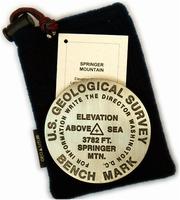
Appalachian Trail Benchmark Paperweights - Springer Mountain and Mt. Katahdin benchmark paperweights. Geo-Situ.
Whether you're a climber, hiker, geography buff, or armchair traveler, you'll love to collect or give these unique bench mark paperweights that celebrate the spirit of exploration, athletic challenge, and personal achievement. Cast in pewter these summit marker paperweights are exact replicas of official USGS benchmark markers. Please click the "sample" button below to see an enlargement of the paperweight. Each marker has a soft felt pad on the bottom so these can be used on glass, wood, or any surface. Supplied in a soft fleece drawstring pouch, 3¼" diameter.
These two replicas of the official USGS mountaintop benchmarks cover the starting point and the ending point of the Appalchian Trail.
Brasstown Bald & Springer Mountain Benchmark Paperweights. Geo-Situ.
Brasstown Bald is Georgia's highest elevation, rising 4784 feet above sea level. The summit is crowned with a stone tower and observation deck from which four states - Georgia, Tennessee, North Carolina, and South Carolina - are visible on a clear day.
Springer Mountain, 3782 feet high and the southern terminus of the Appalachian Trail, is located eight miles north of Amicalola, Georgia, in the northern part of the state.
Larger image of the Brasstown Bald paperweight.
$59.95
62-6297BR
Brasstown Bald, GA paperweight. 4,784 ft. Highest point in Georgia.
$59.95
62-6297SP
Springer Mountain, GA paperweight. Southern start point of the Appalachian Trail.
Benchmark Lapel Pins. Geo-Situ.
Brasstown Bald, Kennesaw Mountain, and Springer Mountain benchmark lapel pins. Lapel pins are 1 inch diameter, cast in fine pewter, with a military clutch back, and mounted on a story card.
Larger image of the Springer Mountain lapel pin.
$11.95
62-6297BRL
Brasstown Bald, GA benchmark lapel pin.
$11.95
62-6297KEL
Kennesaw Mountain, GA benchmark lapel pin.
$11.95
62-6297SPL
Springer Mountain, GA benchmark lapel pin.
Lighthouses of the Southeast Map. Bella Terra Publishing.
This delightful map covers from North Carolina to Georgia and shows ALL the lighthouses in the region. Size is 36 x 24 inches.
Detailed shaded relief map of the coast, plus insets of Wilmington, Charleston and Savannah
24 original watercolor illustrations
Locations of all standing & "lost" lighthouses in the three states
History & description of each lighthouse
Directions to view each standing light
Locations & directory of Lighthouse & Maritime Museums
Directory of Lighthouse Cruises, Sightseeing Flights & Island Ferries
Chattahoochee National Forest Hiking Maps. 1:70,000. National Geographic Maps/Trails Illustrated.
National Geographic's Chattahoochee Bundle Pack combines two new Trails Illustrated titles for Chattahoochee National Forest. Located just north of Atlanta, the Chattahoochee National Forest contains the southern terminus of the Appalachian Trail along with an abundance of recreational opportunities for outdoor enthusiasts of all interests. Maps are folded, printed on waterproof, tear resistant synthetic paper. When unfolded the maps measure 27 x 39".
Springer & Cohutta Mountains, #777.
The West Side of the Map Includes: The Cohutta Wilderness, Cohutta Wildlife Management Area, Fort Mountain State Park, Rich Mountain Wildlife Management Area, Rich Mountain Wilderness, Coosawattee Wildlife Management Area, Segment of the Benton MacKaye Trail , and more..
The East Side of the Map Includes: Nottely Lake, Roundtop Mountain, Coopers Creek Wildlife Management Area, Vogel State Park, Raven Cliffs Wilderness, Chestatee Wildlife Management Area, Blood Mountain Wilderness, Ed Jenkins National Recreation Area, Blue Ridge Wildlife Management Area, Amicalola Falls State Park, Jake Bull Mountain Complex, Whissenhunt Mountain, and more...
Brasstown Bald & Chattooga River hiking map, #778.
The West Side of the Map Includes: Chatuge Lake, Lake Burton, Brasstown National Wilderness, Chattahoochee Wildlife Management Area, Raven Cliffs Wilderness, Blood Mountain Wilderness, Cooper Creek Wildlife Management Area, Anna Ruby Falls Scenic Area, Tray Mountain Wilderness, Swallow Creek Wildlife Management Area, Lake Burton Wildlife Management Area, Southern tip of the Nantahala Wilderness, High Shoals Scenic Area, Unicoi State Park, Smithgall Woods- Dukes Creek Conservation Area, Hardman Farm HS, Mount Yonah, Blood Mountain Wilderness, and more.
The East Side of the Map Includes: Ellicott Rock Wilderness, White Rock Scenic Area, Warwoman Wildlife Management Area, Black Rock Mountain State Park, Chattooga Wild & Scenic River, Sumter National Forest, Tallujah Gorge State Park, Brasstown Creek State Heritage Preserve, Hartwell Reservoir, Lake Russell State Wildlife Management Area, and more...
Map detail from the Springer Mts. map. Map detail from the Brasstown Bald map.
$14.95
63-2100-777
Springer & Cohutta Mountains, #777. 1:70,000.
$14.95
63-2100-778
Brasstown Bald & Chattooga River, #778. 1:70,000.
$19.95
63-2100-777S
Chattahoochee National Forest Map Set, #777 & #778. 1:70,000.
(GA/FL) Okefenokee National Wildlife Refuge hiking map. 1:63,360. National Geographic Maps.
Waterproof and tear-resistant
Clearly marked trails for hiking, biking, horseback riding, and more
Detailed topography and clearly defined, color-coded boundaries of state parks, national recreation areas, wilderness areas, marine sanctuaries and wildlife refuges
Hundreds of points-of-interest, including scenic viewpoints, campgrounds, boat launches and canoe carry downs, swimming areas, fishing access points, and more
UTM and Latitude/Longitude grid, as well as selected waypoints and a scale bar for easy and accurate navigation.
(Georgia) Kennesaw Mountain Battlefield Map. THG.
An excellent map from series covering the important Civil War battlefields.
$8.95
63-2900
1 sheet, folded
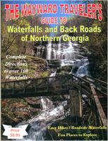
Waterfalls and Back Roads of Northern Georgia. The Wayward Traveler, 2015. This independently produced guide gives complete directions to over 100 waterfalls in northern Georgia. The guide focuses on waterfalls along the roadside or that can be reached by easy hikes of 4 miles or less. Each hike has been done by the author and he includes notes on each waterfall, rates each waterfall, and gives directions on how to find the waterfall.
Sample detail from the Northern Georgia Waterfalls guide.
$8.95
62-6267
Guide.
Georgia Wall Maps
Georgia State and County Wall Maps. Intelligent Direct.
We offer state and county wall maps for all of the USA. The maps come in sizes from 24 x 36 to 108 x 144 inches. They are available in variety of mounting and framing options. The maps are ideal for business applications, sales territory, delivery planning, direct mail targeting and hundreds of other applications.
Click here to order county wall maps and to see sample images, descriptions, and prices.
Click here to order state wall maps and to see sample images, descriptions, and prices.
Georgia City Wall Maps. When it comes to general planning, defining delivery areas, planning direct marketing and delivering products, our city wall maps are perfect to get the detailed information you need.
These maps offer clear mapping by showing all major streets and roads and many of the smaller streets, but leaving out the smallest streets. If you want a clear map for easy planning, then these are the maps for you; if you want a map showing every little back alley, these are not for you.
We offer wall maps for Albany, Alpharetta, Athens, Atlanta, Augusta, Brookhaven, Brunswick, Columbus, Gainesville, Johns Creek, Macon, Marietta, Roswell, Sandy Springs, Savannah, Smyrna, Valdosta, and Warner Robins.
Click here to see sample images, prices, sizes, and mounting options.
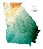
Georgia Shaded Relief Wall Map. 1:500,000. Raven.
The state of Georgia lies between the Chattahoochee and the Savannah Rivers, and the Blue Ridge Mountains and the Atlantic Ocean. The plains, the hilly piedmont, and even the Appalachian Plateau in the northwestern corner are all depicted in delicate shades of brown and green, with each color representing a different elevation. This, in combination with our relief shading technique, gives the map a 3-dimensional look. Size is 40 x 45".
Thumbnail of the map. Sample of the detail.
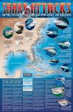
A great gift for the shark enthusiast! Shark Attack Poster of the Atlantic Ocean and the Gulf of Mexico. Sealake Products. This fascinating, educational print shows the locations of over 300 shark attacks in the Atlantic and Gulf of Mexico from 1905 to the present. 35 hair-raising encounters
are detailed, including the 1916 attacks in New Jersey. Plus, you'll learn interesting facts about the 12 types of sharks blamed for the attacks. Also, an actual size tooth from each of the three most dangerous sharks is shown. Size is 24 x 36". Available rolled/flat, either as plain paper or laminated.
Image of the entire poster Sample of the map detail, covering Florida. Sample of the Great White Shark text. Sample of the text describing the attacks.


 Sample
  Sample detail of the Georgia Road Map
 Laminated
 Sample detail of the Georgia Road Map
 Waterproof
 Sample detail of the Georgia Road Map
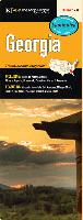 Laminated


 Laminated
 Laminated
 Sample detail from the Atlanta Streetsmart map
 Laminated
 Sample detail from the Athens street map
 Sample detail of the Athens street map.
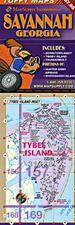 Laminated


 Larger image of the Mt. Katahdin paperweight.
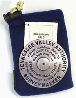
 Larger image of the Brasstown Bald paperweight.
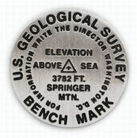
 Larger image of the Springer Mountain lapel pin.
 Image of the entire Lighthouses of the Southeast map.
 Image of the back of the Lighthouses of the Southeast map.
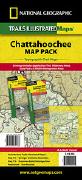
 Map detail from the Springer Mts. map.
 Map detail from the Brasstown Bald map.
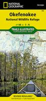
 Sample detail from the Okefenokee hiking map
 Image of the front of the Okefenokee hiking map
 Image of the reverse of the Okefenokee hiking map
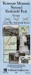

 Sample detail from the Northern Georgia Waterfalls guide.
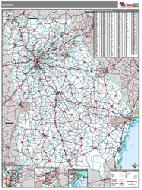 Georgia State and County Wall Maps. Intelligent Direct.
 Thumbnail of the map.
 Sample of the detail.
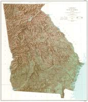
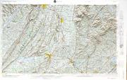
 Thumbnail of the Georgia topographic map.
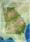


 A great gift for the shark enthusiast!
 Image of the entire poster
 Sample of the map detail, covering Florida.
 Sample of the Great White Shark text.
 Sample of the text describing the attacks.