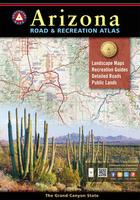
Arizona Road and Recreation Atlas. 1:400,000. Benchmark Maps.
The Grand Canyon State abounds in natural beauty and outdoor possibilities. The Landscape Maps show thousands of miles of backcountry roads and include trailheads, campgrounds, and hundreds of points of interest. Public Lands maps show hunting units, and the Recreation Guide has the latest information on campgrounds, RV parks, golf, and boating.
Sample detail #1 from the Arizona recreation atlas. Sample detail #2 from the Arizona recreation atlas.
$29.95
62-54481
Atlas
&nbps;
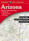
Arizona Atlas and Gazetteer. DeLorme.
Superb road atlas on a topographic map base. With extensive gazetteer and list of places to see and things to do. Softcover.
$29.95
62-5448
Atlas
&nbps;
Route 66 Road Atlas. 1:1,000,000. ITMB.
The 'Mother Road' of the USA is one of the most famous highways of the world. When the highway was developed in the 1920s, America was just discovering the automobile and long-distance roads were visionary. Today, it has been replaced by the US Interstate system, but portions of the original highway remain, as well as many of its original buildings.
This atlas shows the route from its origins in Chicago, through Illinois and other states to California and its terminus in Santa Monica. The atlas shows the Route and has capsule comments about attractions; it includes parks, historic sites, and attractions within reasonable driving distances from Route 66. It covers the entire 2,400 miles of the Route and includes many detailed city plans of urban areas along the highway. 64 pages, printed on paper, saddle stitched. Center-stapled soft-cover atlas.
Sample detail of the Route 66 road atlas
$16.95
62-20973
Atlas.
Arizona Road Maps - Paper Maps
Arizona Recreation Map. 1:792,000. GTR Mapping.
Route 66 highlighted! Detailed travel map - Interstates, exit numbers, highways, more local roads than typical road maps. Topographic contours each 1,000 feet. Color shaded each 2,000 feet above 4,000 feet. Features include national forests, wilderness, campgrounds, parks, state wildlife areas, ski areas, mining districts, points of interest, and more. Size is 29 x 37".
Sample detail from the Arizona recreation map.
$5.95
62-5491
1 sheet, folded
Recommended Arizona Recreation Map. 1:829,265. Benchmark Maps.
This detailed road map of Arizona highlights the roads, recreation opportunities, and historical sites throughout the state. The map includes campground listings, forest and wildlife areas, parks and monuments, and a comprehensive index of wilderness and wildlife areas, with a brief description and contact telephone number for each one..
Sample detail from the Arizona recreation map.
$7.95
62-54907
1 sheet, folded
Arizona Road Map. Rand McNally.
This detailed road map of Arizona includes small inset maps of Flagstaff, Grand Canyon National Park, Lake Havasu City, Petrified Forest National Park, Phoenix & Vicinity, Phoenix, Downtown Prescott, Tucson & Vicinity, Tucson Downtown, and Yuma. Fully indexed. Map size is 28 x 40 inches unfolded.
Arizona & Utah National Parks Grand Circle Road & Recreation Map. Great Pacific Maps.
Comprehensive coverage of Southern Utah (south of I-70) and Northern Arizona
Detailed inset maps of Arches, Bryce Canyon, Canyonlands, Grand Canyon and Zion National Parks + Grand Canyon Village.
"Grand Canyon Regional Access Map" shows highway, scheduled airline and Amtrak access to the Grand Canyon National Park area.
Quality cartography by California State Automobile Association (CSAA) and Great Pacific Recreation & Travel Maps.
Comprehensive Community and recreation indexes. Phone & website and National Park directories.
Map features include an amazing array of stunning, geographic features (mountains, buttes, canyons, basins, deserts, etc.), airports, BLM recreation areas, hiking trails, marinas, museums & historic places, off-road vehicle areas, ranger stations, Scenic Byways & Backways, scenic overlooks, State Parks, US National Forests, US Forest Service Roads, visitor centers, wilderness areas and wildlife watching areas.
Comprehensive mileage chart and mileage map.
$5.95
62-96817
1 sheet, folded.
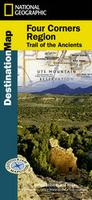
Waterproof Four Corners Region & Trail of the Ancients Destination Map. National Geographic Maps. National Geographic's Four Corners Region DestinationMap strikes the perfect balance between map and guidebook and is ideal for a wide range of travelers. The Four Corners Region is the only place in the United States where four states intersect at one point: Arizona, Colorado, New Mexico and Utah.
The front side of the Four Corners Region DestinationMap reveals a map of the region spanning from Dixie National Forest in southeastern Utah; to Great Sand Dunes National Park and Preserve and San Isabel National Forest in southwestern Colorado; to Santa Fe National Forest and Cibola National Forest in northwestern New Mexico; to Coconino National Forest in northeastern Arizona. At the center of the map is the Four Corners Monument, where visitors can stand on the only spot in the United States where four states meet. The map also includes a detailed road network and areas of interest such as Indian Reservations and National Parks, Forests, Monuments and Recreation Areas. Archaeological sites, historic sites, museums, scenic areas, geotourism locations, state parks and other points of interest are also featured.
Sample detail of the Mount Rogers hiking map Image of the front of the Mount Rogers hiking map Image of the reverse of the Mount Rogers hiking map
$11.99
62-54745
1 sheet, folded.
New map! Arizona and New Mexico Travel Map. 1:900,000. ITMB.
USA Southwest - Mexico Border & San Diego Travel Map. 1:1,390,000 & 1:10,000. ITMB.
The US side of the map extends north from San Diego all the way to Las Vegas eastward to Flagstaff, San Antonio, and Houston, showing tourist attractions across this vast area of America. The map also includes a detailed city-center map of San Diego.
Waterproof Arizona State Guide Map. National Geographic Maps.
The front side is an easy-to-read road map with insets of: - Bullhead City / Laughlin - Yuma - Flagstaff - Tucson - Downtown Phoenix - Saguaro National Park - Petrified Forest National Park The back includes: - Map and information about Phoenix - Map and information for Grand Canyon National Park - Points of interest - Scenic drive - Park Service sites in Arizona.
Sample detail from the Arizona guide map. Front of the Arizona guide map. Reverse of the Arizona guide map.
$7.95
62-54906
1 sheet, folded
Laminated Arizona Easy-to-Fold™ Road Map. Rand McNally.
The durable and convenient Arizona EasyToFold state map will take all the wear and tear your journey can dish out. The heavy-duty laminated design allows you to mark your route, make notes, then wipe the surface clean for further use. Map size is 17 x 18 inches unfolded; ideal for using in a car.
$9.99
62-54903
1 sheet, folded
Arizona City Maps - Paper Maps
Arizona City maps.
$5.95
62-5492FSG
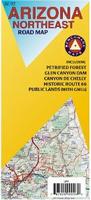
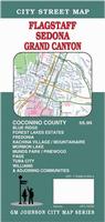
Flagstaff, Sedona, and Grand Canyon city map. (GM Johnson)
$7.99
62-5492AP
Mesa, Gilbert, and Apache Junction city map. (Kappa)
$6.95
62-5492PK
Phoenix PopOut city map. (PopOut)
$6.99
62-5492P
Phoenix city map. (Rand McNally)
$5.95
62-5492PHOE
Phoenix street map. (Global Graphics)
$5.99
62-5492PH
Phoenix & Tucson Regional street map. (Rand McNally)
$5.95
62-5492PRE
Prescott, Verde Valley, Yavapai County. (GM Johnson).
$7.99
62-5492TT
Tucson city map. (Universal)
$5.95
62-5492YUM
Yuma city map. (GM Johnson).
Arizona City Maps - Laminated Maps
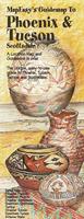
Laminated Phoenix & Tucson MapEasy Waterproof Pocket Map. MapEasy.
Phoenix and Scottsdale offer the blend of a fantastic climate along with all the excitement of cosmopolitan cities. Let MapEasy be your guide as you explore the Arizona Science Center and downtown Phoenix. When it's time to go to Scottsdale and do some shopping, we will show you where everything is located. And, if you have come for the golf, MapEasy has located each of the 24 major courses throughout the area! The Phoenix & Tucson Guidemap include detailed sections for Tucson, Scottsdale, Phoenix and Tempe.
Sample detail from the Phoenix MapEasy map.
When it comes to general planning, defining delivery areas, planning direct marketing and delivering products, our city wall maps are perfect to get the detailed information you need.
We offer wall maps for Avondale, Buckeye, Casa Grande, Chandler, Flagstaff, Gilbert, Glendale, Goodyear, Lake Havasu City, Mesa, Peoria, Phoenix, Scottsdale, Surprise, Tempe, Tucson, and Yuma.
Click here to see prices, sizes, and mounting options.
Grand Canyon Hiking and Driving Maps
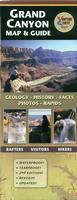
Best map for general tourists! Waterproof! Grand Canyon Map and Guide. Bronze Black Design (Dragon Creek Publishing).
The Grand Canyon Superguide Map is the perfect map for river rafters, hikers, or tourists along the North and South Rims. The map marks the locations of the rapids along the river and has extensive text on the geology and history of the Canyon. Printed on waterproof tear-resistant synthetic paper.
Sample detail from the Grand Canyon map and guide. Image of the entire front side of the Grand Canyon map and guide.
$11.99
62-5473-GR
1 sheet, folded
Waterproof! Grand Canyon Hiking Maps. 1:70,000. National Geographic Maps.
One of the most-visited national parks in the USA, these three new Grand Canyon maps offer exceptional detail for the most popular areas of the park, including the Bright Angel Trail and the North and South rims. These maps replace the classic Grand Canyon map #207. Sheets #262 and #263 offer detailed 1:90,000 topographic coverage of the Grand Canyon National park with sheet #261 offering 1:35,000 scale detail of the main tourist area centered on Bright Angel Canyon, Grand Canyon Village, and the viewpoints of the North and South rim. Each map has a full UTM grid and latitude/longitude tick marks. Printed on waterproof, tear-resistant synthetic paper.
Sample of the Bright Angel Canyon map detail. Image of the entire Bright Angel Canyon map. Sample of the Grand Canyon East map detail. Sample of the Grand Canyon Canyon West map detail.
$14.95
63-2100-261
Grand Canyon - Bright Angel Canyon & North and South Rims Hiking Map. 1:35,000.
$14.95
63-2100-262
Grand Canyon East Hiking Map. 1:90,000. Marble Canyon, Horseshoe Mesa, Kaibab Plateau, Vermillion Cliffs National Monument, and more.
$14.95
63-2100-263
Grand Canyon West Hiking Map. 1:90,000. Toroweap Cliffs, Grand Wash Cliffs and Thunder River, Parashant National Monument, and more.
Grand Canyon Hiking Map. 1:24,000 & 1:48,000. Earthwalk Press.
Detailed topographic and hiking map of the Grand Canyon. The map includes two maps; one for Bright Angel Trail (1:24,000) and one for Hermit Trail to Grandview Trail (1:48,000).
Sample detail from the Baseball map.
Recommended! Waterproof! Grand Canyon Wall Map. Rufus Graphics. An attractive, small (18 x 24 inch) wall poster of the Grand Canyon. A great souvenir poster - not too large - and showing the trails, buttes, spot elevations and much more.
Sample detail from the Grand Canyon wall poster.
$5.95
62-5474-GR
1 sheet, rolled
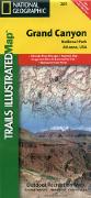
Heart of the Grand Canyon Wall Map. 1:74,000. National Geographic Maps/Trails Illustrated. A beautiful wall map of the central portion of the Grand Canyon. Ideal for framing.
Sample of the map detail.
$19.99
62-54492
1 sheet, rolled
$27.95
62-54492L
Laminated
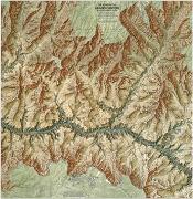
Grand Canyon Hiking Guide - with Bryce and Zion Canyons. Cicerone, 2008. The Grand Canyon is one of the wonders of the world. Its 277-mile length is protected by 1.2 million acres of national park. The fabulous views of nature's sculpture are known world-wide - indeed are even better than our wildest imaginings. The walking trails are equally awesome. Many are serious endeavours only for the most experienced trekkers.
The American South-West hosts a profusion of national and state parks and wildernesses. It boasts a seemingly endless variety of deep canyons, deserts high and low, snow-capped mountains and raging rivers. The Grand Canyon is only the largest of these canyons; the smaller Zion and Bryce National Parks are less famous, but lose nothing in comparison.
Maps recommended by the author, published by National Geographic/Trails Illustrated
$14.95
63-2100-261
Grand Canyon N.P. 1:74,000.
$14.95
63-2100-219
Bryce Canyon N.P. 1:37,000.
$14.95
63-2100-214
Zion N.P. 1:38,000.
Waterproof! Grand Canyon Hiking Map. 1:40,000. Sky Terrain Maps. Some well known points mapped include Bright Angel Trail, Cape Royal, Cape Solitude, Desert View, Grandview Point, Cape Final, Walhalla Plateau, Colorado River, Hermit Gorge, Tower of Ra, Shiva Temple, Point Sublime, North Rim, South Rim, Kaibab Trail, Tonto Trail, Grand Canyon Village, Yavapai Point, Mather Point, Phantom Ranch, Granite Gorge, Crystal Rapids, Silver Bridge, Hopi Wall, Zoroaster Temple and oh so much more.
Please note this map covers the core of the Park, the area where 99% of Park visitors travel, and where 90% of backcountry trips take place. Most trails and water sources are in this mapped area. The map shows 308,000 acres of huge country. It does not cover the far western or northern reaches of the Park.
Sample detail from the Grand Canyon map. Sketch map showing coverage of the Grand Canyon map
$11.95
62-5472-GR
1 sheet, folded.
Historic photos Geologic Map of the Grand Canyon. 1:100,000. USGS, 2000 (I-2688). A large topographic map and legend display in color the geologic layers of the Grand Canyon. Historic photographs and drawings highlight interesting facts and a 15-page pamphlet describes geologic setting and structural geology with sections on surficial deposits, volcanic deposits, and Mesozoic and Paleozoic sedimentary rocks. Use this map to teach and learn about the landforms, geology, and other physical features of the national park. Map scale is 1:100,000 and measures 58"x41".
Thumbnail image of the entire map.
$49.99
62-54801
1 sheet, rolled
$64.99
62-54801L
Laminated
Arizona Recreation & Hiking Maps
Arizona Bicycling Maps. Arizona is crossed by the very popular Southern Tier Transcontinental Cycling Trail (east-west) and the Grand Canyon Connector Trail (north-south).
Click here for 1:250,000 sectional raised relief maps.
Hiking Maps for Other Areas of Arizona.
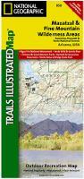
Waterproof! Apache-Sitgreaves, Coconino, Prescott & Tonto National Forests Hiking Maps. 1:70,000. National Geographic Maps. One of the most-visited urban forests in the U.S., with approximately 5.8 million visitors annually, the Tonto National Forest spans almost 3 million acres of diverse terrain just outside of Phoenix, AZ. Tonto encompasses a wide variety of vegetation ranging from cactus-studded desert to pine-forested mountains, and numerous recreational opportunities throughout the year. Our four new Trails Illustrated maps are the most detailed and up-to-date for the forest, carefully researched and developed in co-operation with local land managers and agencies. Each map contains easy to read trails, numbered forest service roads, campsites, access points, scenic points-of-interest, and important facilities.
Printed on waterproof, tear-resistant synthetic paper.
Sample of the Mazatzal map detail. Sample of the Superstition Wilderness map detail. Sample of the Hellsgate & Sierra Ancha map detail. Sample of the Salt River Canyon map detail. Image of the entire Mazatzal map Image of the entire Sedona hiking map. Sample detail from the Sedona hiking map.
$14.95
63-2100-850
Mazatzal & Pine Mountain Wilderness Areas Hiking Map.
$14.95
63-2100-851
Superstition & /Four Peaks Wilderness Areas Hiking Map.
$14.95
63-2100-852
Hellsgate, Salome, & Sierra Ancha Wilderness Areas Hiking Map.
Waterproof! Flagstaff Trails Map. 1:35,000. Emmitt Banks Cartography. The map shows more than 200 miles of single-track trails, 25 miles of Flagstaff Urban Trails (FUTS), 300 miles of rideable forest roads, and 140 miles of on-street bikeways, and covers 375 square miles of area around Flagstaff, from Upper Lake Mary on the south to north of the San Francisco Peaks.
Shaded relief gives the map a "3D" appearance and makes topography easy to read. Contour lines are depicted at an interval of 50 feet. Vertical profiles help users judge the difficulty of the trail before embarking on a hike or ride.
Printed two sides in full color on durable, waterproof, tear-resistant synthetic paper. Unfolded size is 24 x 37 inches; folds down to 4 x 7.75 inches. The scale is 1:35,000 (1 inch = 2,917 feet or 0.552 miles).
$10.95
62-54762
1 sheet, folded.
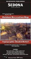
Waterproof Sedona Outdoor Recreation Map, Montana. 1:31,600. Beartooth Publishing.
The classic trails into the surrounding Red Rock Secret Mountain, Munds Mountain, and Sycamore Canyon Wilderness areas offer great hiking experiences. Outside the wilderness areas several new trails are being built every year, providing seemingly endless choices for hiking, mountain biking, and trail running. Although the trails are excellent, the real draw of Sedona has always been its unique, incredible scenery of red rock canyons, spires, and buttes.
Sample detail from the Sedona Map.
Sedona, due to extensive trail building, consistently ranks in the top ten mountain biking destinations in North America. To better show the dense network of trails around town, the scale of this map is larger than other Sedona maps. It includes descriptions for 14 local mountain bike rides. ISBN 9781887460002.
Sample detail from the Sedona single-track trail map.
$11.95
62-54766
1 sheet, folded.
Waterproof Superstition Wilderness Outdoor Recreation Map, Montana. 1:45,000. Beartooth Publishing.
The Superstition Wilderness, just outside of Phoenix, is a hikers and backpackers paradise, containing everything from desert canyons with haunting cliffs and spires to pine covered mountains. The contrast of desolate canyons and lush oasises of creeks, springs, and cottonwoods is staggering.
Sample detail from the Superstition Wilderness Map.
$11.95
62-54765
1 sheet, folded
Hiker's Guide to the Superstition Wilderness. Clear Creek Publishing. Although somewhat old, this remains the best guide to a wonderful area that's as close as 1 hour from Phoenix. Thorough: covers all trails & creekbed routes in great detail, with junctions keyed to reproduced USGS maps, plus a wealth of fascinating info on the area's rich history & legends such as the fabled Lost Dutchman mine.
(AZ/UT) Glen Canyon Topographic Map. 1:250,000. US Geological Survey.
This map makes an excellent wall map of the Glen Canyon National Recreation Area and the surrounding region. With contour lines but lacking trails. For a hiking map we recommend the Trails Illustrated map above.
Sample detail from the Glen Canyon map. Image of the Glen Canyon map.
Grand Staircase, Paunsaugunt Plateau, Grand Staircase - Escalante National Monument. 1:75,000. Trails Illustrated #714. This map includes Willis Canyon in Bryce Canyon National Park, Kodachrome Basin State Park, Bryce Canyon National Park, Grosvenor Arch, and a portion of the Great Western Trail. Cottonwood Canyon backcountry byway, Highway 12 Scenic Byway, and Paunsaugunt Plateau, a popular ATV area, are also included. This uniquely detailed map includes trail mileages, wilderness study areas and clearly identifies 4wd roads.
$14.95
63-2100-859
Paria Canyon, Kanab, Vermilion Cliffs National Monument, Grand Staircase - Escalante National Monument. 1:75,000. Trails Illustrated #859. This map features Vermillion Cliffs National Monument, Paria Canyon Vermillion Cliffs Wilderness, Jacob Lake and Lees Ferry Recreation Areas and portions of the Great Western Trails in Utah and Arizona. Hog Canyon OHV Trail System and Fredonia-Vermillion Cliffs Scenic Byway are also included.
Arizona Wall Maps
Arizona State and County Wall Maps. Intelligent Direct.
We offer state and county wall maps for all of the USA. The maps come in sizes from 24 x 36 to 108 x 144 inches. They are available in variety of mounting and framing options. The maps are ideal for business applications, sales territory, delivery planning, direct mail targeting and hundreds of other applications.
Click here to order county wall maps and to see sample images, descriptions, and prices.
Click here to order state wall maps and to see sample images, descriptions, and prices.
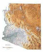
Recommended! Arizona Shaded Relief Wall Map. 1:550,000. Raven Maps.
The Grand Canyon, Petrified Forest, Painted Desert, and Monument Valley are all part of the spectacular Colorado Plateau in the north. Rugged mountain ranges run along just south of the plateau, and a series of fertile valleys lie between mountain ranges like Santa Catalina, Superstition, Chiricahua, and Gila. Elevations are represented by color, and this, in combination with our relief shading technique, gives the map a 3-dimensional look.Size is 107 x 130 cm (42 x 51").
Thumbnail of the map. Sample of the detail.
Arizona Base Maps. 1:500,000. USGS.
This is the official base map and topographic map for Arizona. The base map lacks contour lines. This makes the map easier to read and it is recommended for those that do not need contour lines. The map measures 120 x 140 cm.
Image of the Arizona base map. Sample detail of the Arizona base map.
$12.95
62-54501
Arizona Base map.
$24.95
62-54501L
Laminated
Arizona Landsat Image Map. 1:500,000. 1984. USGS.
This sepia colored map highlights the topography of Arizona, showing the Grand Canyon in the north and copper mining districts in the south. The map measures 120 x 156 cm.
$7.95
62-5477
1 sheet, rolled
Arizona Benchmark Paperweights
Benchmark Paperweights of Arizona locations. Geo-Situ.
Each paperweight, measuring approximately 3-1/4" in diameter, are an authentic replica of famous elevation benchmarks around the world, are crafted from high quality pewter for years of tarnish-free use. Each paperweigh comes in its own small fleece bag for storage, along with a small tag giving a brief description of the geographic location. All are felt-bottomed for scratch-free use on any surface.
Sample of the Phantom Ranch paperweight
$59.95
62-5497FC
Four Corners, Four Corners National Monument, AZ/CO/NM/UT paperweight. 4,862 ft.
$59.95
62-5497HO
Hopi Point, Grand Canyon National Park, AZ paperweight. 7,021 ft.
$59.95
62-5497HU
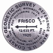
Mt. Humphreys (San Francisco Peak, aka "Frisco"), AZ paperweight. Arizona high point. 12,633 ft. Humphreys Peak is also known as San Francisco Peak, and the benchmark on top of the mountain is actually labelled "Frisco", short for San Francisco Peak. Hence this benchmark reads Frisco and not Humphreys Peak.
$59.95
62-5497KP
Kitt Peak, Kitt Peak National Observatory, AZ paperweight. 6,875 ft. Site of the world's largest collection of optical telescopes.
$59.95
62-5497MC
Meteor Crater, AZ paperweight. 5,723 ft.
$59.95
62-5497PR
Phantom Ranch, Grand Canyon National Park, AZ paperweight. 2,546 ft.
Arizona Benchmark Lapel Pins. Geo-Situ.
These lapel pins, measuring approximately 7/8" across, replicate official USGS benchmarks located on the tops of major mountains in the US. These pins, made of high quality pewter, offer a unique reminder of one's climb towards the summit. Each pin comes with a brief description of the location, including such information as how the mountain got its name.
Sample of the Meteor Crater lapel pin.
$11.95
62-5497FCL
Four Corners, Four Corners National Monument, AZ/NM/UT/CO lapel pin. 4,862 ft.
$11.95
62-5497HOL
Hopi Point, Grand Canyon National Park, AZ lapel pin. 7,021 ft.
$11.95
62-5497HUL
Mt. Humphreys Peak (San Francisco Peak, aka "Frisco") lapel pin. 12,633 ft.
$11.95
62-5497KPL
Kitt Peak, AZ lapel pin. Site of the world's largest collection of optical telescopes.
$11.95
62-5497MCL
Meteor Crater, AZ lapel pin. 5,723 ft.
$11.95
62-5497PRL
Phantom Ranch, Grand Canyon National Park, AZ lapel pin. 2,546 ft.


 Sample detail #1 from the Arizona recreation atlas.
 Sample detail #2 from the Arizona recreation atlas.


 Sample detail of the Route 66 road atlas
 Sample detail from the Arizona recreation map.
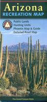 Recommended
 Sample detail from the Arizona recreation map.
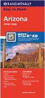
 Sample detail from the Arizona recreation map.
 Sketch map of coverage of the four sheets
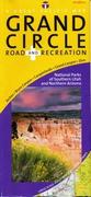
 Waterproof
 Sample detail of the Mount Rogers hiking map
 Image of the front of the Mount Rogers hiking map
 Image of the reverse of the Mount Rogers hiking map
 New map!
 Front of the Arizona and New Mexico travel map.
 Reverse of the Arizona and New Mexico travel map.
 Sample detail #1 of the USA - Mexico Border Travel Map
 Sample detail #2 of the USA - Mexico Border Travel Map
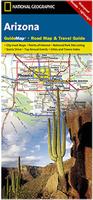 Waterproof
 Sample detail from the Arizona guide map.
 Front of the Arizona guide map.
 Reverse of the Arizona guide map.
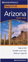 Laminated
 Laminated
 Sample detail from the Phoenix MapEasy map.
 Sample detail from the Phoenix Streetwise map.
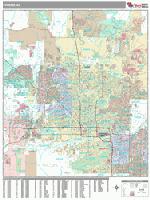
 Best map for general tourists! Waterproof!
 Sample detail from the Grand Canyon map and guide.
 Image of the entire front side of the Grand Canyon map and guide.
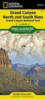 Waterproof!
 Sample of the Bright Angel Canyon map detail.
 Image of the entire Bright Angel Canyon map.
 Sample of the Grand Canyon East map detail.
 Sample of the Grand Canyon Canyon West map detail.
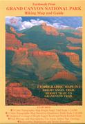
 Sample detail from the Baseball map.
 Sample detail from the South Rim of the Grand Canyon map and guide.
 Image of the entire reverse side of the South Rim of the Grand Canyon map and guide.
 Recommended! Waterproof!
 Sample of the map detail.
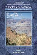
 Index showing the area covered by the guide.
 Sample of a hiking map in the guide.
 Image of the front of the Grand Canyon map.
 Image of the reverse of the Grand Canyon map.
 Sample of the detail of the Grand Canyon map.
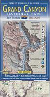 Waterproof!
 Sample detail from the Grand Canyon map.
 Sketch map showing coverage of the Grand Canyon map
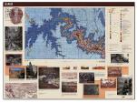 Historic photos
 Thumbnail image of the entire map.
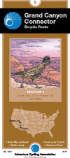


 Arizona Raised Relief Maps.
 Waterproof!
 Sample of the Mazatzal map detail.
 Sample of the Superstition Wilderness map detail.
 Sample of the Hellsgate & Sierra Ancha map detail.
 Sample of the Salt River Canyon map detail.
 Image of the entire Mazatzal map
 Image of the entire Sedona hiking map.
 Sample detail from the Sedona hiking map.
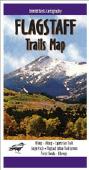 Waterproof!

 Waterproof
 Sample detail from the Sedona Map.
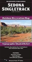 Waterproof
 Sample detail from the Sedona single-track trail map.
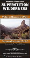 Waterproof
 Sample detail from the Superstition Wilderness Map.
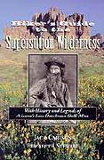
 Index of map coverages
 Thumbnail of the front of the Saguaro N.P. map.
 Thumbnail of the reverse of the Saguaro N.P. map
 Detail from the Saguaro N.P. map.
 Detail from the Grand Canyon N.P. map.
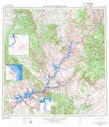
 Sample detail from the Glen Canyon map.
 Image of the Glen Canyon map.
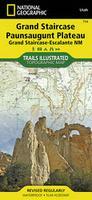
 Sample detail from the Grand Staircase hiking map.
 Front of the Grand Staircase hiking map.
 Reverse of the Grand Staircase hiking map.
 Sample detail from the Paria Canyon-Kanab hiking map.
 Thumbnail of the map.
 Sample of the detail.
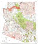
 Image of the Arizona base map.
 Sample detail of the Arizona base map.
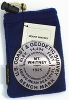
 Sample of the Phantom Ranch paperweight


 Sample of the Meteor Crater lapel pin.


 Arizona Flags