Mississippi Atlas and Gazetteer. 1:250,000. DeLorme.
Excellent road atlas with topographic maps and gazetteer.
$24.95
62-7648
Atlas
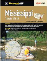
Laminated Mississippi Travel Atlas. Universal Map.
The Mississippi Travel Atlas is a full-color highway atlas, including street-detail insets of: Bay St. Louis, Biloxi, Brandon, Brookhaven, Clarksdale, Cleveland, Clinton, Columbus, Gautier, Greenville, Gulfport, Hattiesburg, Jackson, Laurel, Long Beach, Madison, McComb, Meridian, Moss Point, Natchez, Ocean Springs, Olive Branch, Oxford, Pascagoula, Pearl, Ridgeland, Southaven, Starkville, Tupelo, and Vicksburg; and features: detailed Attractions, Golf Courses, a Mileage Chart, Military Reservations, Museums, Parks and Rec Areas, and Places of Interest.
Now out of print - limited stock left.
$14.99
62-7689
Atlas.
Mississippi Road Maps.
Mississippi Road Maps - paper maps.
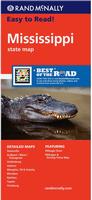
Mississippi Road Map. Rand McNally.
Rand McNally's Easy To Read State Folded Map is a must-have for anyone traveling in and around Mississippi, offering unbeatable accuracy and reliability at a great price. Their trusted cartography shows all Interstate, U.S., state, and county highways, along with clearly indicated parks, points of interest, airports, county boundaries, and streets. Includes detailed inset maps of Greenville, Gulfport/Biloxi/Pascagoula, Hattiesburg, Jackson, Memphis, TN & Vicinity, Meridian, Natchez, Tupelo, and Vicksburg. Size is 28 x 40" unfolded.
$9.99
62-7690
1 sheet, folded.
Mississippi Road Map. Universal Map.
A detailed road map of Mississippi. The map includes seven inset city maps, plus a place-name index.
Sample detail from the Mississippi road map
Mississippi Road Maps - laminated maps.
Laminated Mississippi Road Map Deluxe Flipmap - laminated. Universal Maps. Laminated road map of Mississippi. With seven inset city-center maps and a city/town index.
Sample detail from the Mississippi road map
$9.99
62-76902
1 sheet, folded.
Laminated Mississippi Easyfinder Road Map - laminated. Rand McNally. The durable and convenient Mississippi EasyToFold state map will take all the wear and tear your journey can dish out. The heavy-duty laminated design allows you to mark your route, make notes, then wipe the surface clean for further use. This is a must-have for navigation whether you're a state resident or just passing through. Size is 18 x 17" unfolded.
$9.99
62-76901
1 sheet, folded.
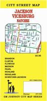
Mississippi City Wall Maps
Mississippi City Wall Maps.
When it comes to general planning, defining delivery areas, planning direct marketing and delivering products, our city wall maps are perfect to get the detailed information you need.
These maps offer clear mapping by showing all major streets and roads and many of the smaller streets, but leaving out the smallest streets. If you want a clear map for easy planning, then these are the maps for you; if you want a map showing every little back alley, these are not for you.
We offer wall maps for Biloxi, Gulfport, Jackson, and Southaven.
Click here to order and to see sample images, prices, sizes, and mounting options.
We stock cycling maps for the "Southern Rivers Cycling Trail" that crosses Mississippi from northeast to southwest, the "Southern Tier Cycling Trail" that cross Mississippi east-west, and the "Historic Underground Railroad Cycling Trail" in northeastern Mississippi.
U.S. Forest Service. We stock all available USFS maps for Mississippi.
Mississippi Wall Maps
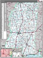
Mississippi State and County Wall Maps. Intelligent Direct.
We offer state and county wall maps for all of the USA. The maps come in sizes from 24 x 36 to 108 x 144 inches. They are available in variety of mounting and framing options. The maps are ideal for business applications, sales territory, delivery planning, direct mail targeting and hundreds of other applications.
Click here to order county wall maps and to see sample images, descriptions, and prices.
Click here to order state wall maps and to see sample images, descriptions, and prices.
Mississippi Raven Relief Map. 1:500,000. Raven Maps. Between the winding Mississippi and Yazoo rivers lies a fertile delta, and east of the Yazoo are the Pearl, the Big Black, and the Pascagoula River drainages. The sandy hills of the northeast give way to pine woods, prairie, and finally the Gulf Coast. Elevations are represented by color, and this, in combination with our relief shading technique, gives the map a 3-dimensional look. Size is 32 x 48".
Thumbnail of the map. Sample of the detail.


 Laminated

 Sample detail from the Mississippi road map
 Laminated
 Sample detail from the Mississippi road map
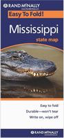 Laminated
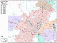
 Sample detail from the Jackson wall map.
 Thumbnail of the Jackson map.


 Mississippi State and County Wall Maps. Intelligent Direct.
 Thumbnail of the map.
 Sample of the detail.
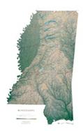
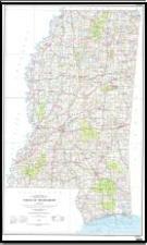 Mississippi Topographic Map. 1:500,000. USGS, 1972. Map size is 48 x 30 inches.
 Sample of the Mississippi topographic map detail.
 Image of the Mississippi topographic map detail.
 Sample image.
 Mississippi Flags