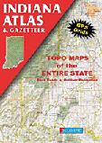
Indiana Atlas and Gazetteer. 1:156,000. DeLorme.
Excellent road atlas with topographic maps and gazetteer. Softcover, paper.
Sample detail from the Indiana atlas
$29.95
62-6648
Atlas
Indiana Road Maps - Paper Maps
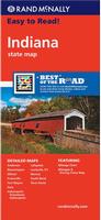
Indiana Road Map. Rand McNally.
Rand McNally's Easy To Read State Folded Map is a must-have for anyone traveling in and around Indiana, offering unbeatable accuracy and reliability at a great price. Our trusted cartography shows all Interstate, U.S., state, and county highways, along with clearly indicated parks, points of interest, airports, county boundaries, and streets. Includes inset city maps of Anderson, Bloomington, Elkhart, Evansville, Fort Wayne, Gary, Indianapolis, Downtown Indianapolis, Lafayette, Louisville, KY; Muncie, South Bend, and Terre Haute. Size is 28 x 40 inches unfolded.
$9.99
62-6690
1 sheet, folded.
Great Lakes Travel Map. 1:1,000,000. ITMB.
Using this map, one can explore Lakes Ontario and Erie as circular routes; also Huron and Superior; visit Ottawa and Toronto, Chicago and Duluth, and find Fort WilliamWawa Goose. This is a double-sided map covering from Ottawa in the north to Pittsburgh and Columbus in the south and Duluth and Thunder Bay in the west. Both Canada and the USA portions of the Great Lakes Region are included.
Sample detail of the Great Lakes Travel Map
$9.95
62-20913-GL
1 sheet, folded.
$24.99
62-20913-GLW
1 sheet, flat.
$34.99
62-20913-GLL
1 sheet, laminated.
Indiana Road Maps - Laminated Maps
Waterproof! Indiana Road Map - Laminated. Rand McNally. The durable, convenient Rand McNally Indiana EasyFinder® maps take all the wear and tear your journey can dish out. The laminated design allows you to mark your route, make notes, then wipe the surface clean for further use. Map size is 18 x 17 inched unfolded.
$9.99
62-66902
1 sheet, folded.
Laminated Indiana Road Map - Laminated. American Map. This map of Indiana State is durably laminated and contains extensive coverage. Laminated maps are easy to fold, write on, and wipe off. Coverage includes street-detail insets of: Evansville, Fort Wayne, Indianapolis, South Bend, and Terra Haute; and features: Airports, Indiana Facts and detailed information, Interstate Exit Numbers, Latitude and Longitude information, a Mileage Chart, National and State Parks, and Places of Interest.
$9.99
62-66905
1 sheet, folded.
Indiana City Maps - Paper Maps
Indiana City Maps. Various publishers. Folded, paper, city street maps.
$5.95
62-6692BL
Bloomington and Terre Haute City Map. (GM Johnson). Street map of Terre Haute with street index and selected points of interest, and insets of Vigo County and Indiana State University. Reverse has a map of Bloomington, IN, with insets of Monroe County and Indiana University, and a street index.
$5.95
62-6692GA
Gary & Hammond City Map. (GM Johnson). This full-color map covers Gary, Hammond, and surrounding communities.
$6.99
62-6692I
Indianapolis City Map. (Rand McNally). A detailed city street map of Indianapolis.
$7.99
62-6692IND
Indianapolis City Map. (American Map). This full-color street map of Indianapolis, IN includes: Beach Grove, Lawrence, Meridian Hills, and Speedway; and features: Airports, Block Numbers, Colleges and Universities, Golf Courses, Hospitals, Parks and Rec Areas, Places of Interest, Schools, and ZIP Codes.
$6.99
62-6692INR
Indianapolis & Region City Map. (Rand McNally). A regional road map covering Indianapolis and the surrounding region.
$6.99
62-6692LAF
Lafayette & West Lafayette City Map. (Warren Map). The Lafayette and West Lafayette, Indiana Street Map includes: Purdue & West Lafayette. Features Airports, Block Numbers, Colleges & Universities, Golf Courses, Government Buildings, Hospitals, Parks & Rec Areas, Places of Interest, Schools, Shopping Centers & ZIP Codes.
$6.95
62-6692SOU
South Bend & Elkhart City Map. 1:36,000. (GM Johnson).
Indiana City Wall Maps
Indiana City Wall Maps.
When it comes to general planning, defining delivery areas, planning direct marketing and delivering products, our city wall maps are perfect to get the detailed information you need.
These maps offer clear mapping by showing all major streets and roads and many of the smaller streets, but leaving out the smallest streets. If you want a clear map for easy planning, then these are the maps for you; if you want a map showing every little back alley, these are not for you.
We offer wall maps for Anderson, Bloomington, Carmel, Elkhart, Evansville, Fishers, Fort Wayne, Gary, Greenwood, Hammond, Indianapolis, Kokomo, Lafayette, Muncie, Noblesville, South Bend, and Terre Haute.
Click here to order and to see sample images, prices, sizes, and mounting options.
Indiana Bicycling Maps. Indiana has three long-distance trails that traverse the state - the Northern Tier Cycling Trail that goes east-west across Indiana; the North Lakes Cycling Trail that crosses the northeast corner of Indiana; and the Underground Railroad Cycling Trail that runs along the Indiana/Kentucky border. In addition, there are numerous "rail trails" and other popular rides throughout the state.
Click here for our Indiana cycling maps & guides list.
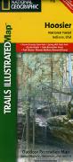
Waterproof! Indiana Recreation Maps. Trails Illustrated/National Geographic Maps. Detailed topographic hiking/canoe map showing trails, beaches, scenic view, campgrounds, and much more. Printed on waterproof, tear-resistant synthetic paper.
Index of Hoosier N.F. map coverage Sample detail from the Hoosier N.P. map.
$14.95
63-2100-770
Hoosier N. F. map. #770. 1:70,000 & 1:35,000.
$14.95
63-2100-260
Ozark Scenic National Waterway map. #260. 1:63,360.
Indiana Wall Maps
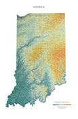
Indiana Raven Shaded Relief Map. 1:500,000. Raven Maps. From Lake Michigan in the north to the Ohio River, Indiana is a state of subtle elevation changes marked by small lakes, low sandy hills, "knobs" or steeper hills, and limestone caves in the south created by underground streams. Elevations are represented by color, and this, in combination with our relief shading technique, gives the map a 3-dimensional look. Size is 29 x 44".
Thumbnail of the map. Sample of the detail.
$40.00
62-6651
Each, rolled
$65.00
62-6651L
Laminated
Indiana State and County Wall Maps. Intelligent Direct.
We offer state and county wall maps for all of the USA. The maps come in sizes from 24 x 36 to 108 x 144 inches. They are available in variety of mounting and framing options. The maps are ideal for business applications, sales territory, delivery planning, direct mail targeting and hundreds of other applications.
Thumbnail of the Indiana Premium style wall map. This style can have zip code boundaries.
Thumbnail of the Indiana Color-Cast style wall map. This style cannot have zip code boundaries.
Sampe detail of the Indiana Premium style wall map. This sample shows county boundaries, zip code boundaries and urban areas.
Click here to order county wall maps and to see sample images, descriptions, and prices.
Click here to order state wall maps and to see sample images, descriptions, and prices.
Indiana Wall Map. 1:316,800 (approx.). Kappa Map Group. Map size is 50 x 62 inches.
This map features color-coded counties, a laminated surface that is both markable and washable, and indexing on the face of the map. Details include all state and federal highways, cities and towns, major waterways, major airports, time zones, state universities, state parks, wildlife areas, military installations, police and state police posts, county names and boundaries, and points of interest.
With plastic rods at top and bottom for easy hanging.
Thumbnail of the Indiana wall map.


 Sample detail from the Indiana atlas

 Sample detail of the Great Lakes Travel Map
 Laminated
 Indiana City Wall Maps.
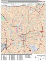
 Sample detail from the Indianapolis wall map.


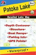
 Waterproof!
 Index of Hoosier N.F. map coverage
 Sample detail from the Hoosier N.P. map.
 Thumbnail of the map.
 Sample of the detail.
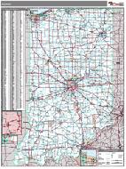 Indiana State and County Wall Maps. Intelligent Direct.
 Thumbnail of the Indiana Premium style wall map.
 Thumbnail of the Indiana Color-Cast style wall map.
 Sampe detail of the Indiana Premium style wall map.
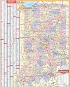
 Thumbnail of the Indiana wall map.
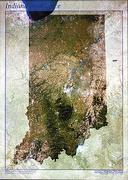
 Thumbnail image of the Indiana satellite poster
 Indiana Flags