Laminated! USA Road Map. 1:4,000,000. Borch.
A good laminated, folded, road map of the entire USA, with the eastern USA on one side and the western USA on the reverse. The USA West, USA East, Hawaiian Islands, Puerto Rico each 1:4,000,000, Alaska 1:8,000,000, USA administrative & time zones. Borch Maps are easy to fold, durable and water-repellent with a wipeable surface. Borch Maps show hotels, museums, monuments, markets, public transport, top sights and points of interest, useful statistics, conversion charts for temperatures, weights and measurements, climate charts showing temperatures, sunshine hours, precipitation and humidity, overview maps, time zones, and much more.
Sample detail of the USA road map
$9.95
62-2100
1 sheet, folded.
USA Road Map. 1:2,300,000. ITMB.
A detailed folded road map of the entire USA. Includes detailed insets of 6 urban areas and of Florida Keys, name index, double sided, large format.
Available as a flat wall map (plot-on-demand) and as a laminated wall map (plot-on-demand and laminated).
Sample detail of the USA road map
$9.95
62-20912
1 sheet, folded.
$59.95
62-20912P
1 sheet, flat, plot-on-demand.
$99.95
62-20912L
1 sheet, flat, laminated.
USA Road Map. Rand McNally.
These US maps feature Interstate and U.S. highways, cities, points of interest, airports, boundaries, and more, mileage chart, mileage & driving times map,
national facts and symbols, toll roads chart, visitor information. The United States Easyfinder laminated map features clearly indicated highways, state boundaries, points of interest, national parks, and more, with a quick-reference legend.
$5.99
62-2093
USA Interstate Highways Map. 1:7M. (Rand McNally)
$7.95
62-20931
USA Easyfinder Road Map, laminated. Durable, convenient laminated Rand McNally EasyFinder map will take all the wear and tear your journey can dish out.
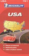
USA Road Map. 1:3,450,000. Michelin.
A detailed road map covering the major road networks across the country. Highlights places of interest, national parks, state flags. Legend/Key in three languages (English, French, Spanish)
$8.95
62-2074
1 sheet, folded.
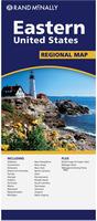
USA Regional Travel Maps by Rand McNally
USA Regional Travel Maps by Rand McNally. Rand McNally.
Rand McNally's folded maps featuring the regions of the United States are must-haves for anyone traveling in and around the country, offering unbeatable accuracy and reliability at a great price. RAnd McNally's trusted cartography shows all Interstate, state, and county highways, along with clearly indicated points of interest, airports, county boundaries, and more.
Regularly updated, full-color maps
Clearly labeled Interstate, U.S., state, and county highways
Detail maps of major cities, a mileage chart, and a Mileages & Driving Times Map
Indications of parks, points of interest, airports, county boundaries, and more
USA East Half Travel Reference Road Map. 1:2,300,000. ITMB.
A double-sided road map of the east half of the United States to plan your trip, prepare your itinerary, and to travel independently from Maine to Florida. One side shows the coast line, the other side shows central-east USA.
Inset maps of Orlando and Washington D.C. The legend is in English. Touristic information: World Heritage Sites, points of interest, campgrounds, hot springs, museums, caves, lighthouses, beaches, scuba-snorkel sites, hiking, airports, ferries, national parks, state parks, Indian lands, salt lakes.
This map covers the following States: Maine, Vermont, New Hampshire, Connecticut, Massachusetts, Rhodes Island, Maryland, New Jersey, Pennsylvania, New York, Virginia, West, Virginia, Carolinas, Georgia, Florida, Alabama, Mississippi, Tennessee, Kentucky, Louisiana, Michigan, Ohio, Indiana, Illinois, Wisconsin, Minnesota, Kansas, Missouri, Oklahoma, Arkansas, as well as southern Ontario and Quebec.
Sample detail of the USA road map
$7.95
62-20912E
1 sheet, folded.
USA West Half Travel Reference Road Map. 1:2,300,000. ITMB.
A double-sided road map of the west half of the United States to plan your trip, prepare your itinerary, and to travel independently.
One side shows the coast line, the other side shows central-east USA. Inset maps of San Francisco Bay, Los Angeles and San Antonio. The legend is in English. Touristic information: World Heritage Sites, points of interest, campgrounds, hot springs, museums, caves, lighthouses, beaches, airports, ferries, national parks, state parks, Indian lands, salt lakes.
This map covers the following States: Washington, Oregon, California, Idaho, Montana, Wyoming, Nevada, Utah, Arizona, New-Mexico, Dakotas, Nebraska, Colorado, Kansas, Oklahoma, Texas.
Sample detail of the USA road map
$8.95
62-20912W
1 sheet, folded.
USA - Canada Border Travel Map. 1:2,500,000. ITMB.
This map shows the border states and their provincial counterparts, starting with British Columbia and Washington/Idaho/Montana for about 150 miles on either side of the actual border, and carries on eastward through the Prairie/Midwest region, before dipping south to encircle the Great Lakes region, before terminating with New York City at the southern extreme and most of New Brunswick/Maine in the northeast. The purpose of the map is to show the true nature of a region where more than 100,000,000 people live; the highways binding them together, the major cities as insets (Long Island, Boston region, Chicago,Toronto central, Seattle, Vancouver, and Victoria), and the many border crossings.
Sample detail of the USA - Canada Border Travel Map
$12.95
62-20913-BO
1 sheet, folded
USA Southwest - Mexico Border & San Diego Travel Map. 1:1,390,000 & 1:10,000. ITMB.
The US side of the map extends north from San Diego all the way to Las Vegas eastward to Flagstaff, San Antonio, and Houston, showing tourist attractions across this vast area of America. The map also includes a detailed city-center map of San Diego.
Mississippi River & Central USA Travel Map. 1:1,840,000. ITMB.
This particular map follows the course of the great Mississippi River from is headwaters in the northern US to its mouth in New Orleans. By the nature of its vast area of drainage, which corresponds to the former French domain of Louisiana (purchased by the USA in 1803), the land includes some of the most famous historic sites in America, all of which are included on this map. Seventeen States are included on this double-sided map.
Sample detail #1 of the Mississipi River Travel Map Sample detail #2 of the Mississipi River Travel Map
$7.95
62-20913-CE
1 sheet, folded
USA 1:1,000,000 Regional Travel Maps by ITMB
ITMB's 1:1,000,000 USA Regional map series includes towns, roads, physical features, major parks and natural monuments, touristic attractions, and border crossings. Most maps include a city/town index.
Route 66 Road Atlas. 1:1,000,000. ITMB.
The 'Mother Road' of the USA is one of the most famous highways of the world. When the highway was developed in the 1920s, America was just discovering the automobile and long-distance roads were visionary. Today, it has been replaced by the US Interstate system, but portions of the original highway remain, as well as many of its original buildings.
This atlas shows the route from its origins in Chicago, through Illinois and other states to California and its terminus in Santa Monica. The atlas shows the Route and has capsule comments about attractions; it includes parks, historic sites, and attractions within reasonable driving distances from Route 66. It covers the entire 2,400 miles of the Route and includes many detailed city plans of urban areas along the highway. 64 pages, printed on paper, saddle stitched. Center-stapled soft-cover atlas.
Sample detail of the Route 66 road atlas
$16.95
62-20973
Atlas.
Waterproof California Road Map. 1:1,000,000. ITMB.
A detailed travel map of all of California. Included are inset maps of San Francisco and Los Angeles. Very detailed with points of interest, golf courses, border crossings, state parks, museums, National Parks, lighthouses, beaches, caves, mountain peaks (with elevation in feet) and much more.
Sample detail of the California road map.
$7.95
62-56904
1 sheet, folded.
Deep South and Florida Travel Map. 1:1,000,000 & 1:720,000. ITMB.
This map has a detailed map of Florida on the front and a US Deep South map on the reverse. The Deep South map is at 1:1,000,000 while the Florida map is at 1:720,000. Map size is 27" x 39".
Thumbnail of the Florida Travel Map
$9.95
62-61902
1 sheet, folded.
Eastern Corridor and Washington D.C. Travel Map. 1:1,000,000 & 1:12,500. ITMB.
The regional map shows the Eastern Corridor from Boston in the north, through NYC and Philadelphia to Baltimore and on past Washington DC to Richmond and Raleigh. The map shows road and rail connections, with motorways noted in blue and toll roads in green, and includes major historic and touristic sites within the area of coverage.
Washington D.C. is a fabulous treasure trove for both Americans and international visitors, with museums and monuments depicting the growth of a great nation. This map uncovers all the statues, memorials, and buildings of interest. Of course, hotels, shopping areas, transportation hubs, parks, etc are also included.
Sample detail of the Washington D.C. street map. Sample detail of the Eastern Corridor road map.
$7.95
62-6092WI
1 sheet, folded.
Great Lakes Travel Map. 1:1,000,000. ITMB.
Using this map, one can explore Lakes Ontario and Erie as circular routes; also Huron and Superior; visit Ottawa and Toronto, Chicago and Duluth, and find Fort WilliamWawa Goose. This is a double-sided map covering from Ottawa in the north to Pittsburgh and Columbus in the south and Duluth and Thunder Bay in the west. Both Canada and the USA portions of the Great Lakes Region are included.
Sample detail of the Great Lakes Travel Map
$9.95
62-20913-GL
1 sheet, folded.
$24.99
62-20913-GLW
1 sheet, flat.
$34.99
62-20913-GLL
1 sheet, laminated.
Lake Michigan Region and Chicago Travel Map. 1:1,000,000 & 1:12,500. ITMB.
The regional map is centered on Chicago and includes Wisconsin, Michigan, Indiana, Illinois and a bit of Ohio. The map encompasses Indianapolis, Detroit, Marquette and Sault Ste. Marie at the northern end of the massive lake.
Mid-Atlantic States and Philadelphia Travel Map. 1:1,000,000 & 1:10,000. ITMB.
The focus of the map is NYC to Raleigh, NC, with New Jersey, Pennsylvania, Washington DC, Delaware, Maryland, Virginia and North Carolina making up the map.
The Philadelphia map covers from the zoo and art gallery in the north to West Oregon St in South Phillie, so takes on much more than the historic area and the downtown, but does so at an excellent scale, so everything from the Liberty Bell to the University of Pennsylvania campus shows up clearly and easy to read.
Sample detail of the Philadelphia Travel Map Sample detail of the Mid-Atlantic States Travel Map
$9.95
62-20913-MID
1 sheet, folded.
Northeast Region and Boston Travel Map. 1:1,000,000 & 1:10,000. ITMB.
The Boston map coverage goes from west of Cambridge to the airport and from Somertown to Brookline. In addition to streets, the map includes the routes followed by rapid transit lines and the locations of a wide range of attractions and hotels.
Northeast Corridor and Manhattan Travel Map. 1:1,000,000 & 1:12,500. ITMB.
The coverage of the map of the Northeast Corridor from Boston to Washington extends considerably west of the rail line forming the 'Corridor'. This is an excellent map for day trips or regional travel, particularly for those driving or going by train to Washington. An inset map of central Washington is included, covering the Mall area.
New York's Manhattan is a magnet for visitors and locals alike. This map stretches from the northern edge of Central Park to The Battery and shows subway lines and railways plus the stations. All ferry routes are included. The core of the subway system is shown on the back cover, with an inset map of the entire system being shown on the map itself.
Sample detail of the Manhattan street map Thumbnail of the Manhattan street map Thumbnail of the Northeast Corridor map
$10.95
62-84921MI
1 sheet, folded
Pacific Coast Travel Map. 1:1,000,000. ITMB.
This map illustrates the entire Pacific Coast of America from Vancouver to San Diego. Our map highlights regions of the entire stretch of Interstate 5 (I-5), from the Canadian border to the Mexican border, as well as other arterial highways, such as Hwy 99, the famous Hwy 101, and Hwy 395. Detailed road and touristic information covers all of Washington, Oregon, and California, along with most of Idaho and Nevada. Along the West Coast are some of the most famous cities of America, Vancouver, Seattle, Tacoma, Portland, Eugene, San Francisco, Sacramento, Los Angeles, Anaheim, and San Diego. This map is truly a must-have for travelers exploring America's fascinating Pacific Coast.
Sample detail of the Pacific Coast Travel Map Sample detail of the Pacific Coast Travel Map
$9.95
62-20913-PC
1 sheet, folded.
Pacific Northwest Travel Map. 1:1,000,000. ITMB.
This map starts in Vancouver in the north and goes to Eureka and Redding in the south. Side 2 includes a fair amount of Montana, as must be expected, given the shape of Idaho. The easternmost border of Idaho is in a direct line with both Bozeman and Great Falls, MT.
Sample detail of the Pacific Northwest Travel Map Sample detail of the Pacific Northwest Travel Map
$9.95
62-20913-PC
1 sheet, folded.
Rocky Mountains Travel Map. 1:1,000,000. ITMB.
This map covers Montana, Wyoming, Colorado, and parts of Idaho, New Mexico, and Arizona. It is the southern extension of ITMB's Canadian Rockies map through 'Blue Sky' Montana and 'Mile High' Denver. This is a double-sided map concentrating on roads and road quality, parks, touristic attractions, and urban areas. Map size is 27" x 39".
Thumbnail of the Rocky Mountains Travel Map Front of the Rocky Mountains Travel Map Reverse of the Rocky Mountains Travel Map
$9.95
62-20913-RM
1 sheet, folded.
South Atlantic States Travel Map. 1:1,000,000. ITMB.
The area of coverage of side A is Philadelphia/Pittsburg south to Augusta and Charleston. Side B continues south to the southernmost portion of Florida and west to Panama City. Inset maps of Orlando and Miami are included on this side as well. Both road and rail connections are shown, and distances between communities shown. Places of touristic interest are included, albeit suitable to the scale. An extensive place name index is included.
Front of the Rocky Mountains Travel Map Reverse of the Rocky Mountains Travel Map
$9.95
62-20913-SA
1 sheet, folded.
Southwest Travel Map. 1:1,000,000. ITMB.
This map covers most of California and Nevada, Arizona, most of Utah, and the western third of New Mexico and Colorado. This double-sided map covers from Reno and Sacramento in the north to Tijuana and Deming NM in the south, and from the Pacific coastline in the west to Gallop NM and Grand Junction CO in the east.
Thumbnail of the Rocky Mountains Travel Map Front of the Southwest Travel Map Reverse of the Southwest Travel Map
Mid-Atlantic Region. Covers from New York City to south of Washington D.C. Michelin #582.
$6.95
62-2090-3
Northeastern USA & NE Canada. Michelin #583.
$6.95
62-2090-4
Southeastern USA. Michelin #584.
$6.95
62-2090-5
Western USA & Western Canada. Michelin #585.
New series! New regional USA maps from Michelin. 1:1,267,200. Michelin.
This new series, part of Michelin's green-covered ZOOM series, offers good quality road maps are a more usable scale for those planning driving or cycling vacations across the USA.
Michelin star-rated sights and a selection of not-to-be-missed annual events and festivals plus coverage of the National Parks serve as inspiration for future road trips.
Each map includes small city-center inset maps for the major cities.
The QR code on the front cover offers even more travel information on destinations through Michelin's ViaMichelin website.
Pacific Northwest road map. The map covers Washington and Oregon, extending up over the Canadian border and down to the northernmost areas of California and Nevada.
$6.95
62-2090-172
Big Sky Country road map. This map covers Idaho, Montana, and Wyoming.
$6.95
62-2090-173
Great Lakes road map. The map covers Wisconsin and Michigan, as well as areas of the other states surrounding the Great Lakes (Minnesota, Iowa, Illinois, Indiana, Ohio, Pennsylvania) and southern Ontario in Canada.
$6.95
62-2090-174
California & Nevada road map. The map covers California and Nevada, as well as western Utah and Arizona.
$6.95
62-2090-175
Four Corners road map. The map covers Arizona, Colorado, New Mexico and Utah.
$6.95
62-2090-176
Texas and Oklahoma road map. The map covers Texas and Oklahoma, as well as eastern New Mexico and western Arkansas and Louisiana.
$6.95
62-2090-177
Deep South & Florida road map. This map covers Arkansas, Tennessee, Louisiana, Mississippi, Alabama, Georgia, and Florida, with parts of North and South Carolina.
USA Regional Travel Maps by Hallwag
USA Regional Travel Maps by Hallwag. 1:1,000,000 - 1:1,200,000. These region by region "USA Road Maps" provide up-to-date, detailed road maps with lots of tourist information. Transit and city maps, as well as detailed maps of national parks, are included in the map layout. The map package also includes a mileage chart with travelling times between major cities, and a brochure with an index of places, travel information from A to Z, top attractions and travel tips.
Sketch map showing sheet coverage Sample detail from the Hallwag USA map series
$11.95
62-20918-01
Pacific Northwest USA. 1:1,000,000.
$11.95
62-20918-02
North-Central USA. 1:1,200,000.
$11.95
62-20918-03
Great Lakes States. 1:1,000,000.
$11.95
62-20918-04
New England. 1:1,200,000.
$11.95
62-20918-05
California (USA). 1:1,000,000.
$11.95
62-20918-06
Southwest USA. 1:1,000,000.
$11.95
62-20918-07
South-central USA. 1:1,200,000.
$11.95
62-20918-08
Southeast USA. 1:1,000,000.
$11.95
62-20918-09
Texas. 1:1,200,000.
$17.95
62-20918-10
Deep South States. 1:1,200,000.
$11.95
62-20918-11
Florida (USA). 1:1,000,000.
$11.95
62-20918-12
USA Travel Map. 1:3,800,000.
USA Regional Motorcycle Road Maps by Mad Maps
Recommended! Great Roads of America road maps. Mad Maps. You know you want it! These are the must-do epic journeys in the United States. Take to the road for a week or two - or even three or more. Our MAD scouts share their insider secrets, while detailed turn-by-turn directions get you there with ease. These maps, although designed for motorcyclists, work just as well for tourists using autos or motor-homes.
Each map has an overview map and then 5 or 6 detailed strip maps covering the route. Numbers along the route correspond to tourist sites recommended by MapMaps own staff - such places as the El Rancho Hotel in Gallup NM, a grand hotel favored by the Hollywood stars of yesteryear, and the their favorite restaurants. Museums, restaurants, hotels, and unusual sites are all noted. Turn-by-turn directions accompany each map, so its next to impossible to get lost.
Sample detail from the Route 66 road map. Sample detail from the Route 66 road map.
$10.95
62-20917-ATL
Atlantic Coast Route.1 sheet, folded.
$10.95
62-20917-NR
Northern Ride Route.1 sheet, folded.
$10.95
62-20917-PC
Pacific Coast Route.1 sheet, folded.
$16.95
62-20917-R66
Route 66 - the Mother Road.1 sheet, folded.
$10.95
62-20917-SR
Southern Ride Route.1 sheet, folded.
$10.95
62-20917-SW
Southwest Route.1 sheet, folded.
Scenic Road Trips of the USA motorcycle road maps. Mad Maps. You know you want it! These are the must-do epic journeys in the United States. Take to the road for a week or two - or even three or more. Our MAD scouts share their insider secrets, while detailed turn-by-turn directions get you there with ease. These maps, although designed for motorcyclists, work just as well for tourists using autos or motor-homes.
Sample detail of the Scenic Road Trips Map of Florida Sample detail of the Scenic Road Trips Map of the Carolinas
$14.95
62-20918-AZ
Arizona and Utah map.
$14.95
62-20918-FL
Florida map.
$14.95
62-20918-CAN
California North map.
$14.95
62-20918-CAS
California South map.
$14.95
62-20918-CO
Colorado and New Mexico map.
$14.95
62-20918-DA
Dakotas map. Also includes eastern Montana, eastern Wyoming, and NE Nebraska.


 Laminated!
 Sample detail of the USA road map

 Sample detail of the USA road map
 Sample from one of the regional maps.
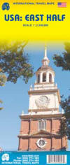
 Sample detail of the USA road map
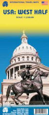
 Sample detail of the USA road map
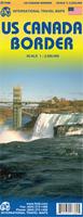
 Sample detail of the USA - Canada Border Travel Map

 Sample detail #1 of the USA - Mexico Border Travel Map
 Sample detail #2 of the USA - Mexico Border Travel Map
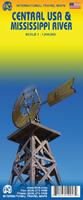
 Sample detail #1 of the Mississipi River Travel Map
 Sample detail #2 of the Mississipi River Travel Map
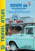
 Sample detail of the Route 66 road atlas
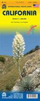 Waterproof
 Sample detail of the California road map.
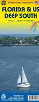
 Thumbnail of the Florida Travel Map
 Sample detail of the Washington D.C. street map.
 Sample detail of the Eastern Corridor road map.
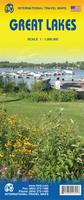
 Sample detail of the Great Lakes Travel Map
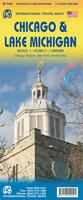
 Sample detail of the Chicago Travel Map
 Sample detail of the Lake Michigan Travel Map
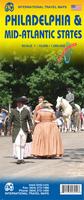
 Sample detail of the Philadelphia Travel Map
 Sample detail of the Mid-Atlantic States Travel Map
 Thumbnail of the Boston side of the map
 Thumbnail of the Northeast USA side of the map
 Sample detail of the Manhattan street map
 Thumbnail of the Manhattan street map
 Thumbnail of the Northeast Corridor map
 Sample detail of the Pacific Coast Travel Map
 Sample detail of the Pacific Coast Travel Map
 Sample detail of the Pacific Northwest Travel Map
 Sample detail of the Pacific Northwest Travel Map
 Thumbnail of the Rocky Mountains Travel Map
 Front of the Rocky Mountains Travel Map
 Reverse of the Rocky Mountains Travel Map
 Front of the Rocky Mountains Travel Map
 Reverse of the Rocky Mountains Travel Map
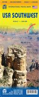
 Thumbnail of the Rocky Mountains Travel Map
 Front of the Southwest Travel Map
 Reverse of the Southwest Travel Map
 Sample detail from the USA road map
 Sample detail from the Western USA road map
 Sketch map showing sheet coverage.
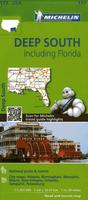 New series!
 Sample detail of the California road map
 Sketch map showing coverage of each map sheet
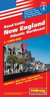
 Sketch map showing sheet coverage
 Sample detail from the Hallwag USA map series
 Recommended!
 Sample detail from the Route 66 road map.
 Sample detail from the Route 66 road map.
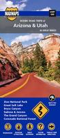
 Sample detail of the Scenic Road Trips Map of Florida
 Sample detail of the Scenic Road Trips Map of the Carolinas