|
|
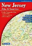
New Jersey Road Atlases.
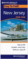
New Jersey Road Maps - Paper Maps.
New Jersey Road Maps - Laminated.
New Jersey City Maps - Paper Maps.
New Jersey County & City Street Atlases.
New Jersey City, County, and State Business Wall Maps
We offer wall maps for Atlantic City, Bayonne, Camden, Cherry Hill, Clifton, East Orange, Edison, Elizabeth, Hamilton, Hoboken, Irvington, Jersey City, New Brunswick, Newark, Old Bridge, Passaic, Paterson, Perth Amboy, Plainfield, Toms River, Trenton, Union, Union City, Vineland, Wayne, and West New York. .
Click here to order city wall maps and to see sample images, prices, sizes, and mounting options.
We offer state and county wall maps for all of the USA. The maps come in sizes from 24 x 36 to 108 x 144 inches. They are available in variety of mounting and framing options. The maps are ideal for business applications, sales territory, delivery planning, direct mail targeting and hundreds of other applications. Click here to order county wall maps and to see sample images, prices, sizes, and mounting options. Click here to order state wall maps and to see sample images, prices, sizes, and mounting options.
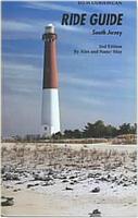
New Jersey Recreation Maps.
 Image of the entire Mid-Atlantic Lighthouses map. Image of the entire Mid-Atlantic Lighthouses map.
New Jersey Wall Maps & New Jersey Satellite Posters.
We offer state and county wall maps for all of the USA. The maps come in sizes from 24 x 36 to 108 x 144 inches. They are available in variety of mounting and framing options. The maps are ideal for business applications, sales territory, delivery planning, direct mail targeting and hundreds of other applications. Click here to order county wall maps and to see sample images, descriptions, and prices. Click here to order state wall maps and to see sample images, descriptions, and prices.
New Jersey Flags.
|
|||||||||||||||||||||||||||||||||||||||||||||||||||||||||||||||||||||||||||||||||||||||||||||||||||||||||||||||||||||||||||||||||||||||||||||||||||||||||||||||
 New Jersey Maps


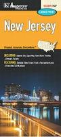 New Jersey Road Map. Hagstrom. A detailed road map of New Jersey by the region's premier local publisher.
 Laminated
 Laminated
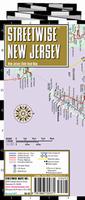
 Reverse side of the New Jersey Streetwise map
 Laminated
 Reverse side of the New Jersey road map
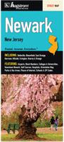
 Front of the Atlantic City map.
 Reverse of the Atlantic City map.
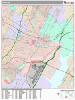
 Sample detail from the Newark wall map.
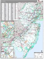 New Jersey County and State Wall Maps.

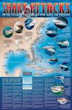 A great gift for the shark enthusiast!
 Image of the entire poster
 Sample of the map detail, covering Florida.
 Sample of the Great White Shark text.
 Sample of the text describing the attacks.
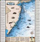
 Thumbnail of the paper chart.
 Thumbnail of the framed chart.
 Thumbnail of the map.
 Sample of the detail.
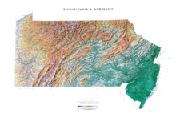
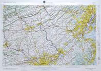
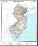 New Jersey Topographic Map. 1:500,000. 1974. US Geological Survey. This map measures 24 x 30 inches, flat. This is the official topographic map of New Jersey.
 Thumbnail of the New Jersey topographic map.
 Sample detail from the New Jersey topographic map.
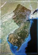
 Sample detail from the New Jersey Satellite Poster
 New Jersey Flags