Alabama Recreation Atlas. 1:125,000. National Geographic Maps. National Geographic's Alabama Recreation Atlas is an ideal recreation resource and contains accurate, detailed topographic maps with private and public land boundaries, a complete road network, valuable recreation information and extensive cross-referenced lists and charts for campgrounds, lakes, parks, attractions and more. State Game Management Unit maps and fish species lists will appeal to the sportsman while detailed primary road networks will be of great interest to motorcyclists, RVers, and those simply touring the state. Size is 11 x 15 inches, softcover.
A sample from the Alabama recreation atlas.
$24.95
62-52485
Atlas
Alabama Road Maps - Paper Maps
Alabama Road Map. Rand McNally.
Detailed road map of Alabama, with inset maps of the major cities. Size is 28 x 40" unfolded.
$7.99
62-5290
1 sheet, folded.
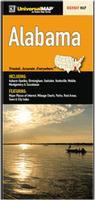
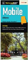
Alabama Road Map. Universal Maps.
The Alabama State fold map is a full-color, regional map, including: Auburn-Opelika, Birmingham, Gadsden, Huntsville, Moblie, Montgomery, and Tuscaloosa; and features: Major Places of Interest, Mileage Charts, Parks, Rest Areas, and a Town and City Index.
A sample from the Alabama road map.
Alabama Road Maps - Waterproof Maps
Waterproof Alabama and Mississippi Laminated Road Map. Universal Map.
This waterproof map of Alabama and Mississippi State is tear-resistant and 100% recyclable. Includes the Alabama insets of: Auburn, Birmingham, Huntsville, Mobile, and Montgomery; and Mississippi insets of: Biloxi, Gulfport, Hattiesburg, Jackson, Meridian, Natchez, Tupelo, and Vicksburg; and features: Airports, Interstate Exit Numbers, Latitude & Longitude Information, Parks and Rec Areas, Places of Interest, and Scenic Routes.
$9.99
62-76902
1 sheet, folded.
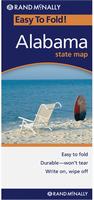
Laminated Alabama Laminated Road Map. Rand McNally.
The durable and convenient Alabama EasyToFold state map will take all the wear and tear your journey can dish out. The heavy-duty laminated design allows you to mark your route, make notes, then wipe the surface clean for further use. This is a must-have for navigation whether you're a state resident or just passing through. Map size is 17 x 18" unfolded.
$9.99
62-52901
1 sheet, folded.
Alabama City Maps
Alabama City Street Maps. Various publishers.
$5.99
62-5292AN
Anniston and Gadsden Street Map. (ADC). Now out of print - limited stock left.
$6.99
62-5292B
Birmingham City Map. (Rand McNally).
$6.95
62-5292BI
Birmingham city map. (GM Johnson).
$5.99
62-5292DO
Dothan City Map. (Universal Map). This full-color street map of Dothan, AL includes: Avon, Cowarts, Grimes, Midland City, Napier Field, Taylor, and Webb; and features: Airports, Block Numbers, Colleges and Universities, Golf Courses, Hospitals, Parks and Rec Areas, Places of Interest, Schools, and ZIP Codes. Now out of print - limited stock left.
$5.95
62-5292F
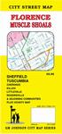
Florence and Muscle Shoals Street Map. (GM Johnson).
$4.95
62-5292FL
Florence and Muscle Shoals Street Map. (Universal). Now out of print - limited stock left.
$5.95
62-5292HU
Huntsville, Decatur, and Athens City Map. (GM Johnson).
$5.99
62-5292D
Huntsville, Decatur, Athens, City Map. (Universal). This full-color street map of Huntsville, Decatur, and Athens, AL features: Airports, Block Numbers, Colleges and Universities, Golf Courses, Government Buildings, Hospitals, Parks and Rec Areas, Places of Interest, Schools, and ZIP Codes.
$6.95
62-5292MOBI
Mobile and Eastern Shore street map. GM Johnson. Paper. Also covers Daphne, Fairhope, Prichard, Saraland, Satsuma, Spanish Fort, and adjoinging communities.
$6.95
62-5292MON
Montgomery city map. (GM Johnson).
Alabama City, County, and State Business Wall Maps
Alabama City Wall Maps.
When it comes to general planning, defining delivery areas, planning direct marketing and delivering products, our city wall maps are perfect to get the detailed information you need.
These maps offer clear mapping by showing all major streets and roads, but leaving out the smaller streets.
If you want a clear map for easy planning, then these are the maps for you; if you want a map showing every little back alley, these are not for you.
We offer wall maps for Auburn, Birmingham, Decatur, Dothan, Hoover, Huntsville, Mobile, Montgomery, and Tuscaloosa.
We offer state and county wall maps for all of the USA. The maps come in sizes from 24 x 36 to 108 x 144 inches. They are available in variety of mounting and framing options. The maps are ideal for business applications, sales territory, delivery planning, direct mail targeting and hundreds of other applications.
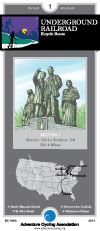
Alabama Bicycling Maps. We stock cycling maps for the Underground Railroad cycling trail across Alabama and the Southern Tier Transcontinental Cycling Trail along Alabama's coastline.
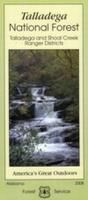
U.S. Forest Service. We stock all available USFS maps for Alabama.
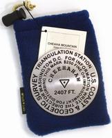
Mount Cheaha Benchmark Paperweight. Geo-Situ. 2,407 ft. elevation. These paperweights, measuring approximately 3-1/4" in diameter, are authentic replicas of famous elevation benchmarks around the world, are crafted from high quality pewter for years of tarnish-free use. Each paperweigh comes in its own small fleece bag for storage, along with a small tag giving a brief description of the geographic location. All are felt-bottomed for scratch-free use on any surface.
Sample of the Mount Cheaha paperweight
$59.95
62-5297CH
Paperweight.
Alabama Wall Maps
Alabama State and County Wall Maps. Intelligent Direct.
We offer state and county wall maps for all of the USA. The maps come in sizes from 24 x 36 to 108 x 144 inches. They are available in variety of mounting and framing options. The maps are ideal for business applications, sales territory, delivery planning, direct mail targeting and hundreds of other applications.
Click here to order county wall maps and to see sample images, descriptions, and prices.
Click here to order state wall maps and to see sample images, descriptions, and prices.
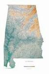
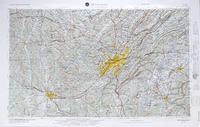
Alabama Raven Shaded Relief Map. 1:600,000. Raven Maps.
The map of Alabama extends from Huntsville and the Sand Mountains in the north, through the low hills and sandy valleys, and down to Mobile and the Gulf Coast. Elevations are represented by color, and this, in combination with our relief shading technique, gives the map a 3-dimensional look. Size is 32 x 49".
Thumbnail of the map. Sample of the detail.
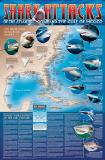
A great gift for the shark enthusiast! Shark Attack Poster of the Atlantic Ocean and the Gulf of Mexico. Sealake Products.
This fascinating, educational print shows the locations of over 300 shark attacks in the Atlantic and Gulf of Mexico from 1905 to the present. 35 hair-raising encounters
are detailed, including the 1916 attacks in New Jersey. Plus, you'll learn interesting facts about the 12 types of sharks blamed for the attacks. Also, an actual size tooth from each of the three most dangerous sharks is shown. Size is 24 x 36". Available rolled/flat, either as plain paper or laminated.


 A sample from the West Virginia atlas.
 A sample from the Maine atlas.
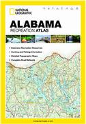
 A sample from the Alabama recreation atlas.
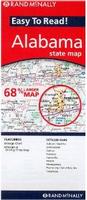
 A sample from the Alabama road map.
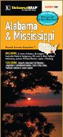 Waterproof
 Laminated
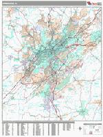
 Sample detail from the Birmingham wall map.
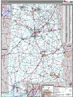 Alabama County and State Wall Maps.

 Sample of the Mount Cheaha paperweight
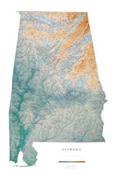
 Thumbnail of the map.
 Sample of the detail.
 A great gift for the shark enthusiast!
 Image of the entire poster
 Sample of the map detail, covering Florida.
 Sample of the Great White Shark text.
 Sample of the text describing the attacks.
 Alabama Flags