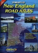
New England Road Atlas. Jimapco. This spiral bound road atlas of New England covers Maine, New Hampshire, Vermont, Massachusetts, Connecticut, and Rhode Island. Includes major roads and highways, communities, lake & rivers, recreational features, and places of interest. 2011, second edition. Spiral-bound, ISBN 9781569146323.
62-20959
Atlas.
$29.95
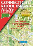
Connecticut & Rhode Island Atlas and Gazetteer. DeLorme. Excellent road atlas with topographic maps and gazetteer.
62-5848
Atlas
$29.95
Connecticut Road Maps - Paper.
Connecticut & Rhode Island Road Map. Rand McNally. Detailed road map of Connecticut and Rhode Island. Includes small inset city maps of Bridgeport/New Haven, CT; Fall River, MA; Hartford, CT; New London, CT; Newport, RI; Providence, RI; Stamford, CT; Springfield, MA; Waterbury, CT. Size is 28 x 40" unfolded.
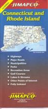
Connecticut & Rhode Island Road Map. Jimapco. State map of Connecticut & Rhode Island. Expanded coverage for Greater Hartford, Providence and the coastline Street level detail for Providence, New Haven and Hartford Includes parks, recreation area, golf courses, lakes, streams and other points of interest. Fully indexed. Size is 38? x25.5? when unfolded.
62-58904
.
$6.95
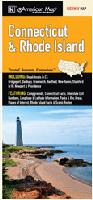
Connecticut Road Map. American Map. The Connecticut & Rhode Island map is a full-color, regional map, including insets of: Bridgeport, Danbury, Greenwich, Hartford, New Haven, Stamford in CT and Newport & Providence in Rhode Island. The map features: Campgrounds, Connecticut Facts, Interstate Exit Numbers, Longitude & Latitude Information, Parks & Rec Areas, Places of Interest, Rhode Island Facts & Scenic Routes.
Connecticut Road Maps - Laminated.
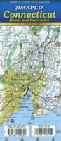
Connecticut Road & Recreation Map - laminated. Jimapco. Plastic coated foldable state map of Connecticut Regional map with insets of greater Hartford/Waterbury area, Bridgeport, Stamford, New Haven, Danbury, and New London/Groton. Includes community index. 19" x 25",
62-58903
1 sheet, folded.
$7.95
Connecticut & Rhode Island Road Map - laminated. Rand McNally. Size is 18 x 17".
62-58902
1 sheet, folded.
$9.99
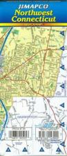
Connecticut Regional Road Maps - laminated. Jimapco. These maps cover several regions of Connecticut. Each map includes small inset maps showing the main streets of several cities within that region. Each map is 25 x 19".
62-58905-CEC
Central Connecticut Laminated Quickmap™.
$7.95
62-58905-NEC
Northeast Connecticut Laminated Quickmap™.
$6.95
62-58905-NWC
Northwest Connecticut Laminated Quickmap™.
$7.95
62-58905-SEC
Southeast Connecticut Laminated Quickmap™.
$7.95
Connecticut City Maps - Paper.
Connecticut City Maps - paper. Various publishers. Folded paper city street maps.
62-5892G
Groton & New London city map. (Universal). Now out of print - limited stock left.
$5.99
62-5892HA
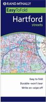
Hartford city map. (American Map).
$5.99
62-5892HAR
Hartford street map. (GM Johnson). Also covers Avon, Bristol, Farmington, Glastonbury, Manchester, New Britain, Rocky Hill, Windsor, and adjoinging communities.
$6.95
62-5892H
Hartford city map. (Rand McNally).
$6.99
Connecticut City Maps - Laminated.
Connecticut City Maps - laminated. Various publishers. Laminated, waterproof, folded city maps.
62-58921HA
Hartford city map - laminated. (Rand McNally).
$7.95
62-58921HAR
Hartford city map - laminated. (Jimapco).
$7.95
62-58921NO
Norwich Quickmap city map - laminated. 1:11,000 & 1:55,000. (Jimapco).
$7.95
62-58921STO
Storrs & UConn Quickmap city map - laminated. (Jimapco).
$6.95
Connecticut City Street Atlases.
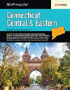
Central & Eastern Connecticut area street atlas. American Map. Spiral-bound street atlas.
62-5893CEC
Atlas.
$29.99
Connecticut City Wall Maps
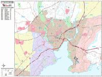
Connecticut City Wall Maps.
When it comes to general planning, defining delivery areas, planning direct marketing and delivering products, our city wall maps are perfect to get the detailed information you need.
These maps offer clear mapping by showing all major streets and roads and many of the smaller streets, but leaving out the smallest streets. If you want a clear map for easy planning, then these are the maps for you; if you want a map showing every little back alley, these are not for you.
We offer wall maps for Bridgeport, Bristol, Danbury, East Hartford, Fairfield, Greenwich, Hamden, Hartford, Manchester, Meriden, Milford, New Britain, New Haven, Norwalk, Stamford, Waterbury, West Hartford, and West Haven.
Click here to see sample images, prices, sizes, and mounting options.
We stock the 3-D plastic raised relief map that covers the Hartford and nearly all of Connecticut. We also stock the Mass./Conn./RI raised relief map.
Connecticut Wall Maps.
Connecticut State and County Wall Maps. Intelligent Direct.
We offer state and county wall maps for all of the USA. The maps come in sizes from 24 x 36 to 108 x 144 inches. They are available in variety of mounting and framing options. The maps are ideal for business applications, sales territory, delivery planning, direct mail targeting and hundreds of other applications.
Click here to order county wall maps and to see sample images, descriptions, and prices.
Click here to order state wall maps and to see sample images, descriptions, and prices.
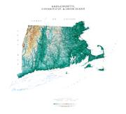
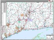
Massachusetts & Connecticut Raven Shaded Relief Map. 1:500,000. Raven Maps. Our map of southern New England places three historic states together. Elevations are represented by color, and this, in combination with our relief shading technique, gives the map a 3-dimensional look. Size is 81 x 91 cm (32 x 36").
Thumbnail of the map. Sample of the detail.
62-7351
Each, rolled
$40.00
62-7351L
Laminated
$65.00
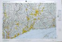
Connecticut Topographic Map. 1:125,000. 1974. USGS. One sheet, in color, size is 142 x 112 cm. The topographic map shows elevation using contour lines (lines of equal elevation); the shaded relief map uses shading to show elevation (more attractive but few absolute elevation data points); the base map shows roads, rivers, etc., but no indication of elevation.
Thumbnail of the Connecticut topographic map.
62-5850
Topographic map, rolled
$12.95
62-5850L
Topographic map, Laminated.
$24.95
Connecticut Geological and Thematic Maps
Connecticut Aeromagnetic Map. 1:125,000. 1974. USGS (GP-897). In black and white. Map size is 99 x 140 cm.
62-5810
1 sheet, folded
$9.95
Connecticut and Rhode Island Seismicity Map. 1:1,000,000. 1981. USGS (MF-1283). Includes Rhode Island. Map size is 69 x 69 cm.
Connecticut Surficial Materials Map of Connecticut. 1:125,000. USGS. 1992. Surficial deposits, color-coded by deposit type, are overprinted on a topographic map.


 Connecticut State and County Wall Maps. Intelligent Direct.
 Thumbnail of the map.
 Sample of the detail.
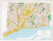
 Thumbnail of the Connecticut topographic map.
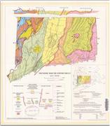
 Connecticut Flags