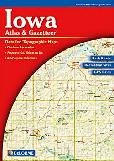
Iowa Atlas and Gazetteer. 1:250,000. DeLorme.
Excellent road atlas with topographic maps and gazetteer. The laminated edition has each page separately laminated and then the atlas is spiral bound. Highly recommended for libraries people who use their atlas alot.
$29.95
62-6748
Atlas
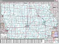
Iowa Road Maps - Paper Maps
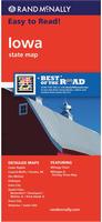
Iowa Road Map. Rand McNally.
A folded full-color map of Iowa. Includes inset maps of Cedar Rapids, Council Bluffs/Omaha, NE; Des Moines, Dubuque, Iowa City, Bettendorf/Davenport/Rock Island, IL/Moline, IL; Waterloo, and Cedar Falls. Map size is 28 x 40 inches unfolded.
$7.99
62-6790
1 sheet, folded.
Iowa Road Map. Universal Map.
The Iowa State fold map is a full-color, regional map, including: Ames, Burlington, Cedar Rapids, Clinton, Council Bluffs, Davenport, Quad Cities, Des Moines, Dubuque, Fort Dodge, Iowa City, Mason City, Sioux City, and Waterloo.
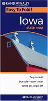
Iowa Road Maps - Laminated Maps
Waterproof Iowa Easyfinder™ Laminated Road Map. Rand McNally. The durable and convenient Iowa EasyToFold state map will take all the wear and tear your journey can dish out. The heavy-duty laminated design allows you to mark your route, make notes, then wipe the surface clean for further use. Map size is 18 x 17 inches unfolded.
$9.99
62-67901
1 sheet, folded.
Iowa City Maps - Paper Maps
Iowa City Maps.
$5.99
62-6792CEF
Cedar Falls & Waterloo city map. (Warren Map).
$4.95
62-6792CE
Cedar Falls & Waterloo city map. (Rand McNally).
$5.95
62-6792C
Cedar Rapids & Iowa City city street map. (Warren Map).
$5.99
62-7992OCB
Council Bluffs & Omaha street map. (Universal). This full-color street map of Omaha, NE and Council Bluffs, IA includes: Bellevue, Boys Town, Carter lake, La Vista, and Ralston; and features: Airports, Colleges and Universities, Golf Courses, Hospitals, Omaha Downtown, Parks and Rec Areas, Places of Interest, and ZIP Codes.
$6.95
62-6792DE
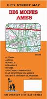
Des Moines & Ames street map. GM Johnson. Also covers Altoona, Ankeny, Norwalk, Urbandale, Waukee, Iowa State Univ., and adjoinging communities.
$6.99
62-6792D
Des Moines City Map. (Rand McNally).
$4.95
62-6792DX
Dubuque Area Street Map, Iowa. (Hedberg).
$4.95
62-6592QU
Quad Cities/Moline/Davenport City Map. (Universal).
$5.99
62-9392SI
Sioux City (IA) & Sioux Falls (SD) street map. (American Map). This full-color street map of Sioux Falls, SD & Sioux City, IA includes: Brandon, Dakota City, Sergeant Bluff, and South Sioux City; and features: Airports, Block Numbers, Colleges and Universities, Golf Courses, Interstate Exit Numbers, Parks and Rec Areas, Places of Interest, Schools, and ZIP Codes.
Iowa City Wall Maps
Iowa City Wall Maps.
When it comes to general planning, defining delivery areas, planning direct marketing and delivering products, our city wall maps are perfect to get the detailed information you need.
These maps offer clear mapping by showing all major streets and roads and many of the smaller streets, but leaving out the smallest streets. If you want a clear map for easy planning, then these are the maps for you; if you want a map showing every little back alley, these are not for you.
We offer wall maps for Ames, Ankeny, Cedar Rapids, Council Bluffs, Davenport, Des Moines, Dubuque, Iowa City, Sioux City, Waterloo, and West Des Moines.
Click here to order and to see sample images, prices, sizes, and mounting options.
We stock all USGS topographic maps of Iowa at all available scales.
Iowa Bicycling Maps. Iowa has three long-distance trails that traverse the state - the Lewis & Clark Cycling Trail that goes north-south along the Iowa/Nebraska border; the Northern Tier Cycling Trail that runs along Iowa's eastern border; and the Great Rivers Cycling Trail that runs along the Iowa/Illinois border. In addition, there are numerous "rail trails" and other popular rides throughout the state, covered in both the state cycling map and guide.
Click here for our Iowa cycling maps & guides list.
Iowa State and County Wall Maps. Intelligent Direct.
We offer state and county wall maps for all of the USA. The maps come in sizes from 24 x 36 to 108 x 144 inches. They are available in variety of mounting and framing options. The maps are ideal for business applications, sales territory, delivery planning, direct mail targeting and hundreds of other applications.
Click here to order county wall maps and to see sample images, descriptions, and prices.
Click here to order state wall maps and to see sample images, descriptions, and prices.
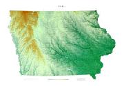
Iowa Shaded Relief Wall Map. 1:500,000. Raven Maps. Situated between the Missouri River on the west and the Mississippi River on the east, Iowa has some of the most fertile soil in the country. Elevations are represented by color, and this, in combination with our relief shading technique, gives the map a 3-dimensional look. Size is 34 x 49".
Thumbnail of the entire map. Sample of the detail.


 Waterproof
 Sample detail from the Des Moines wall map.

 Thumbnail of the entire map.
 Sample of the detail.
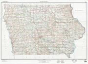
 Sample detail of the Iowa topographic map.
 Image of the Iowa topographic map.
 Iowa Flags