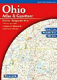
Ohio Atlas and Gazetteer. 1:150,000. DeLorme.
Excellent road atlas with topographic maps and gazetteer, tables of campgrounds and outdoor recreation sites. Softcover, 88 pages. This atlas is aimed at recreational users and is better for campers, birders, hikers, etc.
Sample detail of the road atlas.
$29.95
62-8748
Atlas
Ohio Road Maps - Paper Maps
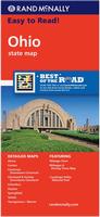
Ohio Road Map. Rand McNally.
This is a detailed road map of Ohio. The map has inset city maps of Akron, Canton, Cincinnati, Downtown Cincinnati, Cleveland & Vicinity, Downtown Cleveland, Columbus, Cuyahoga Valley National Park, Dayton, Springfield, Toledo, and Youngstown/Warren. The map includes a driving time-and-distance chart and a full city-town index. Map size is 28 x 40 inches unfolded.
$7.99
62-8790
1 sheet, folded.
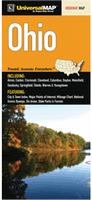
Ohio Road Map. Universal Map.
The Ohio fold map is a full-color, regional map, including: Akron, Canton, Cincinnati, Cleveland, Columbus, Dayton, Mansfield, Sandusky, Springfield, Toledo, Warren, and Youngstown; and features: a City and Town index, major Points of Interest, a mileage chart, National Scenic Byways, Ski Areas, and State Parks and Forests.
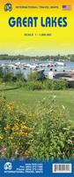
Great Lakes Travel Map. 1:1,000,000. ITMB.
Using this map, one can explore Lakes Ontario and Erie as circular routes; also Huron and Superior; visit Ottawa and Toronto, Chicago and Duluth, and find Fort WilliamWawa Goose. This is a double-sided map covering from Ottawa in the north to Pittsburgh and Columbus in the south and Duluth and Thunder Bay in the west. Both Canada and the USA portions of the Great Lakes Region are included.
Sample detail of the Great Lakes Travel Map
$9.95
62-20913-GL
1 sheet, folded.
$24.99
62-20913-GLW
1 sheet, flat.
$34.99
62-20913-GLL
1 sheet, laminated.
Ohio Regional Road Map Series. Universal Map.
This three-sheet road map series offers complete, detailed, coverage of Ohio. The larger, more detailed, scale of these maps means more roads and more place-names can be shown. Map features include color-coded travel routes, railroads, boundaries, parks, forests, Native American reservations, military areas, schools, airports, and points of interest. Size is 27" x 39" unfolded.
$7.99
62-87905-NE
Northeast Ohio road map. The Northeastern Ohio fold map is a full-color, regional map, including: Akron, Ashland, Canton, Cleveland, Dover, Lorain, Mansfield, New Philadelphia, and Sandusky.
$7.99
62-87905-NW
Northwest Ohio road map. The Northwest Ohio fold map is a full-color, regional map, including street-detail insets of Downtowns: Columbus, Dayton, Springfield, and Toledo.
$7.99
62-87905-S
Southern Ohio road map. The Southern Ohio fold map is a full-color, regional map, including: Athens, Cincinnati, Dayton, Lancaster, and Marietta; and a Columbus vicinity map.
Ohio Road Maps - Laminated Maps
Laminated Ohio Easy-to-Fold™ Road Map - Laminated. Rand McNally.
The durable and convenient Ohio EasyToFold state map will take all the wear and tear your journey can dish out. The heavy-duty laminated design allows you to mark your route, make notes, then wipe the surface clean for further use. Map size is 18 x 17 inches, an ideal size for using in a car.
$9.99
62-87903
1 sheet, folded.
Ohio City Maps - Paper Maps
Ohio City Maps - paper maps. Various publishers.
These are full-sized detailed street maps of the each city. Maps of the same city by different publishers are very similar and show the same level of detail Map size is typically 28 x 40 inches or so, unfolded.
$5.99
62-8792A
Akron City Map. (Rand McNally).
$4.95
62-8792AK
Akron City Map. (GM Johnson).
$4.95
62-8792AS
Ashland City Map. (Universal Map). Now out of print and we have limited stock left.
$4.95
62-8792CA
Canton City Map. (GM Johnson).
$6.99
62-8792C
Cincinnati City Map. (Rand McNally).
$7.99
62-8792CH
Cincinnati City Map. (Universal Map). This full-color street map of Cincinnati, OH includes: Deer Park, Golf Manor, Madeira, Mariemont, Milford, Newton, Norwood, Silverton, and Northern Kentucky; and features: Block Numbers, Colleges and Universities, Golf Courses, Parks and Rec Areas, Places of Interest, and ZIP Codes.
$4.95
62-8792CIN
Cincinnati City Map. (GM Johnson).
$6.99
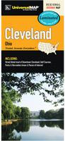
62-8792CLE
Cleveland & Cuyahoga County Street Map. (Rand McNally).
$7.99
62-8792D
Cleveland City Map. (Universal Map). This full-color street map of Cleveland, OH includes: Bay Village, Brook Park, Brooklyn, Fairview Park, Garfield Heights, Lakewood, North Olmsted, Rocky River, and Westlake; and features: Airports, Block Numbers, Cleveland Downtown, Colleges and Universities, Golf Courses, Marinas, Parks and Rec Areas, Places of Interest, and ZIP Codes.
$5.99
62-8792CO
Columbus City Map. (Rand McNally).
$5.99
62-8792COL
Columbus City Map. (Universal Map). This full-color street map of Columbus, OH includes: Bexley, Dublin, Gahanna, and surrounding communities. The map features Airports, Block Numbers, Colleges and Universities, Golf Courses, Parks and Rec Areas, Places of Interest, and ZIP Codes.
$5.99
62-8792COV
Columbus and Vicinity City Map. (Rand McNally).
$5.95
62-8792DA
Dayton, Springfield, and Xenia street map. (GM Johnson). Also covers Beavercreek, Centerville, Fairborn, Huber Heights, Kettering, Miamisburg, Vandalia, and adjoinging communities.
$5.95
62-8792NEP
New Philadelphia city map. With coverage of Dover and Coshocton.
$4.95
62-8792SB
Sandusky City Map. (Rand McNally).
$5.95
62-8792SA
(OH) Sandusky, Fremont, and Port Clinton street map. (GM Johnson).
$6.95
62-8792T
Toledo City Map. (GM Johnson).
$4.95
62-8792YOU
Youngstown & Warren City Map. (GM Johnson). Also covers Austintown, Cortland, and adjoining communities.
$4.95
62-8792ZA
Zanesville, Cambridge, & New Lexington City Map. (GM Johnson). Also covers Caldwell, Somerset, and adjoining communities.
Ohio City, County, and State Business Wall Maps
Ohio City Wall Maps.
When it comes to general planning, defining delivery areas, planning direct marketing and delivering products, our city wall maps are perfect to get the detailed information you need.
These maps offer clear mapping by showing all major streets and roads, but leaving out the smaller streets.
If you want a clear map for easy planning, then these are the maps for you; if you want a map showing every little back alley, these are not for you.
We offer wall maps for Akron, Canton, Cincinnati, Cleveland, Cleveland Heights, Columbus, Dayton, Elyria, Euclid, Hamilton, Kettering, Lakewood, Lorain , Mansfield, Mentor, Middletown,
Parma, Springfield, Toledo, Warren, and Youngstown.
We offer state and county wall maps for all of the USA. The maps come in sizes from 24 x 36 to 108 x 144 inches. They are available in variety of mounting and framing options. The maps are ideal for business applications, sales territory, delivery planning, direct mail targeting and hundreds of other applications.
Ohio Bicycling Maps. Two popular long-distance trails traverse parts of Ohio. These include the Northern Tier Transcontinental Trail that crosses Ohio east-west along its northern border and the shores of Lake Erie, and the Underground Railroad Trail that crosses the entire state from Cincinnati in the southwest to Ashtabula in the northeast. In addition we stock a single-sheet cycling map for Ohio and a small bicycle trail guidebook.
Click here for our complete US Forest Service maps list.
Ohio Wall Maps
Ohio State and County Wall Maps. Intelligent Direct.
We offer state and county wall maps for all of the USA. The maps come in sizes from 24 x 36 to 108 x 144 inches. They are available in variety of mounting and framing options. The maps are ideal for business applications, sales territory, delivery planning, direct mail targeting and hundreds of other applications.
Click here to order county wall maps and to see sample images, descriptions, and prices.
Click here to order state wall maps and to see sample images, descriptions, and prices.
Ohio Shaded Relief Wall Map. 1:500,000. Raven Maps. The northern portion of Ohio shares 312 miles of shoreline with Lake Erie. The land then becomes part of the Till Plains, the beginning of the corn belt and one of the most fertile farming regions in the nation. The southern border is the historic Ohio River. Elevations are represented by color, and this, in combination with our relief shading technique, gives the map a 3-dimensional look. Size is 97 x 107 cm (38 x 42").
Thumbnail of the map. Sample of the detail.


 Sample detail of the road atlas.
 Sample detail of the Great Lakes Travel Map
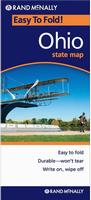 Laminated


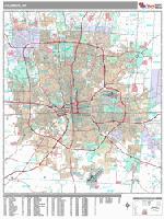
 Sample detail from the Columbus wall map.
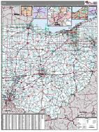 Ohio County and State Wall Maps.


 Thumbnail of the Ohio wall map with colored counties.
 Thumbnail of the Ohio wall map with white counties.
 Sample detail of the Ohio wall map.
 Thumbnail of the map.
 Sample of the detail.
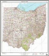
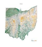
 Sample detail from the Ohio topographic map.
 Image of the Ohio topographic map.

 Ohio Flags