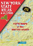
New York Atlas and Gazetteer. 1:127,000. DeLorme.
This atlas is more of a recreation atlas and less of a road atlas than the two atlases below. Contains topographic maps with unbeatable detail, plus gazetteer information on great places to go and things to do. Fully indexed. The atlas is a quality paperback; size 11" x 15-1/2". Softcover, 120 pages.
$29.95
62-8448
Atlas
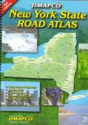
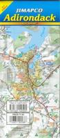
New York Road Atlas. Jimapco.
Spiral bound atlas of the whole state of New York with major roads and highways, communites, lakes & rivers, recreational features and places of interest Includes detailed maps for larger metro areas in the back section Fully indexed for communities, physical features and places of interest. Spiral-bound, 9½ x 12".
Sample detail New York road atlas
We have numerous city street maps of New York City and other cities in New York State. Please click on the link above to go to those listings. These listings include maps for:
Manhattan streets
Manhattan subways and public transportation
New York City
Other cities in New York State
Paper and waterproof maps
New York Paper Road Maps.
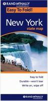
New York Road Map. Rand McNally.
A detailed road map of the state showing Interstate, U.S., state, and county highways, along with clearly indicated parks, points of interest, airports, county boundaries, and streets. Includes inset city maps of Albany/Schenectady, Binghamton, Buffalo/Niagara Falls, Central Long Island, Elmira, New York City & Vicinity, Manhattan, Rochester, Syracuse, and Utica.
$7.99
62-84905
1 sheet, folded.
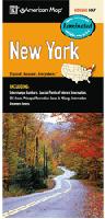
New York Road Map. 1:710,000. American Map.
The New York State Large Print fold map features an easy-to-read format with points of interest, public recreation areas, airports, highways and connecting road all highlighted. City insets include: Albany, Buffalo, Long Island, Niagara Falls, Schnectady & Troy.
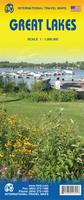
Great Lakes Travel Map. 1:1,000,000. ITMB.
Using this map, one can explore Lakes Ontario and Erie as circular routes; also Huron and Superior; visit Ottawa and Toronto, Chicago and Duluth, and find Fort WilliamWawa Goose. This is a double-sided map covering from Ottawa in the north to Pittsburgh and Columbus in the south and Duluth and Thunder Bay in the west. Both Canada and the USA portions of the Great Lakes Region are included.
Sample detail of the Great Lakes Travel Map
$9.95
62-20913-GL
1 sheet, folded.
$24.99
62-20913-GLW
1 sheet, flat.
$34.99
62-20913-GLL
1 sheet, laminated.
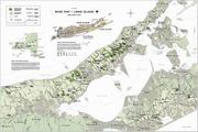
New York Regional Maps - paper maps. Jimapco.
Detailed road maps by this popular NE USA regional map publisher. These maps show interstates, highways, and major roads, parks, campgrounds, golf courses, wineries and many other recreational areas and points of interest. Map size is 25.5" x 38" when unfolded.
Sample detail of the Hudson Valley road map
$5.95
62-84909-CE
Central Region of New York Street Map. Major routes from Binghamton to Massena; Little Falls to Auburn, including Syracuse area, Oneida, Utica, Rome, Ithaca, Oneonta, Watertown, Oswego, Auburn, and more.
$6.95
62-84909-WE
Western Region of New York Street Map. Interstates, highways, and major roads from Cayuga Lake to western border of New York State. Includes the counties of Niagara, Erie, Cattaraugus, Chautauqua, Orleans, Genesee, Wyoming, Allegany, Monroe, Livingston, Wayne, Ontario, Yates, Steuben, and Schuyler. Contains insets for Rochester, Niagara Falls, and Buffalo and others.
New York Waterproof Road Maps.
New York State Easyfinder™ Road Map - waterproof map. Rand McNally.
Good laminated road map of New York - perfect for leaving in your glove compartment. The durable and convenient New York EasyToFold state map will take all the wear and tear your journey can dish out. The heavy-duty laminated design allows you to mark your route, make notes, then wipe the surface clean for further use. This is a must-have for navigation whether you're a state resident or just passing through. Size is 18 x 17" unfolded.
Easy to fold means no fumbling
Heavy-duty lamination allows you to write on, wipe off
Durable and tear resistant
Folds to display individual map sections
Full-color maps with enhanced cartography
Clearly indicated highways, county boundaries, points of interest, and more
Quick-reference legend and city index
$9.99
62-84902
1 sheet, folded.
Waterproof! New York State Destination Road Map - waterproof map. National Geographic Maps.
The front side is an easy-to-read road map with insets of: - Rochester - Syracuse - Utica - Binghamton - Albany / Schenectady / Troy. The back side includes: - Map and information for New York City - Map and information for Buffalo / Niagara Falls - Points of interest - Scenic drive - Park Service sites for New York State.
$7.95
62-84904
1 sheet, folded.
Laminated New York State Road Map - waterproof map. American Map.
This state slicker shows highways, state parks, airports, rest areas and points of interest. It also features detailed insets of Albany, Troy, Rochester, Buffalo, Niagara Falls, and Syracuse.
New York State has four long-distance trails that traverse the state. These include the Adirondack Loop Trail loop; the Atlantic Coast Trail across southern New York; the Northern Tier Trail that runs from coast to coast and east-west across New York; and the Historic Underground Railroad Trail along the western state border.
U.S. Forest Service. We stock the Finger Lakes National Forest map.
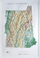
New York Raised Relief Maps Hubbard makes an excellent 3D vinyl raised relief map of New York as well as four more detailed raised relief maps of sections of the state. Click on the links below to see sample images and to order.
Waterproof! New York - Adirondack Park. 1:75,000. Trails Illustrated/National Geographic Maps. Detailed topographic hiking maps, printed on waterproof, tear-resistant, synthetic paper.
New York Hiking Map Index
$14.95
63-2100-742
Lake Placid & High Peaks. 1:75,000.
$14.95
63-2100-743
Lake George & Great Sacandaga Lake. 1:75,000.
$14.95
63-2100-744
Northville & Raquette Lake. 1:75,000.
$14.95
63-2100-745
Old Forge & Oswegatchie. 1:75,000.
$14.95
63-2100-746
Paul Smiths & Saranac. 1:75,000.
Waterproof! Catskill Park Hiking Map National Geographic Maps/Trails Illustrated #755. This is a two-sided, waterproof map created in partnership with the Adirondack Mountain Club (ADK) which provided trail information from its Forest Preserve Series of trail guides. Loaded with valuable information about recreating in the park, the map also includes a UTM and Latitude/Longitude grid, as well as selected waypoints and a scale bar for easy and accurate navigation.
Sample detail of the Catskill Park map
$14.95
63-2100-755
1 sheet, folded.
Waterproof! Harriman / Bear Mountain / Sterling Forest State Parks Hiking Map National Geographic Maps/Trails Illustrated #756. This is a two-sided, waterproof map loaded with valuable safety tips, guidelines for outdoor recreation, park contact information and more. The map also includes a UTM and Latitude/Longitude grid, as well as selected waypoints and a scale bar for easy and accurate navigation.
Sample detail of the Harriman Park map
$14.95
63-2100-756
1 sheet, folded.
Waterproof Shawangunk Mountains Hiking Map. Trails Illustrated #750.
This map features key points of interest including the Minnewaska State Park Preserve, Sams Point Preserve, Neversink River Unique Area, the Long Path, the Appalachian Trail, and the Shawangunk Mountains Scenic Byway. This uniquely detailed map includes Mohonk Preserve and Mohonk Mountain House inset maps and trail charts, along with a Shawangunk Ridge Trail profile. Public fishing easements and Mongaup Valley and Bashakill Wildlife Management Areas are clearly marked.
Sample detail from the Shawangunk Mountains hiking map. Front of the Shawangunk Mountains hiking map. Reverse of the Shawangunk Mountains hiking map.
$14.95
63-2100-750
1 sheet, folded.
New York Wall Maps and New York Satellite Posters.
New York State and County Wall Maps. Intelligent Direct.
We offer state and county wall maps for all of the USA. The maps come in sizes from 24 x 36 to 108 x 144 inches. They are available in variety of mounting and framing options. The maps are ideal for business applications, sales territory, delivery planning, direct mail targeting and hundreds of other applications.
Click here to order county wall maps and to see sample images, descriptions, and prices.
Click here to order state wall maps and to see sample images, descriptions, and prices.
New York Shaded Shaded Relief Wall Map. 1:500,000. Raven Maps.
From Lake Erie and Lake Ontario in the north to Montauk Point on the tip of Long Island, New York is incredibly diverse. Points of interest include the Adirondack Mountains, the Finger Lakes, the Catskill Mountains, and the historic Hudson River. Elevations are represented by color, and this, in combination with our relief shading technique, gives the map a 3-dimensional look. Size is 107 x 150 cm (42 x 59").
Thumbnail of the map. Sample of the detail.
$40.00
62-8451
1 sheet, rolled
$65.00
62-8451L
Laminated
New York Wall Map. 1:750,000. National Geographic Maps.
New York's diverse terrain and vegetation is rendered accurately through the map's color palate, and shaded relief. Inherent to National Geographic reference cartography, NGS's state wall maps contain thousands of place names and precise locations of: cities, major roadways and railways, airports, federal and state protected lands, mountain ranges and prominent peaks, marine sanctuaries, military installations, major lakes, rivers and reservoirs, and other geographic features.
Detail from the New York wall map. Thumbnail of the New York wall map.


 Sample detail New York road atlas
 Sample detail of the Great Lakes Travel Map
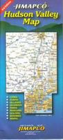
 Sample detail of the Hudson Valley road map
 Waterproof!
 Laminated
 Sample detail #1 of the Finger Lakes road map
 Sample detail #2 of the Finger Lakes road map

 New York Hiking Map Index
 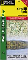 Waterproof!
 Sample detail of the Catskill Park map
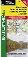 Waterproof!
 Sample detail of the Harriman Park map
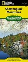 Waterproof
 Sample detail from the Shawangunk Mountains hiking map.
 Front of the Shawangunk Mountains hiking map.
 Reverse of the Shawangunk Mountains hiking map.
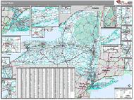 New York State and County Wall Maps. Intelligent Direct.
 Thumbnail of the map.
 Sample of the detail.
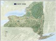 New York Wall Map. 1:750,000. National Geographic Maps.
 Detail from the New York wall map.
 Thumbnail of the New York wall map.
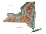
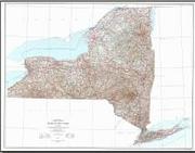 New York Topographic Wall Map. 1:500,000. 1974. USGS.
 Detail from the New York topographic map.
 Thumbnail of the New York topographic map.
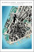
 Thumbnail of Manhattan
 Detail image of Manhattan
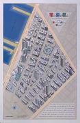
 Thumbnail of Tribeca bird's-eye view poster
 Detail image of Tribeca bird's-eye view poster
 New York Flags