|
|
Kansas Road and Topographic Atlases.
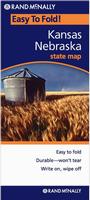
Kansas Road and City Maps.
 Sample detail from the Kansas road map. Sample detail from the Kansas road map.
Kansas City Wall Maps
We offer wall maps for Kansas City, Lawrence, Lenexa, Manhattan, Olathe, Overland Park, Shawnee, Topeka, and Wichita. Click here to order and to see sample images, prices, sizes, and mounting options.
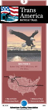
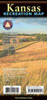
Kansas Recreation Maps.click here. We stock the "TransAmerica Cycling Trail" maps for Kansas.
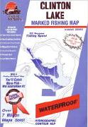
click here. We stock a selection of fishing maps for Kansas.
click here. We stock all USGS topographic maps of Kansas at all available scales.
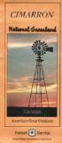
U.S. Forest Service. We stock the Cimarron Grassland USFS maps for Kansas.
Kansas Wall Maps
We offer state and county wall maps for all of the USA. The maps come in sizes from 24 x 36 to 108 x 144 inches. They are available in variety of mounting and framing options. The maps are ideal for business applications, sales territory, delivery planning, direct mail targeting and hundreds of other applications. Click here to order county wall maps and to see sample images, descriptions, and prices. Click here to order state wall maps and to see sample images, descriptions, and prices.
Kansas Flags
|
||||||||||||||||||||||||||||||||||||||||||||||||||||||||||||||||
 Kansas Maps


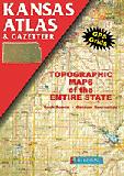
 A sample from the Maine atlas.
 Laminated
 Kansas Street Maps - paper. Various publishers.
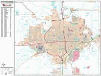
 Sample detail from the Wichita wall map.
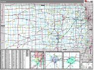 Kansas State and County Wall Maps. Intelligent Direct.
 Thumbnail of the map.
 Sample of the detail.
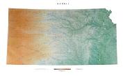
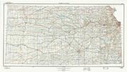 Kansas Topographic Map. 1:500,000. 1984. USGS. Map size is 33 x 56 inches. The official topographic map of the state of Kansas.
 Sample detail of the Kansas topographic map.
 Thumbnail of the Kansas topographic map.
 Kansas Flags