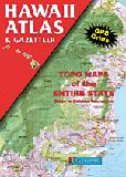
Hawaii Atlas and Gazetteer. 1:84,000. DeLorme. Excellent road atlas with topographic maps and gazetteer.
$29.95
62-6348
Atlas
Hawaii Travel Maps & Hawaii City Maps
Hawaii Road Maps
Hawaiian Islands Road Map. Phears Hawaii Maps. With large, easy to read text, vibrant color, and information on everything from parks, to freeways. The maps feature accurate and comprehensive road maps, as well as visitor information.
NOTE: Phears has ceased publishing and we have only limited stock left of these titles.
Sample of the Maui road map. Sample of a city map on the Maui map.
$4.99
62-6390KA
Kaui. 1:85,00. 2010.
Hawaii Maps by Nelles Verlag. Nelles Verlag. Detailed shaded relief maps with road networks and tourist information overlain on the map.
Sample of Nelles Verlag's Kauai map
$8.95
62-6390
Hawaiian Islands Road Map.
$9.95
62-63900
Kauai road map. 1:150,000. Includes city maps at 1:35,000 of Hanalei, Hanapepe, Kalaheo, Kapaa, Kekaha/Waimea, Koloa/Poipu, and Lihue. Size is 79 x 50 cm unfolded.
$9.95
62-63901
Oahu and Honolulu road map. 1:150,000. Includes city maps at 1:35,000 of Honolulu, Kaneohe/Kailua, and Laie.
$11.95
62-63902
Maui, Molokai, Lanai road map. 1:150,000. Includes city maps at 1:25,000 or 1:35,000 of Haiku, Hana, Kalaupapa, Kaunakakai, Kihei, Kula, Lahaina, Lanai City, Pukalani/Makawao, and Wailuku/Kahului.
$9.95
62-63903
Hawaii (Big Island) road map. 1:330,000. Includes inset maps of Volcanoes National Park and Kapaau at 1:125,000 and city maps at 1:35,000 of Captain Cook, Hilo, Honokaa, Kailua-Kona, Keauhou, and Waimea (Kamuela).
Hawaii Road and City Maps. University of Hawaii Press. These maps include detailed road networks, large-scale inset maps of towns, points of interest (historic, natural and cultural), hiking trails, parks, beaches, waterfalls, peaks and ridges (with altitudes), and more than 1000 place names (index included).
Sample map detail from the Kauai map Sample detail from the Kauai map.
$4.95
62-6391-1
Hawaii (Big Islands) road map. 20 x 30" unfolded.
$3.95
62-6391-2
Kauai road map. 22 x 14.5" unfolded.
$4.95
62-6391-3
Maui road map. 18.5 x 24" unfolded.
$3.95
62-6391-4
Molokai and Lanai road map. 21 x 18" unfolded.
$3.95
62-6391-5
Oahu road map. 25 x 28" unfolded.
Road Maps of the Hawaiian Islands. Global Graphics. These are three popular road maps for the Hawaiian Islands, the Big Island, and Maui. The maps include inset city street maps of the main cities on the island, plus town and city-street indexes and tourist information.
Sample detail of the Big Island road map.
$4.95
62-63917
Hawaiian Islands road map. Scales vary with island. 2005. This map has maps of Oahu, Maui, Hawaii, Molokai, Lanai, and Kahoolawe and a detailed street map of Honolulu. There are street indexes, places of interest and other information as well.
$4.95
62-63907
Hawaii - the Big Island - road map. 1:260,000. 2006. This is a detailed road map of the Big Island. There are inset city maps of Hilo (approx. 8 x 10 inches) at 1:38,000 and Kailua-Kona (approx. 6 x inches) at 1:35,000. The reverse has a detailed map of Hawaii Volcanoes National Park eastern section, covering the East Rift Zone and Kilauea Caldera; city/town index for the Big Island; and street indexes for both of the city inset maps.
Hawaiian Islands Road Map. Rand McNally. Detailed road map of the Hawaiian Islands. Includes detailed inset maps of Hawaii Volcanoes National Park, Hilo, Honolulu & Vicinity, Wailuku. Size is 25 x 37 inches when opened.
$7.99
62-6390H
1 sheet, folded.
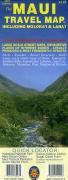
Oahu, the Big Island, and Honolulu Travel Map. 1:80,000 / 1:200,000 / 1:35,000. ITMB.
This map covers the Big Island, where active volcanoes erupt fairly regularly and lava flows are common. Oahu is the most popular island in the state, having Honolulu(1:35.000), Waikiki, and Pearl Harbour, along with such attractions as the Dole Pineapple Plantation. Waterproof.
Front of the Oahu travel map. Reverse of the Oahu travel map.
$11.95
62-63919
1 sheet, folded.
Hawaii Road Maps - Waterproof!
Maps in this section are waterproof and tear-resistant. They are typically printed on synthetic paper such as tyvek(™) or polyart (™) and noted as waterproof, or are paper maps that have been laminated and are noted as laminated.
Waterproof Hawaiian Islands Travel Map. ITMB, Now on waterproof paper, fully indexed, with extensive additional detail. Includes a street map of Honolulu from Waikiki to Pearl Harbor.
Sample detail of the Hawaii Road Map
$19.95
62-63909
1 sheet, folded.
Laminated! Hawaiian Islands Travel Map. 1:200,000 & 1:400,000. Borch. Borch Maps are easy to fold, durable and water-repellent with a wipeable surface. Borch Maps show hotels, museums, monuments, markets, public transport, top sights and points of interest, useful statistics, conversion charts for temperatures, weights and measurements, climate charts showing temperatures, sunshine hours, precipitation and humidity, overview maps, time zones, and much more... Borch's soft-laminated folded map of Hawaii shows: Hawaii (Big Island) 1:400,000; Kilauea Caldera 1:150,000; Hilo 1:70,000; Maui, Molokai / Lanai / Kahoolawe 1:200,000; Wailuku & Kahului 1:35,000; Hawaiian Islands 1:4,000,000; Niihau 1:400,000; Kauai / Oahu 1:200,000; Honolulu & Pearl Harbour 1:26,000; Honolulu Downtown 1:15,500; USA administrative & time zones.
Sample detail of the Hawaii Road Map
$9.95
62-63905
1 sheet, folded.
Waterproof! Hawaii Road Map. 1:200,000. Reise Know-How. This map combines topographic mapping with road and tourist detail. The road information is clear and elevation is shown using contours, spot heights and altitude shading. The map shows six different types of roads, highlighting scenic routes, places of interest, archaeological sites, monasteries, monuments, police stations, railroads, and viewpoints.
$15.99
62-20953-12
1 sheet, folded.
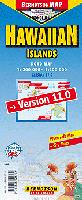
Laminated Hawaiian Islands Road Map. 1:200,000 - 1:400,000. Berndtson. Folded, laminated map of Hawaiian Islands at 1:4,000,000 with more detailed individual maps of the main islands. Inset maps
include Honolulu at 1:26,000; Kilauea Caldera at 1:100,000; Kauai 1:200 000; Maui, Molokai, Lanai, Kahloolawe at 1:200,000; Niihau at 1:400,000; and
Oahu at 1:200,000. Touristic information includes: 15 top POIs (Points of Interest) shown in LocatorMap with text information, including e.g. opening hours and web links). With latitude/longitude grid.
Sample detail of the Berndtson Hawaiian Islands map Image of the front of the Berndtson Hawaiian Islands map Image of the back of the Berndtson Hawaiian Islands map
Hawaii Streetsmart® Road Map - Laminated. VanDam. VanDam's best selling Hawaii StreetSmart maps all of Hawaii's attractions, neighborhoods, hotels, beaches and more at an immensely legible scale with 3D buildings. Map covers all of the Hawaiian islands; Kauai, Lanai, Maui, Molokai, Oahua and the Big Island. Includes detail maps of Downtown Honolulu and Waikiki Beach.
This sexy laminated city map package refolds easily to 4" x 9" (24" x 9" open) and snuggly fits into your pocket.
Front of the VanDam Hawaii map Reverse of the VanDam Hawaii map Sample detail of the VanDam Hawaii map
$7.95
62-63915
1 sheet, folded.
Hawaii City Street Maps
There are very few individual city maps for Hawaiian cities. The individual island maps above usually have small city-center maps on them for the main cities on that particular island. Thus if you want a street map of Hilo, please check the Hawaii Big Island maps listed above.
Honolulu & Oahu Street Map. Great Pacific Recreation Maps. Includes several maps; full island, greater Honolulu, Waikiki/downtown Honolulu, and University of Hawaii at Manoa. Includes a bus system overview and map. "The Bus" reaches all corners of Oahu. The map shows all bus routes with frequent service. Comprehensive symnbols and indexes for tourist sites and services highlight everything from bus stations, to scuba shops, from beaches and parks to golf courses and shopping centers.
$7.95
62-63880
1 sheet, folded.
Hawaii City Maps. Various publishers.
$5.99
62-6392H
Honolulu & Oahu street map. Rand McNally. Paper map.
Honolulu & Oahu Popout City Map. Compass Maps/Popout. O'ahu and Honolulu Popout® map is a portable, comprehensive, and multipart map this tropical destination. Complete with easy-to-read color maps, this pocket-size guide includes at-a-glance travel information about O'ahu and the city of Honolulu. The PopOut maps give an overview of the island of O'ahu and detail downtown Honolulu; three smaller maps detail Waikiki and list distances from this destination to other points on the island. Details show places of interest, historic sites, shopping, parks, and more.
$6.95
62-6392HON
1 sheet, folded.
Hawaii City Wall Maps
Hawaii City Wall Maps.
When it comes to general planning, defining delivery areas, planning direct marketing and delivering products, our city wall maps are perfect to get the detailed information you need.
These maps offer clear mapping by showing all major streets and roads and many of the smaller streets, but leaving out the smallest streets. If you want a clear map for easy planning, then these are the maps for you; if you want a map showing every little back alley, these are not for you.
We offer wall maps for Honolulu.
Click here to see sample images, prices, sizes, and mounting options.
Waterproof Obama's Oahu Guide Map. Franko's Maps. Franko's Obama's Oahu Guide Map is packed with a wealth of visitor information about Oahu with our favorite things to see and do and with many attractions that mark President Obama's early life. These include special insets with descriptions and photos of the hospital where he was born, his schools, his family homes, his favorite beach and much, much more. In addition to a large detailed map of Oahu with roads, trails and place names there are special sections on Makiki, the neighborhood where Barack Obama grew up, and on Oahu's South Shore.Printed on durable waterproof synthetic paper using fade-resistant inks, this oversized Oahu map incorporates a sense of place as experienced by President Barack Obama.
Sample detail of the Oahu Guide Map.
$7.99
62-63913-OB
1 sheet, folded.
Waterproof Oahu Surf Map. Franko's Maps. This waterproof map highlights the numerous surfing spots around the island, concentrating on the South Shore and the North Shore. Surfing beaches are marked and descriptive text is in the margins for most locations. Over 150 surfing spots are shown and described on the two sides of this map. Side one also shows photos of famous surfing spots, including Waimea, Bowls, Sandy Beach and Makaha. A tribute is made to Duke Kahanamoku, the Father of Modern Day Surfing, with a turn-of-the-20th century photograph. Amongst the numerous surfing spots shown and described on side 1 of Franko's Oahu Surfing Map are Makaha, Point Panic, Sandy Beach, Pounders, Sunset Beach, Banzai Pipeline, Waimea Bay, Hale'iwa, and on and on. However, it is side two of Oahu Surfing that the viewer will find the most detail, as it zooms in on the famous North Shore and the heavily visited South Shore.
Front of the Oahu Surf Map. Reverse of the Oahu Surf Map. Sample detail of the Oahu Surf Map.
$7.99
62-63913-OS
1 sheet, folded.
Waterproof Hawaiian Islands Dive Maps. Franko's Maps. Franko's Dive Maps show the viewer most of each island's most popular diving and snorkeling destinations, gives you the locations on the map, and guides you with a description. These maps are specifically for snorkelers and divers - for general tourist maps, the Guide Maps above are ideal, and coupled with the dive maps will be all you need for travelling in the Hawaiian Islands.
Front of the Oahu Dive Map. Reverse of the Oahu Dive Map. Sample detail of the Oahu Dive Map.
$7.99
62-63914-HI
Big Island of Hawaii Dive Map.
$7.99
62-63914-KA
Kauai Dive Map.
$7.99
62-63914-MA
Maui Dive Map.
$7.99
62-63914-OA
Oahu Dive Map.
Waterproof Hawai'i Reef Creatures & Fish Cards. Franko's Maps. Franko's fish cards are stiff, laminated plastic, with a hole for a lanyard. Take it snorkeling or scuba diving with you! Size of Fish Cards: large are 6" x 9", small are 4" x 6".
Front of the Kauai fish card. Reverse of the Kauai fish card.
Waterproof Haleakala & Hawaii Volcanoes National Park Hiking Maps. Trails Illustrated/National Geographic Maps.
Detailed topographic hiking/canoe map showing trails, beaches, scenic view, campgrounds, and much more. Printed on waterproof, tear-resistant synthetic paper.
Sample detail from the Volcanoes N.P. map.
Volcanoes National Park Topographic Map. USGS. 1:100,000.
Folded. The official US Geological Survey topographic map of the Volcanoes National Park. Done in 1986, it is a nice wall map of the Park, but it is not up to date as far as locating tourist services, etc.
$14.99
62-6375
1 sheet, folded.
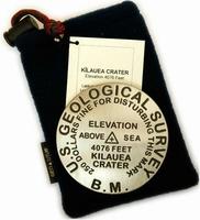
Hawaii Benchmark Paperweights, Lapel Pins, Keychains, and Magnets
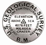
Cast in pewter! USGS benchmark paperweights! Geo-Situ. Whether you're a climber, hiker, geography buff, or armchair traveler, you'll love to collect or give these unique bench mark paperweights that celebrate the spirit of exploration, athletic challenge, and personal achievement. Cast in pewter these summit marker paperweights are exact replicas of official USGS benchmark markers. Please click the "sample" button below to see an enlargement of the paperweight. Each marker has a soft felt pad on the bottom so these can be used on glass, wood, or any surface. Supplied in a soft fleece drawstring pouch, 3¼" diameter.
Larger image of the Kilauea paperweight.
$59.95
62-6397DH
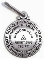
Diamond Head, HI paperweight. 762 ft.
$59.95
62-6397HA
Haleakala Crater, Haleakala National Park, HI paperweight. 10,023 ft.
$59.95
62-6397KI
Kilauea, Volcanoes National Park, HI paperweight. 4,076 ft.
$59.95
62-6397MK
Mauna Kea, Mauna Kea Observatory, HI paperweight. 13,796 ft. Mauna Kea is the world's tallest peak, from base (below sea level) to summit.
$59.95
62-6397ML
Mauna Loa, Hawaii Volcanoes National Park, HI paperweight. 13,677 ft. One of the world's most massive volcanoes.
Cast in pewter! Benchmark lapel pins. Lapel pins are 1" benchmark replicas, made of pewter.
$11.95
62-6397DHL
Diamond Head, HI lapel pin. 762 ft.
$11.95
62-6397HAL
Haleakala Crater, Haleakala National Park, HI lapel pin. 10,023 ft.
$11.95
62-6397KIL
Kilauea, Volcanoes National Park, HI lapel pin. 4,076 ft.
$11.95
62-6397MKL
Mauna Kea, HI lapel pin. Site of the world's largest observatory.
$11.95
62-6397MLL
Mauna Loa, HI lapel pin. One of the world's largest volcanoes.
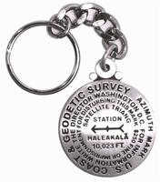
Cast in pewter! Benchmark keychains. Benchmark keychains are 1-1/4" in diameter.
$12.95
62-6397HAK
Haleakala Crater, Haleakala National Park, HI keychain. 10,023 ft.
$12.95
62-6397MKK
Mauna Kea, HI keychain. 13,796 ft.
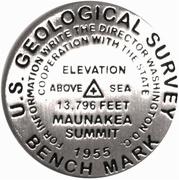
Cast in pewter! Benchmark magnets. Benchmark magnets are 1-1/4" in diameter.
$12.95
62-6397HAM
Haleakala Crater, Haleakala National Park, HI magnet. 10,023 ft.
$12.95
62-6397MKM
Mauna Kea, HI magnet. 13,796 ft.
Cast in pewter! Benchmark zipper pulls / pendants. Benchark zipper pulls / pendants are 1" benchmark replicas, made of pewter.
$11.95
62-6397DHZ
Diamond Head, HI zipper pull / pendant. 762 ft.
$11.95
62-6397HAZ
Haleakala Crater, Haleakala National Park, HI zipper pull / pendant. 10,023 ft.
$11.95
62-6397KIZ
Kilauea, Volcanoes National Park, HI zipper pull / pendant. 4,076 ft.
$11.95
62-6397MKZ
Mauna Kea, HI zipper pull / pendant. Site of the world's largest observatory.
Hawaii wall maps and Hawaii Historic Wall Maps
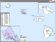
Hawaii State and County Wall Maps. Intelligent Direct.
We offer state and county wall maps for all of the USA. The maps come in sizes from 24 x 36 to 108 x 144 inches. They are available in variety of mounting and framing options. The maps are ideal for business applications, sales territory, delivery planning, direct mail targeting and hundreds of other applications.
Click here to order county wall maps and to see sample images, descriptions, and prices.
Click here to order state wall maps and to see sample images, descriptions, and prices.
Hawaii Raven Shaded Relief Map. 1:750,000. Raven Maps. This stunning map of Hawaii displays the eight main islands, each of which is actually a submerged volcano. The ocean depths are shown in rich shades of blue. Elevations are represented by color, and this, in combination with our relief shading technique, gives the map a 3-dimensional look. Size is 30 x 42".
Thumbnail of the map. Sample of the detail.
Waterproof Pearl Harbor Guide Map - Then and Now. Franko's Maps. Franko's Map of Pearl Harbor, Oahu is loaded with compelling images, and information about the December 7, 1941 attack on Pearl Harbor, and present day Pearl Harbor. If you study this map you will learn what happened on that dreadful, infamous day. Side one of Franko's Map of Pearl Harbor features a wonderful view of Pearl Harbor during the attack of Sunday morning, December 7, 1941, known as the "Day of Infamy" when Pearl Harbor was suddenly and deliberately attacked by the Empire of Japan. You can see the history laid out right before your eyes. Each of America's battleships are laid out on the map, with short descriptions and stories of what happened.
Thumbnail view of the front side Thumbnail view of the reverse side Detail of the map
$7.99
62-63913-PE
1 sheet, folded.
Hawaii Antique-style Wall Map. 28 X 20".
"The Aloha State" was admitted to the Union in 1959, making it the fiftieth state. Located 2,400 miles southwest of San Francisco, Hawaii is made up of several islands covering 10,932 square miles. Its population of 1.8 million is more than sixty percent Asian or Pacific Islanders. Honolulu, on the island of Oahu, is the capital and largest city. Oahu is the site of Pearl Harbor where the Japanese attacked on December 7, 1941 which brought the United States into World War II.
$25
62-63482
1 sheet, rolled.
$275
62-63482D
Deluxe frame
$224.99
62-63482S
Standard frame
Hawaii Topographic Map. 1:500,000. USGS, 1971. Flat wall map showing the topographic of the Hawaiian Islands.
Sample detail of the map
$12.95
62-6350
1 sheet, flat.
$29.99
62-6350L
1 sheet, laminated.
Hawaii Geological and Thematic Maps
Hawaii Aeromagnetic Map. 1:250,000. 1981. USGS (GP-946). Map size is 61 x 76 cm.
$5
62-6310
1 sheet, folded
Hawaii Free-air Gravity Map of the Hawaiian Islands and Adjacent Areas of the Pacific Ocean. 1:2,055,480. 1988. Geol. Soc. America (MCH-0 65). This four-sheet map covers the region of 14°N - 30°N and 175°W - 149°W.


 Sample of the Maui road map.
 Sample of a city map on the Maui map.
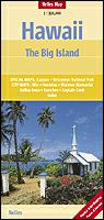
 Sample of Nelles Verlag's Kauai map
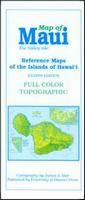
 Sample map detail from the Kauai map
 Sample detail from the Kauai map.
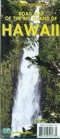
 Sample detail of the Big Island road map.

 Front of the Oahu travel map.
 Reverse of the Oahu travel map.
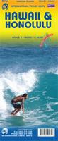 Waterproof
 Sample detail of the Hawaii Road Map
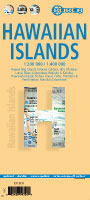 Laminated!
 Sample detail of the Hawaii Road Map
 Waterproof!

 Laminated
 Sample detail of the Berndtson Hawaiian Islands map
 Image of the front of the Berndtson Hawaiian Islands map
 Image of the back of the Berndtson Hawaiian Islands map
 Laminated

 Front of the VanDam Hawaii map
 Reverse of the VanDam Hawaii map
 Sample detail of the VanDam Hawaii map


 Front of the Oahu Guide Map.
 Reverse of the Oahu Guide Map.
 Sample detail of the Oahu Guide Map.
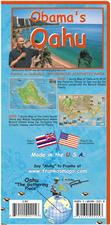 Waterproof
 Sample detail of the Oahu Guide Map.
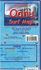 Waterproof
 Front of the Oahu Surf Map.
 Reverse of the Oahu Surf Map.
 Sample detail of the Oahu Surf Map.
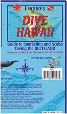 Waterproof
 Front of the Oahu Dive Map.
 Reverse of the Oahu Dive Map.
 Sample detail of the Oahu Dive Map.
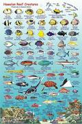
 Waterproof
 Front of the Kauai fish card.
 Reverse of the Kauai fish card.
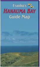 Waterproof
 Sample detail of the Hanauma Bay Guide Map.
 Sample detail of the Hanauma Bay Guide Map.
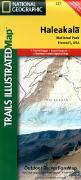 Waterproof
 Sample detail from the Volcanoes N.P. map.
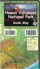 Waterproof
 Front of the Hawaii Volcanoes Guide Map.
 Back of the Hawaii Volcanoes Guide Map.
 Sample detail of the Hawaii Volcanoes Guide Map.
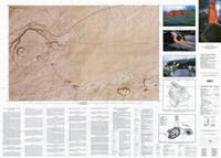
 Cast in pewter!
 Larger image of the Kilauea paperweight.


 Cast in pewter!


 Cast in pewter!


 Cast in pewter!


 Cast in pewter!


 Hawaii State and County Wall Maps. Intelligent Direct.
 Thumbnail of the map.
 Sample of the detail.
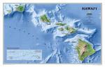
 An image of the full map
 A detail of the map
 A sample of the legend
 An enlarged view of the mounted map

 Waterproof
 Thumbnail view of the front side
 Thumbnail view of the reverse side
 Detail of the map
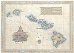


 Sample detail of the map
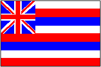 Hawaii Flags