South Carolina Atlas and Gazetteer. DeLorme.
Excellent road atlas with topographic maps and index. Softcover.
$29.95
62-9248
Atlas
South Carolina Road Maps - Paper Maps.
South Carolina Road Map. Rand McNally.
Detailed road map by this world-famous map publisher.
$9.99
62-9290
1 sheet, folded.
South Carolina Road Map. Map Supply.
Detailed road map of South Carolina by this North Carolina-based regional publisher.
$4.95
62-92905
1 sheet, folded.
North & South Carolina Road Map. Map Supply.
Detailed road map of the two Carolinas (North & South) by this North Carolina-based regional publisher.
$6.95
62-85906
1 sheet, folded.
Upstate South Carolina Recreation Map. 1:1,100,000. Upstate Maps.
This is a map of upstate South Carolina that covers an area of this state and neighboring NC and GA. The map attempts to bring you the areas the residents of "The Upstate" so often escape to in order to enjoy the great outdoors. On it you will find waterfall locations, boat ramps, state and local parks, national forests, heritage preserves, historical points of interest, Clemson's Experimental Forest, lakes, rivers and a wealth of other information that will aid in planning and finding your adventure.
Image of the entire Upstate South Carolina map Sample of the Upstate South Carolina map detail
$9.95
62-92904
1 sheet, folded.
South Carolina Road Maps - Laminated Maps.
Laminated South Carolina Road Map - Laminated Map. Rand McNally.
The durable and convenient EasyFinder™ of South Carolina will take all the wear and tear your journey can dish out. The laminated design allows you to mark your route, make notes, then wipe the surface clean for further use.
$9.99
62-92901
1 sheet, folded.
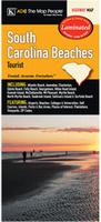
Laminated South Carolina Beaches Street Map - Laminated Map. ADC.
This map of the South Carolina Beaches is durably laminated and contains extensive coverage. Laminated maps are easy to fold, write on, and wipe off. Coverage includes: Atlantic Beach, Awendaw, Charleston, Edisto Beach, Folly Beach, Georgetown, Hilton Head Island, Kiawah Island, McClellanville, Mt Pleasant, Myrtle Beach, North Myrtle Beach, Seabrook Island, Sullivan's Island, and Surfside Beach; and features: Airports, Beaches, Colleges and Universities, Golf Courses, Islands, Parks and Rec Areas, Places of Interest, Plantations, Vineyards, and ZIP Codes.
$8.99
62-92921BE
1 sheet, folded.
South Carolina City Maps - Paper Maps.
South Carolina City Maps - Paper Maps. Various publishers.
$4.95
62-9292AU
Aiken and North Augusta Street Map. (Map Supply).
$5.95
62-6292AUGU
Aiken (SC) and Augusta (GA) city map. (GM Johnson).
$5.95
62-9292AN
Anderson & Anderson County street map. (Map Supply)
$7.95
62-9292BE
Beaufort & Hilton Head and Beaufort County street map. (Map Supply).
$4.95
62-9292CB
Camden City and Kershaw County Street Map. (Map Supply).
$6.99
62-9292CH
Charleston City Map. (Rand McNally).
$5.95
62-9292CHA
Charleston and Charleston County street map. (Map Supply).
$4.95
62-9292CI
Chester and Winnsboro Street Map. (Map Supply).
$5.95
62-9292CLE
Clemson and Pickens County Street Map. (Map Supply).
$5.95
62-9292CP
Greater Columbia and Richland County street map. (Map Supply).
$6.99
62-9292CO
Columbia street map. (Rand McNally).
$4.95
62-9292COL
Colleton County street map. (Map Supply).
$4.95
62-9292FLO
Florence & Darlington street map. (GM Johnson).
$4.95
62-9292FLOR
Florence Street Map. (Map Supply).
$4.95
62-9292GB
Gaffney Street Map. (Map Supply). Out of print and only a few copies remaining.
$4.95
62-8592GE
Georgetown County street map.
$5.95
62-9292GRE
Greenville Street Map. (Map Supply).
$4.95
62-8592GS
Greenwood street map.
$4.95
62-9292GT
Greer Street Map. (Map Supply).
$7.95
62-9292BE
Hilton Head, Beaufort, and Beaufort County street map. (Map Supply). Same as 62-9292BE above.
$4.95
62-9292LB
Lake Murray street map. (Map Supply)
$4.95
62-9292LD
Laurens and Clinton Street Map. (Map Supply).
$6.95
62-9292MY
Myrtle Beach City Map. (Rand McNally).
$6.95
62-9292MYR
Myrtle Beach & The Grand Strand and Horry County street map. (Map Supply).
$6.99
62-9292MYRT
Myrtle Beach City Map. (Kappa Map Group).
$4.95
62-9292NE
Newberry Street Map. (Map Supply).
$4.95
62-9292OC
Oconee County Street Map. (Map Supply).
$4.95
62-9292OR
Orangeburg Street Map. (Map Supply).
$4.95
62-9292HAR
Ridgeland and Hardeeville Street Map. (Map Supply).
$4.95
62-9292ROC
Rock Hill and York County street map. (GM Johnson).
$3.95
62-9292RO
Rock Hill and York County street map. (Rand McNally).
$6.95
62-9292R
Rock Hill and York County street map. (Map Supply).
$5.95
62-9292SPA
Spartanburg Street Map. (Map Supply).
$4.95
62-9292SU
Sumter Street Map. (Map Supply).
$4.95
62-9292HA
Varnville and Hampton Street Map. (Map Supply).
South Carolina City Maps - Laminated Maps.
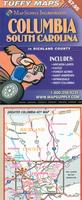
Laminated South Carolina City Maps - Laminated Maps. Map Supply.
Detailed laminated city-center street maps. Fully indexed on the reverse. Accordian-folded for easy use in a car or while walking. Laminated for long-lasting use.
Sample detail of the Columbia laminated city map.
$7.95
62-92921COL
Columbia Tuffy Laminated Street Map.
$7.95
62-92921GR
Greenville Tuffy Laminated Street Map.
South Carolina City, County, and State Business Wall Maps
South Carolina City Wall Maps.
When it comes to general planning, defining delivery areas, planning direct marketing and delivering products, our city wall maps are perfect to get the detailed information you need.
These maps offer clear mapping by showing all major streets and roads, but leaving out the smaller streets.
If you want a clear map for easy planning, then these are the maps for you; if you want a map showing every little back alley, these are not for you.
We offer wall maps for Charleston, Columbia, Greenville, Mount Pleasant, North Charleston, Rock Hill, and Spartanburg.
We offer state and county wall maps for all of the USA. The maps come in sizes from 24 x 36 to 108 x 144 inches. They are available in variety of mounting and framing options. The maps are ideal for business applications, sales territory, delivery planning, direct mail targeting and hundreds of other applications.
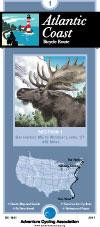
South Carolina Bicycling Maps. South Carolina has a very popular long-distance trail that traverses the state along its coastline - the Atlantic Coast Cycling Trail.
Click here for our South Carolina cycling maps list.
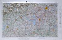
South Carolina Raised Relief Maps. We have a 1:250,000 regional raised relief map for Greenville area, plus two maps covering part of the North and South Carolina border.
We stock all USGS topographic maps of South Carolina at all available scales.
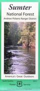
US Forest Service Maps for South Carolina. We stock USFS maps for five different National Forest sections in South Carolina.
Click here for our South Carolina Forest Service maps.
Click here for our complete US Forest Service maps list.
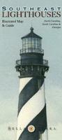
Lighthouses of the Southeast Map. Bella Terra Publishing, June 2010. Size is 36 x 24 inches.
The illustrated map and guide to ALL the lighthouses of North Carolina, South Carolina and Georgia features:
Detailed shaded relief map of the coast, plus insets of Wilmington, Charleston and Savannah
24 original watercolor illustrations
Locations of all standing & "lost" lighthouses in the three states
History & description of each lighthouse
Directions to view each standing light
Locations & directory of Lighthouse & Maritime Museums
Directory of Lighthouse Cruises, Sightseeing Flights & Island Ferries
Upstate South Carolina Recreation Map. 1:1,100,000. Upstate Maps, 2009. This is a map of upstate South Carolina that covers an area of this state and neighboring NC and GA. The map attempts to bring you the areas the residents of "The Upstate" so often escape to in order to enjoy the great outdoors. On it you will find waterfall locations, boat ramps, state and local parks, national forests, heritage preserves, historical points of interest, Clemson's Experimental Forest, lakes, rivers and a wealth of other information that will aid in planning and finding your adventure.
Image of the entire Upstate South Carolina map Sample of the Upstate South Carolina map detail
$9.95
62-92904
1 sheet, folded.
A great gift for the shark enthusiast! Shark Attack Poster of the Atlantic Ocean and the Gulf of Mexico. Sealake Products. This fascinating, educational print shows the locations of over 300 shark attacks in the Atlantic and Gulf of Mexico from 1905 to the present. 35 hair-raising encounters
are detailed, including the 1916 attacks in New Jersey. Plus, you'll learn interesting facts about the 12 types of sharks blamed for the attacks. Also, an actual size tooth from each of the three most dangerous sharks is shown. Size is 24 x 36". Available rolled/flat, either as plain paper or laminated.
South Carolina State and County Wall Maps. Intelligent Direct.
We offer state and county wall maps for all of the USA. The maps come in sizes from 24 x 36 to 108 x 144 inches. They are available in variety of mounting and framing options. The maps are ideal for business applications, sales territory, delivery planning, direct mail targeting and hundreds of other applications.
Click here to order county wall maps and to see sample images, descriptions, and prices.
Click here to order state wall maps and to see sample images, descriptions, and prices.
Recommended South Carolina Shaded Relief Wall Map. 1:500,000. Raven Press.
The Low Country of South Carolina, with its many rivers and swamps, also boasts a forested area know as the Pine Barrens. The Up Country to the northwest consists of rolling hills and the Blue Ridge Mountains. Sassafrass Mountain, at 3,554", is the highest point in the state. Elevations are represented by color, and this, in combination with our relief shading technique, gives the map a 3-dimensional look. Size is 35 x 41".
Thumbnail of the map. Sample of the detail.
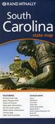
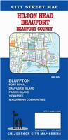

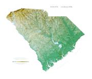

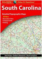


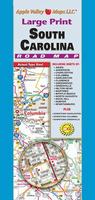
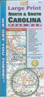
 Image of the entire Upstate South Carolina map
 Sample of the Upstate South Carolina map detail
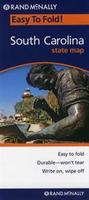 Laminated
 Laminated

 Laminated
 Sample detail of the Columbia laminated city map.
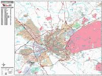
 Sample detail from the Columbia wall map.
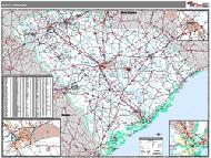 South Carolina County and State Wall Maps.

 Lighthouses of the Southeast Map. Bella Terra Publishing, June 2010. Size is 36 x 24 inches.
 Image of the entire Lighthouses of the Southeast map.
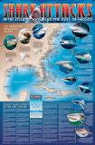 A great gift for the shark enthusiast!
 Image of the entire poster
 Sample of the map detail, covering Florida.
 Sample of the Great White Shark text.
 Sample of the text describing the attacks.
 Thumbnail of the map.
 Sample of the detail.
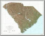 South Carolina Topographic Map. 1:500,000. 1979. USGS. Map size is 36 x 40 inches.
 Sample detail of the South Carolina map.
 Thumbnail of the South Carolina map.
 South Carolina Flags