Pennsylvania Atlas and Gazetteer. 1:150,000. DeLorme.
Excellent road atlas with topographic maps and full index. The maps show back roads, dirt roads and trails; elevation contours; remote lakes and streams; boat ramps; public lands for recreation;
land use / land cover forests, wetlands, agriculture; trailheads; campgrounds; and prime hunting and fishing spots. Each Gazetteer entry's location is cross-referenced to the corresponding map. Softcover, 88 pages, size is 11 x 15 inches closed.
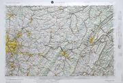
Sample of the detail from the Pennsylvania atlas
$29.95
62-9048
Atlas
Pennsylvania Recreation Map. 1:150,000. National Geographic Maps.
This atlas is ideal for any recreation activity from hunting and fishing to camping, golfing, hiking, and more. The atlas includes topographic maps, a comprehensive road network, recreation guides, and a detailed index. Road types are clearly identified, making the atlas useful for bicycling, motorcycling and off-road adventures. Maps include boundaries for parks and federal lands, and clearly labeled lakes, rivers, and streams. Each map page has a latitude and longitude grid and fact-checked points-of-interest. Also included are charts of fishing areas with species information, game management units, campgrounds and attractions charts, state park maps and facilities, hiking, golfing, skiing and paddling destinations, climate information, and more. Atlas size is 11 x 15 inches when closed.
A two-page spread from the Pennsylvania road atlas Sample detail from the Pennsylvania road atlas
$24.95
62-90485
atlas.
Pennsylvania Road Maps - Paper Maps
Pennsylvania Road Map. Rand McNally. Detailed road map of Pennsylvania with small inset city maps of Allentown/Bethlehem, Altoona, Erie, Gettysburg, Harrisburg, Johnstown, Lancaster, Philadelphia & Vicinity, Downtown Philadelphia, Pittsburgh & Vicinity, Downtown Pittsburgh, Reading, Scranton/Wilkes-Barre, and York. Map size is 28 x 40 inches unfolded.
$7.99
62-9090
1 sheet, folded.
Pennsylvania Road Map. Jimapco. Map of the state of Pennsylvania including insets of: Altoona, Erie, Johnstown, Greater Philadelphia, Greater Pittsburgh, Scranton/Wilkes-Barre, Southeast Pennsylvania, Sharon and State College. You will also find: cities/villages/townships, major roads/highways/interstates, parks, state gamelands, recreation areas, historic sites, points of interest. Fully indexed. Map size is 38 x 25 inches unfolded.
Sample detail #1 from the Pennsylvania road map Sample detail #2 from the Pennsylvania road map
$6.95
62-90904
1 sheet, folded.
Great Lakes Travel Map. 1:1,000,000. ITMB.
Using this map, one can explore Lakes Ontario and Erie as circular routes; also Huron and Superior; visit Ottawa and Toronto, Chicago and Duluth, and find Fort WilliamWawa Goose. This is a double-sided map covering from Ottawa in the north to Pittsburgh and Columbus in the south and Duluth and Thunder Bay in the west. Both Canada and the USA portions of the Great Lakes Region are included.
Sample detail of the Great Lakes Travel Map
$9.95
62-20913-GL
1 sheet, folded.
$24.99
62-20913-GLW
1 sheet, flat.
$34.99
62-20913-GLL
1 sheet, laminated.
Pennsylvania Road Maps - Laminated Maps
Laminated Pennsylvania Laminated Guide Map. National Geographic Maps. The front side is an easy-to-read road map with insets of Erie - Altoona - Johnstown - Harrisburg - State College - Reading - York - Lancaster - Scranton / Wilkes / Barre - Allentown / Bethlehem The back includes: - Maps and information for Pittsburgh and Philadelphia - Information for Gettysburg National Military Park - Points of interest - Scenic drive - Park Service sites in Pennsylvania. Map size is 17 x 24 inches unfolded.
Sample detail #1 from the Pennsylvania Guidemap road map Front of the Pennsylvania Guidemap road map Reverse of the Pennsylvania Guidemap road map
$7.95
62-90903
1 sheet, folded.
Laminated Pennsylvania Easy-to-Fold™ Laminated Road Map. Rand McNally. Map size is 18 x 17 inches, ideal for use in a car. The durable and convenient Pennsylvania EasyToFold state map will take all the wear and tear your journey can dish out. The heavy-duty laminated design allows you to mark your route, make notes, then wipe the surface clean for further use.
$9.99
62-90901
1 sheet, folded.
Laminated Pennsylvania QuickMap™. Jimapco. Plastic-coated, foldable road map of the state of Pennsylvania. Includes insets with enlargements of the area around Pittsburgh, Philadelphia, Allentown, Scranton, Wilkes-Barre, Erie, Lancaster, and Reading. Fully indexed. Map size is 19 x 25 inches unfolded.
Sample detail #1 from the Pennsylvania Quickmap road map Front of the Pennsylvania Quickmap road map
$7.95
62-90902
1 sheet, folded.
Laminated Poconos Quickmap® Laminated Road Map. 1:190,080. Jimapco. Laminated, foldable, regional map of the Poconos area of PA. Borders on the north at Carbondale, Honesdale and Tunkhannock to Hazelton down to the Delaware Water Gap on the south. There are insets for Mt. Pocono, Lehighton, Hazelton, Port Jervis, Stroudsburg, East Stroudsburg and the Delaware Water Gap Nat'l Recreation Area.
Sample detail #1 from the Poconos Quickmap road map Sample detail #2 from the Poconos Quickmap road map
$6.95
62-9070-PO
1 sheet, folded.
Pennsylvania City Maps - Paper Maps
Philadelphia & Pittsburgh City Maps - Paper Maps
Philadelphia Street Map. Rand McNally. This detailed street map of Philadelphia also covers Abington, Camden, NJ; Cheltenham, Conshohocken, Jenkintown, Lansdowne, Palmyra, NJ; Prospect Park, Westville, NJ; and Yeadon. Map size is 28 x 40 inches unfolded.
$6.99
62-9092P
1 sheet, folded.
Waterproof Philadelphia and Mid-Atlantic States Travel Map. 1:1,000,000 & 1:10,000. ITMB.
The focus of the map is NYC to Raleigh, NC, with New Jersey, Pennsylvania, Washington DC, Delaware, Maryland, Virginia and North Carolina making up the map.
The Philadelphia map covers from the zoo and art gallery in the north to West Oregon St in South Phillie, so takes on much more than the historic area and the downtown, but does so at an excellent scale, so everything from the Liberty Bell to the University of Pennsylvania campus shows up clearly and easy to read.
Sample detail of the Philadelphia Travel Map Sample detail of the Mid-Atlantic States Travel Map
$9.95
62-20913-MID
1 sheet, folded.
Philadelphia PopOut Map. PopOut. A popular street map that uses origami-style folding to fit a detailed city-center map into a shirt-pocket-sized folded product.
$6.95
62-9092PB
1 sheet, folded.
Philadelphia Unfolds Street Map. VanDam. VanDam's award winning Philadelphia Unfolds maps all of Philadelphia's top attractions, hotels, museums and more at an immensely legible scale with 3D buildings. Includes details of City Center, Independence National Historical Park and full transit map.
This compact map package refolds easily to 3" x 7.25" (8.5" x 11" open) and fits in your shirt pocket. Complete street index makes navigating "Philly" easy.
Sample detail from the Philadelphia Unfolds map
$6.95
62-9092PHIL
1 sheet, folded.
Highways of Philadelphia & Southeast Pennsylvania Map. Rand McNally. This regional map shows the main roads and highways in the region, covering Allentown, Berlin, NJ; Bethlehem, Camden, NJ; Doylestown, Hazleton, Lancaster, Reading, Trenton, NJ; and Wilmington, DE. Map size is 28 x 40 inches unfolded.
$6.99
62-9092PA
1 sheet, folded.
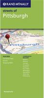
Pittsburgh Street Map. Rand McNally. This detailed street map also covers Baldwin, Bellevue, Carnegie, Coraopolis, Duquesne, Fox Chapel, McKeesport, West Mifflin, White Oak, and Wilkinsburg. Map size is 28 x 40 inches unfolded.
$6.99
62-9092PI
1 sheet, folded.
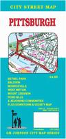
Pittsburgh Street Map. GM Johnson. This detailed map of Pittsburgh also covers Bethel Park, Baldwin, Monroeville, and adjoining communities. There is also an inset detailed map of the city center area.
$4.95
62-9092PITT
1 sheet, folded.
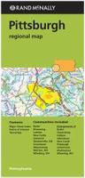
Pittsburgh Regional Map. Rand McNally. This regional road/street map covers Pittsburgh and the region as far as Butler, Kittanning, Latrobe, Morgantown, WV; New Castle, Uniontown, Waynesburg, Weirton, WV; Wheeling, WV; and Youngstown, OH. Map size is 28 x 40 inches unfolded.
$6.99
62-9092PIT
1 sheet, folded.
City Maps for cities other than Philadelphia or Pittsburgh - Paper Maps
Pennsylvania City Maps (other than Philadelphia and Pittsburgh) - Paper Maps. Various publishers. Folded city street maps.
$4.95
62-9092ALN
Allegheny North & Butler Counties street map. (GM Johnson).
$5.95
62-9092A
Allentown, Bethlehem, and Easton Street Map. (Franklin Maps)
$4.95
62-9092BE
Beaver & Western Allegheny Counties street map. (GM Johnson).
$4.95
62-9092CHAM
Chambersburg street map. (GM Johnson).
$8.99
62-9092CHE
Chester County street map. (Franklin).
$4.95
62-9092DE
Delaware County street map. (Franklin).
$4.95
62-9092ERI
Erie County Map. (Jimapco).
$6.95
62-9092ERIE
Erie City Map. (GM Johnson).
$4.95
62-9092FRA
Franklin street map. (GM Johnson).
$5.95
62-9092GR
Greensburg city & Westmoreland County street map. (GM Johnson).
$8.99
62-9092HA
Harrisburg City Map. (Franklin).
$6.95
62-9092HAR
Harrisburg City Map. (GM Johnson).
$4.95
62-9092IN
Indiana & Kittaning street map. (GM Johnson).
$4.95
62-9092JOH
Johnstown City Map. (GM Johnson).
$4.95
62-9092LAC
Lackawanna street map. (Franklin).
$6.95
62-9092LANC
Lancaster street map. (GM Johnson).
$8.95
62-9092LEB
Lebanon County street Map. (Franklin).
$4.95
62-9092LEH
Lehigh street Map. (Franklin).
$9.95
62-9092MO
Montgomery County Street Map. Includes Norristown, Pottstown, Jenkintown, and Landsdale. (Franklin Maps).
$6.95
62-9092NE
New Castle, Sharon & Hermitage street map. Also covers Lawrence & Mercer Counties. (GM Johnson).
$4.95
62-9092PIK
Pike County Street Map. (Jimapco).
$5.95
62-9092PIKE
Pike County Street Map. (Franklin).
$5.95
62-9092S
Scranton & Wilkes-Barre City Map. Also covers Carbondale, Pittston, Clarks Summit, Cunmore, Nanticoke, Dickson City, Kingston. 1:36,000. (Jimapco).
$6.95
62-9092ST
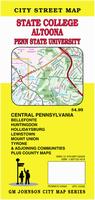
State College and Altoona city map. (GM Johnson)
$5.95
62-9092WA
Washington & Greene Counties street map. (GM Johnson)
$4.95
62-9092Y
York City Map. (Franklin).
$6.95
62-9092YOR
York and Gettysburg City Map. (GM Johnson).
Philadelphia & Pittsburgh City Maps - Laminated Maps
Laminated Philadelphia Streetsmart Map. VanDam. VanDam's best selling Philadelphia StreetSmart maps all of Philadelphia's attractions, neighborhoods, museums, hotels and more at an immensely legible scale with 3D buildings. Includes detail of Independence Historical National Park.
NOTE: We have only 2 copies left. The title is sold out and the publisher has not set a reprint/revision date.
Sample from the Philadelphia Streetsmart map The reverse of the Philadelphia Streetsmart map
$7.95
62-90921PHI
1 sheet, folded.
Laminated Philadelphia Street Map. Red Map. The Philadelphia Red Map shows you everything you need to find the best shopping, where to eat, and what to see in the city of brotherly love. Included on the map are: Independence Park, the iconic Liberty Bell and Independence Hall, as well as the National Constitution Center. And for the Arts, see the Philadelphia Museum, Kimmel Center, the Rodin Museum and the new Barnes Foundation Map size is 24 x 9 inches unfolded.
Sample from the Philadelphia Red Map
$9.95
62-90921PHA
1 sheet, folded.
Waterproof Philadelphia MapEasy® Street Map. MapEasy. Philadelphia, long considered the birthplace of America, is now a thriving metropolitan city. Accompany us as we explore the wonders of this historic city. Let's begin at Independence Hall, where the Declaration of Independence was signed. Then we'll see some of the magnificent paintings and sculptures at the Philadelphia Museum of Art, or stroll along Boathouse Row. And if you are looking for a break from all the history, Philadelphia offers a great mix of retail shops and green spaces. Tour the hip neighborhood of South Street with us, or lets grab some lunch overlooking the Delaware River. A wide array of hotel and dining options are available as well, and MapEasy locates all of them for you...making your choice much easier. The Philadelphia Guidemap includes detailed sections for Independence Mall, Rittenhouse Square, and Fairmount Park.
Sample #1 from the Philadelphia MapEasy map Sample #2 of the Philadelphia MapEasy map
$7.95
62-9092PE
1 sheet, folded.
Laminated Philadelphia Laminated Street Map. Borch. Our soft-laminated folded map of Philadelphia shows: Philadelphia Downtown 1:7,000, Philadelphia & Region 1:125,000, University City 1:12,000, Fairmount Park 1:15,000, Public Transport Philadelphia, Top 30 Sights, USA administrative & time zones. Borch Maps are easy to fold, durable and water-repellent with a wipeable surface. Borch Maps show hotels, museums, monuments, markets, public transport, top sights and points of interest, useful statistics, conversion charts for temperatures, weights and measurements, climate charts showing temperatures, sunshine hours, precipitation and humidity, overview maps, time zones, and much more...
Sample from the Philadelphia street map The front of the Philadelphia street map The reverse of the Philadelphia street map
$9.95
62-9092PC
1 sheet, folded.
Laminated Pittsburgh Street Map. ADC. The Pittsburgh PA Laminated Map includes: Street Detail Inset of Downtown Pittsburgh. Featuring: Airports, Colleges & Universities, Golf Courses, Hospitals, Parks & Rec Areas, Places of Interest & ZIP Codes.
$8.99
62-90921PI
1 sheet, folded.
Pennsylvania City Street Atlases
Pennsylvania City and County Street Atlases. ADC. ADC (Kappa) publishes an excellent series of county and city street atlases for Pennsylvania. Unfortunately the publisher has decided to not reprint/update these atlases and only two are still available. Some are spiral-bound, some are softcover center-stapled atlases. Nearly all are approximately 10 x 12 inches in size.
The atlases feature:
Block Numbers
Colleges & Universities
Parks & Rec Areas & Golf Courses
Downtown areas
Airports
Places of Interest
Historical Parks and monuments
ZIP Codes.
$21.99
62-90921BU
Bucks County Street Atlas.
$21.99
62-90921CH
Chester County Street Atlas.
Pennsylvania City, County, and State Business Wall Maps
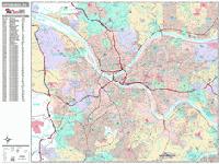
Pennsylvania City Wall Maps.
When it comes to general planning, defining delivery areas, planning direct marketing and delivering products, our city wall maps are perfect to get the detailed information you need.
These maps offer clear mapping by showing all major streets and roads, but leaving out the smaller streets.
If you want a clear map for easy planning, then these are the maps for you; if you want a map showing every little back alley, these are not for you.
We offer wall maps for Allentown, Altoona, Bethlehem, Erie, Harrisburg, Lancaster, Levittown, Philadelphia, Pittsburgh, Reading, and Scranton.
We offer state wall maps for all of the USA. The maps come in sizes from 24 x 36 to 108 x 144 inches. They are available in variety of mounting and framing options. The maps are ideal for business applications, sales territory, delivery planning, direct mail targeting and hundreds of other applications.
Thumbnail image of the Pennsylvania wall map Sample detail from the Pennsylvania wall map
Pennsylvania Bicycling Maps. Three popular long-distance trails traverse parts of Pennsylvania. These include the Northern Tier Transcontinental Trail and the Underground Railroad Trail along the Lake Erie shoreline in northwestern Pennsylvania, and the Atlantic Coast Trail through eastern Pennsylvania. The Pittsburgh Connector Route connects Pittsburgh to Erie where it joins the Northern Tier and the Underground Railroad routes.
Click here for our Pennsylvania cycling maps list.
We offer state wall maps for all of the USA. The maps come in sizes from 24 x 36 to 108 x 144 inches. They are available in variety of mounting and framing options. The maps are ideal for business applications, sales territory, delivery planning, direct mail targeting and hundreds of other applications.
Thumbnail image of the Pennsylvania wall map Sample detail from the Pennsylvania wall map
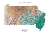
Pennsylvania & New Jersey Shaded Relief Wall Map. 1:500,000. Raven Maps. Our map of these two states together presents the Delaware River plain in context. Elevations are represented by color, and this, in combination with our relief shading technique, gives the map a 3-dimensional look. Size is 91 x 137 cm (36 x 54").
Thumbnail of the Pennsylvania wall map. Sample of the Pennsylvania wall map detail.
$40.00
62-9051
1 sheet, rolled
$65.00
62-9051L
laminated
Pennsylvania Topographic Map. 1:500,000. 1975. USGS. This map measures 29 x 60" (112 x 74 cm).
$12.95
62-9050
Contoured topographic map.
$24.95
62-9050L
Topographic map, laminated
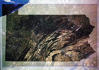
Pennsylvania Satellite Image Posters
$19.99
67-88786
Pennsylvania.
Pennsylvania Geology Maps.
Pennsylvania Geologic Map. 1:500,000. Pennsylvania Geological Survey. The geologic shaded-relief map of Pennsylvania shows the bedrock geology of the state
superimposed on a shaded-relief image, giving the map a three-dimensional appearance. The new map shows, in a very striking way, the regional distribution of the geologic units and structural patterns, and the relationship between the geologic units and the topography. No symbols were placed on the map other than fault lines, county boundary lines, and major streams so that the view of the terrain would be as unobstructed as possible. Now out of print, we offer color plots.
Detailed sample from the map Thumbnail of the entire map


 Sample of the detail from the Pennsylvania atlas
 A two-page spread from the Pennsylvania road atlas
 Sample detail from the Pennsylvania road atlas
 Sample detail #1 from the Pennsylvania road map
 Sample detail #2 from the Pennsylvania road map
 Sample detail of the Great Lakes Travel Map
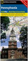 Laminated
 Sample detail #1 from the Pennsylvania Guidemap road map
 Front of the Pennsylvania Guidemap road map
 Reverse of the Pennsylvania Guidemap road map
 Laminated
 Laminated
 Sample detail #1 from the Pennsylvania Quickmap road map
 Front of the Pennsylvania Quickmap road map
 Laminated
 Sample detail #1 from the Poconos Quickmap road map
 Sample detail #2 from the Poconos Quickmap road map
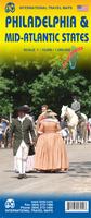 Waterproof
 Sample detail of the Philadelphia Travel Map
 Sample detail of the Mid-Atlantic States Travel Map
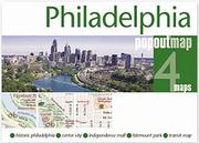

 Sample detail from the Philadelphia Unfolds map
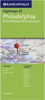

 Laminated
 Sample from the Philadelphia Streetsmart map
 The reverse of the Philadelphia Streetsmart map
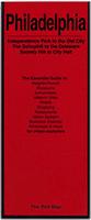 Laminated
 Sample from the Philadelphia Red Map
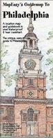 Waterproof
 Sample #1 from the Philadelphia MapEasy map
 Sample #2 of the Philadelphia MapEasy map
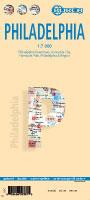 Laminated
 Sample from the Philadelphia street map
 The front of the Philadelphia street map
 The reverse of the Philadelphia street map
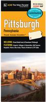 Laminated
 Sample detail from the Pittsburgh wall map.
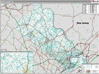 Pennsylvania County Wall Maps.
 Thumbnail image of the Dauphin County wall map
 Sample detail from the Dauphin County wall map
 Thumbnail image of the Bucks County wall map
 Sample detail from the Bucks County wall map
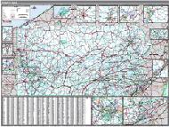 Pennsylvania State Wall Maps.
 Thumbnail image of the Pennsylvania wall map
 Sample detail from the Pennsylvania wall map


 Thumbnail of the Pennsylvania wall map.
 Sample of the Pennsylvania wall map detail.
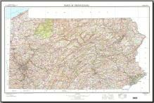 Pennsylvania Topographic Map. 1:500,000. 1975. USGS. This map measures 29 x 60" (112 x 74 cm).


 Detailed sample from the map
 Thumbnail of the entire map
 Pennsylvania Flags