We have a good selection of thematic maps of the continent of Africa, which are listed below. We also have a good stock of thematic, topographic, and travel maps of the individual countries. The ex-British colonies tend to be better mapped than the ex-French, ex-Portuguese, or ex-Belgian colonies. Please see the individual listings for the following countries for more detailed mapping.
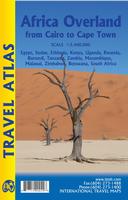
Africa Overland: Cairo to Cape Town Travel Atlas. 1:3,400,000. ITMB.
This atlas portrays the classic eastern route from Cairo to Cape Town over a hundred pages of maps. It covers 14 countries and gives advice on particularly sensitive travel areas, such as between Egypt and Sudan. We do not show only one recommended route, as there are alternatives once one reaches Kenya, but all are shown. The great advantage of this book is that it is compact and easy to carry, as well as being as accurate as we could make it.
Sketch map of the Cairo to Cape route
$16.95
66-17913
Atlas.
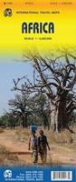
Africa Travel Map. 1:5,000,000. ITMB.
The folded map covers all of Africa in a single double-sided sheet - ideal for planning trips or getting an overview of this amazing continent. The map is available in both folded and flat (wall) versions - see below for the wall version. The northern and western part of Africa is on one side and the eastern and southern portion on the reverse (see examples below).
Sample detail of the Africa Map The front of the Africa Map The reverse of the Africa Map
$14.95
66-17509
1 sheet, folded.
$24.99
66-17509R
1 sheet, flat.
$44.99
66-17509RL
1 sheet, laminated.
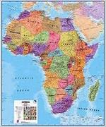
Africa Travel Map. Kümmerly + Frey. Detailed political and road map of the continent. This is the only folded single-sheet map of all of Africa that we offer. Multilingual legend.
$24.99
66-17501
1 sheet, folded.
Waterproof! Coastal West Africa Road Map. 1:650,000. Reise Know-How.
This map combines topographic mapping with road and tourist detail. The road information is clear and elevation is shown using contours, spot heights and altitude shading. The map shows six different types of roads, highlighting scenic routes, places of interest, archaeological sites, monasteries, monuments and viewpoints.
Includes coverage of: Benin, Burkina Faso, Cabo Verde, Cote d'Ivoire, Gambia, Ghana, Guinea, Guinea Bissau, Liberia, Nigeria, Senegal, Sierra Leone, and Togo.
$15.99
66-17902
1 sheet, folded.
Waterproof! Inland West Africa Road Map. 1:650,000. Reise Know-How.
This map combines topographic mapping with road and tourist detail. The road information is clear and elevation is shown using contours, spot heights and altitude shading. The map shows six different types of roads, highlighting scenic routes, places of interest, archaeological sites, monasteries, monuments and viewpoints.
Includes coverage of: Mali, Mauritania, and Niger.
$15.99
66-17904
1 sheet, folded.
Africa Travel Map Series. 1:4,000,00. Michelin. This is an excellent three-sheet series that covers all of Africa.
$12.95
66-1775
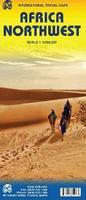
Northwest Africa travel map. Michelin #M741.
$12.95
66-1776
Northeast Africa travel map. Michelin #M745.
$12.95
66-1777
Central and Southern Africa travel map. Michelin #746.
East-central Africa regional travel map. 1:3,400,000.
$12.95
66-17515-EQ
Equatorial Africa regional travel map. 1:3,400,000.
$12.95
66-17515-N
North Africa regional travel map. 1:3,400,000.
$12.95
66-17515-NE
Northeast Africa regional travel map. 1:3,800,000.
$12.95
66-17515-NW
Northwest Africa travel map. 1:3,800,000.
$12.95
66-17515-SC
South and Central Africa travel map. 1:2,200,000 / 1:3,400,000.
Sahara Travel Map. 1:3,400,000. ITMB.
The map covers the northern portion of Africa, from southern Morocco and Mauritania in the west to Egypt in the east, and from the Mediterranean coast south to partway through Niger, Chad, and Sudan. Indexed, with a glossary of arabic terms, and with short paragraphs on points of interest. Printed on both sides. Map size is 27 x 39 inches.
Image of the front of the Sahara map Image of the reverse of the Sahara map
$12.95
66-17901
1 sheet, folded
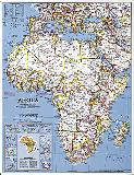
New Political Map of Africa. 1:10,000,000. Tourist Maps Kenya. A classic base map of Africa, showing country borders highlighted in black, rivers and major geographic features, main roads and cities, etc. With a 5 degree latitude/longitude grid. Africa is the world's second largest and second most populous continent after Asia. It is the home of 53 independent countries, over 1000 languages and 797 million people. Africa covers 5.9% of the earth's surface and 20.3% of the total land area. It is the oldest inhabited territory on earth with the human species originating from this continent.
$16.95
66-17506
1 sheet, folded.
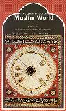
Muslim World Map. 1:35,000,000. GEOprojects.
Side one has a Map of the World showing international boundaries and settlements with countries colored according to percentage Muslim population. Side two has a chart showing Muslim population totals and percentages in each country. Size is 44 x 78 cm.
Sample detail from the Muslim World map.
$12.95
67-10912
1 sheet, folded.
Map of the West Africa National Parks. Variable scale. IGN, France. This map has shaded relief maps for the national parks in several west African countries. In French.
$12.95
66-1790
1 sheet, folded
Africa Atlases
Illustrated Road Atlas of Africa. 1:3,500,000. Map Studio. 1st edition. Beautiful road atlas of Africa. There are 47 pages of maps over all of Africa. There are 16 pages of maps over tourist areas/national parks. There are 36 pages of street maps over the major cities of Africa. And, there's a 13 page index to place names. Spiral bound.
$44.95
66-1788
Atlas
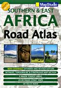
Southern Africa Road Atlas. Map Studio. A good road atlas covering the southern half of Africa. 116 pages, softcover.
$30.99
65-3088-5
Atlas
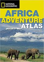
African Adventure Atlas. National Geographic/Rand McNally, 2001/2003.
This atlas divides the African continent into 15 geographical regions which are introduced over 30 pages and serve to lead the reader into the sections of the atlas, comprising National Parks, town plans and adventure activities. For ease of reference, color-coded "tabs" clearly identify the different sections.
$44.95
66-1789
Atlas, flex-cover.
$59.99
66-1789H
Atlas, hard-cover.
Ultimate Africa Atlas. Map Studio, 2007.
The Ultimate Africa Atlas covers 57 countries of the continent, it includes traveling tips, information on the cultures within the countries and the environment across all featured places. This color-coded atlas features activities, places of interest, entertainment, climatology, awareness of risk factors, important facilities and it gives a guide on the ideal wardrobe to pack for each and every country featured.
$17.99
66-1787
Atlas
Africa Physical Wall Maps & Africa Political Wall Maps
Africa Wall Map - Executive Style. National Geographic Maps.
Our executive style political map of Africa features country boundaries, place names, bodies of water, airports, major highways and roads, and much more. Size is 24 x 31 inches.
Africa Physical Wall Map. 1:5,000,000. ITMB.
This wall map covers all of Africa in a two single-sided sheets - ideal for getting an overview of this amazing continent. The northern and western part of Africa is on one side and the eastern and southern portion on the reverse (see examples below).
The front of the Africa Map The reverse of the Africa Map
$24.99
66-17509R
2 sheets, flat.
$44.99
66-17509RL
2 sheets, laminated.
Northwest Africa Political Map. National Geographic Maps.
Stunning, large-format print from the award-winning National Geographic World Atlas. These finely-detailed, informative maps are perfect for home, office, or school.
Expand your world with this stunning print of Northwestern Africa. Includes country boundaries, cities and towns, parks and game reserves, roadways, major geographic features, lakes, and waterways. Available in two sizes, 29 x 36" and 36 x 48."
An image of the full map Sample detail of the map
$24.95
66-17493NW
Small size, flat/rolled
$39.95
66-17493NWL
Small size, laminated
$54.95
66-17494NW
Large size, flat/rolled
$99.95
66-17494NWL
Large size, laminated
Northeast Africa Political Map. National Geographic Maps.
Stunning, large-format print from the award-winning National Geographic World Atlas. These finely-detailed, informative maps are perfect for home, office, or school.
Includes country boundaries, cities and towns, parks and game reserves, roads, major geographic features, lakes, and waterways. Available in two sizes, 29 x 36" or 36 x 48."
An image of the full map Sample detail of the map
$24.95
66-17493NE
Small size, flat/rolled
$39.95
66-17493NEL
Small size, laminated
$54.95
66-17494NE
Large size, flat/rolled
$99.95
66-17494NEL
Large size, laminated
Southern Africa Political Map. National Geographic Maps.
Stunning, large-format print from the award-winning National Geographic World Atlas. These finely-detailed, informative maps are perfect for home, office, or school.
This beautiful print of Southern Africa includes country boundaries, cities and towns, parks and game reserves, roadways, major geographic features, lakes, and waterways, plus a large-scale inset of Madagascar. Available in two sizes, 29 x 36" or 36 x 48."
An image of the full map Sample detail of the map
$24.95
66-17493S
Small size, flat/rolled
$39.95
66-17493SL
Small size, laminated
$54.95
66-17494S
Large size, flat/rolled
$99.95
66-17494SL
Large size, laminated
Africa Historical Political Wall Maps
Africa Map 1909. National Geographic Society. This map is a reprint of the NGS Africa map published in 1909. This historic map of Africa takes you back to 1909, a time when the "Dark Continent" was barely known in the outside world. A time when the only way to get to far off places like Abyssinia, the Congo State, and Bechuanaland Protectorate was to take a long sea voyage, then travel many miles by rail. National Geographic was among the first to bring this amazing land to the world, and this incredible map provides a time capsule into these times. Artistic cartography and painstaking detail make this a map for any collector.
The 1909 Africa map features:
Country boundaries that show Independent Territories and Congo State, along with territories under control of Egypt, England, Germany, Spain, Italy, Turkey, France, and Portugal.
Railroads in operation and those that were proposed
Africa Geologic Map (Carte Géologique Internationale de l'Afrique. 1:5,000,000. Geologic Map of the World, CGMW, France. This Geologic Map of Africa is in 6 sheets. Bilingual; sheet size 92 x 94 cm.
$33.95
66-1401A
Northwestern Africa (#1)
$33.95
66-1401B
Northcentral Africa (#2)
$33.95
66-1401D
Northeastern Africa (#3)
$33.95
66-1401E
Legend sheet (#4)
$33.95
66-1401F
Southwestern Africa (#5)
$33.95
66-1401G
Southeastern Africa (#6)
$172.26
66-1401K
Set of 6 maps
Map Showing Free-Air Anomalies off the Western Coast of Africa. 1:500,000. U.S. Geological Survey. 1990. Black and white maps.
$6.95
66-1412L
Liberia to Ghana.
$6.95
66-1412N
Nigeria to Gabon. MF-2098-D.
$6.95
66-1412S
Senegal to Sierra Leone. MF-2098-F.
Africa Tectonic Map (Carte Tectonique Internationale de l'Afrique). 1:5,000,000. 1969. UNESCO. Nine sheets illustrate the tectonics of the continent; with explanatory booklet. Sheet size 93 x 68 cm. In French. Note the large discount for purchasing the whole set.
$10.95
66-1420-T
Text.
$19.95
66-1420-1
Sheet 1.
$19.95
66-1420-2
Sheet 2.
$19.95
66-1420-3
Sheet 3.
$19.95
66-1420-4
Sheet 4.
$19.95
66-1420-5
Sheet 5.
$19.95
66-1420-6
Sheet 6.
$19.95
66-1420-7
Sheet 7.
$19.95
66-1420-8
Sheet 8.
$19.95
66-1420-9
Sheet 9.
$150.00
66-1420A
9 sheets + text
Northern Africa Quaternary Geology. 1:2,500,000. 1973. UNESCO. Three sheets depict the Quaternary geology of northern Africa. Sheet size 100 x 70 cm.
$26.95
66-1430
3 sheets, rolled
Map of Quaternary Deposits in Africa. 1:5,000,000. 1986. VNIIzar. Nine trilingual sheets with 87-page Russian text.
$125.00
66-1432
Nine sheets + text
Africa Hydrogeologic Map (Carte Hydrogéologique Internationale de l'Afrique). 1:5,000,000. 1989. OAU (CGMW). This, the first of 6 sheets that will give complete coverage of Africa, covers NW Africa. With 140-page text. In French.
$27.95
66-1435-1
Northwest sheet
West Africa Gold Deposits. 1:2,000,000. 1989. BRGM, France. This bilingual map shows west African gold deposits in their lower Proterozoic lithostructural settings. With 96-page French text.
$89.95
66-1444
1 sheet, folded
West Africa Energy Map. 1:600,000. Petroleum Institute, U.K. 1993. With inset charts and graphs on exports, principal fields, oil & gas production, pipelines, and contracts. Laminated, flat sheet.
$130.00
66-1459
1 sheet, rolled
Limited stock; recommended Geological and Mineral Deposits Maps of the Arab World. 1:2,500,000 and 1:5,000,000. Arab Organisation for Mineral Resources. This series offers the best maps of northern Africa. The extensive text (some over 700 pages) gives information on individual deposits, etc. Some of the sheets are now out of print. We have the following in stock:
Occidental Africa Geologic Map (Carte Géologique). 1:2,000,000. 1960. BRGM, France. Detailing the geology of northwestern Africa; includes Ivory Coast, Guinea, Senegal, Mali, Niger, Mauritania, Upper Volta, and more. Nine sheets, each 75 x 54 cm with French legend. Sheet 6 is out of print.
$281.00
66-1550
8 sheets, rolled
Geologic Map of the Hoggar Massif. 1:500,000. 1962. BRGM. Provides detailed coverage of the geology of the central Saharan region, including parts of Mali, Niger, and Algeria. The 12-sheet map comes with a 100-page French text.
$275.00
66-1615
12 sheets + text
Southern Africa Geological Map. 1:5,000,000. 1985. Geol. Soc. South Africa. Includes Zimbabwe, Botswana, Mozambique, Namibia, and contiguous areas. 76 x 51 cm.
 Sketch map of the Cairo to Cape route
 Sample detail of the Africa Map
 The front of the Africa Map
 The reverse of the Africa Map
 Waterproof!

 Waterproof!


 Front of the East and Central Africa map.
 Reverse side of the East and Central Africa map.
 Front of the Africa Equatorial regional map
 Reverse of the Africa Equatorial regional map
 Image of the front of the Northwest Africa travel map
 Image of the reverse of the Northwest Africa travel map
 Sample detail from the Southern Africa travel map.
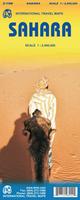
 Image of the front of the Sahara map
 Image of the reverse of the Sahara map
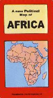
 Sample detail from the Muslim World map.


 An image of the full map
 A detail of the map
 A sample of the legend
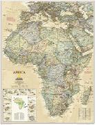
 Sample detail of the map
 A small image of the full map
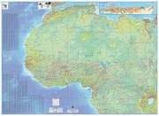

 An image of the full map
 Sample detail of the map
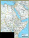
 An image of the full map
 Sample detail of the map
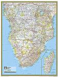
 An image of the full map
 Sample detail of the map
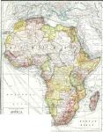
 Image of the entire map
 Sample #1 of the map detail
 Sample #2 of the map detail