|
|
Road Atlas of Southern and Eastern Africa. These road atlases contain town plans, enlarged area maps, distance tables and indexes to place names. Some include trip routes between major centers.
South Africa Road Maps
Road Maps by Map Studio.
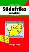
South Africa Travel Map. 1:2,000,000. Freytag/Berndt. The map shows four levels of road classification, gas stations, distances between major road junctions, railroads, mountain passes, administrative boundaries, border crossings, national parks and sancuaries, and much more.
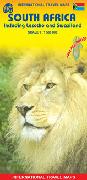
South Africa Travel Map. 1:1,500,000. ITMB. Includes Lesotho and Swaziland. Double-sided road map with two levels of road classification. Includes inset maps of Cape Town, Johannesburg, and Pretoria. Indexed. Printed on waterproof, tear-resistant, synthetic paper.
National Park Maps - Kruger & Cape Peninsual
South Africa City Maps
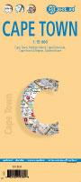
Cape Town Laminated City Center Map. 1:15,000. Borch. Our soft-laminated folded map of Cape Town shows: Cape Town 1:15,000, Cape Peninsula 1:140,000, Cape Town and Region 1:635,000, Garden Route 1:3,000,000, Robben Island 1:40,000, South Africa administrative & time zones, Public Transport Cape Town. Borch Maps are easy to fold, durable and water-repellent with a wipeable surface. Borch Maps show hotels, museums, monuments, markets, public transport, top sights and points of interest, useful statistics, conversion charts for temperatures, weights and measurements, climate charts showing temperatures, sunshine hours, precipitation and humidity, overview maps, time zones, and much more...
South Africa City Street Atlases
South Africa Street Guides by Map Studio. These large scale guides include large-scale city center map, a comprehensive index and a key plan to map pages. 8" x 10.5". Spiralbound.
South Africa City Street Maps
South Africa Street Map Plans by Map Studio. The maps in this series are 1:20,000 folded street maps. They are printed on both sides. These maps include indexes to streets and suburbs and sports venues.
South Africa EaziMapsSouth Africa Eazimaps by Map Studio. Eazimaps are detailed road maps covering various areas and countries. Typically with places of interest, border control points, parks and nature reserves, etc.
South Africa Guidebooks
Digital South Africa Road Maps
South Africa Topographic Quadrangle Maps
South Africa Topographic Quadrangle Map. 1:1,000,000. South Africa Department of Lands and Survey.
South Africa 1:250,000 Topographic Quadrangle Maps. - click here. South Africa Topographic Quadrangle Map. 1:50,000. South Africa Department of Lands and Survey. The set of 1915 sheets provides complete coverage of South Africa. These are special-order sheets. Please allow 8 weeks for delivery.
South Africa 1:200,000 Topographic Quadrangle Map Set. 1:200,000. Soviet government. High quality topographic maps with good detail. Each sheet has extensive descriptive text on the reverse. This set gives complete coverage of South Africa in 201 sheets. In Russian.
South Africa Geologic and Thematic Maps
South Africa Magisterial Districts and Provinces (Landdrosdistrikte en Provinsies). South Africa Survey, 1998. This map shows the provincial and magisterial district boundaries. Also shows main roads and cities. Bilingual.
South Africa Geologic Map. 1:1,000,000. 1984. GSSA. Including South Africa, Transkei, Bophuthatswana, Venda, Ciskei, Lesotho, and Swaziland. 220 x 156 cm.
South Africa Mineral Map. 1:1,000,000. 1981. GSSA. The companion to map #65-3000 above, this map highlights the world's largest diamond resources as well as major copper and tin deposits. 203 x 152 cm.
South Africa Mineral Deposits of South Africa (text). 1986. Geological Society of South Africa. This two-volume set offers extensive data, interpretation, and summarization of mineral deposits and mining in South Africa. Hardcover, 2,335 pages. Temporarily out of stock.
South Africa 1:250,000 Geologic Quadrangle Map. 1:250,000. Council for Geoscience.
South Africa, Bushveld Complex Tectonic Map. 1:500,000. 1975. Univ. Witswatersrand. The geology and tectonics are depicted in detail, showing strike & dip, faults, location of ore deposits, and more. With an 18-page text.
|
||||||||||||||||||||||||||||||||||||||||||||||||||||||||||||||||||||||||||||||||||||||||||||||||||||||||||||||||||||||||||||||||||||||||||||||||||||||||||||||||||||||||||||||||||||||||||||||||||||||||||||||||||||||||||||||||||||||||||||||||||||||||||||||||||||||||||||||||||||||||||||||||||||||||||||||||||||||||||||||||||||||||||||||||||||||||||||||||||||||||||||||||||||||||||||||||||||||||||||||||||||||||||||||||||||||||||||||||||||||||||||||||||||||||||||||||||||||||||||||||||||||||||||||||||||||||||||||||||||||||||||||||||||||||||||||||||
 South Africa Maps & Guides

 Recommended!
 Sample from the Japan atlas
 Sample from the Sardinia atlas
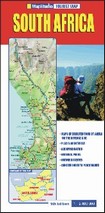


 Waterproof!

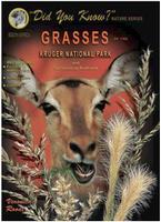
 Sample detail from the Grasses of Kruger National Park guidebook
 Sample detail from the Grasses of Kruger National Park guidebook
 Sample detail from the Mammals of Kruger National Park guidebook
 Sample of the Lowveld road map
 Sample of the Nelspruit city map

 Coverage for Table Mountain sheet.
 Coverage for Hout Bay sheet.
 Coverage for Silvermine sheet.
 Coverage for Simon's Town sheet.
 Coverage for Cape Point sheet.

 Thumbnail of the front of the Cape Town map
 Thumbnail of the reverse of the Cape Town map
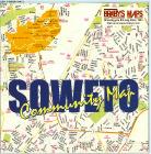
 Sample of the Soweto city map

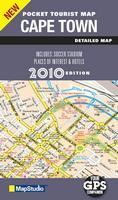
 Sample detail from the Cape Town pocket map.

 Sample of one of the road map pages
 Sample of one of the city map pages
 Index map as a .pdf file
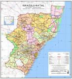


 South Africa 1:250,000 Index.