Algeria Maps and Guides


Algeria digital topographic maps!

  • Algeria Digital Road Maps. Available for several GPS software formats.
  • Algeria Travel and City Maps.
  • Algeria Topographic Maps
    • ONC 1:1,000,000 Topographic Maps for Algeria - US Military editions.
    • TPC 1:500,000 Topographic Maps for Algeria - US Military editions.
    • Algeria 1:500,000 Topographic Maps - native editions.
    • Algeria 1:200,000 Topographic Maps - native editions.
    • Algeria 1:200,000 Topographic Maps - soviet military editions. Itemized listings, sample images, and index maps.
    • Algeria 1:100,000 Topographic Maps - soviet military editions.
    • Algeria 1:10,000 City Topographic Maps - soviet military editions.
  • Algeria Geologic & Thematic Maps.
  • Algeria Flags

Digital Algeria Road Maps


Algeria digital mapDownloadable digital maps!
Algeria and Tunisia Digital Road Map. 1:1,700,000. Reise Know-How. This map combines topographic mapping with road and tourist detail. The road information is clear and elevation is shown using contours, spot heights and altitude shading. The map shows six different types of roads, highlighting scenic routes, places of interest, archaeological sites, monasteries, monuments, police stations, railroads, and viewpoints.
Digital versions available for immediate download! Digital versions are available for Compe-GPS, Fugawi, OziExplorer, PathAway, and Touratech-Quo Vadis, for use with a PocketPC or a PC.
Fugawi Global Navigation Software Package. Need a good moving-map software package that allows you to use any geo-referenced scanned map to make a moving map display, upload and download route tracks and waypoints to your GPS, and more? Click on the link to the left for more information.

NOTE: You must own/buy the basic software program for any of these packages - these maps do not come with run-time software. You only need to acquire the software once; additional Reise maps do not require additional copies of the software.
Ordering Algeria for CompeGPS64-08901CImmediate download digital version for Compe-GPS. (min v6.8) (.rmap).$21.99
Ordering Algeria for Fugawi64-08901FImmediate download digital version for Fugawi. (.fx4 for v4 or higher).$21.99
Ordering Algeria for Oziexplorer64-08901OImmediate download digital version for OziExplorer. (.ozfx3 for v3.x or higher)$21.99
Ordering Algeria for TouratechQV64-08901TImmediate download digital version for Touratech QV. (.pny) $21.99


Algeria Travel & City Maps


Algeria physical map
Algeria Geographic Map. 1:2,500,000. Gizimap. Detailed map of Algeria, also covering Morocco and Tunisia. The map shows roads, towns, villages, rivers, etc. The geographic map has shaded relief and hypsometric shading to show elevation. Bilingual English/Arabic. Size is 98 x 87 cm.
Sample of the Algeria map detail.
Thumbnail image of the Algeria map
Ordering Algeria geographic map, fold (Gizi)64-08902Geographic map, folded.$14.99
Ordering Algeria geographic map (Gizi) Flat.64-08903Geographic map, rolled.$19.99


Algeria road map 
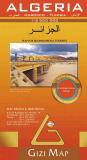
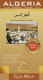
Algeria Road Map. 1:2,500,000. Gizimap. Detailed map of Algeria, also covering Morocco and Tunisia. The road map shows major political boundaries, shaded relief, spot elevations, but lacks the hypsometric shading showing elevation. The map shows roads, towns, villages, rivers, etc. Bilingual English/Arabic. Size is 98 x 87 cm.
Sample of the map detail.
Thumbnail image of the entire map
Ordering Algeria Road Map, folded (Gizi)64-08904Political map, folded.$14.99
Ordering Algeria Road Map (Gizi)  Rolled.64-08904RPolitical map, rolled.$19.99


Algeria road mapWaterproof!
Algeria and Tunisia Road Map. 1:1:700,000. Reise Know-How. This double-sided map combines topographic mapping with road and tourist information. The map has an index of place names, a 30' latitude/longitude grid, and names of major towns are given in both Latin script and Cyrillic. The map shows six different types of roads, highlighting scenic routes, places of interest, archaeological sites, monasteries, monuments and viewpoints. Size is 70 x 100 cm.
Ordering Algeria travel map (Reise)64-089011 sheet, folded$15.99


Algeria travel mapNew Map!
Algeria Travel Map. 1:2,000,000. ITMB, 2010. The map includes roads by classification, ferry routes, bodies of water, horse and foot tracks, beaches, world heritage sites, camping sites, accommodation, national parks, mosques, synagogues, rock art painting, spas, points of interest and other information. ISBN 9781553411062.
Algeria map sample
Ordering Algeria travel map.  1:2M.   (ITMB)64-089091 sheet, folded$12.95


Algeria travel map
Algeria Travel Map. 1:700,000. Freytag & Berndt. New edition of Freytag's popular travel map of Algeria. Multilingual, size is 125 x 85 cm (49 x 33 inches).
Sample of the Algeria map detail.
Ordering Algeria Travel Map (F/B)64-089081 sheet, folded.$14.99


Algeria Travel Map with Algers & Oran City Insets. 1:1,000,000. GEOprojects. This map has a 1:4,500,000 map of the entire country; a 1:1,000,000 map of the maritime regions, and city inset maps for Algers and Oran. In French. Out of print until the publisher finishes a new edition. No print date is yet known. We suggest the Gizi map as the best substitute.
64-089151 sheet, folded


Algeria Travel Map. 1:1,000,000. Michelin. Covers Algeria & Tunisia.
Ordering Algeria Travel Map (M-743).64-08911 sheet, folded.$12.99


Algeria Northern Algeria Road Map. 1:1,000,000. Algeria INC. 1987. In French.
Ordering Algeria--Northern Algeria road64-089061 sheet, folded$9.95

(Algeria) Northeastern Algeria Road Map. 1:500,000. Algeria INC. 1987. In French.
Ordering Algeria-Northeast Algeria road64-089071 sheet, folded$9.95


Algers city map

Algers city map. 1:10,000. Editions Laure Kane. The best city map of central Algers, with street names, tourist information, etc. In French.
Sample of the Algers map detail.
Ordering (Algeria) Algers city map (Kane)64-0892AL1 sheet, folded.$13.99

Algeria city maps
Algeria City Street Maps. Algeria Institute National Cartographique. Dates range from 1992 to 2005. All maps are fully indexed (some indexes are along the margins, others are on the reverse). Flat sheets, in French.
Sample from the Annaba map
Ordering Algeria--Annaba City map64-0892BAnnaba. 1:7,500. 1992.$44.99
Ordering (Algeria) Batna city map64-0892BABatna. 1:7,500. 2004.$44.99
Ordering (Algeria) Bejaia city map64-0892BEBejaia. 1:7,500. 1993.$44.99
Ordering (Algeria) Bordj-Bou-Arreiredj city64-0892BORBordj Bourreridj. 1:5,000. 1996.$15.95
Ordering (Algeria) Bouira city map64-0892BOUBouira. 1:5,000. 1996.$44.99
Ordering Algeria--Mostaganem city64-0892MMostaganem. 1:5,000. 1992.$44.99
Ordering (Algeria) Mascara city map64-0892MAMascara. 1:7,500. 1994.$44.99
Ordering Algeria--Oran City map64-0892POran. 1:7,500. 1988.$179.95
Ordering Algeria--Setif city map64-0892SSetif. 1:5,000. 1992.$89.98
Ordering (Algeria) Tebessa city map64-0892TETebessa. 1:7,500. 1996.$44.99
Ordering (Algeria) Tizi-Ouzou city map64-0892TITizi Ouzou. 1:5,000. 1993.$44.99
Ordering (Algeria) Tlemcen city map64-0892TLTlemcen. 1:7,500. 1993.$44.99


Algeria Topographic Maps

Algeria 1:200,000 Topographic Quadrangle Maps - click here. 1:200,000. 1957-. Algeria INC. There are approximately 137 of 239 sheets available. The sheets on the index maps marked with a hand-drawn "X" are available; the others are currently restricted. In French. For ordering individual sheets or digital quads, please look at the index to figure out which sheet(s) you need and then order them using the Click the link above to see index maps, sample images, a complete list of available quadrangles and/or to order these maps.

Algeria 1:500,000 Topographic Quadrangle Maps - click here. 1:500,000. 1961-. INC. There are 37 of 43 sheets currently available. In French. Click the link above to see index maps, sample images, a complete list of available quadrangles and/or to order these maps.


Algeria Topographic Quadrangle Maps (TPC/Tactical Pilotage Charts). 1:500,000. NGA. World Aeronautical Charts, including TPC and ONC charts, cover land areas at a standard size and scale for navigation by aircraft operating at high altitudes. However, their level of detail makes them useful as topographic maps for those areas where little else is available. The topographical information includes city tints, principal roads, railroads, distinctive landmarks, drainage patterns, topography and relief. contour lines are at 500 feet intervals, with intermediate contours where appropriate, along with numerous spot heights. Color tints on a hypsometric scale are also shown. The aeronautical information includes visual and radio aids to navigation, airports, airways, restricted areas, obstructions and other pertinent data. There is less detail in some areas due to insufficient information - these areas are labelled on the charts. These are large maps, with a typical size of 42 x 56 inches. Due to the size and color variation of the different print runs and the Conformal Conic Projection, these maps do not splice together well. World Aeronautical Charts are not recommended for use by pilots of low speed, low altitude aircraft.
Index showing sheet coverage
Sample from this series (image is from a sheet covering Korea)

TPC 1:500,000 Charts
Ordering TPC Chart--Sheet G01-B67-1055-G01BTPC Chart G01B. Algeria/Europe. North 36°-40°, West 3° - East 4°.$24.99
Ordering TPC Chart--Sheet G01-C67-1055-G01CTPC Chart G01C. Algeria/Europe. North 32°-36°, West 3° - East 4°.$14.99
Ordering TPC Chart--Sheet G02-A67-1055-G02ATPC Chart G02A. Algeria/Tunisia/Europe. North 36°-40°, East 4°-11°.$14.99
Ordering TPC Chart--Sheet G02-D67-1055-G02DTPC Chart G02D. Algeria/Libya/Tunisia. North 32°-36°, East 4°-11°.$14.99
Ordering TPC Chart--Sheet H01-B67-1055-H01BTPC Chart H01B. Algeria/Morocco. North 28°-32°, West 13°-7°.$24.99
Ordering TPC Chart--Sheet H02-A67-1055-H02ATPC Chart H02A. Algeria/Morocco. North 28°-32°, West 7°-1°.$14.99
Ordering TPC Chart--Sheet H02-B67-1055-H02BTPC Chart H02B. Algeria. North 28°-32°, West 1°-East 5°.$24.99
Ordering TPC Chart--Sheet H02-C67-1055-H02CTPC Chart H02C. Algeria. North 24°-28°, West 1°-East 5°.$24.99
Ordering TPC Chart--Sheet H02-D67-1055-H02DTPC Chart H02D. Algeria/Mali/Mauritania. North 24°-28°, West 7°-7°.$24.99
Ordering TPC Chart--Sheet H03-A67-1055-H03ATPC Chart H03A. Algeria/Libya. North 28°-32°, East 5°-11°.$14.99
Ordering TPC Chart--Sheet J03-A67-1055-J03ATPC Chart J03A. Algeria/Mali. North 20°-24°, East 0°-6°.$24.99
Ordering TPC Chart--Sheet J03-B67-1055-J03BTPC Chart J03B. Algeria/Niger. North 20°-24°, East 6°-12°.$24.99
Ordering TPC Chart--Sheet J03-C67-1055-J03CTPC Chart JO3C. Algeria/Niger. North 16°-20°, East 6°-12°.$24.99
Ordering TPC Chart--Sheet J03-D67-1055-J03DTPC Chart JO3D. Algeria/Mali/Niger. North 16°-20°, East 0°-6°.$24.99
Ordering TPC Chart--Sheet H03-D67-1055-H03DTPC Chart H03D. Algeria/Libya. North 24°-28°, East 5°-11°.$24.99

ONC 1:1,000,000 Charts
Ordering ONC chart--sheet G-1.67-1056-G01ONC Chart G01. Europe & Africa. North 32°-40°, West 10° - East 4°.$24.99
Ordering ONC chart--sheet G-2.67-1056-G02ONC Chart G02. Europe & Africa. North 32°-40°, East 4°-18°.$24.99
Ordering ONC chart--sheet H-1.67-1056-H01ONC Chart H01. Africa. North 24°-32°, West 19°.$24.99
Ordering ONC chart--sheet H-2.67-1056-H02ONC Chart H02. Africa. North 24°-32°, West 7° - East 5°.$24.99
Ordering ONC chart--sheet H-367-1056-H03ONC Chart H03. Africa. North 24°-32°, East 5°-17°.$24.99
Ordering ONC chart--sheet J-3.67-1056-J03ONC Chart J03. Africa. North 6°-14°, East 0°-12°.$24.99


Algeria Geologic & Thematic Maps

Algeria Geologic Quadrangle Maps (Carte Géologique de l'Algerie). 1:500,000. Scattered coverage of only a small portion of Algeria.
Ordering Algeria 1:500,000 Geology  #864-0855-01In Salah. 1952.$49.95
Ordering Algeria 1:500,000 Geology64-0855-02Kerzaz. 1952.$49.95
Ordering Algeria 1:500,000 Geology64-0855-03Adrar (NG-30-NE). 1970.$49.95
Ordering Algeria 1:500,000 Geology64-0855-04Amguid (NG-31-NE). 1954.$49.95
Ordering Algeria 1:500,000 Geology64-0855-05Illizi (NG-32-NO/NE). 1965.$49.95
Ordering Algeria 1:500,000 Geology64-0855-06Timimoun (NH-31-SO). 1974.$49.95
Ordering Algeria--1:500K Geol QuadFort64-0855-07Fort Flatters (NH-32-SO/SE). 1964$49.95


Algeria Flags
Ordering Flag-Algeria67-1070ALGAlgeria. Size 4 x 6 in.$3.99
Ordering Algeria flag.  2 x 367-1073ALGAlgeria. Size 2 x 3 ft.$44.95


image

© Copyright 2007 Omni Resources All Rights Reserved
For more information please Contact Us