|
|
 Sample of the map detail. Sample of the map detail.
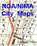
Luanda City Topographic Map. Soviet military. This is a Soviet military topographic map of the city of Luanda. This map shows significant detail of the infrastructure of the city including power lines, water and gas lines, etc. It does not include tourist information and is not a substitute for a tourist map for tourists going to Luanda. In Russian.
1:1,000,000 ONC charts.
|
|||||||||||||||||||||||||||||||||||||||||||||||||||||||||||||||||||||||||||||||||||||||||||||||||||||||||||||||||||||||||||||||||||
 Angola Maps
 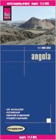 Waterproof!
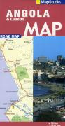
 Sample detail of the Angola travel map

 Sample detail of the Afghanistan map
 Sample from the Entebbe map in the same series.
 Index showing sheet coverage
 Sample from the TPC series (image is from a sheet covering Korea)
 Sample from the ONC series (image is from a sheet covering Korea)
 Angola Flags