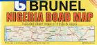
Nigeria Road Map. 1:1,900,000. MDZMultimedia, Nigeria. A Nigerian-produced road map of Nigeria with detailed street maps of Lagos and Abuja with a small place name index. In English.
65-10901
1 sheet, folded.
$15.99
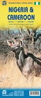
New title Nigeria and Cameroon Travel Map. 1:1,600,000 (Nigeria) and 1:1,500,000 (Cameroon). ITMB. This map, while the 3rd edition of the Nigeria map, is the first time ITMB combines the Nigeria and Cameroon maps onto a single sheet.
Sample detail from the Nigeria Map
65-10902
1 sheet, folded.
$12.95
Abuja Federal Capital City Map. 1:17,800. MDZMultimedia, Nigeria. This map covers Abuja Federal Capital City, phase 1 development. It is a detailed street map which includes symbols showing locations of hotels/guesthouses, restaurants, fire stations, police, embassies, schools, banks, gas stations, government offices, and many more. Numerous named shops are also shown. A street index is along the bottom of the map. The map has a 1/2 x 1/2 km alphanumeric grid but lacks latitude/longitude information. In English.
65-1093AB
1 sheet, folded.
$15.99
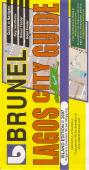
Lagos City Map. 1:20,000. MDZMultimedia, Nigeria. This map covers Lagos Island, Ikoyi, Victoria Island and Lekki. It is a detailed street map which includes symbols showing locations of hotels/guesthouses, restaurants, fire stations, police, embassies, schools, banks, gas stations, government offices, and many more. Numerous named shops are also shown. A street index is along the bottom of the map. The map has a 1 x 1 km alphanumeric grid but lacks latitude/longitude information. In English.
65-1093LA
1 sheet, folded.
$15.99
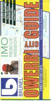
Owerri City Map. 1:15,000. MDZMultimedia, Nigeria, 2012. One side has a detailed street map of Owerri with symbols locating gas stations, banks, religious buildings, police, hotels, and much more. The reverse side has a road map of Imo State, which contains Owerri.
Sample detail from the Owerri city map
65-1093OW
1 sheet, folded.
$15.99
Port Harcourt City Map. 1:15,000. MDZMultimedia, Nigeria, 2009. One side has a detailed street map of Port Harcourt with symbols locating gas stations, hotels, restaurants, police stations, hospitals, shopping, and much more. The reverse side has a 1:1,200,000 road map of Rivers State, which contains Port Harcourt. It also has a small inset map of Nigeria showing the 36 states and the Federal Capital City district.
Sample detail from the Port Harcourt city map
65-1093P
1 sheet, folded.
$15.99
Nigeria TPC/Tactical Pilotage Charts & ONC/Operational Navigation Charts. 1:500,000 & 1:1,000,000. NGA. Standard topographic maps of Sudan are restricted by the Sudanese. World Aeronautical Charts, including TPC and ONC charts, cover land areas at a standard size and scale for navigation by aircraft operating at high altitudes. However, their level of detail makes them useful as topographic maps for those areas where little else is available. The topographical information includes city tints, principal roads, railroads, distinctive landmarks, drainage patterns, topography and relief. contour lines are at 500 feet intervals, with intermediate contours where appropriate, along with numerous spot heights. Color tints on a hypsometric scale are also shown. The aeronautical information includes visual and radio aids to navigation, airports, airways, restricted areas, obstructions and other pertinent data.
There is less detail in some areas due to insufficient information - these areas are labeled on the charts. These are large maps, with a typical size of 42 x 56 inches. Due to the size and color variation of the different print runs and the Conformal Conic Projection, these maps do not splice together well. World Aeronautical Charts are not recommended for use by pilots of low speed, low altitude aircraft.
Index showing sheet coverage Sample from this series (image is from a sheet covering Korea) Nigeria 1:500,000 TPC Charts.
67-1055-K02B
TPC Chart K02B. Benin/Burkina Faso/Mali/Niger/Nigeria. North 12°-16, East 1°-7°.
$34
67-1055-K02C
TPC Chart K02C. Benin/Burkina Faso/Niger/Nigeria. North 8°-12, East 1°-7°.
$34
67-1055-K03A
TPC Chart K03A. Niger/Nigeria. North 12°-16°, East 7°-13°.
$34
67-1055-K03B
TPC Chart K03B. Chad/Niger/Nigeria. North 12°-16°, East 13°-19°.
$34
67-1055-K03C
TPC Chart K03C. Cameroon/Chad/Nigeria. North 8°-12°, East 13°-19°.
$34
67-1055-K03D
TPC Chart K03D. Cameroon/Nigeria. North 8°-12°, East 7°-13°.
$34
67-1055-L02B
TPC Chart L02B. Benin/Ghana/Nigeria/Togo. North 4°-8°, East 0°-6°.
$34
67-1055-L03A
TPC Chart L03A. Cameroon/Nigeria. North 4°-8°, East 6°-12°.


 New title
 Sample detail from the Nigeria Map


 Sample detail from the Owerri city map
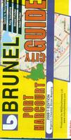
 Sample detail from the Port Harcourt city map
 Index showing sheet coverage
 Sample from this series (image is from a sheet covering Korea)