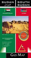
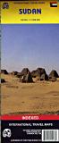
Recommended! Sudan Geographic Travel Map. 1:2,500,000. Gizimap, 2012. Detailed geographic map of Sudan and the new country of South Sudan. The map uses color tinting to show elevation, shows many spot heights, and uses symbols to locate tourist sites and services. Distances are shown along major roads. There are two inset city street maps covering Khartoum and Juba.
Image of the Sudan geographic map Sample detail #1 of the Sudan geographic map Sample detail #2 of the Sudan geographic map
$14.99
65-34903
1 sheet, folded.
Sudan Travel Map
&
Khartoum City Map.
1:4,000,000. GEOprojects. Good travel map for the businessperson, with telephone numbers and other business information. General map with a large, indexed street plan of Khartoum. Altitude colouring shows the topography, with additional graphics for sand or gravel deserts, lava flows, marshes or swamps, and salt marshes or flats. Administrative boundaries are shown, with both English and local names of the provinces. Information on the road network is rather basic, and the map shows relatively few smaller settlements. The map has an index of place names and latitude/longitude grid at 2° intervals. The legend is in English, French, and Arabic. Buy this map if you want a Khartoum city map and businessperson's information, buy the ITMB map below if you want a road map of the country.
On the reverse there is a large, indexed street plan of Khartoum at 1:15,000, although beyond the city centre and the 'Amarat district only names of the districts are shown. The plan indicates markets, souks, and shopping centres, bus stations, hospitals, post offices, banks, petrol stations, places of worship, selected hotels, foreign embassies, etc. There is also a small plan of Omdurman at 1:50,000 and notes on the country's geography, history and economy. Size is approx. 48 x 60cm.
$16.99
65-3490
1 sheet, folded
Waterproof! Sudan Travel Map. 1:1,800,000. Reise Know-How.
A detailed road map of the country. Relief is shown contour lines and spot heights. A good detailed road map of the country.
$15.99
65-34902
1 sheet, folded
Sudan Travel Map. 1:2,700,000. ITMB.
A detailed road map of the country. Relief is shown through altitude tinting with spot heights, and additional graphics distinguish sand dunes, lava fields, and areas liable to seasonal flooding. Road detail includes unsurfaced roads and tracks, and indicates intermediate driving distances on main routes. Railways and stations are marked, also ferries, airports, ports, gas stations, border crossings, antiquities, reserves, churches, missions, mosques, campsites, oases, wadis, wells, etc. Internal administrative boundaries are marked and names of the provinces are shown. Latitude and longitude lines are drawn at 1 degree intervals. The map also includes a small inset with a street plan of central Khartoum. Buy this map if you want a road map of the country; buy the GEOprojects map above if you want a Khartoum city map and businessperson's information.
$12.95
65-34901
1 sheet, folded
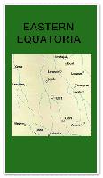
Sudan Wilayat/State Maps. Tourist Maps Kenya, Nairobi.
These maps include hypsometric shaded relief to show elevation, roads, towns and villages, and much more.
$22.99
65-3478EQ
Eastern Equatoria. 1:1,000,000. 1997. Covers from 3-8°N and 29-36°E.
$22.99
65-3478WQ
Western Equatoria. 1:1,000,000. 1997. Covers from 3-8°N and 26-33°E.
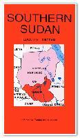
Southern Sudan Map. 1:2,000,000. Tourist Maps Kenya, Nairobi.
The map shows 500 meter contours to show elevation, roads, villages, airports, railroads, and more.
$22.99
65-3478
1 sheet, folded.
Trail Guide to North & South Sudan. The City Trail Guides, 2nd ed. 2011.
The Trail Guide to North & South Sudan is the first and only guidebook that covers both North and the newly-independent South Sudan. This guidebook is specifically aimed at those people that are either moving to Sudan or going there for work and business purposes, although it can just as well be used for those independent travelers that want to explore the two countries. This travel guide has plenty of information on visa requirements, transportation, archeological treasures and on what to do and see. The guidebook has detailed sections on the local culture, business and social etiquette and everything that you need to know about living in the countries. This really is a must-have guide for anyone considering going to either North or South Sudan. Softcover.
Sample detail #1 from the Sudan guidebook Sample detail #2 from the Sudan guidebook
$39.99
65-3495SU
Guidebook.
Sudan & South Sudan Regional Topographic Overview Maps
1:500,000 Topographic Base Map for Darfur Humanitarian Relief Operations. 1:500,000. Switzerland CDE, 2008. This map offers topographic coverage of the Darfur area. Symbols locate features such as airfields, minefields, mosques, churches, dams, etc. In English.
Sample detail of the Darfur Map Image of the Darfur Map
$64.99
65-3462-DA
1 sheet, flat.
1:250,000 Topographic Base Maps for Darfur Humanitarian Relief Operations. 1:250,000. Switzerland CDE, 2008. This four-sheet map set offers topographic coverage of the Darfur region. Symbols locate features such as airfields, minefields, mosques, churches, dams, etc. In English.
Sample detail of the Northeast Darfur Map Image of the Northeast Darfur Map
$64.99
65-34625-NE
North-east Darfur topographic map.
$64.99
65-34625-NW
North-west Darfur topographic map.
$64.99
65-34625-SE
South-east Darfur topographic map.
$64.99
65-34625-SW
South-west Darfur topographic map.
The Nuba Mountains (Central Sudan) 1:500,000 Topographic Overview Map. 1:500,000. Switzerland CDE, 2003. This map offers topographic coverage of the Nuba Mountains. Symbols locate features such as airfields, minefields, mosques, churches, dams, etc. In English.
Sample detail of the Nuba Mountains Map Image of the Nuba Mountains Map
$47.99
65-3460-NU
1 sheet, flat.
The Nuba Mountains (Central Sudan) 1:250,000 Topographic Overview Maps. 1:250,000. Switzerland CDE, 2005. This two-sheet map set offers topographic coverage of the Nuba Mountains. Symbols locate features such as airfields, minefields, mosques, churches, dams, etc. In English.
Sample detail of the Nuba Mountains Map Image of the Nuba Mountains Map
$47.99
65-3461-NE
East Nuba Mountains sheet.
$47.99
65-3461-NW
West Nuba Mountains sheet.
South Sudan 1:1,000,000 Topographic Base Map. 1:1,000,000. Switzerland CDE. This map offers basic topographic coverage of South Sudan. Symbols locate features such as airfields, minefields, mosques, churches, dams, etc. In English.
Sample detail of the South Sudan Map Image of the South Sudan Map
Sudan 1:200,000 Topographic Quadrangle Map Set. 1:200,000. Soviet government. 1978-1985. High quality topographic maps for a country where little else is available. This set gives complete coverage of Sudan in 351 sheets. In Russian. Available only as color plots.
Specify sheet number in the comments section at check-out.
Sudan Topographic Quadrangle Maps (TPC/Tactical Pilotage Charts). 1:500,000. NGA. Standard topographic maps of Sudan are restricted by the Sudanese. World Aeronautical Charts, including TPC and ONC charts, cover land areas at a standard size and scale for navigation by aircraft operating at high altitudes. However, their level of detail makes them useful as topographic maps for those areas where little else is available. The topographical information includes city tints, principal roads, railroads, distinctive landmarks, drainage patterns, topography and relief. contour lines are at 500 feet intervals, with intermediate contours where appropriate, along with numerous spot heights. Color tints on a hypsometric scale are also shown. The aeronautical information includes visual and radio aids to navigation, airports, airways, restricted areas, obstructions and other pertinent data. There is less detail in some areas due to insufficient information - these areas are labelled on the charts. These are large maps, with a typical size of 42 x 56 inches. Due to the size and color variation of the different print runs and the Conformal Conic Projection, these maps do not splice together well. World Aeronautical Charts are not recommended for use by pilots of low speed, low altitude aircraft.
NOTE: These maps are now out of print. We have some inventory of as original paper sheets, the rest are supplied as color plots.

 Recommended!
 Image of the Sudan geographic map
 Sample detail #1 of the Sudan geographic map
 Sample detail #2 of the Sudan geographic map

 Waterproof!


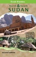
 Sample detail #1 from the Sudan guidebook
 Sample detail #2 from the Sudan guidebook
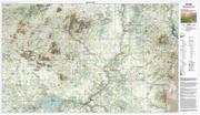
 Sample detail of the Sudan - South Sudan Boundary Map
 Image of the Sudan - South Sudan Boundary Map
 Sample detail of the Sudan - South Sudan Boundary Map, AR Rank sheet
 Image of the Sudan - South Sudan Boundary Map, Ar Rank sheet
 Sketch map showing sheet coverage
 Sample detail of the Darfur Map
 Image of the Darfur Map
 Sample detail of the Northeast Darfur Map
 Image of the Northeast Darfur Map
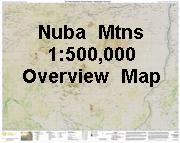
 Sample detail of the Nuba Mountains Map
 Image of the Nuba Mountains Map
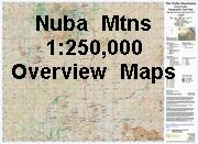
 Sample detail of the Nuba Mountains Map
 Image of the Nuba Mountains Map
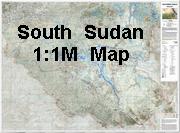
 Sample detail of the South Sudan Map
 Image of the South Sudan Map
 Sample detail of the Sudan - South Sudan Boundary Map, AR Rank sheet
 Image of the Sudan - South Sudan Boundary Map, Ar Rank sheet
 Sketch map showing sheet coverage
 Sample detail of the South Sudan Map
 Image of the South Sudan Map
 Sketch map showing sheet coverage
 Sketch map showing grid system for Sudan.
 Index showing sheet coverage
 Sample from this series (image is from a sheet covering Korea)