Recommended! Ethiopia Geographic Travel Map. 1:2,000,000. Gizimap.
Detailed geographic map of Sudan and the new country of South Sudan. The map uses color tinting to show elevation, shows many spot heights, and uses symbols to locate tourist sites and services. Distances are shown along major roads. There is an inset map showing Addis Ababa at 1:25,000 and an inset of Simien (Simen) National Park at 1:275,000.
Sketch map showing area covered by the Ethiopia travel map Image of the Ethiopia geographic map Image of the Ethiopia geographic map
$14.99
64-53901
1 sheet, folded.
$19.99
64-53901R
1 sheet, flat.
$36.99
64-53901L
Laminated.
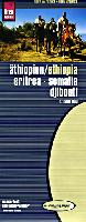
Ethiopia Travel Map (with Somalia, Eritrea, Djibouti). 1:2,000,000. Reise Know-How.
Waterproof and tear resistant Polyart(c) synthetic paper. Detailed road map with elevation shown by contour lines. In German with multilingual legend.
$15.99
64-53911
1 sheet, folded
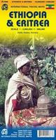
Ethiopia travel map. 1:2,000,000. ITMB.
Detailed road map of Ethiopia, with tourist sites marked.
$12.95
64-5391
1 sheet, folded
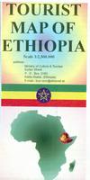
Tourist Map of Ethiopia. A basic road map of Ethiopia.
The map uses shaded relief to indicate elevation, symbols to locate tourist sites and services.
Sample detail of the Ethiopia Tourist map
$14.99
64-5390
1 sheet, folded.
Simen Mountains World Heritage Site Map. 1:100,000. University of Berne, 3rd ed., 2010.
This is a detailed topographic map with contours at 100m intervals and hill shading to show the relief. Vegetation distribution is indicated, ie. forest, scrub, cultivation, and the boundary of the Simen Mountains National Park is shown. Hiking & riding trails are highlighted, and symbols denote campgrounds, basic-standard tourist lodges, spectacular viewpoints and locations with noteworthy populations of Walya Ibexes, Simen Foxes & Gelada Baboons.
Coverage includes the town of Debark and the peak Ras Dejen. Latitude & longitude margin ticks are at 5' intervals. On the reverse are photographs and notes on the local geography, flora & fauna. Also, general advice for visitors and trekking route descriptions, illustrated with vertical profile diagrams.
Sample image
$26.99
64-5375
1 sheet, folded
Spatial Guide Map of Addis Abeba for Tourists and Shoppers. GS Info Solutions, 2007.
Double-sided map showing the greater Addis Abeba city area. The map shows the locations of shopping zones, market areas, shopping centers, embassies, banks, hotels and restaurants, museums, tourist sites and services, and much more. In English.
Sample detail of the Addis Ababa city map
$24.95
64-5392AD
1 sheet, folded.
$24.95
64-5392AF
1 sheet, flat/rolled.
Ethiopia Topographic Maps
Ethiopia Topographic/Aeronautical Quadrangle Maps - TPC/Tactical Pilotage Charts & ONC Operational Navigation Charts. 1:500,000 & 1:1,000,000. NGA. Standard topographic maps of Ethiopia are restricted by the Ethiopians. World Aeronautical Charts, including TPC and ONC charts, cover land areas at a standard size and scale for navigation by aircraft operating at high altitudes. However, their level of detail makes them useful as topographic maps for those areas where little else is available. The topographical information includes city tints, principal roads, railroads, distinctive landmarks, drainage patterns, topography and relief. contour lines are at 500 feet intervals, with intermediate contours where appropriate, along with numerous spot heights. Color tints on a hypsometric scale are also shown. The aeronautical information includes visual and radio aids to navigation, airports, airways, restricted areas, obstructions and other pertinent data. There is less detail in some areas due to insufficient information - these areas are labelled on the charts. These are large maps, with a typical size of 42 x 56 inches. Due to the size and color variation of the different print runs and the Conformal Conic Projection, these maps do not splice together well. World Aeronautical Charts are not recommended for use by pilots of low speed, low altitude aircraft. Nearly all of these are color plots as printed copies are no longer avaiable to the public.
Index showing sheet coverage Sample from this series (image is from a sheet covering Korea)
ONC 1:1,000,000 Charts.
$34
67-1056-K05
ONC Chart K05. Africa. North 8°-16°, East 31°-43°.
$34
67-1056-K06
ONC Chart K06. Africa. North 8°-16°, East 43°-55°.
$34
67-1056-L05
ONC Chart L05. Africa. North 0°-8°, East 30°-42°.
$34
67-1056-L06
ONC Chart L06. Africa. North 0°-8°, East 42°-54°.
TPC 1:500,000 Charts.
$34
67-1055-J06D
TPC Chart J06D. Eritrea/Saudi Arabia/Sudan. North 16°-20°, East 36°-42°.
$34
67-1055-K05A
TPC Chart K05A. Eritrea/Ethiopia/Sudan. North 12°-16°, East 31°-37°.
$34
67-1055-K05B
TPC Chart K05B. Djibouti/Eritrea/Ethiopia/Yemen. North 12°-16°, East 37°-43°.
$34
67-1055-K05C
TPC Chart K05C. Djibouti/Ethiopia/Somalia. North 8°-12°, East 37°-43°.
$34
67-1055-K05D
TPC Chart K05D. Ethiopia/Sudan. North 8°-12°, East 31°-37°.
$34
67-1055-K06D
TPC Chart K06D. Djibouti/Ethiopia/Somalia. North 8°-12°, East 43°-49°.
$34
67-1055-L05A
TPC Chart L05A. D.R. Congo/Ethiopia/Kenya/Sudan. North 4°-8°, East 30°-36°.
$34
67-1055-L05B
TPC Chart L05B. Ethiopia/Kenya. North 4°-8°, East 36°-42°.
$34
67-1055-L05C
TPC Chart L05C. Ethiopia/Kenya/Somalia. North 0°-4°, East 36°-42°.
$34
67-1055-L06A
TPC Chart L06A. Ethiopia/Somalia. North 4°-8°, East 42°-48°.
$34
67-1055-L06B
TPC Chart L06B. Ethiopia/Somalia. North 4°-8°, East 48°-54°.
$34
67-1055-L06D
TPC Chart L06D. Ethiopia/Somalia. North 0°-4°, East 42°-48°.
 Ethiopia Flags
 Ethiopia Maps
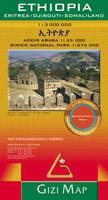


 Sketch map showing area covered by the Ethiopia travel map
 Image of the Ethiopia geographic map
 Image of the Ethiopia geographic map

 Sample detail of the Ethiopia Tourist map
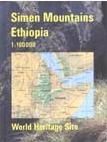
 Sample image
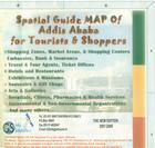
 Sample detail of the Addis Ababa city map
 Index showing sheet coverage
 Sample from this series (image is from a sheet covering Korea)