Waterproof! Namibia Travel Map. 1:1,000,000. Track4Africa. The roads, tracks, places of interest as well as the distance data and travel time estimates on the map reflect the collective travel experience of the Tracks4Africa community of travellers over the past 10 years, with every single road being GPS recorded and verified by this community. ISBN 9780986987601.
Travel times and distances included on the map
Comprehensive set of roads and tracks in nature reserves
Detailed information on camp sites and attractions
Border crossings indicated with opening and closing times
Visit www.tracks4africa.com for details on places of interest
Kaokoland in great detail with all off road tracks shown
Detailed maps for Swakopmund and Windhoek
Each town is shown with up to date tourist services information
Waterproof! Namibia Travel Map. 1:1,250,000. Reise Know-How. Double sided, indexed road map printed on durable, waterproof paper. The map combines clear road and tourist detail with relief indicated by contours, altitude tinting, and peak heights. Road detail distinguishes untarred roads, 4x4 tracks and impassable routes. Intermediate driving distances are shown on many roads, gas stations are marked and border crossing opening times are shown. Railways are included and symbols depict airports and airfields. Saltflats are indicated, regional boundaries (and names), the restricted Diamond Area, national parks and reserves are marked, and a further range of symbols shows mines, antiquities, campsites, viewpoints, hot springs and places of interest. The country is divided into north and south sections, with an inset showing the Caprivi region in the north east. Latitude and longitude lines are drawn at 1° intervals, and the map legend is in English and German. Advantages: waterproof, elevation contours.
65-03905
1 sheet, folded.
$15.99
Namibia Road Map. 1:1,550,000. Map Studio. This is a detailed road map of Namibia, with numerous inset maps.
City center inset maps - Windhoek, Walvis Bay, Swakopmund, Grootfontein, Otjiwarongo, Lùderitz, Kolmanskop, Keetmanshoop.
Detailed inset maps - Etosha National Park, Mudumu and Mamili National Parks, Sesriem and Sossusviel, Ai-Ais/Richtersveld Transfrontier Park
Namibia Travel Map. Freytag & Berndt. A very large sheet presenting the whole of the country on one side, but with the Caprivi Strip as a separate inset. The map itself is basically identical to the one published by Reise Know-How, except for colouring and the presentation of the topography; here with relief shading and spot heights rather than with contours and altitude colouring. Internal administrative boundaries are shown with names of the provinces. Road network indicates restricted roads, includes 4x4 cart and sand tracks, and shows frequent intermediate distance even on minor roads. Boundaries of national parks and reserves and of the restricted Diamond Area are marked, and symbols highlight main places of interest and campsites. Latitude and longitude grid is at 30' intervals. Index of main place names is on the reverse of the map. Multilingual legend, which includes English, gives its user a chance to learn basic terms in ten languages ( 3 x museum, 2 x muzeum, 1 x múzeum, 1 x musée, and 2 x museo). Size is 95 x 124 cm. Advantages: whole country on one side, picture chart of wildlife.
65-03903
1 sheet, folded.
$12.95
Namibia Travel Map. ITMB. Indexed road map with street plans of Windhoek and Swakopmund. The whole of the country including the Caprivi Strip is shown together. Altitude colouring and spot heights indicate the topography, with sand dunes, cliffs, salt pans, etc. National parks and reserves, as wells as the restricted area of the Namib Desert are all prominently marked. Communications network includes tracks and restricted access roads, petrol stations, railways, and domestic airports and small aerodromes. Internal administrative boundaries are shown with names of the provinces. Symbols highlight places of interest and various types of accommodation from hotels to campsites, etc. Latitude/longitude grid is at 1° intervals. The map also includes two large plans of Windhoek and Swakopmund, naming main streets and highlighting facilities and places of interest. Also included are brief notes on the main places of interest within country and historical information about the two cities.
Advantages: the two inset city maps.
65-03904
1 sheet, folded.
$12.95
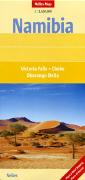
Namibia Travel Map. 1:1,500,000. Nelles Verlag. A popular road map of Namibia using a physical shaded relief map as a base map. Multilingual legend.
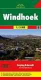
Windhoek City Map. Freytag & Berndt. Detailed street map of this capital city. Multilingual legend.
Sample of the map detail.
65-0392WJ
1 sheet, folded.
$13.95
Fish Canyon and the Richtersveld Map. 1:230,000 and 1:476,000. National Geographic Maps, 2004. This largely desolate and treacherous territory along the Namibia and South Africa border, ranging from desert, to mountains, to deep gorge and tempestuous white water, provides endless adventure opportunities. The abundant flora and fauna that inhabits these two regions are fed largely by the waters of the Fish and Orange rivers.
Printed on waterproof, tear-resistant material. Includes a detailed road network, a regional overview map, detailed coverage of the Fish River Canyon and Richtersveld National Park, regional mapping of the Luderitz Peninsula, and town plans of Kolmanskop, Keetmanshoop, and Springbok.
Sample of the map detail. Thumbnail of the front of the map Thumbnail of the reverse of the map
65-0370
1 sheet, folded.
$9.95
Namibia Travel Guides
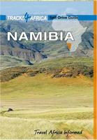
Namibia Self-Drive Guidebook. Tracks4Africa. These guide books are specifically aimed at self-drive travellers that like to roam African via their own transportation. This guide advises you on matters like planning your trip, navigation, preparing your vehicle, buying the right equipment for travelling into remote areas and staying in contact with the rest of the world when you are on the road.
If you are a self-drive tourist, there are five things that you need to know when you are on the road:
Recommended! Namibia & Botswana Lodging and Camping Directory. Track4Africa, Oct. 2011. The book is printed in full colour on high quality paper and comprises 1082 listings spread over more than 250 pages. A short description is given of each travel region to help you plan your trip. We believe that this easy to use and well organised directory will enable you to find whatever type of accommodation you are looking for, be it in the most touristymost remote areas of Namibia or Botswana.
For Botswana there are total of 293 listings which is made up of 116 camp sites and 177 lodgings. Namibia has a total of 780 listings with 212 camp sites and 577 lodgings. Typical information provided for each listing includes a short description, type of accommodation, contact details, rates, facilities and activities. For out of town listings we also give the distance and estimated travel time from the town centre.
All camping and lodging listed in the guide are noted in the Tracks4Africa GPS map chip for Garmins (see elsewhere on this page for the GPS map chip). Each listing also has a grid reference for where it occurs on the paper maps, although not all listings are shown on the map due to the map scale.
This is the same guide listed above in the Botswana section.
Sample detail from the Namibia & Botswana Lodging Guide Sample detail from the Namibia & Botswana Lodging Guide
65-0395LO
Guidebook.
$39.99
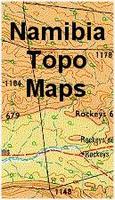
Namibia Topographic Maps
Namibia Topographic Quadrangle Maps. 1:250,000. Total coverage is available. For ordering individual sheets, please look at the index to figure out which sheet(s) you need and then order them using the
"Each, specify area" order button below. On the order form, specify the sheet number in the "Comments" section.
Namibia Topographic Quadrangle map index Sample image
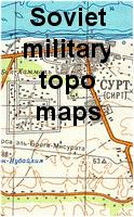
Namibia 1:200,000 Topographic Quadrangle Map Set. 1:200,000. Soviet government. High quality topographic maps with good detail. This set gives complete coverage of Namibia in 146 sheets. In Russian. Available only as digital maps; non-georeferenced rasters and geo-referenced rasters.
65-03525
Set of 145 sheets, non-georeferenced rasters
$584.00
65-03526R
Non-georeferenced raster, specify sheet number when you check out.
$20.00
Namibia 1:50,000 Topographic Quadrangle Maps. 1:50,000. Namibia Survey. Total coverage is available, although 5% of the maps are black/white. These are special-order items with an 8-week delivery time.


 Sample detail of the Namibia travel map
 Waterproof!


 Sample of the map detail.


 Sample of the map detail.
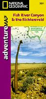
 Sample of the map detail.
 Thumbnail of the front of the map
 Thumbnail of the reverse of the map
 Sample detail of the Namibia Self-Drive Guidebook
 Sample detail of the Namibia Self-Drive Guidebook
 Sample detail of the Namibia Self-Drive Guidebook
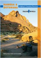 Recommended!
 Sample detail from the Namibia & Botswana Lodging Guide
 Sample detail from the Namibia & Botswana Lodging Guide
 Namibia Topographic Quadrangle map index
 Sample image