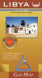
Libya Road Map. 1:1,750,000. Gizimap. Detailed maps of Libya, available in two versions. Both maps show roads, towns, villages, rivers, etc. The geographic map has shaded relief and hypsometric shading to show elevation. The political map shows major political boundaries and shaded relief but lacks the hypsometric shading showing elevation. Bilingual English/Arabic.
64-95904
Libya road map, folded.
$34.95
64-95904R
Libya road map, rolled.
$19.99
64-95904L
Libya road map, laminated.
$36.99
There are four different travel maps listed below. Each has its strong point. If you want a city street map of Tripoli or Benghazi, the Geoprojects map has
good city maps on the reverse plus good detailed maps of the Old Towns in the two cities. The Reise Know-How map is waterproof and tear-resistant.
Libya Travel Map. 1:3,500,000. GEOprojects. The road map is fairly simple but the inset maps of Tripoli and Benghazi are much more detailed than on the other maps. It has a businessman's guide and a complete index. 91 x 66 cm.
If you are going on business and will spend most of your time in Benghazi and Tripoli, buy this map.
64-9591
1 sheet, English
$20.95
Waterproof! Libya travel map. 1:2,000,000. Reise Know-How. Detailed physical/road map showing elevation with contour lines. Printed on Polyart(c) waterproof and tear-resistant synthetic paper.
64-95902
1 sheet, folded
$15.99
Waterproof! Libya travel map. 1:1,650,000. ITMB. Typical ITM travel map with shaded relief. Printed on waterproof, tear-resistant, synthetic paper.
64-95901
1 sheet, folded
$12.95
Libya Travel Map. 1:2,000,000. Cartographia. 72 x 66 cm. Has simple city street inset maps for Banghaze (Benghazi) and Tarabulus (Tripoli), plus an index of town and place names. More detailed than 64-9591 below, but lacks the useful traveler's information. A compromise between the map above and below.
64-9590
1 sheet, folded
$12.99
Tripoli & Benghazi City Street Map (Reverse side of Libya Travel Map). GEOprojects. This is the same map as listed just above. The inset maps of Tripoli and Benghazi are much more detailed than on the other maps, hence we have listed it as a city map. It has a businessman's guide and a complete index. 91 x 66 cm.
If you are going on business and will spend most of your time in Benghazi and Tripoli, buy this map. If you want a detailed road map, then either the ITMB or Cartographia maps have more road detail.
64-9591
1 sheet, English
$20.95
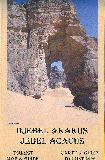
Djebel Akakus (Jebel Acacus) Tourist Map and Guide. 1:100,000. West Col, 2006. Full colour topographical map covering the Acacus, Tadrart and Awiss mountains from Serdeles (Al Awainat) to the Algerian border. Tourist information covering access, the Tuareg, water, archeological sites. Text in French and English. Size is 70 x 100cm.
64-9570
1 sheet, folded
$19.99
Sudan Topographic Quadrangle Maps (TPC/Tactical Pilotage Charts). 1:500,000. NGA. Standard topographic maps of Libya are restricted by the Libyan military. World Aeronautical Charts, including TPC and ONC charts, cover land areas at a standard size and scale for navigation by aircraft operating at high altitudes. However, their level of detail makes them useful as topographic maps for those areas where little else is available. The topographical information includes city tints, principal roads, railroads, distinctive landmarks, drainage patterns, topography and relief. contour lines are at 500 feet intervals, with intermediate contours where appropriate, along with numerous spot heights. Color tints on a hypsometric scale are also shown. The aeronautical information includes visual and radio aids to navigation, airports, airways, restricted areas, obstructions and other pertinent data. There is less detail in some areas due to insufficient information -
these areas are labelled on the charts. These are large maps, with a typical size of 42 x 56 inches. Due to the size and color variation of the different print runs and the Conformal Conic Projection, these maps do not splice together well. World Aeronautical Charts are not recommended for use by pilots of low speed, low altitude aircraft.
Index showing sheet coverage Sample from this series (image is from a sheet covering Korea)
TPC 1:500,000 Charts
67-1055-G02C
TPC Chart G02C. Libya/Tunisia. North 32°-36°, East 11°-18°.
$34
67-1055-G03D
TPC Chart G03D. Libya/Europe. North 32°-36°, East 18°-25°.
$34
67-1055-H03A
TPC Chart H03A. Algeria/Libya. North 28°-32°, East 5°-11°.
$34
67-1055-H03B
TPC Chart H03B. Libya. North 28°-32°, East 11°-17°.
$34
67-1055-H03C
TPC Chart H03C. Algeria/Libya. North 24°-28°, East 11°-17°.
$34
67-1055-H03D
TPC Chart H03D. Algeria/Libya. North 24°-28°, East 5°-11°.
$34
67-1055-H04A
TPC Chart H04A. Libya. North 28°-32°, East 17°-23°.
$34
67-1055-H04B
TPC Chart H04B. Egypt/Libya. North 28°-32°, East 23°-29°.
$34
67-1055-H04C
TPC Chart H04C. Egypt/Libya. North 24°-28°, East 23°-29°.
$34
67-1055-H04D
TPC Chart H04D. Libya. North 24°-28°, East 17°-23°.
$34
67-1055-J04A
TPC Chart J04A. Chad/Libya/Niger. North 20°-24°, East 12°-18°.
$34
67-1055-J04B
TPC Chart J04B. Chad/Libya. North 20°-24°, East 18°-24°.
$34
67-1055-J05A
TPC Chart J05A. Egypt/Libya/Sudan. North 20°-24°, East 24°-30°.
$34
ONC 1:1,000,000 Charts
67-1056-G02
ONC Chart G02. Europe/Africa. North 32°-40°, East 4°-18°.
$34
67-1056-G03
ONC Chart G03. Europe/Africa/Middle East. North 32°-40°, East 18°-32°.
$34
67-1056-H03
ONC Chart H03. Africa. North 24°-32°, East 5°-17°.
$34
67-1056-H04
ONC Chart H04. Africa/Middle East. North 24°-32°, East 17°-29°.
$34
67-1056-J04
ONC Chart J04. Africa. North 16°-24°, East 12°-24°.
$34
67-1056-J05
ONC Chart J05. Africa/Middle East. North 16°-24°, East 24°-36°.

 in Leptis Magna, the well preserved ancient city along the Mediterranean Sea, located 120 km Est of Tripoli, Libya. Photo by Lucca Galuzzi, via Wikipedia.")
 Superb wall map
 Sample detail from the Libya geographic map
 Image of the entire Libya geographic map
 Sketch map showing area covered by the Libya geographic map
 Libya Road Map. 1:1,750,000. Gizimap. Detailed maps of Libya, available in two versions. Both maps show roads, towns, villages, rivers, etc. The geographic map has shaded relief and hypsometric shading to show elevation. The political map shows major political boundaries and shaded relief but lacks the hypsometric shading showing elevation. Bilingual English/Arabic.


 Waterproof!

 Waterproof!


 Index showing sheet coverage
 Sample from this series (image is from a sheet covering Korea)