Waterproof! Tunisia Road Map. 1:600,000. Reise Know-How. This map combines topographic mapping with road and tourist detail. The road information is clear and elevation is shown using contours, spot heights and altitude shading. The map shows six different types of roads, highlighting scenic routes, places of interest, archaeological sites, monasteries, monuments, police stations, railroads, and viewpoints.
65-44916
1 sheet, folded.
$15.99
Tunisia Travel Map. 1:800,000. ITMB. This is an indexed road map with a small inset map of Tunis and a glossary of geographical terms. Elevation coloring (in feet) and spot heights (in metres) show the country's topography. Oasis, sand dunes, lava fields, salt marshes, wetlands and swaps, dry lakes and streams are shown, plus numerous wells and waterholes, many with names. Road network includes unsurfaced minor roads and tracks, with intermediate distances on major roads and locations of gas stations. Symbols highlight selected accommodations, parks and reserves, beaches, scuba diving facilities, archeological sites, and other places of interest. The map has an index of localities, but does not show any geographical coordinates.
A small map of central Tunis shows main streets and highlights a few places of interest to visitors. There is also a glossary of geographical terms used on the map.
Image of the reverse of the map.
65-44913
1 sheet, folded.
$10.95
Waterproof Tunisia World Compact Travel Map. 1:1,200,000. Freytag/Berndt, 2012. A waterproof tourist road map of Tunisia. Includes four city center maps, travel information, sights to see, information on the country, photographs, fully indexed, and more. Multilingual
Sample detail of the Tunisia Travel Map
Tunis Laminated Destination City Map. National Geographic Society. The main street plan of the city at 1:4,000 is complemented by maps of the region around Tunis, a plan of the metro system, street plans of Bizerte and Sousse and an introduction to the city and its points of interest, including a plan of the Bardo Museum and useful contact details for visitors. Size approx. 62 56 cm.
Image of the reverse of the map.
65-4492TD
Tunis. 1:4,000.
$8.99
Tunis city map. 1:12,000. Editions Laure Kane. Colorful and informative map for visitors showing streets, railways, metro lines, parks and districts. Indexed for streets, administrative buildings, mosques, squares, hotels, hospitals & places of interest.
Large symbols depict such features as railway stations, cemeteries, places of worship, police and fire stations, schools, hospitals, embassies & post offices. Colors distinguish the town's districts. A small inset map shows the metro system beyond the confines of the main map. Legend in English and French. Includes glossary of terms used in place names.
Image of the reverse of the map.
65-4492TT
1 sheet, folded.
$13.99
Tunisia Rail Map. No scale. Kümmerly + Frey. 1986. One sheet, in color. This map shows the main rail lines of northern and central Tunisia overprinted on a colorful shaded relief map. Multilingual.
65-4487
1 sheet, folded
$7.95
Tunisia Flags
67-1070TUN
Tunisia flag, small. Size 4 x 6 in.
$3.99
67-1073TUN
Tunisia flag, large. Size 2 x 3 ft.
$64.95
Digital Tunisia Topographic Maps
Ideal for 4WD and desert touring! Tunisia Digital 1:200,000 Topographic Maps for MemoryMap. 1:200,000. Omnimap/GoTrekker/MemoryMap. This set uses the very detailed Soviet military 1:200,000 topographic maps (in Russian/cyrillic) as the base maps. Includes complete coverage of Tunisia. The set includes a full version of Memory-Map Discoverer, normally a $75 value. Maps can be set up to print along roads or your trails. Print up to 13" x 19" on paper. See your route in an amazing 3D fly through in suitable areas. Can be used as secondary navigation for boating or flying with a go-to VOR-style arrow to your next waypoint. Allows you to upload/download routes, tracks & waypoints to & from most gps, laptops & pda's on windows operating systems, maps will not go into a gps. Export your map as a bitmap image. Software in English/French/Spanish/German, topo maps in cyrillic (Russian).
65-4452D
DVD
$69.99
Tunisia Topographic Maps
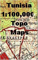
Tunisia 1:100,000 Topographic Quadrangle Map Set. 1:100,000. Soviet government. High quality topographic maps for a country where little else is available. This set covers the norther, central, and east coast of Tunisia; the south and southwest are not available. In Russian.
65-4451
Set of 131 sheets, rolled
$1310.00
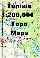
Tunisia 1:200,000 Topographic Quadrangle Map Set. 1:200,000. Soviet government. High quality topographic maps for a country where little else is available. This set of 39 sheets gives complete coverage of Tunisia. In Russian.
65-4452
Set of 39 sheets, rolled
$312.00
Tunisia Topographic/Aeronautical Quadrangle Maps - TPC/Tactical Pilotage Charts & ONC Operational Navigation Charts. 1:500,000 & 1:1,000,000. NGA. World Aeronautical Charts, including TPC and ONC charts, cover land areas at a standard size and scale for navigation by aircraft operating at high altitudes. However, their level of detail makes them useful as topographic maps for those areas where little else is available. The topographical information includes city tints, principal roads, railroads, distinctive landmarks, drainage patterns, topography and relief. contour lines are at 500 feet intervals, with intermediate contours where appropriate, along with numerous spot heights. Color tints on a hypsometric scale are also shown. The aeronautical information includes visual and radio aids to navigation, airports, airways, restricted areas, obstructions and other pertinent data. There is less detail in some areas due to insufficient information - these areas are labelled on the charts. These are large maps, with a typical size of 42 x 56 inches. Due to the size and color variation of the different print runs and the Conformal Conic Projection, these maps do not splice together well. World Aeronautical Charts are not recommended for use by pilots of low speed, low altitude aircraft.
Index showing sheet coverage Sample from the TPC series (image is from a sheet covering Korea)
TPC 1:500,000 Charts
67-1055-G02A
TPC Chart G02A. Tunisia/Tunisia/Europe. North 36°-40°, East 4°-11°.
$34
67-1055-G02B
TPC Chart G02B. Italy/Malta/Tunisia. Offshore islands only, no mainland Tunisia. North 36°-40°, East 11°-18°.
$34
67-1055D-G02C
TPC Chart G02C. Libya/Tunisia. North 32°-36°, East 11°-18°. Note: paper edition is out of print.
$34
67-1055-G02D
TPC Chart G02D. Tunisia/Libya/Tunisia. North 32°-36°, East 4°-11°.
$34
ONC 1:1,000,000 Charts.
67-1056-H03
ONC Chart H03. Southern Tunisia/Tunisia/Libya. North 24°-32°, East 5°-17°.

 Waterproof!


 Image of the reverse of the map.
 Waterproof
 Sample detail of the Tunisia Travel Map
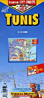
 Detail from the map.
 Image of the front of the map.
 Image of the reverse of the map.
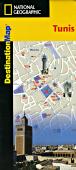
 Image of the reverse of the map.
 Image of the reverse of the map.
 Ideal for 4WD and desert touring!


 Index showing sheet coverage
 Sample from the TPC series (image is from a sheet covering Korea)