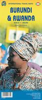
Rwanda/Burundi Travel Map. 1:300,000. ITMB.
A general map of the two countries with elevation tinting to show the relief. Main roads, secondary roads and tracks are distinguished and settlements are classified by symbols according to size. Driving distances on main roads between specific points are shown and provincial parks, forest areas, principal hydrographic features and provincial boundaries are included. Additional symbols highlight airports, churches/missions, lodgings and points of interest. The map has a 30' latitude/longitude grids.
Also included are small street plans of Kigali and Bujumbura. Size is approximately 30 x 34 inches. The folded map is also listed in teh Burundi section with the same catalog number.
Note: Folded map has Rwanda on one side of the map, Burundi on the reverse. Wall map and laminated map are single-sided with Rwanda only on the map.
Sample #1 of the map. Sample #2 of the map.

 Sample #1 of the map.
 Sample #2 of the map.
 New title!
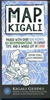
 Sample of the general Kigali city map.
 Sample of the tips noted on the Kigali map.
 Sample of the map legend from the Kigali map.
 Sample detail of the city center from the Kigali map.
 Sample from the Maputo map from the same series.
 Sample from the Entebbe map from the same series.