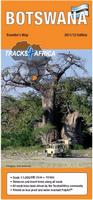
Waterproof! Botswana Travel Map. 1:1,000,000. Track4Africa.
The roads, tracks, places of interest as well as the distance data and travel time estimates on the map reflect the collective travel experience of the Tracks4Africa community of travellers over the past 10 years, with every single road being GPS recorded and verified by this community.
Travel times and distances included on the map
Comprehensive set of roads and tracks in nature reserves
Maps ground-checked by local staff
Detailed information on camp sites and attractions
Border crossings indicated with opening and closing times
Complete Kgalagadi Transfrontier Park included
Detailed maps for Moremi, Gaborone, Maun, Kasane and Savuti
Each town is shown with up to date tourist services information
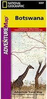
Waterproof! Botswana Travel Map. 1:1,040,000. National Geographic Maps.
The front side of the Botswana map details the northern region of the country, from Namibia to the north and west, to the bordering country of Zimbabwe to the east. The reverse side of the map details the southern region, showing the bordering country of Zimbabwe to the east, and South Africa to the south. Map size is 26 x 38" when unfolded.
64-2390
1 sheet, folded.
$11.95
Botswana Travel Maps - Paper Maps
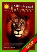
Botswana Travel Map. Veronica Roodt. The map has the main map on the front and 15 additional enlarged maps of tourist areas. The Kgalagadi Transfrontier Park has changed considerably since the previous edition and the area north of the Park - the Kaa Kalahari Concession - has been added as this is also a new tourist destination in Botswana. All the National Park roads have also been updated and some additional routes have been added in the Makgadikgadi Pans area. Over 300 GPS co-ordinates are supplied on these maps to make traveling easier in remote areas. Visitors are urged, however, to use these co-ordinates to stick to the main tracks and not to make shortcuts. The vegetation of Botswana is very fragile and undisciplined driving will cause tremendous damage. Shell Oil and Veronica Roodt are devoted to conservation and they trust the readers will be responsible in this respect.
Thumbnail of the front of the map Thumbnail of the reverse of the map
64-23904
1 sheet, folded.
$15.99
Botswana Road Map. 1:1,650,000. Map Studio.
This is a detailed road map of Botswana, with inset maps of Gaborone and Francistown.
Gaborone & Francistown - detailed maps on the reverse of the main map.
Detailed inset maps - Chobe National Park, Makgadikgadi and Nxai National Parks, Central Kalahari & Moremi Game Reserves, Kgalagadi Transfrontier Park, Okavango Delta.
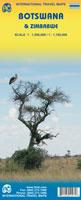
Botswana & Zimbabwe Travel Map. 1:560,000. ITMB.
This updated map adds new roads and generally more detail. The reverse side now has the map of Zimbabwe for those that want to cross the border into this ravaged country.
Botswana map sample
64-23901
1 sheet, folded
$12.95
Botswana Map Pack - Botswana and Gaborone maps. Brabys (B&T Directories Pty, Ltd), 16th ed., 2009.
This two-sheet map pack includes a basic road map of Botswana, coupled with a good city map of Gaborone. Also included are city maps of Francistown, Maun, Dumela, Broadhurst, Phakalane, Madirelo. Includes two double-sided sheets.
Botswana map sample Gaborone map sample
64-23906
1 sheet, folded
$19.99
Botswana City Maps
Botswana Map Pack - Botswana and Gaborone maps. Brabys (B&T Directories Pty, Ltd), 16th ed., 2009. This two-sheet map pack includes a basic road map of Botswana, coupled with a good city map of Gaborone. Also included are city maps of Francistown, Maun, Dumela, Broadhurst, Phakalane, Madirelo. Includes two double-sided sheets.
Botswana map sample Gaborone map sample
64-23906
1 sheet, folded
$19.99
Botswana City Street Maps. Dept. Surveys & Mapping. These maps include street names, block numbers, etc. In black/white.
64-2392G
Gaborone City Map.1:17,500. 1999. A basic map of Gaborone, not indexed.
$18.95
64-2392L
Lobatse Plot Numbers and Street Names. 1:5,000. B/W. 1987, 1st ed. 2 sheets.
$19.95
64-2392S
Selebi Phikwe Street Names and Plot Numbers. 1:5,000. 1985. ed. 1. 5 sheets.
$39.95
64-2392J
Jwaneng Plot Numbers and Street Names. ed. 2, 1992. 1:5,000.
$14.95
64-2392F
Francistown Plot Numbers and Street Names. 5 sheets. 1:5,000.
$39.95
Botswana National Park Travel Maps
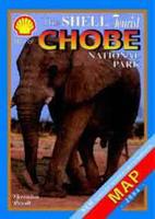
Recommended! Chobe National Park Map. 1:290,000. Veronica Roodt.
Detailed map of the Chobe National Park. The map uses satellite imagery as a base map and overprints roads and tourist information. Includes larger scale inset maps of the Chobe River, Nogatsaa, and Savute. The map contains about 250 GPS co-ordinates and distances.
Sample #1 of the Chobe map. Sample #2 of the Chobe map.
64-2370-CH
1 sheet, folded
$16.99
Recommended! Kgalagadi Transfrontier Park. 1:400,000. Veronica Roodt.
Detailed road map of the Kgalagadi Park. The map uses satellite imagery as a base map and overprints roads and tourist information. Includes insets of Kaa Kalahari concession, Mabuasehube area, plus others. The map contains about 250 GPS co-ordinates and distances.
Sample #1 from the Kgalagadi map. Sample #2 from the Kgalagadi map.
64-2370-KG
1 sheet, folded
$16.99
Recommended! Moremi Game Reserve. 1:200,000. Veronica Roodt.
Detailed road map with insets for Third Bridge, Xakaxana, Mboma Island, Khwai floodplain, and Moremi game reserve. The map uses satellite imagery as a base map and overprints roads and tourist information. The map contains about 250 GPS co-ordinates and distances.
Sample #1 from the Moremi map. Sample #2 from the Moremi map.
64-2370-MO
1 sheet, folded
$16.99
Recommended! Okavango Delta and Linyanti. Veronica Roodt.
The front of the map has a map of the entire Okavango Delta and Linyanti. The map uses satellite imagery as a base map and overprints roads and tourist information. The back of the map contains enlarged maps of all the tourist areas in the Delta where most lodges occur as well as an enlarged map of Linyanti. The map contains about 30 GPS co-ordinates and distances. Since most of the Delta is not open to self-drive tourists, GPS co-ordinates of only the main public roads and facilities on those routes were provided.
Sample detail from teh Okavango Delta map.
64-2370-OK
1 sheet, folded.
$16.99
Botswana National Park Travel Guidebooks
Trees & Shrubs of the Okavango Delta: Medicinal uses and nutritional value (guidebook). Veronica Roodt & Shell Oil Botswana.
This book is 220 pages long and consists of 62 color-illustrated tree and shrub species with numerous line drawings of plant species, birds, animals etc. There is an illustration of each tree or shrub mentioned as wells as separate drawings of the leaf, flower and fruit . The sixty-two plants chosen include all the common, most useful and most noticeable plants in the area. Most of the plants described in this book occur commonly elsewhere in southern Africa as well, especially in Namibia, Zimbabwe and the northern part of South Africa.
Although there is a section on the description of leaves, flowers, fruit etc., the author uses a holistic approach in the wider description of the plant. Each plant is described within its habitat and ecological niche – soil preference, habitat preference, the fauna associated with it, the animals, birds and insects that feed on it, medicinal and food values to humans, superstitious beliefs and there is even a short description on propagation. Additionally, there are fifty information ‘boxes’ which provide information on a variety of related subjects ranging from ‘How to create fire by friction’, ‘How to make palm wine’, ‘Do animals get drunk from Marula fruits?’, ‘Poisonous snakes of Botswana’, ‘Ringworm disease’ etc.
At the back of the book is a campfire quiz, providing questions and answers on information provided in the book. The quiz is in three sections, each on a different level of advancement.
64-2395OKT
Guide.
$29.99
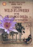
Common Wildflowers of the Okavango Delta: Medicinal uses and nutritional value. Veronica Roodt & Shell Oil Botswana.
This book is 160 pages thick and the 50 species that occur most commonly in the area are discussed. Each one of these species is illustrated by a color photograph, as well as a water-color illustration. Apart from the 50 main species, there are at least 30 additional photographs of plants that occur in the area but they are not discussed in the same detail. There are numerous line drawings and extra information boxes, containing information on related subjects such as diseases, plant poisons, natural insect repellents, natural dyes etc. There are very interesting information about superstitions and traditions of the people of the Okavango.
Like in the tree book, the author has used a holistic approach, describing each species within its habitat and the purpose it serves within that habitat. Flowering herbs of the Okavango are very rich in chemicals and many of them are used medicinally. The author collected information on their medicinal and food values from the local tribes. There is also information on the habitat preference of these plants, plants associated with them, animals and birds that feed on them, insects associated, poisonous values, medicinal values, food values etc.
At the back of the book is a campfire quiz, providing questions and answers on information provided in the book. The quiz is in three sections, each on a different level of advancement.
64-2395OKW
Guide.
$29.99
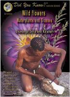
Wildflowers, Waterplants and Grasses of the Okavango Delta and Kalahari Guidebook. Veronica Roodt.
A handy, easy-to-use guidebook for tour guides, tourists and students - ideal for game walks and easy size to carry in a suitcase. A small pocketsized book limits the amount of information and the size of the photographs. A compromise was therefore reached by limiting the number of pages and placing three plants on a page.
There is a separate 'quick reference' photographic list of the water plants with page references on pg 6-8. The grasses were placed in a separate section (pg 98-119).
The rest of the book is colourcoded as to plant type. The book includes 322 plant species.
Each colour group is presented in alphabetical family groups starting for example with the Asteraceae and ending with Zygophyllaceae. These families are indicated in the colour strip at the bottom of the page. This arrangement has the unfortunate consequence that all the members of one family do not appear together in the book. However, on pg 3 and 4 all plants in this book are listed in their family groups, with page references.
Sample detail of the Wildflowers of the Okavango Delta
64-2395OWW
Guidebook.
$23.99
Botswana Travel Guides
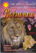
The Shell Tourist Travel and Field Guide of Botswana. Veronica Roodt & Shell Oil Botswana.
A detailed travel and field guide to Botswana. The guide contains 57 maps including satellite image maps, an extensive wildlife checklist for photography, airstrips with GPS coordinates, descriptions of towns and villages, descriptions of things to see and do in both dry and wet seasons, and much more. 244 pages, softcover.
64-2395RO
Guide.
$30.99
Botswana Travel Guide. Bradt.
Botswana's Okavango Delta is a wetland paradise and a top destination in Africa for wildlife enthusiasts who will delight in the thorough coverage of this new Bradt guide. The Okavango's unique ecosystem provides a habitat for a multitude of birdlife and plants and its swampland is patrolled by hippos and crocodiles. The lure of Chobe National Park as a prime conservation area, the Linyanti Swamp, central Kalahari Game Reserve, and Tsodilo Hills with their wealth of bushman, rock art, are also covered in depth, supplying visitors with a wide range of very accessible attractions and a background to the culture and people of the region. Botswana is an ideal guide for visitors heading for lodges and safari camps, either as overlanders exploring the wilderness Botswana or those on tailor-made tours and fly-drive trips.
The author recognizes the bewildering choice facing the visitor planning a trip to this major safari destination and provides independent guidance on travel options.
64-2395BR
Guide.
$25.95
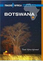
Botswana Self-Drive Guidebook. Tracks4Africa. These guide books are specifically aimed at self-drive travellers that like to roam African via their own transportation. This guide advises you on matters like planning your trip, navigation, preparing your vehicle, buying the right equipment for travelling into remote areas and staying in contact with the rest of the world when you are on the road.
If you are a self-drive tourist, there are five things that you need to know when you are on the road:
Recommended! Namibia & Botswana Lodging and Camping Directory. Track4Africa. The book is printed in full colour on high quality paper and comprises 1082 listings spread over more than 250 pages. A short description is given of each travel region to help you plan your trip. We believe that this easy to use and well organised directory will enable you to find whatever type of accommodation you are looking for, be it in the most touristymost remote areas of Namibia or Botswana.
For Botswana there are total of 293 listings which is made up of 116 camp sites and 177 lodgings. Namibia has a total of 780 listings with 212 camp sites and 577 lodgings. Typical information provided for each listing includes a short description, type of accommodation, contact details, rates, facilities and activities. For out of town listings we also give the distance and estimated travel time from the town centre.
All camping and lodging listed in the guide are noted in the Tracks4Africa GPS map chip for Garmins (see elsewhere on this page for the GPS map chip). Each listing also has a grid reference for where it occurs on the paper maps, although not all listings are shown on the map due to the map scale.
This is the same guide listed below in the Namibia section.
Sample detail from the Namibia & Botswana Lodging Guide Sample detail from the Namibia & Botswana Lodging Guide
65-0395LO
Guidebook.
$39.99
Mammals of Botswana Guidebook. Veronica Roodt.
This book is a handy, easy-to-use guidebook for tour guides, tourists and students - ideal for game walks and an easy size to carry in a suitcase. A small pocket- sized book limits the amount of information and the size of the photographs, so a compromise was reached by limiting the number of pages to one page per animal.
The first section of the book (pg 3 to pg 26), provides information on the anatomy and physiology of mammals. The skeleton and skull are described in detail with photographs and illustations and there is information on skull muscles, dentition, locomotion, senses, reproduction, digestion and thermoregulation.
In the identification section (pg 27 to pg 120), one page is allocated to each animal. There is at least one photograph per animal, but where possible, two (male and female). Photographs of the droppings and skull and a sketch of the spoor are provided for each animal. The droppings were photographed with a match-stick for scale and the spoor include measurements.
Distribution maps for the Southern African subregion as well as one for Botswana accompany each animal. This will make the book useful in other areas as well. The animal names occur in English, Setswana, German, Afrikaans, Spanish, French and Italian (with only a few exceptions).
The basic information on weight, gestation, habitat, food, social structure, etc., is summarized in a separate block for each animal. The dental formula is also included in the summary and the formula is explained on pg 13. The 'Did you know?' section contains additional interesting facts about the animal.
Sample detail of the Mammals of Botswana guide
64-2395MA
Guidebook.
$23.99
The Safari Companion: A Guide to Watching African Mammals Including Hoofed Mammals, Carnivores, and Primates. Chelsea Green Publishing Co., 1999. Anyone who goes on safari will want to make room in his or her suitcase for this treasure. Estes, who is affiliated with Harvard University and the Smithsonian Institute as a research associate, spent over eight years doing fieldwork in Africa and over 17 years leading safaris. His admirable qualifications as an expert on the social ecology of African mammals are reflected in the text, which describes approximately 86 species of African mammals. Introductory chapters give practical advice on how to observe animals, including tips on using binoculars and photographic equipment. Other chapters are arranged by standard taxonomic classification. Estes first covers the characteristics of families and subfamilies and then goes into even more detail on the individual species, charting behaviors one can expect to see and the usual context or meaning.
Icons illustrating the behaviors effectively take the reader to a description of the behavior being observed. Appended to the text are a brief suggested reading list, addresses of major wildlife organizations, a glossary of terms, and a thorough index.
66-1795SA
Guide.
$29.95
Botswana Topographic Maps
Botswana Topographic Maps - TPC/Tactical Pilotage Charts & ONC/Operational Navigation Charts. 1:500,000 & 1:1,000,000. NGA. World Aeronautical Charts, including TPC and ONC charts, cover land areas at a standard size and scale for navigation by aircraft operating at high altitudes. However, their level of detail makes them useful as topographic maps for those areas where little else is available. The topographical information includes city tints, principal roads, railroads, distinctive landmarks, drainage patterns, topography and relief. contour lines are at 500 feet intervals, with intermediate contours where appropriate, along with numerous spot heights. Color tints on a hypsometric scale are also shown. The aeronautical information includes visual and radio aids to navigation, airports, airways, restricted areas, obstructions and other pertinent data. There is less detail in some areas due to insufficient information - these areas are labelled on the charts. These are large maps, with typical size of 42 x 56 inches. Due to the size and color variation of the different print runs and the Conformal Conic Projection, these maps do not splice together well. World Aeronautical Charts are not recommended for use by pilots of low speed, low altitude aircraft.
Index showing sheet coverage Sample from the TPC series (image is from a sheet covering Korea) Sample from the ONC series (image is from a sheet covering Korea)
67-1055-P04B
TPC Chart P04B. Angola/Botswana/Namibia/Zambia/Zimbabwe. South 16°-24°, East 23°-29°.
$34
67-1055-Q04B
TPC Chart Q04B. Botswana/Namibia/South Africa. South 24°-28°, East 19°-25°.
$34
67-1055-Q05A
TPC Chart Q05A. Botswana/South Africa/Swaziland. South 24°-28°, East 25°-31°.
$34
1:1,000,000 ONC charts.
67-1056-P04
ONC chart P04. South 16°-24°, East 17°-29°.
$34
67-1056-P05
ONC Chart P05. Africa. South 16°-24°, East 29°-41°.
$34
67-1056-Q04
ONC Chart Q04. Africa. South 24°-32°, East 13°-25°.
$34
Botswana Planimetric Quadrangle Maps. 1:500,000. 1962-1971. DOS (847), Britain. This 11 sheet map set offers complete coverage of Botswana. The maps are in English, with color, but lack contours.
64-2350
Each
$18.95
Botswana 1:250,000 Planimetric Quadrangle Maps. 1:250,000. BSD/OSD. These maps lack contour lines. The older black/white series (1979-1981 typically) have sheet numbers in the IMW series, such as SF-34-7. The newer color series are numbered as below; 1-41.
Index map. Sample of the black/white sheets. Sample of the color sheets.
Botswana 1:200,000 Topographic Quadrangle Maps. 1:200,000. Soviet government. High quality topographic maps with good detail. This set gives complete coverage of Botswana in 121 sheets. In Russian. Available as original paper maps, non-georeferenced raster files, and georeferenced raster files.
64-23503
Set of 121 sheets as non-georeferenced raster files.
$1452.00
Botswana Planimetric Quadrangle Maps. 1:125,000 and 1:100,000. 1958-1983. DOS (547), Britain. These maps offer coverage of the north, northwest, and southeastern sections of the country. The maps are in English, with color but lacking contour lines. The 1:100,000 series are satellite image maps.
Sample of a 1:125,000 planimetric map. Sample of a 1:100,000 satellite image map.
64-2351
Each, 1:125,000
$18.95
64-2352
Each, 1:100,000
$18.95
Botswana Topographic Quadrangle Maps. 1:50,000. BSD. The 5-color topographic maps cover various parts of Botswana, with 214 sheets currently available. On the index map, the blue number in the quad is the date of publication of that quad. Only those quads with dates in them are available.
64-2353
Per sheet, specify area
$18.95
Botswana National Atlas
Botswana National Atlas - CD-ROM edition. 1st ed., 2001. 404 pages. Dept. Surveys & Mapping. 29 chapters covering environment, industry, commerce, development activity. Only available as a CD-ROM.
64-2347D
Atlas, CD-ROM edition.
$50.00
Botswana Geologic and Thematic Maps
Botswana Bouguer Gravity Map. 1:1,000,000. 1976. Geological Survey Department. This 2-sheet map illustrates Bouguer gravity anomalies contoured in 100 gravity units. The map measures 108 x 110 cm.
64-2312
2 sheets, folded
$9.95
Botswana Geologic Quadrangle Maps. 1:125,000. Geological Survey Department. 34 sheets currently in print.


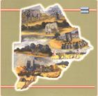

 Sample detail of the Botswana Travel Map
 Waterproof!
 Thumbnail of the front of the map
 Thumbnail of the reverse of the map
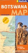
 Sample of the map detail.
 Botswana map sample
 Botswana map sample
 Gaborone map sample
 Sample #1 of the Chobe map.
 Sample #2 of the Chobe map.
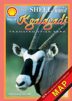 Recommended!
 Sample #1 from the Kgalagadi map.
 Sample #2 from the Kgalagadi map.
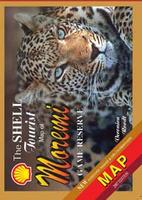 Recommended!
 Sample #1 from the Moremi map.
 Sample #2 from the Moremi map.
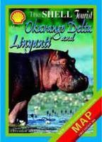 Recommended!
 Sample detail from teh Okavango Delta map.
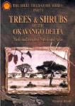
 Sample detail of the Wildflowers of the Okavango Delta
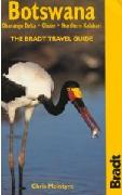
 Sample detail of the Botswana Self-Drive Guidebook
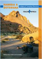 Recommended!
 Sample detail from the Namibia & Botswana Lodging Guide
 Sample detail from the Namibia & Botswana Lodging Guide
 Sample detail of the Mammals of Botswana guide
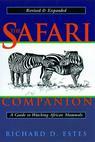

 Index showing sheet coverage
 Sample from the TPC series (image is from a sheet covering Korea)
 Sample from the ONC series (image is from a sheet covering Korea)
 Index map.
 Sample of the black/white sheets.
 Sample of the color sheets.
 Sample of a 1:125,000 planimetric map.
 Sample of a 1:100,000 satellite image map.