Waterproof! Zambia Road Map. 1:1,000,000. Reise Know-How. This map combines topographic mapping with road and tourist detail. The road information is clear and elevation is shown using contours, spot heights and altitude shading. The map shows six different types of roads, highlighting scenic routes, places of interest, archaeological sites, monasteries, monuments and viewpoints.
65-58904
1 sheet, folded.
$15.99
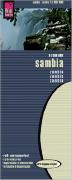
Zambia Travel Map. 1:1,500,000. ITMB. Good quality folded travel map with color-shaded relief to show elevation.
Detail of the map.
65-58901
1 sheet, folded
$12.95
Zambia City Maps. 1984-1989. Survey Department, Zambia. These are good quality color street maps without indexes.
65-5892CI
Chingola. 1:15,000.
$14.95
65-5892KI
Kitwe. 1:15,000.
$14.95
65-5892M
Mufulira. 1:10,000.
$14.95
65-5892N
Ndola. 1;15,000.
$14.95
Zambia Atlases
Zambia National Atlas Series. Survey Department, Zambia. The National Atlas is a loose-leaf atlas first produced in the late 1960's. Some sheets were issued as new editions in the late 1980's. We have limited stock of the sheets listed below and no new stock is expected.
New Series. 1:3,000,000. 1986-.
65-5848-04
Population Growth. Sheet #4. 1986.
$10.00
65-5848-17A
July Mean Temperature. Sheet 17A. 1987.
$10.00
65-5848-26
Educational Facilities. Sheet 26. 1987.
$10.00
Old Series. 1:2,500,000. 1966-1976.
65-5848-02
Central African Communication. Sheet 2. 1966.
$10.00
65-5848-17
Annual Temperature Range. Sheet 17. 1976.
$10.00
65-5848-18
Relative Humidity. Sheet 18. 1968.
$10.00
65-5848-19
Sunshine. Sheet 19. 1967.
$10.00
Zambia Topographic Quadrangle Maps
Zambia Topographic Quadrangle Map. 1:250,000. Survey Department, Zambia. 1971-. There are only about 30 of the 54 sheets currently in available.
65-5850
Per sheet, specify area
$21.95
65-5851
Set of 46 sheets
$822.80
Zambia Topographic Quadrangle Maps. 1:100,000. Survey Department, Zambia. This series covers southwestern Zambia. There is no overlap with the 1:50,000 topographic maps listed below.
65-5852
Per sheet
$19.95
Zambia Topographic Quadrangle Map. 1:50,000. 1949- continuing series. DOS (424) + ZS. This series covers most of the country, except for southwestern Zambia, which is covered by 1:100,000 topographic maps. We have very few sheets left and will not be getting any new stock.
Zambia 1:50,000 topo index - east half. Large file.
Zambia 1:50,000 topo index - west half. Large file.
65-5854
Per sheet, specify area
$19.95
Zambia Geologic Maps
Zambia Geologic Quadrangle Map. 1:250,000. 1984-. Geological Survey of Zambia (1217). This series will eventually give complete coverage of the country; twelve sheets are now available.
65-5855
Each, folded
$14.95
Zambia Geologic Quadrangle Maps. 1:100,000. Geological Survey of Zambia. This older series will eventually be replaced by the 1:250,000 maps above.


 Waterproof!


 Detail of the map.
 Zambia 1:50,000 topo index - east half.
 Zambia 1:50,000 topo index - west half.