For over 85 years National Geographic has mapped the world, setting the standard in cartographic excellence. From the remote jungles of Africa to the far reaches of the Universe, their extensive line of reference and wall maps is your key to discovering more about our world.
The National Geographic Maps listed below are available as plain paper maps or laminated maps
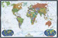
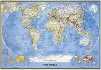
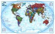
Colorful and bold - countries easily identified. Enjoy the accuracy and beauty of the latest world map from the cartographers at National Geographic. This map features the Winkel Tripel projection. The Decorator map has spectacular color and detail to bring the world alive. Ideal for home, office, or school.
Thumbnail of the entire map Sample map detail #1 Sample map detail #2
Small Size - paper and/or laminated
$16.99
67-10536
World Political Map, Winkel projection. 1:38,931,000. 46 x 30".
$29.95
67-10536L
World Political Map, laminated.
Large Size - paper and/or laminated
$34.99
67-10537
World Political Map, Winkel projection - large size. 1:24,000,000. 73 x 48".
$59.99
67-10537L
World Political Map - large size, laminated.
Classic National Geographic World Map! World Political Map. This famous map features the Robinson projection, which minimizes distortion relative to shapes, distances and perspective. Insets of physical hemispheres, polar views, vegetation and land use, and population density. Available in three sizes.
Small size - 43-1/2" x 30-1/4". Huge size - 71-1/4" x 50". Mural size - 110" x 76" (9' 2" x 6' 4"). An image of the full map A detail of the map A sample of the legend
Small Size - paper and laminated
$14.99
67-10530
Small size - 43-1/2" x 30-1/4". Rolled.
$24.99
67-10530L
Small size - laminated.
Large Size - paper and laminated
$34.99
67-10531
Large size - 71-1/4" x 50".
$59.99
67-10531L
Large size - laminated.
Wall Mural Size - wall paper
$99.99
67-10532
Mural size - 110" x 76" (9' 2" x 6' 4"). 1:15,267,000. This supersized panorama comes boxed in three sections and hangs like wallpaper. Printed on latex-coated paper stock.
Classic Pacific-Centered World Map by National Geographic! World Political Map. This famous map features the Robinson projection, which minimizes distortion relative to shapes, distances and perspective. Insets of physical hemispheres, polar views, vegetation and land use, and population density. Available in three sizes.
Small size - 43-1/2" x 30-1/4". Huge size - 71-1/4" x 50". Mural size - 110" x 76" (9' 2" x 6' 4"). An image of the full map A detail of the map A sample of the legend
Small Size - paper and laminated
$14.99
67-10530
Small size - 43-1/2" x 30-1/4". Rolled.
$24.99
67-10530L
Small size - laminated.
Large Size - paper and laminated
$34.99
67-10531
Large size - 71-1/4" x 50".
$59.99
67-10531L
Large size - laminated.
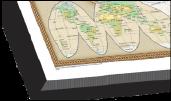
World Maps - Executive Style (Antique style).
Current information with an old look. Enjoy the accuracy and beauty of the latest world map from the cartographers at National Geographic. This map features the Winkel Tripel projection and has elegant, rich tones that will complement any office or home. Astounding detail and board room quality make these maps excellent for reference or as a keepsake for your map library. This is a current political map featuring an antique style. 43'' x 30''.
Winner of the 2001 Premier Print Award from Printing Industries of America for "a unique ability to create visual masterpieces"
Winner of the 2002 Best Reference Map from the American Congress on Surveying & Mapping.
Small Size - paper and laminated
$16.99
67-10538
World Political Map, Winkel projection. 1:38,931,000. 46 x 30".
$24.99
67-10538L
World Political Map - small size, laminated. 46 x 30".
Large Size - paper and laminated
$34.99
67-10539
World Political Map, large size. 1:24,000,000. 70 x 49".
$59.99
67-10539L
World Political Map - large size, laminated. 73 x 48".
Wall Mural Size - paper
$99.99
67-10539M
World Political Map - wall mural size. 116 x 76"
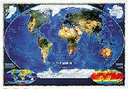
World Satellite Map. 1:39,000,000. The most accurate map of Earth's surface yet produced from satellite data. This computer-generated composite map draws from more that 500 images to give one-kilometer detail and consistent representation of natural colors.
$12.99
67-10542
World Satellite Image Map. 1:39,000,000. 44 x 30".
$24.99
67-10542L
World Satellite Image Map, laminated. 44 x 30".
World Explorer Map. Enjoy the accuracy and beauty of the latest world map from the cartographers at National Geographic. Map features Winkel Triple projection to reduce distortion of land masses as they near the poles. Features include charts listing largest cities by population and the largest countries in the world by land mass and population.
$5.99
67-10540
World Explorer Map, folded. 32 x 20".
$9.99
67-10541
World Explorer Map, flat/rolled. 32 x 20".
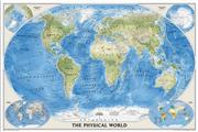
World Physical - Ocean Floor Map. This classic world map highlights land and undersea forms with dramatic relief. Insets depict currents, winds and Earth's crust. Available in two sizes:
Standard size - 43-1/2" x 30-1/4". Huge size - 71 x 50". An image of the full map A detail of the map A sample of the legend
Small Size
$16.99
67-10534
Standard size - 43-1/2" x 30-1/4". Paper, rolled.
$24.99
67-10534L
Standard size - laminated.
Large Size
$34.99
67-10535
Huge size - 69" x 46". Rolled.
$59.99
67-10535L
Huge size - laminated.
Amazonia: A World Resource at Risk Map. This physical map of northern South America shows tropical and sub-tropical vegetation, industry, and land use. Accompanied by a beautiful illustration of Amazon basin wildlife, from river to canopy. ISBN 1-57262-180-X. Size is 20-1/4" x 28".
$12.95
66-2484
Flat/rolled
$29.95
66-2484L
Laminated
Endangered Earth Map. Satellite imagery, maps and text located and describe threats to the Earth and its resources. A timeline illustrates the "troubled partnership" of people and planet. ISBN 1-57262-183-4. Size is 46" x 29".
A full image of the map A detail of the map
United States Political Map, small size. 1:6,107,000. 32 x 20 inches
$9.99
62-19410
Paper.
$14.99
62-19410L
Laminated.
United States Political Map, standard size. 1:4,560,000. 44 x 30 inches
$16.99
62-19413
Paper.
$24.99
62-19413L
Laminated.
United States Political Wall Map - large size - 69 x 48 inches. 1:2,815,000.
$34.99
62-19414
Large size - paper.
$59.99
62-19414L
Large size - laminated.
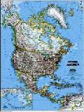
United States Political Map - Classic Style. Our most popular United States wall map. Features all 50 States with insets for Alaska and Hawaii. All major cities, transportation routes, State boundaries, National Parks, inland waterways, and mountain ranges are clearly displayed and labeled.
Standard size - 43" x 30". Large size - 69 x 48". Mural size - 110 x 76". An image of the full map A detail of the map A sample of the legend
United States Classic Style Political Map, standard size - paper and laminated. 1:4,560,000. 40" x 27"
$16.99
62-19411
Standard size - flat.
$24.99
62-19411L
Standard size - laminated.
United States Classic Political Wall Map - large size - paper and laminated. 69 x 48 inches. 1:2,815,000.
$34.99
62-19412
Large size - flat.
$59.99
62-19412L
Large size - laminated.
United States Classic Political Wall Map - mural size - wall paper. 110 x 76". 1:1,788,000.
$99.99
62-1941M
Mural size - flat.
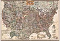
USA Political Map - Executive Antique style. Sepia-toned antique-style map with current information. Attractive map for offices, waiting rooms, and other public places.
Sample #1 Sample #2
United States Executive Style Political Map, standard size - paper and laminated. 1:4,560,000. 44" x 30"
$16.99
62-19415
United States Political Map. 1:4,560,000. 44 x 30".
$24.99
62-19415L
United StatesPolitical Map Laminated. 44 x 30".
United States Executive Political Wall Map - large size - paper and laminated. 69 x 48 inches. 1:2,815,000.
$34.99
62-19416
United States Political Map - large size. 1:2,815,000. 69 x 48".
National Geographic Adventure Road Atlas. National Geographic Maps, 2014.
National Geographic's North American Road Atlas, Adventure Edition, is the ideal companion for the next time you hit the road. Includes up-to-date road maps for all 50 U.S. States, plus Canada, Mexico, and Puerto Rico. Major cities and metropolitan areas are shown in detail with inset maps that include popular attractions, infrastructure and points-of-interest.
Mileage charts and approximate driving times between major cities are shown on each State page, as well as in a robust matrix at the back of the book.
NGS "GuideMaps". With the same laminated format as international city "Destination Maps", each GuideMap covers an individual state with detailed road maps, city insets and travel information. Folded size is 4-1/2 x 9".
View of the cover of the map. Detailed view of part of the Arizona map.
$7.95
62-52902
Alabama Guidemap.
$7.95
62-54902
Arizona Guidemap.
$7.95
62-56902N
Northern California Guidemap.
$7.95
62-56902S
Southern California Guidemap.
$6.99
62-57903
Colorado Guidemap.
$7.95
62-61903
Florida Guidemap.
$7.95
62-62904
Georgia Guidemap.
$9.95
$7.95
62-65902
Illinois Guidemap.
$7.95
62-69905
Kentucky Guidemap.
$7.95
62-71903
Maine Guidemap.
$6.95
62-73905
Massachusetts Guidemap.
$7.95
62-84904
New York State Guidemap.
$7.95
62-85909
North Carolina Guidemap.
$7.95
62-89903
Oregon Guidemap.
$7.95
62-90903
Pennsylvania Guidemap.
$7.95
62-94903
Tennessee Guidemap.
$7.95
62-95903
Texas Guidemap.
$7.95
62-96903
Utah Guidemap.
$7.95
62-98903
Virginia Guidemap.
$7.95
62-99914
Washington Guidemap.
$7.95
63-01903
Wisconsin Guidemap.
National Geographic Destination City Maps - Waterproof! Destination City Maps feature large-scale detailed city maps, richly layered with tourist and business travel locations and information. 3-D styled axonametric drawings show famous buildings and landmarks for easy orientation. Each Destination City Map is also a travel guide, featuring regional maps, top attractions, airport diagrams, travel tips, transit maps, street indexes, and much more. Multi-language legends are included on each international map.
Printed on waterproof, tear-resistant synthetic paper.
Newly revised!
Detailed and easy to read.
Includes tourist and business travel information.
3D drawings of famous buildings.
Regional maps and top area attractions.
Airport diagrams and transit/subway maps.
Printed on waterproof, tear-resistant synthetic paper.
United States Territorial Growth Map. 1987. Seven sequential insets chart the growth of the USA over time and show territorial acquisitions. Features a reproduction of Abel Buell's 1783 map of the USA. Size is 43-1/2" x 30-1/2". ISBN 1-57262-144-3.
An image of the full map A detail of the map A sample of the legend
$16.95
62-1944
Flat/rolled.
$25.95
62-1944L
Laminated
Mesoamerica Historical Map. National Geographic Society. About 1200 B.C., when the Trojan War was being fought half a world away, an agrarian people raising maize, beans, and squash began to build the first of many independent city-states in Mesoamerica. This double-sided map is an excellent reference to these amazing civilizations. Side one shows an artistic rendering of the ancient Mayan city of Palenque, several drawings of artifacts, as well as a timeline and facts about the region from 1200 B.C. to 1600 A.D. Side two displays a large map of ancient Mesoamerica detailing where ruins can be found, as well as five inset maps detailing civilizations, cities and states, trade and natural resources.
Bird Migration in the Americas Map. 1:20,000,000. National Geographic Society. This National Geographic classic shows the mystery of bird migration and the incredible journeys that birds undertake in the Americas each year. 67 types of birds that migrate are shown on a map of the Americas that is overlaid with pathways that show migration routes from nesting grounds to wintering areas. Full-color bird paintings by noted illustrator Arthur Singer show each of the 67 species, making it easy to identify birds as they fly their amazing journeys.
Thumbnail view of the map
$14.99
66-23371
1 sheet, rolled.
Spain in the Americas Map. 1:15,040,000. National Geographic Society. In 1493, after his triumphant voyage of discovery in 1492, Columbus returned to the Americas with 17 ships and a thousand men under his command, beginning the Spanish conquest in the Americas. Spain in the Americas combines maps with hundreds of facts to make this a fascinating historical resource. Included are maps showing trade and slave routes, notable campaigns of conquest, and interesting facts about the people who were most influential in changing the course of history in the Americas.
Thumbnail view of the map
$14.99
66-23372
1 sheet, rolled.
Native American Heritage Map. 1991. This visitor's guide lists tribal centers, museums, and archaeological and historic sites. An overview map locates these places along with selected Indian reservations and national parks. Printed on both sides. Size is 29" x 20-1/2". ISBN 1-57262-142-7.
An image of the full map A detail of the map A sample of the legend
$14.99
62-19451
Flat/rolled
$19.95
62-19451L
Laminated.
Battlefields of the Civil War Map. This highly annotated map tracks the offensives, battles and campaigns of the War Between the States. Includes insets of major battles. Double-sided. Size is 30" x 23-1/4". ISBN 1-57262-138-9.
An image of the full map An image of the reverse side
$16.99
62-1946
Flat/rolled.
$24.99
62-1946L
Laminated.
Alaska Map. Combining political and physical features, this map locates national parks and wildlife refuges. An inset compares Alaska's size to the lower 48 states. Size is 38" x 23". ISBN 1-57262-137-0.
An image of the full map A detail of the map
$19.99
62-53492
Flat/rolled
$29.99
62-53492L
Laminated.
Hawaii Map. This striking shaded relief map depicts the islands and the ocean floor with a three-dimensional appearance in vivid color. Includes lava fields. Size is 34-1/2" x 22-1/2". ISBN 1-57262-140-0.
An image of the full map A detail of the map A sample of the legend
$14.99
62-63492
Hawaii Map Flat/rolled
$19.99
62-63492L
Hawaii Map Laminated.
Pearl Harbor Historic Map. National Geographic Society. National Geographic's 60th Anniversary Commemorative Map of the attack on Pearl Harbor includes authoritative text with detailed descriptions of each wave of the attack. Spectacular aerial photos show the massive destruction in the Harbor following the attack. The flip side includes a re-print of National Geographic's Theater of War in the Pacific map, first published in February 1942. Size 21 x 31", double-sided.
Thumbnail view of the front side Detail of the map
$14.99
62-6379
1 sheet, rolled.
Heart of the Grand Canyon Map. A large-scale map showing the Canyon in exquisite detail with shaded relief and topographic contours. Based on field surveys by famed cartographer Bradford Washburn. Size is 35" x 37-3/4". ISBN 1-57262-141-9.
An image of the full map A detail of the map
$19.99
62-54492
Flat/rolled
$27.95
62-54492L
Laminated.
North America in the Age of Dinosaurs Map. 1994. Looking for a different map of North America? Try the Mesozoic era! Locations of dinosaur fossil discoveries, beautiful illustrations, and adescriptions of the dinosaurs themselves. Available in two sizes.
Standard size - 22-1/4" x 30-1/2". ISBN 1-57262-181-8.
An image of the full map A detail of the map
$14.99
66-23361
Flat/rolled.
$19.95
66-23361L
Laminated.
International Country and Region Maps
Afghanistan, Pakistan, and the Middle East map. National Geographic Maps. This finely detailed political map shows up-to-date country boundaries and place names, as well as beautiful shaded relief.
The map covers a broad geographic area ranging from northern Africa through the Middle East to the western edge of China and India. Includes complete coverage of Afghanistan, Pakistan, Tajikistan, Iran, Iraq, Kuwait, Syria, Israel, Jordan, Lebanon, Saudi Arabia, Qatar, Bahrain, United Arab Emirates, Yemen, Oman, Cyprus, and Eritrea.
Also includes parts of India, China, Kyrgyzstan, Uzbekistan, Turkmenistan, Azerbaijan, Armenia, Turkey, Egypt, Sudan, Ethiopia, and Djibouti. Measures 30" x 23". Scale: 1 inch = 96 miles.
An image of the full map A detail of the map
$14.99
64-0646
Afghanistan, Pakistan, and the Middle East map Flat/rolled
$24.99
64-0646L
Afghanistan, Pakistan, and the Middle East map Laminated
Afghanistan & Pakistan - Land in Crisis. National Geographic Maps. Featured in the December 2001 NATIONAL GEOGRAPHIC magazine. One side shows Afghanistan, Pakistan and parts of bordering countries. The reverse side depicts the history, landscape, and peoples of Afghanistan.
Side One: Afghanistan & Pakistan. Features a highly detailed political map of Afghanistan, Pakistan, and surrounding countries, as well as flags and facts for Afghanistan, Iran, Pakistan, Tajikistan, Turkmenistan, and Uzbekistan. (Scale: 1 inch = 53 miles)
Side Two: Afhganistan: Land in Crisis. This side shows a captivating satellite image of the country and includes mini-maps of Afghanistan's ethnic minorities, droughts and earthquakes, and refugees from war and famine. A historical timeline traces major events in the region, and 15 full-color photographs depict the landscape and its peoples. Measures 31" x 20".
An image of the front of the map A detail from the main map
$16.99
64-0645
Flat/rolled
$19.99
64-0645L
Laminated
The Balkans Map. 1:2,850,000. National Geographic Society. Study the countries of the Balkans with this up-close, detailed look at political boundaries for the region, as well as country flags and facts, history, and helpful inset maps. Size is 30 x 20".
Thumbnail view of the map
$11.99
66-2268
1 sheet, rolled.
$19.99
66-2268L
1 sheet, laminated.
Canada Map. One side shows a traditional political map of Canada, while the reverse side provides descriptions and illustrations of Canada's vacationlands and tourist attractions. Printed on both sides. ISBN 1-57262-159-1. Size 34" x 23".
An image of the reverse side of the map A detail of the map A sample of the legend
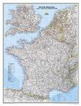
France, Belgium & the Netherlands Map. National Geographic Map's classic wall map of France, Belgium, and the Netherlands shows political boundaries, major highways and roads, cities and towns, and a wealth of other incredibly accurate geographic detail.
Measures 30" x 23". Scale: 1 inch = 31 miles.
An image of the full map A detail from the map
Iraq Map. National Geographic Maps. This timely two-sided map of Iraq and the Middle East features a wealth of geographic, political, natural resource, and cultural information.
The front of the map features an incredibly accurate, detailed map of political boundaries, cities and towns, major roadways, bodies of water, oil fields and pipelines, and other geographic features. Side One also includes city insets that show street plans and describe the history and cultures of Baghdad, Beirut, Damascus, and Jerusalem.
The map's reverse side shows an eye-catching satellite view of the region, as well as fact boxes that show each country's flag, population, economy, oil reserves, military strength, and include a brief historical and cultural description of each country. Three thematic maps also cover the region's historical conflicts, geographic concentrations of religions, and natural resources.
Measures 36" x 23". Scale: 1 inch = 31 miles.
Thumbnail view of the entire map. Detailed view of part of the map.
North and South Korea: The Forgotten War Map. 1:1,357,000. 2003. This two-sided map of North Korea and South Korea explores the historical and ongoing political challenges of this region. One side displays a detailed political map and inset maps on population, economy, and armaments. The reverse side features pictures and maps of the Korean War, as well as a colorful relief map that reveals the rugged physical geography of the Korean peninsula. New place-names introduced by the South Korean government are shown--changing places such as Pusan to Busan and Cheju to Jeju. Map size 23" x 36".
An image of the full map A detail of the map
Spain & Portugal wall map. National Geographic Maps. The wall map of Spain and Portugal shows both countries in incredible detail. Also included are inset maps for major cities and surrounding islands.
Measures 33" x 22". Scale: 1 inch = 33 miles.
An image of the full map A detail from the map
National Geographic Destination City Maps - Waterproof! Destination City Maps feature large-scale detailed city maps, richly layered with tourist and business travel locations and information. 3-D styled axonametric drawings show famous buildings and landmarks for easy orientation. Each Destination City Map is also a travel guide, featuring regional maps, top attractions, airport diagrams, travel tips, transit maps, street indexes, and much more. Multi-language legends are included on each international map.
Printed on waterproof, tear-resistant synthetic paper.
Newly revised!
Detailed and easy to read.
Includes tourist and business travel information.
3D drawings of famous buildings.
Regional maps and top area attractions.
Airport diagrams and transit/subway maps.
Printed on waterproof, tear-resistant synthetic paper.
Antarctica Map. This map is enhanced by subglacial information and an inset of territorial claim treaties. ISBN 1-57262-147-8. Size 26-1/4" x 20-1/2".
An image of the full map A detail of the map
Europe Political Map, antique executive style. Make a statement with the newest addition to our European Wall Map library. The rich tones of the Political Executive map combine the popular antique look with up-to-date information so that you have a map that is elegant enough for the board room, study, or office, and contemporary enough to make it an ideal reference.
Two sizes: standard size, 30" x 24" - Scale: 1 inch = 133 miles, and enlarged size, 46" x 36" - Scale: 1 inch = 86 miles.
An image of the full map A detail of the map
The Moon Map. 1995. A relief mapof Earth's moon, pinpointing the landing sites of manned explorations. Includes an index of craters plus illustrations of moon phases. ISBN 1-57262-252-0. Size 42-1/2" x 28-1/2".
An image of the full map A detail of the map
$19.99
67-7751
Flat/rolled
$34.95
67-7751L
Laminated
Mars, the Red Planet Reference Map. National Geographic Maps. See Mars as it really looks, from the heights of Olympus Mons (nearly 70,000 feet above the surface), to ancient canyons, to Hellas Planitia, the lowest point on Mars, where a meteorite punched a hole in the surface 1,300 miles wide and five miles deep. Mars Revealed was created for National Geographic with over 1,000 images taken by the Mars Orbiter Camera, and merged with 330 million elevation points to create the sharpest view yet of Mars and its spectacular terrain. Size is 20 x 31", double-sided.
An image of the front side of the map An image of the reverse side of the map A detail from the map
$19.99
67-7849
Flat/rolled
$24.99
67-7849L
Laminated
The Solar System Map. This chart diagramsthe positions and orbits of the planets, with illustrations of all planets and moons, accompanied by descriptive text. Printed on both sides. ISBN 1-57262-253-9. Size 24-1/4" x 18-1/4".
An image of the front of the map An image of the reverse of the map

 Thumbnail of the entire map
 Sample map detail #1
 Sample map detail #2
 An image of the full map
 A detail of the map
 A sample of the legend
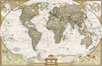


 An image of the full map
 A detail of the map
 A sample of the legend
 A full image of the map
 A detail of the map
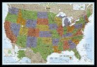
 Thumbnail image of the entire map
 Sample of the map detail
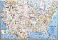 United States Political Map - Classic Style. Our most popular United States wall map. Features all 50 States with insets for Alaska and Hawaii. All major cities, transportation routes, State boundaries, National Parks, inland waterways, and mountain ranges are clearly displayed and labeled.
 An image of the full map
 A detail of the map
 A sample of the legend
 Sample #1
 Sample #2
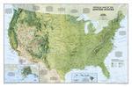
 A full image of the map
 A detail of the map
 A sample of the legend
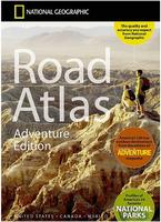
 Sample of a text page from the North America road atlas
 Sample of a map page from the North America road atlas
 Sample detail of North America road atlas
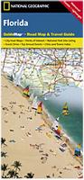 Waterproof!
 View of the cover of the map.
 Detailed view of part of the Arizona map.
 Sample of the map detail from the Boston map
 Sample of the text and inset maps from the Florence map
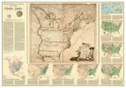
 An image of the full map
 A detail of the map
 A sample of the legend
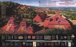
 Thumbnail view of the front side of the map
 Thumbnail view of the reverse side of the map
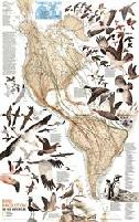
 Thumbnail view of the map
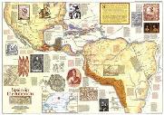
 Thumbnail view of the map
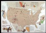
 An image of the full map
 A detail of the map
 A sample of the legend
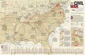
 An image of the full map
 An image of the reverse side
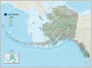
 An image of the full map
 A detail of the map
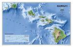
 An image of the full map
 A detail of the map
 A sample of the legend
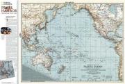
 Thumbnail view of the front side
 Detail of the map
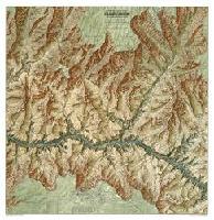
 An image of the full map
 A detail of the map
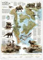
 An image of the full map
 A detail of the map
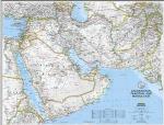
 An image of the full map
 A detail of the map
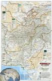
 An image of the front of the map
 A detail from the main map
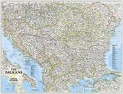
 Thumbnail view of the map
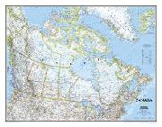
 An image of the reverse side of the map
 A detail of the map
 A sample of the legend
 View of the front of the map.
 Detailed view of part of the map.
 Detailed view of the scale bar of the map.
 An image of the full map
 A detail of the map
 A sample of the legend
 An image of the full map
 A detail from the map
 An image of the full map
 A detail of the map
 A sample of the legend
 Thumbnail view of the entire map.
 Detailed view of part of the map.
 Thumbnail view of the entire map.
 Detailed view of part of the map.
 Thumbnail of the front of the map.
 Thumbnail view of the reverse of the map.
 Detailed view of part of the map.
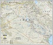
 Thumbnail view of the entire map.
 Detailed view of part of the map.
 An image of the full map
 A detail of the map
 An image of the reverse side
 A sample of the legend
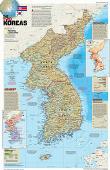
 An image of the full map
 A detail of the map
 An image of the full map
 A detail of the map
 A sample of the legend
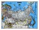
 An image of the full map
 A detail of the map
 A sample of the legend
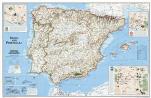
 An image of the full map
 A detail from the map
 An image of the full map
 An image of the reverse side of the map
 A detail of the map
 A sample of the legend
 An image of the full map
 A detail of the map
 A sample of the legend
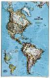
 Thumbnail view of the front of the map.
 Detailed view #1 of part of the map.
 Detailed view #2 of part of the map.
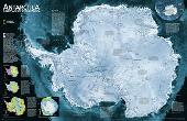
 An image of the full map
 A detail of the map
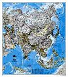
 An image of the full map
 A detail of the map
 A sample of the legend
 An image of the full map
 A detail of the map
 A sample of the legend
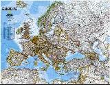
 An image of the full map
 A detail of the map
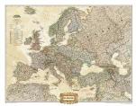
 A full image of the map
 A detail of the map
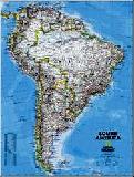
 An image of the full map
 A detail of the map
 A sample of the legend
 An image of the full map
 A detail of the map
 A sample of the legend
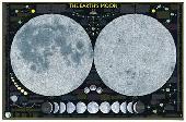
 An image of the full map
 A detail of the map
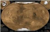
 An image of the front side of the map
 An image of the reverse side of the map
 A detail from the map
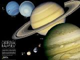
 An image of the front of the map
 An image of the reverse of the map
 An image of the full map
 A detail of the map
 A sample of the legend