We particularly like the Trails Illustrated maps, which are printed on Polyart, a tear-resisitant, waterproof plastic using up-to-date information. Trails Illustrated starts with the most current USGS topographic maps, then adds roads and trail information, along with information about hiking, biking,
skiing, boating, and trails, and prints them on waterproof Polyart(TM) "paper". Trails Illustrated has several different series; a National Park series; an excellent trail map series for Colorado and Utah; a mountain-biking
series; and an American Discovery Trail series. Most maps are updated either every year or every other year, insuring the most up-to-date maps available. We recommend these maps highly. The maps come
folded to a convenient 4 x 9" size.
Merced & Toulumne River hiking map. #808. 1:63,360.
$14.95
63-2100-256
Mohave National Preserve hiking map. #256. 1:125,000.
$14.95
63-2100-266
Mount Tamalpais & Point Reyes hiking map. #266. 1:45,000.
$11.95
63-2100-322
Mount Whitney hiking map. #322. 1:40,000.
$14.95
63-2100-218
Redwood National Park hiking map. #218. 1:70,000.
$11.95
63-2100-253
Santa Monica Mtns. National Recreation Area hiking map. #253. 1:40,000.
$14.95
63-2100-205
Sequoia/Kings Canyon National Park hiking map. #205. 1:80,000.
$14.95
63-2100-810
Shaver Lake hiking map. #810. 1:63,360.
$14.95
63-2100-815
Skyline Boulevard hiking map. #815. 1:40,000.
$14.95
63-2100-206
Yosemite National Park hiking map. #206. 1:80,000 & 1:40,000.
John Muir Trail Hiking Pocket atlas. 1:40,000. National Geographic Maps/Trails Illustrated.
Expertly researched and created in partnership with local land management agencies, this product provides detailed topographic maps, interesting history, a waypoint table, information about wilderness safety, and key points of interest you will encounter along the trail. A resupply location chart shows shipping address/contact information, distances, and services available at each resupply point. Each map page has a detailed trail profile that shows the elevation changes you will encounter. Also, the John Muir Trail is highlighted and centered on each page so you can easily track your progress.
Thumbnail of a data page from the atlas. Sample detail from one of the map pages Image showing the pocket-atlas format.
$14.95
63-2100-1001
Atlas
Yosemite National Park Detailed Regional Maps. 1:40,000. National Geographic Maps/Trails Illustrated. These Trails Illustrated/National Geographic maps offer enhanced detail of Yosemite National Park. These maps meet the demand of hikers wanting to travel the more remote trails and off-trail back country. Waterproof, tear-resistant, these are the best and most current maps available for Yosemite National Park.
Thumbnail of the front of the map. Thumbnail of the reverse of the map Detail from the map.
$11.95
63-2100-306
Yosemite National Park Southwest - Yosemite Valley & Wawona hiking map.
$11.95
63-2100-307
Yosemite National Park Northwest - Hetch Hetchy Reservoir hiking map.
$11.95
63-2100-308
Yosemite National Park Northeast - Tuolumne Meadows and Hoover Wilderness hiking map.
$11.95
63-2100-309
Yosemite National Park Southeast - Ansel Adams Wilderness hiking map.
Lake Tahoe Basin & Tahoe National Forest Maps. 1:63,360. National Geographic Maps/Trails Illustrated. Detailed waterproof, tear-resistant double-sided topographic hiking maps. Trails are classified by use - hiking, horse and hike, mountain bike, shared use, or motorized - and includes a trail chart showing trail name, location, and allowed use. Trail mileage, private land designation, and information on general regulations, safety, Desolation Wilderness, camping, fishing, and snow parks round out the usefulness of this map. It also includes bathymetric shading of Lake Tahoe. Size is approximately 25 x 38".
Thumbnail of the front of the Lake Tahoe Basin map. Thumbnail of the reverse of the Lake Tahoe Basin map Map detail from the Lake Tahoe Basin map. Map detail from the Yuba River map.
$14.95
63-2100-803
Lake Tahoe Basin hiking map. #803. 1:63,360.
$14.95
63-2100-804
Yuba & America Rivers Map, Tahoe National Forest hiking map. #804. 1:63,360.
$14.95
63-2100-805
Sierra Buttes & Donner Region hiking map. #805. 1:63,360.
Silverton-Ouray-Telluride-Lake City hiking map. #141. 1:66,667.
$14.95
63-2100-142
South San Juan & Del Norte Hiking hiking map. #142. 1:67,000.
$14.95
63-2100-120
State Bridge & Burns hiking map. #120.
$14.95
63-2100-118
Steamboat Springs hiking map. #118.
$14.95
63-2100-105
Tarryall Mountains hiking map. #105.
$14.95
63-2100-147
Uncompahgre Plateau North hiking map. #147. 1:63,360.
$14.95
63-2100-146
Uncompahgre Plateau South hiking map. #146. 1:63,360.
$14.95
63-2100-108
Vail, Frisco & Dillon hiking map. #108.
$14.95
63-2100-114
Walden & Gould hiking map. #114. 1:40,680.
$14.95
63-2100-140
Weminuche Wilderness hiking map. #140.
$14.95
63-2100-103
Winter Park, Central City & Rollins Pass hiking map. #103.
$14.95
63-2100-119
Yampa & Gore Pass hiking map. #119.
Delmarva Peninsula Map (Delaware-Maryland-Virginia). 1:250,000. National Geographic Maps/Trails Illustrated #772. The new Delmarva Trails Illustrated regional topographic recreation map covers all major recreation areas for the Peninsula and Chesapeake Bay region.
This beautifully designed map includes all state parks, state wildlife areas, national wildlife areas and key recreation access points. Locations for camping, boating, canoeing/kayaking, hunting, biking/greenways, and fishing are displayed. Highlights include Blackwater and Chincoteague National Wildlife Refuges, Assateague Island National Seashore, Cape Henlopen State Park, and Maryland's Eastern Shore. This map will be an essential trip planning tool, road map, and on-the-ground guide for accessing Delmarva Peninsula's public lands. Map size is 25-1/2 x 37-3/4".
Index of map coverage Thumbnail of the front of the map. Thumbnail of the reverse of the map Detail from the map.
 Index of Alaskan map coverages
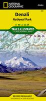
 Thumbnail of the Denali/Mt. McKinley map
 Sample of the map detail from the Denali map
 Thumbnail of the front of the Klondike Gold Rush map.
 Thumbnail of the reverse of the Klondike Gold Rush map
 Detail from the Klondike Gold Rush map.
 Index of map coverages
 Thumbnail of the front of the Saguaro National Park map.
 Thumbnail of the reverse of the Saguaro National Park map
 Detail from the Saguaro National Park map.
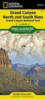
 Detail from the Grand Canyon National Park map.
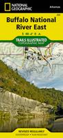
 Arkansas Hiking Map Index
  Map detail from the Buffalo River West map.
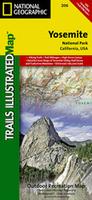
 California Hiking Map Index
  Map detail from the Yosemite National Park map.
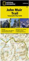
 Thumbnail of a data page from the atlas.
 Sample detail from one of the map pages
 Image showing the pocket-atlas format.
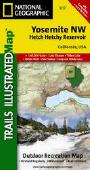
 Thumbnail of the front of the map.
 Thumbnail of the reverse of the map
 Detail from the map.
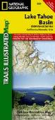
 Thumbnail of the front of the Lake Tahoe Basin map.
 Thumbnail of the reverse of the Lake Tahoe Basin map
 Map detail from the Lake Tahoe Basin map.
 Map detail from the Yuba River map.
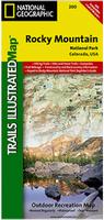
 Colorado Hiking Map Index
  Thumbnail of the Rocky Mtns. map
 Sample of the Rocky Mtns. National Park map detail.
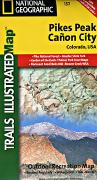
 Detail from the Pikes Peak map.
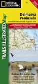
 Index of map coverage
 Thumbnail of the front of the map.
 Thumbnail of the reverse of the map
 Detail from the map.
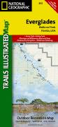
 Florida Hiking Map Index
  Image of the front of the map.
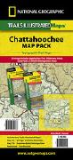
 Georgia Hiking Map Index
  Sample of the Brasstown Bald map detail.
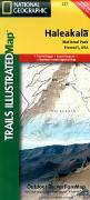
 Index of Hawaii map coverage
 Sample detail from the Volcanoes National Park map.
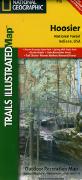
 Index of Indiana map coverage
 Sample detail from the Hoosier National Park map.
 Index of Kentucky map coverage
 Thumbnail of the front of the map.
 Thumbnail of the reverse of the map
 Detail from the map.


 Index of Ozark S.N.R. map coverage
 Sample detail of the Glacier National Park map
 Sample detail of the North Fork map
 Sample detail of the Many Glacier map
 Sample detail of the Two Medicine map

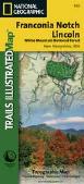
 New Hampshire hiking map coverages
 Thumbnail of the front of the map.
 Thumbnail of the reverse of the map
 Detail from the map.
 New Mexico hiking map coverage
 New York Hiking Map Index
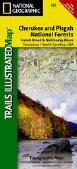
 North Carolina hiking map coverage
 Thumbnail of the front of the map.
 Thumbnail of the reverse of the map
 Detail from the map.
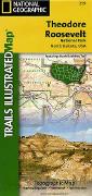
 Index of North Dakota hiking map coverage
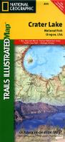
 Index of Oregon hiking map coverage
 Sample of the Crater Lake map detail
 Thumbnail image of the Columbia River Gorge map
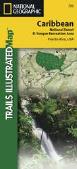
 Caribbean National Forest map coverage
 Thumbnail of the front of the map.
 Thumbnail of the reverse of the map
 Detail from the map.
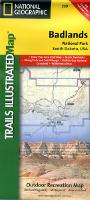
 Index of South Dakota hiking map coverage
 Sample from the Badlands map
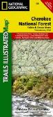
 Tennessee hiking map coverage
 Thumbnail of the front of the map.
 Thumbnail of the reverse of the map
 Detail from the map.
 Texas hiking map coverage
 Thumbnail of the front of the map.
 Thumbnail of the reverse of the map
 Detail from the map.
 Sample of the Arches N.P. map detail.
 Sample of the map detail.
 Sample of the map detail.
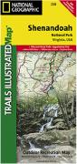
 Index for the Virginia series
 Sample #1 of the map detail.
 Sample #2 of the map detail from the Shenandoah map.
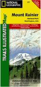
 Washington Hiking Map Index
  Sample of the map detail from the Mt. Rainier map.
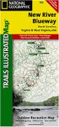
 West Virginia Hiking Map Index
  Sample of the detail from the New River Blueway map.
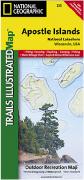
 Index of Wisconsin hiking map coverage
 Sample of the detail from the Apostle Islands map.
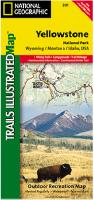
 Wyoming Hiking Map Index
  Sample of the detail from the Yellowstone National Park map.