Chateau of the Loire Map. Blay, France. A good quality road map of the Loire Valley region showing the locations of the numerous castles in the area. Photos of some of the castles are in the margins. A good map for planning bicycling tours or car tours.
$14.95
64-5678
1 sheet, folded
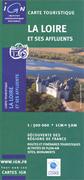
Loire River and its Tributaries Map (La Loire et ses Affluents. 1:500,000. France IGN, 2004. This tourist map highlights places of interest and recreational facilities in the departments bordering the Loire River and some of its tributaries: Ardèche, Lozère, Haute Loire, Puy de Dome, Loire, Allier, Creuse, Haute Vienne, Saône et Loire, Nièvre, Cher, Loiret, Loir et Cher, Indre et Loire, Maine et Loire and Loire Atlantique.
The map presents the road network on the base with relief shading to show the region's topography. Large, easy to see icons highlight various places of interest and recreational facilities, including heritage places and historical towns, châteaux and churches, nature reserves and bird watching sites, leisure centres for kayaking and canoeing, fishing and rafting sites, etc. The map has no geographical coordinates. Legend includes English. Size is 131 x 96 cm.
Loire River map sample
France "Découverte Régionales" (Regional Discovery) Maps
Cycling maps: Nearly all of the maps in this series and the two that follow clearly show cycling routes and mountain bike trails. The 1:100,000 topographic series are also useful, but the maps below are better if there is one that covers your area of interest.
Bourgogne "Découvertes Régionales" Map. 1:250,000. IGN, Paris. A shaded relief map showing the roads and towns of this region centered on Chateauroux. Includes boundaries for regions, departments, and arrondissements. In French with trilingual legend.
Bourgogne map sample
$14.95
64-5686-BO
1 sheet, folded.
Corrèze "Découvertes Régionales" Map. 1:100,000. IGN, Paris. An good shaded relief map of this region in Limousin. Symbols locate points of interest on the map. In French with trilingual legend.
Corrèze map sample
$14.95
64-5686-CO
1 sheet, folded.
Limousin "Découvertes Régionales" Map. 1:200,000. IGN, Paris. A shaded relief map showing the roads and towns of this region centered around Limoges. Includes symbols showing the numerous art centers and museums in the area as well as recreational opportunities. In French with trilingual legend.
Limousin map sample
$14.95
64-5686-LI
1 sheet, folded.
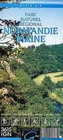
Parc Naturel Regional Livaradois Forez "Découvertes Régionales" Map. 1:100,000. IGN, Paris. A good topographic map showing the roads and towns of this region south of Orleans. Symbols locate the numerous tourist sites and recreational opportunities. In French with trilingual legend.
$14.95
64-5686-LJ
1 sheet, folded.
Loiret Carte Départementale "Découvertes Régionales" Map. 1:100,000. IGN, Paris. An good map with surprising detail, but lacking the symbols found on other maps in the series. In French.
Loiret map sample
$14.95
64-5686-LN
1 sheet, folded.
Pays de la Loire "Découvertes Régionales" Map. 1:250,000. IGN, Paris. An excellent map of this region along the Loire River from its mouth inland to LeMans and Tours. Symbols locate points of interest on the map. In French with trilingual legend.
Loire map sample
$14.95
64-5686-PL
1 sheet, folded.
Luberon Park Naturel Regional "Découvertes Régionales" Map. 1:60,000. IGN, Paris. This is an excellent topographic tourist map of the park, with symbols indicating various types of accommodation, centers selling local produce, recreational facilities, natural curiosities, places of interest, etc. The map also highlights scenic roads, a cycling circuit around the park, and the GR long-distance footpaths within the park. The map has no geographical co-ordinates grid. Text and map legend are in French only.
Luberon map sample Sketch showing Luberon map coverage
$14.95
64-5684-LU
1 sheet, folded.
Picardie "Découvertes Régionales" Map. 1:250,000. IGN, Paris. An excellent shaded relief map of this region in northwest France, across the channel from London. Symbols locate points of interest on the map. In French with trilingual legend.
Picardie map sample
$14.95
64-5686-PI
1 sheet, folded.
France Culture & Environment Maps
Armorique/Arvorig Parc Naturel Hiking Map. 1:100,000. IGN. This map covers the peninsula of Camaret-sur-Mer, Monts d'Arree, and the Aulne valley. Symbols show accommodations, including campsites, leisure and sport facilities, craft centers, and various places of interest, including stone age sites for which this area is well known. The road information is basic and sometimes covered by the numerous symbols. A real bonus of the map is the use of both French and Breton names for main towns and villages in the park and its surrounding area. Also included is a list of Breton toponyms with their French equivalents and a legend with both Breton and English. Other text is in French only.
$14.95
64-5684-AR
1 sheet, folded.
(France) Parc naturel régional du Haut-Jura. 1:50,000. IGN, Culture & Environment Series. A large double-sided topographic map covering the entire park, with extensive hiking trails, including the GTJ - Grand Traversée du Jura, bicycling trails, equestrian trails and much more. The map has 20m contour intervals, shaded relief, and spot heights. Special protected areas within the park are marked. Symbols show accommodations from hotels to campsites, gîtes d'etape and chambers d'hôtes, groceries and local produce shops, places of interest and local curiosities, sport and leisure facilities, etc. Inset maps cover the towns of Morez, St-Claude, Gex and Bellegarde-sue-Valserine. Map legend includes English while the descriptive text is in French only.
Image showing area covered by the map Sample of the map detail
$14.95
64-5684-HB
1 sheet, folded
Pays du Mont-Cenis Culture & Environnement Map. 1:50,000. IGN, Paris. A topographic map showing the trails, tourist sites, roads, and towns in this region along the French-Italian border. Symbols give locations of hiking trails, camping huts, tennis courts, horse trails, golf courses, miniature golf courses, etc. In French with trilingual legend.
Pays du Mont-Cenis map sample
$14.95
64-5684-MP
1 sheet, folded.
Montagne de Reims "Culture & Environnement" Map. 1:50,000. IGN, Paris. An excellent topographic map of this famous wine region and regional park. Symbols locate points of interest on the map. In French with trilingual legend.
Montagne de Reims map sample #1 Montagne de Reims map sample #2
$14.95
64-5686-MO
1 sheet, folded.
France "Plein-Air" (Fresh-Air) Maps
Haute Vallée de l'Aube en Champagne "Plein-air" Outdoors Map. 1:50,000. IGN, Paris. Highlights the numerous outdoor activity possibilities in the Champagne region. We also recommend the Wine Map of Champagne listed elsewhere in this file. In French.
$15.95
64-5683-HV
1 sheet, folded.
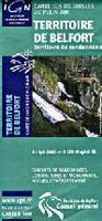
Territoire de Belfort "Plein-air" Outdoors Map. 1:50,000. IGN, Paris. Highlights the hiking, cycling, horseback riding and other outdoor opportunities in this region of northeast France along the Swiss border. In French.
$15.95
64-5683-TE
1 sheet, folded.
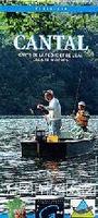
Cantal - Fishing Lakes and Rivers (Carte de la Pêche et de l'Eau Lacs et Rivières "Plein-air" Outdoors Map). 1:100,000. IGN, Paris. Highlights the various fishing and hiking locations around Aurillac in southern France. In French with trilingual legend.
$15.95
64-5683-CC
1 sheet, folded.
Ille et Vilaine Randonees en Haute Bretagne "Plein-air" Outdoors Map. 1:50,000. IGN, Paris. This series of 8 maps covers recreation opportunities in Bretagne in western France. In French with trilingual legend.
$15.95
64-5683-JV1
Sheet 1. Côte d'Emeraude - Rance Baie du Mont-St-Michel.
$15.95
64-5683-JV2
Sheet 2. Combourge.
$15.95
64-5683-JV4
Sheet 4. Brocéliande. ISBN 2118202416.
$15.95
64-5683-JV5
Sheet 5. Pays de Rennes. ISBN 2118201914.
$15.95
64-5683-JV7
Sheet 7. Pays de Redon et de Vilaine.
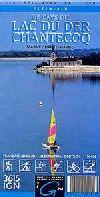
Le Pays du Lac du Der Chantecoq "Plein-air" Outdoors Map. 1:50,000. IGN, Paris. Highlights the vacation possibilities around this lake near St. Dizier. In French.
$15.95
64-5683-LB
1 sheet, folded.
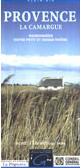
Hiking maps of La Camargue & la Calanques, Provence. 1:50,000. IGN.
Only one of the four sheets is still available for this 4-sheet set. The map includes hiking trails, Grande Randonnée routes, horseback riding centers and trails, mountain biking centers and trails, vineyards, and much more. In French.
Sample from the Camargue hiking map
$15.95
64-5683-PR3
Les Alpilles.
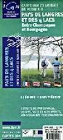
Pays de Langres et des 4 Lacs "Plein-air" Outdoors Map. 1:50,000. IGN, Paris. This map highlights the popular "outdoors" region centered on the historic town of Langres. The mix of rivers, lakes, forest, and historic sites and towns offers a wide variety of activities for all ages. In French.
$15.95
64-5683-PL
1 sheet, folded.
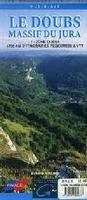
Le Doubs Massif du Jura "Plein-air" Outdoors Maps. 1:50,000. IGN, Paris. This is a three-sheet topographic map set that covers the Le Doubs region of the northern Jura Mountains, but only the West sheet is still in print. The set highlights 1,750 km of hiking trails in the region. The Grand Rondonnée trails are shown and labelled and other tourist information is included. In French.
$15.95
64-5683-DMW
Le Doubs west.
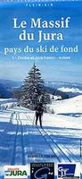
Le Massif du Jura pays du ski de fond "Plein-air" Outdoors Maps. 1:50,000. IGN, Paris. This is a two-sheet set of topographic maps that are overlain with the ski trails in the region. The trails are color-coded by difficulty level; distances, restaurants, huts, and other tourist information is also shown. In French.
Doubs et Jura Ain et Jura
$15.95
64-5683-MJ1
Sheet 1 - Doubs et Jura franco-suisse (Doubs region of northern Jura).
$15.95
64-5683-MJ2
Sheet 2 - Ain et Jura franco-suisse (southern Jura and the French-Swiss border).
Trois Vallees region "Plein Air" Hiking Map. 1:25,000. IGN, Paris, France.
$15.95
64-5683-TV
1 sheet, folded
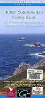
Bigouden Country, Cap Sizun (Pays Bigouden) hiking map. 1:50,000. IGN. Detailed hiking map. In French.
$15.95
64-5683-BI
1 sheet, folded.
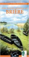
Brière Regional Park hiking map. 1:50,000. IGN. Colourful tourist map indicating various zones inside the overall boundary of the park: the conservation area, the Marais de Grande Brière, and the two nature reserves within the marches. Extensive overprint across the park itself and in the surrounding area highlights various types of accommodation (hotels, gîtes d'etape, campsites, etc.), tourist information centres, restaurants, sport and leisure facilities, viewpoints, and other places of interest. Local hiking trails are prominently marked. The map has no geographical coordinates. In French.
$15.95
64-5683-BR
.
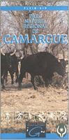
Camargue Regional Natural Park hiking map. 1:50,000. IGN. Detailed hiking map. In French.
$15.95
64-5683-CD
1 sheet, folded.
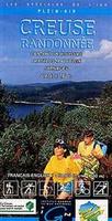
Creuse Randonnee #6 - northeast region hiking map. 1:50,000. IGN. In French.
$15.95
64-5683-CR6
1 sheet, folded.
Gulf of Morbihan (Golfe du Morbihan), Belle-Ile hiking map. 1:50,000. IGN. In French.
$15.95
64-5683-GU
1 sheet, folded
Creuse Randonnee #6 - northeast region hiking map. 1:50,000. IGN. In French.
$15.95
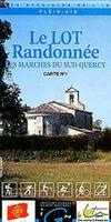
64-5683-LR1
Le Lot Randonnee, Sud-Quercy #1. 1:50,000.
$15.95
64-5683-LR2
Le Lot Randonnee, Sud-Quercy #2. 1:50,000.
Normandie Maine Regional Park hiking map. 1:100,000. IGN. In French.
$15.95
64-5683-NO
1 sheet, folded.
Sologne hiking map. 1:100,000. IGN. With multilingual legend..
France Satellite Poster. 27 x 34 inches, flat/rolled.
Sample detail.
$19.99
67-88047
1 sheet, flat/rolled.
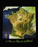
On Sale! France Satellite Image Maps. Scale varies. BRGM. These very colorful Landsat image maps highlight the better-known regions of France. Printed on heavy poster paper, these images make excellent wall displays. Map size varies. In French.
France poster thumbnail image


 Loire River map sample
 Bourgogne map sample
 Corrèze map sample
 Limousin map sample
 Loiret map sample
 Loire map sample
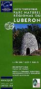
 Luberon map sample
 Sketch showing Luberon map coverage
 Picardie map sample
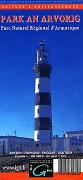
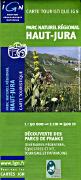
 Image showing area covered by the map
 Sample of the map detail
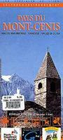
 Pays du Mont-Cenis map sample
 Montagne de Reims map sample #1
 Montagne de Reims map sample #2
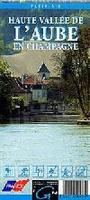


 Sample from the Camargue hiking map

 Doubs et Jura
 Ain et Jura
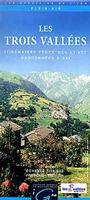
 Sample detail.
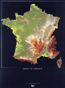 On Sale!
 France poster thumbnail image
 Front of 64-56917.
 Sample detail of 64-56917
 Legend of 64-56917.