|
|
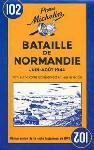
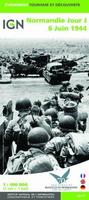
The main panel at 1:100,000 shows the five beaches: Utah, Omaha, Gold, Juno and Sword together with the command structure and the disposition of the Allied Forces, from General Eisenhower to individual units including the supporting airborne divisions, and the defending German forces, plus indicates beach heads and the front line 24 hours later. A smaller panel at 1:500,000 shows the whole of the Cotintin Peninsula indicating changes in the front line between D-Day and 18th August 1944. Another large panel at 1:250,000 shows north-western Normandy, including Caen and Bayeux, indicating museums, war memorials, military cemeteries and other WWII related information including a suggested tour of the five beaches. Map size is 100 x 121 cm.
:
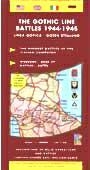
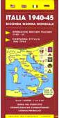
Italy WWII Maps.
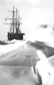
Photographs from Shackleton's Expedition to AntarcticaSir Ernest Shackleton's 1914-1916 voyage with the Endurance is one of the greatest survival adventures of all time. In August of 1914, Shackleton and 27 crew set sail to cross the Antarctic continent on foot. Before reaching the continent the Endurance was trapped in pack ice and slowly crushed. Over the next 20 months Shackleton and the crew managed to survive, culminating in the 800 mile voyage in the 22-foot open lifeboat James Caird to South Georgia Island which led to their rescue. Listed below are some of the best books on the voyage as well as posters printed from original negatives from the voyage. This poster is reprinted from original photographs and negatives in the British Royal Geographic Society's archives. Printed on off-white heavy-duty poster paper these prints are ideal for framing.
:
|
||||||||||||||||||||||||||||||||||||||||||||||||||||||||||||||||||||||||||||||||||||||||||||||||||||||||||||||||||||||||||||||||||||||||||||||||||||||||||||||||||||||||||||||||||||||||||||||||||||||||||||||||||||||||||||||||||||||||||||||||||||||||||||||||||||||||||||
 Sample #1
 Sample #2
 Sample detail from the map of the Camps and Other Nazi Detention Centers
 Thumbnail image of the map of the Camps and Other Nazi Detention Centers
 Sketch map of the area covered by the map

 Sample #1
 Sample #2
 Sample from the map.
 Sample from the map.
 Sample from the map.

 Sample from the map
 Sample of the Belgium Battlefield map detail.
 Thumbnail image of the front of the entire map
 Sample of the map detail


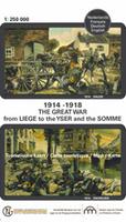
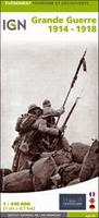
 Sample detail #1 from the Great War 1914-1918 map
 Sample detail #2 from the Great War 1914-1918 map
 Sample detail #3 from the Great War 1914-1918 map
 Sample detail #4 from the Great War 1914-1918 map
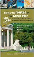 Cycling guide!
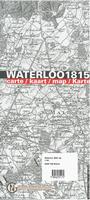
 Sample #1 from the Waterloo map.
 Sample #2 from the Waterloo map.

 Thumbnail of the entire poster


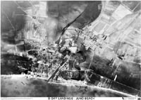
 Sample detail from the Normandy D-Day map.
 Sketch map of the area covered by the map

 Sample detail of the map.