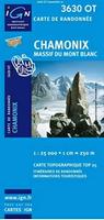
France 1:25,000 Topographic Map Series. This is the most detailed topographic map series for France, comparable to the USGS 1:24,000 (7-1/2 minute) topographic series for the USA. The maps are significantly larger and cover more area per sheet than the typical USGS topo. In French only.
All the maps are GPS compatible, with a 1km UTM grid plus latitude and longitude lines at 5 intervals. Contours are at 5m intervals except for mountainous areas where the maps have contours at 10m intervals,
This series is undergoing a major revision. Newer editions covering popular tourist areas are coming with tourist information overprinted and some, but not all, come with a bilingual French/English legend.
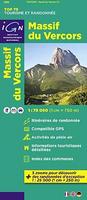
France 1:75,000 topographic hiking/cycling map series. 1:75,000. France IGN.
This series highlights the most popular tourist regions of France on GPS compatible, contoured topographic maps at 1:75,000. This series highlights local and long-distance hiking paths, cycling routes and sites for other recreational activities. Each sheet includes five large inset maps at 1:25,000 which cover its most popular areas in greater detail.
The 1:75,000 cartography is an enlargement of the mapping used in the IGN's 1:100,000 series. Contours are at 40m intervals, enhanced by relief shading; vegetation type is shown using additional coloring. Boundaries of national parks and other protected areas are marked. An overprint highlights long-distance GR hiking routes and cycling trails. Symbols indicate various places of interest including mountain refuges and gîtes d'etape, areas for other recreational pursuits such as climbing, hand gliding or water and winter sports, historic or cultural sites, etc. The maps have a UTM grid and an index of communes. Map legend includes English.
Each sheet also contains five enlargements of popular areas, shown at 1:25,000 (extracts from IGN's 1:25,000 topographic map series). In addition to the GR routes shown, the insets also highlight local hiking paths and provide more information on tourist facilities including campsites.
Sample detail from this map series
64-5651-01
1:75,000 topo #01. Vercors Massif.
$15.99
64-5651-02
1:75,000 topo #02. Chartreuse - Belledonne.
$15.99
64-5651-03
1:75,000 topo #03. Vanoise Massif and the National Park.
$15.99
64-5651-04
1:75,000 topo #04. Massif du Mont Blanc - Beaufortain.
1:75,000 topo #29. Calvi - Cargèse - Monte Cinto - Monte Rotondo.
$15.99
64-5651-30
1:75,000 topo #30. Bastia - Corte - Cap Corse.
$15.99
64-5651-31
1:75,000 topo #31. Ajaccio - Porto-Vecchio - Aiguilles de Bavella - Monte Renoso.
$15.99
France TOP100 Topographic Maps. 1:100,000. France IGN. France IGN has replaced its famous 1:100,000 series with a new 1:100,000 topographic series called TOP100. This new series, which now has yellow-green covers, offers complete coverage of France in 76 sheets (up from the 74 sheet of the current series). The sheet boundaries of the new series are not the same from the old editions. Because of this, there is no direct correlation between the new sheet numbers and the old, so please check the indexes carefully before you order.
Also linked below is an image comparing the same area in the new edition and in the previous edition. This way you can easily see the changes in the series - roads are emphasized, less clutter, GR routes are marked, etc.
Click here. Comparison of new series to previous series, over the same map area.
Click here. Larger sample of the new series cartography.
Click here to see the index for the entire new series.
 Sample detail from this map series


 Click here.
 Click here.
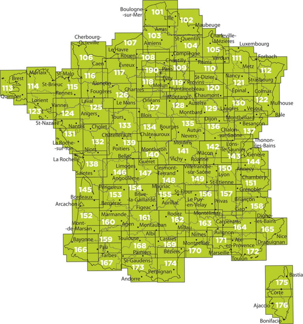 Click here