We have an extensive stock of European maps. The bulk of the maps are listed under the appropriate country listing. The maps below are continental series and regional maps. For more detailed mapping, please check the appropriate country listing, along with Scandinavia.
Recommended! Europe Road Atlas. 1:500,000 - 1:1,500,000. Michelin. Spiral-bound. The Atlas covers over 40 countries, includes 78 city center maps, and has a full place-name index. The map road map section covers Europe at 1:1,000,000 (102 pages), Scandinavia at 1:1,500,000 (23 pages), Baltic countries at 1:500,000 (31 pages), with Poland, Greece, and Cyprus at 1:700,000 (52 pages). The road map detail includes eleven categories of roads, from unpaved single-lane to divided highways. Car ferries, passenger ferries, toll barriers, steep sections, numerous tourist sites, and much more are shown by symbols.
Coverage extends from Moscow to Iceland, to Malta, Cyprus, and western Turkey; eastern Turkey is not covered.
Sample from the Europe road atlas
66-2296
Atlas.
$24.00
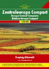
Central Europe Road Atlas. 1:500,000 - 1:3,500,000. Freytag & Berndt. This road atlas covers central Europe country by country at 1:500,000, with a legend and map-page overview as an introduction in each country. A place name index follows each country. Cartography is detailed but clear, although two noticeably different styles are used. Driving distances are indicated on the map between specific points and railways and ferry routes are included, also details such as steep gradients, seaonal road closures, filling stations, scenic routes etc. Relief is indicated by some hill shading and spot heights.
NOTE: The only countries covered at the 1:500,000 scale are: Austria, Germany, Switzerland, Italy, Slovenia, Croatia, Bosnia & Herzegovina, Hungary, Czech & Slovak Republics, the Benelux countries, Denmark and Poland. All other European countries are covered at 1:3,500,000 and extends to Moscow, western Turkey, Scandinavia and Iceland.
At the end is a section of indexed street plans of 34 European city centers. These highlight through-roads, pedestrian zones, railway & metro lines and visitor information points.
Index of atlas coverage
Recommended Europe Road Map. 1:3,000,000. Michelin #705. This is the classic road map of Europe by the famous French tire and map maker. Multilingual legend.
66-22911
1 sheet, folded.
$12.95
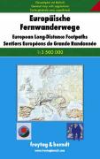
Europe Long Distance Footpaths map. 1:3,500,000. Freytag & Berndt. A must for planning hiking trips in Europe. This map of Europe shows all of the long distance footpaths: E1 to E11. This political map also shows the main roads, railroads, and ferries, which helps in planning access to your starting point. The attached text, in German only, contains short descriptions of each route. Multilingual legend.
Waterproof! Baltics Road Map. 1:600,000. Reise Know-How. This map combines topographic mapping with road and tourist detail. The road information is clear and elevation is shown using contours, spot heights and altitude shading. The map shows six different types of roads, highlighting scenic routes, places of interest, archaeological sites, monasteries, monuments and viewpoints.
Includes coverage of: Estonia, Kaliningrad, Latvia, and Lithuania.
66-22722
1 sheet, folded.
$15.99
Waterproof Baltic Sea Region Travel Map (Ostsee). 1:1,300,000. Reise Know-How, 2011. Detailed road map of the Baltic Sea region and surrounding coastlines. The reverse side has detailed city-center street maps for Gdansk, Helsinki, Kobenhavn, Riga, St. Petersburg, Stockholm, and Tallinn. With contour lines and spot heights showing elevation, detailed road network, symbols for tourist sites and services. In German with English legend. ISBN 9783831772353.
Sample detail of the Baltic Sea Region Travel Map
Europe Wall Map - Executive Style. National Geographic Maps. Make a statement with the newest addition to our European Wall Map library. The rich tones of the Political Executive map combine the popular antique look with up-to-date information so that you have a map that is elegant enough for the board room, study, or office, and contemporary enough to make it an ideal reference. Available in two sizes; 24 x 30 inches and 36 x 46 inches.
Thumbnail image of the entire map Sample of the map detail.
66-22903
Small, flat
$14.99
66-22903L
Small, laminated.
$19.99
66-22904
Large, flat
$19.99
66-22904L
Large, laminated.
$39.99
Europe Historical Wall Maps
Europe Map 1915 with Africa and Asia. National Geographic Society Maps. This beautifully rendered map of Europe was published in July 1915, one year into the First World War. A historical snapshot of a region in turmoil, this map is a must-have for map collectors, as well as those interested in The Great War. A National Geographic classic.
The 1915 Europe map with portions of Africa and Asia features:
Detailed inset of the Dardanelles
Colorful, distinct country borders
Thousands of place names including capitals, cities, and towns
Intricately rendered mountain ranges and rivers
Railroads and ship canals
Coverage Area: Europe, western Turkish Empire, western Russia
European Western Theatre Of War Map 1918. National Geographic Society Maps. Printed in May 1918 a short time before the end of World War I, this map shows the western theatre of war in France and Belgium. Details of battle lines make this map a unique and compelling historical piece perfect for collectors.
The 1918 Map of the Western Theater of War features:
Inset map showing the relation of the Western Theater of War to the surrounding region and the connection of the two sections of the main map
War details including the line of greatest German advance in 1914 and the battle line before the spring drive of 1918
An abundance of place names including cities and towns
Central Europe And The Mediterranean Map 1939. National Geographic Society Maps. This map of Central Europe and the Mediterranean shows international boundaries as of September 1, 1939, before Germany invaded Poland. Published in October 1939, this map appeared with the article "War Clouds Over Danzig and Poland's Port." A unique historical map for collectors.
The 1939 Central Europe and the Mediterranean map features:
Names of countries in English and the national language
Thousands of place names including capitals of countries, other capitals, cities, and towns
Mountain relief, rivers, lakes, glaciers, wadies, swamps, and areas below sea level
 Recommended!
 Sample from the Europe road atlas

 Index of atlas coverage
 Sample of the Western Europe road map
 Sample detail of the Europe political road map
 Image of the Europe physical road map
 Sample detail of the Europe political road map
 Image of the Europe Political road map
 Sketch map showing area covered by the Northern Europe/Scandinavia map
 Sketch map showing area covered by the Central Europe map
 Sketch map showing area covered by the Eastern Europe map
 Sketch map showing area covered by the Western map
 Sketch map showing area covered by the Alps road map
 Sketch map showing area covered by the Baltics map
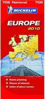
 Waterproof!

 Waterproof
 Sample detail of the Baltic Sea Region Travel Map
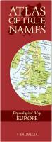
 Sample #1 of the Europe True Names map
 Sample #2 of the Europe True Names map
 Image of the entire Europe True Names map
 Thumbnail of the map
 Detail from the map
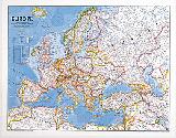
 An image of the full map
 A detail of the map
 A sample of the legend
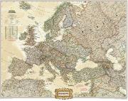
 Thumbnail image of the entire map
 Sample of the map detail.
 Image of the entire map
 Sample #1 of the map detail
 Sample #2 of the map detail
 Sample #3 of the map detail
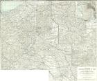
 Image of the entire map
 Sample #1 of the map detail
 Sample #2 of the map detail
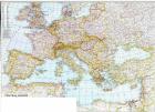
 Image of the entire map
 Sample #1 of the map detail
 Sample #2 of the map detail