Austria 125 Cities & Road Atlas (125 Städt Österreich). 1:10,000 - 1:500,000. Freytag/Berndt. Subtle relief shading presents the country's mountainous terrain. The mapping includes railways, driving distances, road traffic restrictions, seasonal closures on mountain roads and road gradient indications. Tourist information includes, scenic routes, places of interest, campsites and youth hostels, etc. An overprint highlights the national network of the long-distance footpaths indicating, where appropriate, their European numbers. The index gives the postcode for each locality and includes locations outside the Austrian border. Map legend includes English.
The street plans section covers Vienna, Graz, Klagenfurt, Linz, St Polten, Salzburg, Bregenz, Eisenstadt & Innsbruck. Scales vary, but in each case the whole town is covered and there is a street index. For Vienna there is an overview plan showing principal routes. Detail includes public transport, tourist information offices, post offices, notable buildings, campsites, etc.
Next is an indexed road atlas for Europe at 1:3,500,000 showing driving distances between selected towns.
The final section is a set of city centre street maps for Europe's capital cities, at 1:15,000. Each is indexed.
64-1488
Austria Road Atlas.
$27.99
Austria SuperTouring Road Atlas (Autoatlas Österreich Supertouring). 1:150,000. Freytag/Berndt. Includes the same road maps described above. Also contains a reduced section of street plans shows principal routes through 63 Austrian town and cities. These map are not indexed but indicate a variety of features including railway & metro lines, car parks, tourist information offices, post offices, public buildings etc. Does not contain the Europe road and city maps.
Austria Travel Map. 1:300,000. Freytag & Berndt. Most detailed single-sheet road map of Austria currently available. Multilingual map including English.
Thumbnail of the map. Detail from the map.
64-14915
1 sheet, folded
$15.99
Austria Road Maps. 1:150,000. Freytag & Berndt. "Top Ten Tips" road map series - with bike routes and long distance hiking paths, city inset maps, and more detailed than series from other publishers. Excellent road map series for tourists. Multilingual.
Austria Road Map Series Index. Sample image from the Tirol map (#7).
64-1491-1
Austria #1 - NiederÖsterreich - Wien (Vienna) travel map.
$15.99
64-1491-2
Austria #2 - OberÖsterreich - Salzkammergut (Linz, Salzburg) travel map.
$15.99
64-1491-3
Austria #3 - Burgenland travel map.
$14.99
64-1491-4
Austria #4 - Steiermark (Graz) travel map.
$15.99
64-1491-5
Austria #5 - Kärnten (Klagenfurt, Lienz) travel map.
$14.99
64-1491-6
Austria #6 - Salzburg - Salzkammergut travel map.
$14.99
64-1491-7
Austria #7 - Tirol (Innsbruck) travel map.
$14.99
64-1491-8
Austria #8 - Voralberg (Bregenz) travel map. 1:100,000.
$15.99
Vienna Laminated City Map. 1:11,000. Borch. Laminated, waterproof city map.
Sample of the map detail
64-1492VB
1 sheet, folded.
$9.95
Vienna City Map, in Russian. 1:10,000. These are for those that want cyrillic-language maps of European capital cities - for Russian-speaking patrons/customers, for Russian-language classes, etc. All are standard folded tourist city street maps, with index. All of the maps are in cyrillic and in the local language. Additional cities available include Helsinki, London, Moscow, Paris, Prague, Rome, Stockholm - please see the appropriate country listing to order these maps.
Sample detail of the Rome city map
64-1492VIE
1 sheet, folded.
$12.99
Austria City Maps. Freytag & Berndt. Freytag and Berndt, Austria's leading map publishers, produce a series of street plans covering the country's main cities. All the plans are indexed and show public transport systems. Plans of cities in the mountainous parts of the country are contoured to indicate the terrain. Most plans have enlargements showing the town centre in greater detail. Some plans include a black and white map of the city overprinted with cycle routes. Map legend includes English.
Sample from the Bregenz map.
64-1492VI
Bregenz. 1:10,000. ADAC.
$9.99
64-1492GR
Graz. 1:15,000. Freytag & Berndt.
$12.99
64-1492IN
Innsbruck. 1:15,000. Freytag & Berndt.
$12.99
64-1492KL
Klagenfurt. 1:15,000. ADAC.
$12.99
64-1492LI
Linz. 1:15,000. Freytag & Berndt.
$12.99
64-1492SB
Salzburg. 1:15,000. Freytag & Berndt.
$12.99
64-1492ST
St. Polten. 1:15,000. ADAC.
$12.99
64-1492VA
Vienna (Wien). 1:25,000. Freytag/Berndt.
$12.99
64-1492VK
Vienna. Falk-fold (patented folding method - you love it or hate it). Falk Verlag.
$9.95
64-1492VI
Villach. 1:20,000. Freytag & Berndt.
$12.99
64-1492WE
Wels. 1:15,000. Freytag & Berndt.
$12.99
Austria City Topographic Maps. 1:10,000. Soviet government. These maps are regular topographic maps that include contour lines, power lines, rail/trolley lines, etc. In Russian.
64-1493W
Wien (Vienna). 1976. 6 sheets.
$120.00
Austria Railroad Atlas & Map
Austria Railroad Atlas. Schweers + Wall.
Detailed scale - 1:150,000 for all of Austria.
Shaded relief physical maps as base maps.
Detailed sections covering the major cities - 1:50,000.
Includes working railroads, tourist railroads, closed railroads.
Austria Long-Distance Footpaths Map. 1:800,000. Freytag & Berndt. An excellent planning map of Austria with hill shading and plenty of geographical names. Overprinted with long-distance walking routes. Includes separate booklet, in German only, which briefly describes the routes, section by section, in terms of the locations through which they pass. Legend is in English/German.
64-1475
1 sheet, Folded.
$12.99
Kompass Hiking Maps for Germany, Italy, and Austria - click here for a complete list. Kompass Wanderkarten produces excellent hiking/topographic maps of the popular hiking regions of Germany, Austria (especially the Tirol), and Italy (especially the Dolomites and South Tirol).
These maps are all topographic maps with contour lines, hiking trails, hiking information such as huts, etc. They often contain a guide booklet describing the hiking routes and scenery. All maps and text information is in Italian only.
Click on the link above to see detailed index maps and a listing of the available maps.
For areas of Austria not covered by the Kompass maps we recommend the Austrian government topographic maps listed above. For bicycling, we recommend the 1:50,000
topographic mapsKompass maps.
Austria National Park hiking maps. Freytag & Berndt.
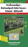
Nationalpark Hohe Tauern - Krimml - Mittersill. 1:35,000. (F/B 0343-5). In German. ;
$11.95
64-1477-WK5501
Nationalpark Kalkalpen hiking map. 1:35,000.
$10.95
64-1475-03
Nationalpark Thayatal. 1:50,000. (F/B WK073). In German. ;
$11.95
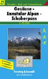
Austria Hiking Maps. Freytag & Berndt. Detailed topographic hiking maps for popular hiking areas in Austria. In addition to these listed below (which are in stock), we can special order any of the hundreds of hiking maps published by Freytag & Berndt. Delivery times to us are typically 10-14 days.
Sample detail from the Ennstaler Alpen map
Austria Topographic Quadrangle Maps. 1:50,000. BfE. In German.
Click here to see index maps, sample images, a complete list of available quadrangles and/or to order these maps.
Austria Topographic Quadrangle Maps. 1:25,000. BfE. In German.


 Sample of the Michelin Austria map detail.
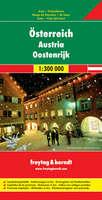
 Thumbnail of the map.
 Detail from the map.
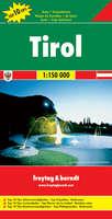
 Austria Road Map Series Index.
 Sample image from the Tirol map (#7).
 Sample of the map detail
 Sample detail of the Rome city map
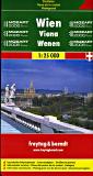
 Sample from the Bregenz map.
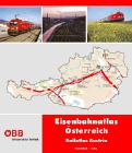
 Sample of the main Austria maps at 1:150,000
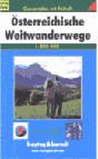


 Sample detail from the Ennstaler Alpen map