Germany


  • Germany Political & Physical Maps
  • Germany Topographic Maps
    • Germany 1:25,000 Topographic Maps. Itemized listings, sample images, and index maps.
    • Germany 1:50,000 Topographic Maps. Itemized listings, sample images, and index maps.
    • Germany 1:100,000 Topographic Maps. Itemized listings, sample images, and index maps.
    • Germany 1:200,000 Topographic Maps. Itemized listings, sample images, and index maps.
  • Germany Travel, Tourist, Hiking Maps
    • Germany National Park hiking maps
    • Germany Hiking Maps by Kompass
    • Germany Cycling Maps
    • Germany Rail Maps
    • Germany Travel Maps
      • Germany travel maps by Freytag & Berndt
      • Germany travel maps by Michelin
    • Germany City Maps & Atlases
  • Germany Hiking/Trekking Guidebooks
  • Germany Geologic Maps
  • Germany Flags

Germany Physical and Political Maps

Physical Map of Mecklenburg-Vorpommern Land (Übersichtskarte Mecklenburg-Vorpommern). 1:250,000. 1991. LMV. One sheet showing good detail of this district. In German.
Ordering (Germany) Mecklenberg/65-544781 sheet, rolled$10.95

General/Physical Map of Rheinland/Pfalz (Rheinland-Pfalz Übersichtskarte). 1:250,000. Landesvermessungsamt Rheinland. 1992. One sheet showing the general features of this area. Roads and cities are highlighted in bright colors. The map shows political boundaries including Landesgrenze, Regierungsbezirksgrenze, and Kreisgrenze. Elevation is shown by shaded relief. 30 x 32". In German.
Ordering (Germany)--Rheinland/Pfalz65-544761 sheet, rolled$12.95

Satellite Map of Rheinland-Pfalz and Saarland (Satellitenbildkarte Rheinland-Pfalz und Saarland). 1:250,000. Landesvermessungsamt Rheinland. 1994. A Landsat-TM satellite image poster of Rheinland-Pfalz and Saarland. The borders and city/town names are overprinted in red. 35 x 37". In German.
Ordering (Germany)--Rheinland/Pfalz65-544771 sheet, rolled$12.95

Administrative Map of Sachsen (Freistaat Sachsen Verwaltungsgrenzen). 1:300,000. LS. 1994. One sheet, in German, showing the administrative divisions with "county seats", etc.
Ordering (Germany) Sachsen Admin. Map64-495351 sheet, folded$11.95

Topographic Map of Sachsen-Land (Übersichtskarte von Sachsen). 1:200,000. 1991. Covers one of the five new "Lands" in the former East Germany. In German.
Ordering Germany - Sachsen topo map64-495361 sheet, folded$11.95

Administrative Map of East Germany (Länderkarte Deutschland-Ost). 1:750,000. GKD. 1990. In German.
Ordering (Germany) Admin. Map East Germany64-49471 sheet, rolled$9.95

Topographic Map of East Germany. 1:750,000. 1985. In German.
Ordering E.G.-Topo Map.  1:750,00064-49481 sheet, rolled$9.95

Germany Postalcode Map (Postleit-Karte). 1:700,000. RV. 1993. With index of place names and 10 town plans. In German.
Ordering Germany--Postal Code Map65-5471Set, folded.$24.95

Geologic Hiking Map of the Rothaargebirge (SÜdteil) Naturepark (Naturpark Rothaargebirge (SÜdteil) - Geologische Wanderkarte 1:50,000). 1:50,000. GLANW. H. MÜ and M. ThÜnker, compilers. 1994. One sheet with four cross sections and text on the reverse. In German, measuring 87 x 93 cm.
Ordering (Germ.) Naturpark Rothaarge-65-5459-01$20.95

Natureparks and National Parks in Schleswig-Holstein (NaturschÜtzgebiete, Landschaftsschutz-Gebiete, Naturparks in Schleswig-Holstein). 1:250,000. GLASH. 1991. In German.
Ordering Germany-Nature & NationalParks65-54721 sheet$37.95

Watersport Map of Potsdam region. 1:50,000. KDP. 1990. Two sheets showing locations of watersport facilities in the Berlin-Potsdam region. In German.
Ordering Germany--Watersport Map of Pot64-6080Two sheets, folded$17.95


Germany National Atlas & Climatic Atlas


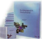
National Atlas of Germany (Atlas Bundesrepublik Deutschland). Institut für Landerkunde, Leipzig, 1999 - continuing series. Twelve volumes plus an index volume as a printed edition or a CD-ROM edition. This is the first update of this atlas in 30 years. It is estimated that it will take 6 years to complete this atlas. volumes are now available with more to come.
Ordering Germany Nat. Atlas Vol. 165-54451-01PVolume 1 - Society & the State (Gesellschaft und Staat), print edition.Ordering Germany Nat. Atlas Vol. 1 $119.95
Ordering Germany Nat. Atlas Vol. 265-54451-02PVolume 2 - Relief, Soil and Water (Relief, Boden und Wasser), print edition. $119.95
Ordering Germany Nat. Atlas Vol. 365-54451-03PVolume 3 - Climate, Flora and Fauna (Klima, Pflanzen- und Tierwelt), print edition. $119.95
Ordering Germany Nat. Atlas Vol. 465-54451-04PVolume 4 - Population (Bevölkerung), print edition.Ordering Germany Nat. Atlas Vol. 4 $119.95
Ordering Germany Nat. Atlas Vol. 565-54451-05PVolume 5 - Villages & Cities (Dörfer und Städt), print edition. $119.95
Ordering Germany Nat. Atlas Vol. 665-54451-06PVolume 6 - Education & Culture (Bildung und Kultur), print edition.Ordering Germany Nat. Atlas Vol. 6 $119.95
Ordering Germany Nat. Atlas Vol. 765-54451-07PVolume 7 - Labor and Standard of Living (Arbeit und Lebnensstandard), print edition. $119.95
Ordering Germany Nat. Atlas Vol. 7 - CD-ROM65-54451-07CVolume 7 - Labor and Standard of Living (Arbeit und Lebnensstandard), CD-ROM edition. $69.95
Ordering Germany Nat. Atlas Vol. 865-54451-08PVolume 8 - Enterprises and Markets (Unternehmen und Märkte), print edition. $119.95
Ordering Germany Nat. Atlas Vol. 965-54451-09PVolume 9 - Traffic & Communication (Verkehr und Kommunikation), print edition.Ordering Germany Nat. Atlas Vol. 9 $119.95
Ordering Germany Nat. Atlas Vol. 1065-54451-10PVolume 10 - Leisure & Tourism (Freizeit und Tourismus), print edition.Ordering Germany Nat. Atlas Vol. 10 $119.95
Ordering Germany Nat. Atlas Vol. 1165-54451-11PVolume 11 - Germany in the World (Deutschland in der Welt), print edition. $119.95
Ordering Germany Nat. Atlas Vol. 1265-54451-12PVolume 12 - Living in Germany (Leben in Deutschland), print edition. $119.95
Ordering Germany Nat. Atlas Vol. 1365-54451-13PVolume 13 - Index volume (Register), print edition.$64.95

Climate Atlas of Germany (Klimaatlas Bundesrepublik Deutschland). DWD, Offenbach am Main. 1999-. This atlas is being produced in parts over the next several years, organized by subject. Map plates are at 1:2,500,000 and include text, figures and graphs. In German. Size is 30 x 42 cm, cloth cover 35 x 44cm. The first part includes air temperature, Niederschlagshohe, Sonnenscheindauer. 57 maps.
Ordering Germany Climate Atlas65-5431Germany Climatic Atlas.$74.95

Germany Hydrologic Atlas (Hydrologishcer Atlas von Deutschland) - Vols I & II (continuing series). 1:2,000,000 & 1:4,000,000. BfG, BUNR, 2000-2001. Atlas contains 33 maps on seven subject groups. Includes overlays, graphs, notes, etc. 170 pages, with CD-ROM. Bilingual.
Ordering Germany Hydrologic Atlas, vol.65-5432Atlas.$179.95


image


© Copyright 2025 East View Companies, Inc.
5130 Industrial Street, Suite 100, Maple Plain, MN 55359-8005
All Rights Reserved
For more information please Contact Us