Lithuania Maps


  • Lithuania Road and City Maps.
  • Lithuania Bicycling Map.
  • Lithuania Topographic Maps.
  • Lithuania Flags


    Lithuania Travel Maps


    Lithuania Road Atlas. 1:200,000. Jana Seta.
    The 1:200,000 scale mapping allows a lot of detail and clarity at the same time. The map distinguishes between six different types of roads, it shows railways, museums and other place of interest, petrol stations, hotels and campsites and national parks. Towns are marked according to the size of the population. A latitude and longitude grid is given at an interval of 10'.
    Sample #1
    Sample #2
    Ordering Lithuania Road Atlas 1:200,000 (JS)$49.9965-8388Atlas


    Baltics travel map
    Baltic Region Travel Map. 1:500,000. ITMB.

  • The Baltic States of Estonia, Latvia, and Lithuania are three of the nicest countries to visit in Europe. Access is easy, through Poland heading north or via a ferry from Finland coming south. As part of the EU, the three countries enthusiastically removed border controls for citizens of other EU countries a number of years ago.
  • This map focuses on the countries in great detail, showing the sophisticated road network, the many historic and touristic sites, and camping areas in parks. Gas stations and hotels are plentiful so are not shown on the map. Double-sided map.
    Sample detail of the Baltic region map
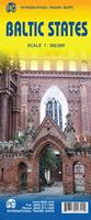
    Thumbnail of the front of the Baltic region map
    Thumbnail of the reverse of the Baltic region map
    Ordering Baltic Region map (ITMB)$12.9566-227211 sheet, folded.


    Lithuania road mapWaterproof!
    Lithuania Road Map. 1:325,000. Reise Know-How.
    This map combines topographic mapping with road and tourist detail. The road information is clear and elevation is shown using contours, spot heights and altitude shading. The map shows six different types of roads, highlighting scenic routes, places of interest, archaeological sites, monasteries, monuments and viewpoints.
    Ordering Lithuania road map (Reise)$15.9965-839011 sheet, folded


    Lithuania road map
    Lithuania Road Map. 1:500,000. Jana Seta.
    Detailed road map of Lithuania, with small-scale inset maps on the reverse covering Vilnius, Kaunas, Klaipeda, Siauliai, Panevezys and Kaliningrad. Map is in Lithuanian with English/Lithuanian/Latvian/Estonian/German/Russian legend.
    Thumbnail image of the front of the map.
    Sample detail #1 from the map
    Sample detail from one of the city inset maps
    Ordering Lithuania Road Map. (JS). 1:500,000$11.9965-83901 sheet, folded.


    Iceland road mapWaterproof!
    Lithuania Road Map - waterproof. 1:600,000. Jana Seta, 2016.
    A waterproof and tear-resistant, indexed road map of Lithuania. Includes small inset maps of Vilnius and Kaunas, plus a distance table.
    Sample detail of the Lithuania road map.
    Ordering Lithuania Road Map. (JS). 1:500,000$11.9565-839061 sheet, folded.


    Aukstaitijos National Park Map
    Aukstaitijos National Park Map. 1:50,000. Breidis.
    This is a topographic map of this popular national park. The map has tourist information over-printed on the map and descriptive text on the reverse. Multilingual text and legend.
    Sample detail from the map.
    Ordering (Lith.) Aukstaitijos National Park$15.9565-83701 sheet, folded


    Vilnius Region Map. 1:200,000. Jana Seta. This map covers Vilnius and the surrounding region. Multilingual.
    Ordering Lithuania--Vilnius region map$9.9565-83911 sheet, folded


    Lithuania City Maps. Multilingual legend.
    Ordering (Lithuania) Palanga city map$10.9565-8392PPalanga.
    Ordering (Lithuania) Vilnius city map (J.S.)$12.9965-8392VVilnius. 1:25,000. Jana Seta.   ;


    Vilnius City Map. 1:12,000. Freytag & Berndt. A detailed city street map of Vilnius. Numerous buildings are named and symbols on the map locate tourist sites and services, such as hotels, police, historic monuments, etc. Includes a detailed street index. The map legend is multilingual including English, the map is in Lithuanian.
    Ordering (Lith.) Vilnius city map (F/B)$12.9965-8392VI1 sheet, folded.


    Klaipeda City Topographic Map. 1:10,000. Soviet government, 1989. This 2-sheet map is a regular topographic map that includes contour lines, power lines, rail/trolley lines, etc. In Russian.
    Ordering (Lith.)--Klaipeda city topo$40.0065-8393L2 sheets, rolled.


    Lithuania Topographic Maps


    Lithuania topographic maps
    Lithuania 1:50,000 topographic maps. Institute of Aerial Geodesy, 1997-2000. 58 sheets offer partial coverage of Lithuania; additional sheets due in the coming months. UTM projection, WGS 84. In Lithuanian.
    Ordering Lithuania 1:50,000 topo set$799.0065-83503Set, flat


    Lithuania 1:50,000 color topographic satellite base maps. Lithuania Valstybine Geodezijos, 1998. 133 maps give complete coverage of Lithuania. With lat/long and UTM grid, GRS 80 reference ellipsoid, ETRS 89 coordinate system. In Lithuanian.

    Sample of one of the maps.
    Ordering Lithuania 1:50,000 sat./base$945.0065-83505Set, folded

    Lithuania 1:50,000 Topographic Quadrangle Map Set. 1:50,000. Soviet government. High quality topographic maps giving complete coverage of Lithuania in 264 sheets. In Russian.
    Ordering Lithuania--1:50,000 topos Set$792.0065-8351Set of 264 sheets, rolled

    Baltic Coast Nautical Charts. 1:50,000 - 1:2,000. These are Soviet Navy charts of the Baltic coastline from the Russian-Estonian border to Kaliningrad. Additional large-scale charts, up to 1:2,000 in scale, cover major harbors or coastal military ports. This set includes 36 sheets. In Russian.
    Ordering Baltics--Nautical Charts Set o$499.9566-22705Set of 36 sheets, rolled


    Lithuania Flags


    image


  • © Copyright 2025 East View Companies, Inc.
    5130 Industrial Street, Suite 100, Maple Plain, MN 55359-8005
    All Rights Reserved
    For more information please Contact Us