|
|
Map of Zanzibar Stone Town. Approx. 1:3,500/1:35,000/1:156,000. 1996. One side shows the general region of Zanzibar Town (1:35,000) and a detailed map of the Town itself (1:3,500). 150 buildings, stores, museums, etc. are marked on the detailed street map. The reverse side has a map of the island (1:156,000) showing various tourist attractions outside of Zanzibar Town. Drawings around the edge of the map show plants and fishes likely to be seen. Size is 24-1/2 x 17-1/2".
Mt. Kilimanjaro National Park Maps & Guides
Tanzania National Park MapsTombazzi hiking maps. These maps are all artist's renditions, rather than computer cartography. The maps lack contour lines and some other detail on the main map, but have detailed inset maps of the summits which include contour lines and climbing routes.
There is alot of added tourist information on suggested hiking routes, guides and porters, safari companies, numerous drawings of different types of plants and animals seen in the area, inset maps, etc. The maps are in English. All in all, very useful maps for the tourists.
Tanzania Topographic MapsTanzania 1:50,000 Topographic Maps - click here for itemized listings, index maps, and sample images.
(Tanzania) Pemba 1:100,000 Topographic Map. 1:100,000. Ministry of Lands & Surveys. 1987. A single-sheet monochromatic topo map of Pemba.
(Tanzania) Zanzibar 1:100,000 Topographic Map. 1:100,000. Ministry of Lands & Surveys. 1987. A single-sheet monochromatic topo map of Zanzibar.
Tanzania Geologic & Thematic MapsTanzania Geologic Quadrangle Maps. 1:125,000. TGSD. Approximately 60% of the country is covered in the 131 sheets that were available. A recent trip found that many of these are no longer available. We have limited stock and will be discontinuing these when our inventory is sold.
Tanzania Flags
|
||||||||||||||||||||||||||||||||||||||||||||||||||||||||||||||||||||||||||||||||||||||||||||||||||||||||||||||||||||||||||||||||||||||
 Tanzania Maps and Guides
 Waterproof
 Sample detail of the Tanzania road map
 Waterproof!

 Sample detail of the Tanzania Safari Map
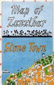
 Sample #1 of the topographic map.
 Sample #2 of the trekking map.
 Sample #3 of the Mendoza city map.
 Sample of Wet Season map
 Sample of the Kilimanjaro map detail
 Sample detail from the Kilimanjaro map.
 Larger image of the Mt. Kilimanjaro paperweight.
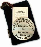
 Larger image of the Mt. Kilimanjaro summit sign paperweight.
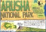
 Sample of Wet Season map
 Thumbnail of the front of the map
 Thumbnail of the reverse of the map
 Image of the front side of the Arusha map.
 Image of the reverse side of the Arusha map.
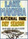
 Sample of Wet Season map detail
 Sample of Dry Season map detail
 Thumbnail of the "wet season" side of the map
 Thumbnail of the "dry season" side of the map
 Image of the front side of the Lake Manyara map.
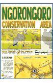
 Sample of Wet Season map
 Thumbnail of the front of the map
 Thumbnail of the reverse of the map
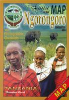
 Sample detail of the Ngorongoro travel map
 Sample of Serengeti Wet Season map detail
 Sample of Serengeti Dry Season map detail
 Thumbnail of the front of the Serengeti map (wet season)
 Thumbnail of the reverse of the Serengeti map (dry season)
 Image of the front of the Serengeti map
 Image of the reverse of the Serengeti map
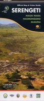
 Sample of the Serengeti map detail
 Sketch map showing Serengeti map coverage
 Thumbnail of the front of the map
 Thumbnail of the reverse of the map
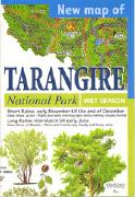
 Sample of the Tarangire map.
 Thumbnail of the front of the map
 Thumbnail of the reverse of the map
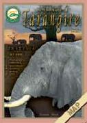
 Image of the front side of the Arusha map.
 Image of the reverse side of the Arusha map.
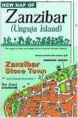
 Image of the front of the Zanzibar & Stone Town map.
 Image of the reverse of the Zanzibar map.