Ontario Maps


Ontario Maps - scroll down page


      Canada Road Maps, City Maps, and Atlases

    • Canada Road & Street Atlases

    • Canada Province Road and Recreation Maps - Paper

    • Canada Province Road Maps - Laminated

    • Canada City Street Maps - Paper

    • Canada City Street Maps - Laminated
    • Canada Hiking Maps & Atlases

    • Canada Backroads Mapbooks. Topographic recreation road atlases.

    • National Park Maps by GoTrekker. Many maps for the northern National Parks.

    • Gem Trek hiking maps. Hiking/topo maps of Banff N.P., Jasper N.P., etc.

    • Chrismar hiking and canoeing maps.

    • Hiking Maps by ITMB.
    • Canada Fishing Maps
      Canada Raised Relief Maps

    • Backroads Fishing Atlases.

    • Canada Lake/river fishing maps.

    • Canada Raised Relief Maps.
    • Canada Topographic Maps

    • Canada 1:50,000 Topographic Maps. Itemized topo lists, index maps, sample images.

    • Canada 1:250,000 Topographic Maps. Itemized topo lists, index maps, sample images.

    • Canada 1:500,000 VNC Aeronautical/topographic maps.

    • Canada 1:1,000,000 WAC Aeronautical/topographic maps.
    • Canada Wall Maps
      Canada Railway Maps
      Canada Geology Maps

    • Canada Wall Maps.

    • Canada Satellite Image Posters.

    • Canada Railway Maps and Atlas.

    • Canada & Provincial Geologic and Thematic Maps .
    • Canada Flags
      Map Pins & Map Flags
      Gifts for Map Lovers

    • Canada Flags.

    • Map Pins, Map Tacks, Map Flags.

    • Gifts for the Map Enthusiast.

    •  


      Ontario & Quebec Travel Atlas. Scales vary. ITMB, 2016.

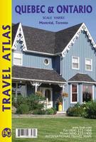
      ITMB presents in a compact atlas format the ideal way for visitors to explore two very different but at the same time two very similar societies that have been closely linked for more than 400 years. It includes Niagara Falls, Toronto, the Thousand Islands, Cottage Country, Ottawa, Montreal and the Laurentians, Quebec City and the North Shore, the Eastern Townships and the unsurpassable Gaspe Peninsula. All in one volume!
      Ordering (Can.) Quebec and Ontario atlas (ITM)$16.9564-32902Atlas.


      Southern Ontario Road Map. 1:550,000. ITMB, 2016.

      The province of Ontario is huge, with the geographic center being nearly 1000 miles north of the nearest road. This map centers on the small ppulated area of the southern border area, south of Sudbury and North Bay. The map covers from Detroit to London and Toronto, Buffalo, and the Bruce Peninsula. The reverse side covers from Toronto to Quebec border, Ottawa, and the Kawarthas.
      Front of the Southern Ontario travel map.
      Reverse of the Southern Ontario travel map.
      Ordering (Can.) Southern Ontario road map (ITM)$9.9564-349011 sheet, folded.


      image


      © Copyright 2025 East View Companies, Inc.
      5130 Industrial Street, Suite 100, Maple Plain, MN 55359-8005
      All Rights Reserved
      For more information please Contact Us