|
|
Gem Trek Hiking/topo Maps for the Columbia Icefield and other areas in British Columbia and Alberta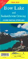
Bow Lake - Saskatchewan Crossing (map #3). 1:70,000. Explore this wonderous area in the heart of the Rockies, with the aid of this map. Includes all types of trails for all kinds of activities. Bow Lake, The Crossing, Wapta Icefield, Glacier Lake, Pinto Lake, Peyto Lake and Hector Lake are some of the attractions.  Thumbnail of the map. Thumbnail of the map.
 Detail of the map. Detail of the map.
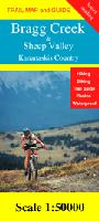
Bragg Creek & Sheep Valley (map #8). 1:50,000. This map is a new addition to the Kananaskis map series. The map covers the very popular hiking and skiing terrain accessed via Bragg Creek.
|
||||||||||||||||||||||||||||||||||||||||||||||||||||||||||||||||||||||||||||||||||||||||||||
 Canada Hiking Maps by Gem Trek
 Gem Trek's Maps for the Rocky Mountains. Gem Trek Publishing, Canada. This series offers hiking maps for a variety of popular tourist locals, particularly in the "big three" national parks of Banff, Jasper, and Yoho in the Canadian Rocky Mountains.
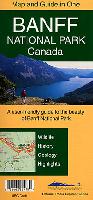
 Index map showing the National Park and regional maps.
 Index map showing the four large-area driving maps.
 Sample of the shaded relief features seen on 11 of the Gem Trek maps.
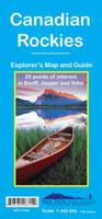
 Thumbnail of the front of the map
 Thumbnail of the reverse of the map
 Thumbnail of the front of the map
 Thumbnail of the reverse of the map
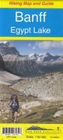
 Sample detail from the Highland and Cataract Creek map.
 Thumbnail image of the Highland and Cataract Creek map.
 Thumbnail of the front of the map
 Thumbnail of the reverse of the map
 Sample of the detail.
 Thumbnail of the front of the map
 Thumbnail of the reverse of the map
 Detail of the map.
 Thumbnail of the front of the map
 Thumbnail of the reverse of the map
 Detail of the map.
 Thumbnail of the front of the map
 Thumbnail of the reverse of the map
 Detail of the map.
 Thumbnail of the front of the map
 Thumbnail of the reverse of the map
 Sample of the detail.
 Waterproof
 Thumbnail of the front of the map
 Thumbnail of the reverse of the map
 Detail of the map.
 Thumbnail of the front of the map
 Thumbnail of the reverse of the map
 Detail of the map.
 Thumbnail of the map.
 Thumbnail of the reverse side of the map.
 Detail of the map.
 Thumbnail of the front of the map
 Thumbnail of the reverse of the map
 Detail of the map.
 Thumbnail of the map.
 Thumbnail of the reverse side of the map.
 Waterproof
 Sample detail from the Highland and Cataract Creek map.
 Thumbnail image of the Highland and Cataract Creek map.
 Thumbnail of the front of the map
 Thumbnail of the reverse of the map
 Detail of the map.
 Thumbnail of the map.
 Reverse side of the map.
 Detail of the map.
 Waterproof
 Thumbnail of the front of the map
 Thumbnail of the back side of the map
 Thumbnail of the front of the map
 Thumbnail of the reverse of the map
 Detail of the map.
 Thumbnail of the front of the map
 Thumbnail of the reverse of the map
 Thumbnail of the map.