Massachusetts Regional Atlases. American Map.
These atlases are full-color street detail atlases which feature Airports, Block Numbers, Colleges and Universities, Golf Courses, Parks and Rec Areas, Places of Interest, Regional Maps, Schools, and ZIP Codes.
$24.99
62-73922WO
Central Massachusetts & Worcester Street Atlas.
$32.99
62-73904
Eastern Massachusetts & Boston Metro Street Atlas.
$24.99
62-73922WE
Western Massachusetts Street Atlas.
Massachusetts Road Maps - Paper Maps.
Massachusetts Road Map. Rand McNally. Detailed road map of Massachusetts. Includes inset maps of Boston & Vicinity, Downtown Boston, Cape Cod National Seashore, Lowell/Lawrence, New Bedford/Fall River, Springfield, and Worcester. Map size is 28 x 40 inches unfolded.
$5.99
62-73902
1 sheet, folded.
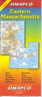
Massachusetts Road Map. Jimapco. Road map of the state of Massachusetts. Includes cities, villages, hamlets, major roads, highways, interstates, parks, state campgrounds, recreation areas, historic sites, and points of interest. Includes expanded maps of Greater Boston, downtown Boston, the 495 corridor from Newburyport to Lowell, Brockton, New Bedford, Fall River and Greater Springfield. Fully indexed for communities and points of interest. Turnpike mileage chart included. Map size is 25 c 38 inches unfolded.
Sample detail #1 from the Massachusetts road map Sample detail #2 from the Massachusetts road map
Massachusetts Road Map. American Map. The Massachusetts State fold map is a full-color, regional map, including: Brockton, Fall River, Lawrence, Lowell, New Bedford, Springfield, and Worcester.
Central Massachusetts Road Map. Regional map of eastern Massachusetts with an inset of the Greater Boston area. Fully indexed. Map size is 25 x 38 inches unfolded.
$6.95
62-73907-EA
Eastern Massachusetts Road Map. This regional map centers on Worcester and covers from the Quabbin Reservoir to Lowell. Includes expanded maps for Gardner, Fitchburg, Leominster, Marlborough, and Worcester. Fully indexed. Map size is 25 x 38 inches unfolded.
Massachusetts Road Maps - Laminated Maps.
Laminated Massachusetts Easy-to-Fold® Road Map. Rand McNally. A surprisingly detailed map of Massachusetts, considering the smaller size. Map size is 17 x 18 inches unfolded, ideal for using in a car or for leaving in your glove box.
$9.99
62-73903
1 sheet, folded.
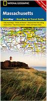
Laminated Massachusetts Guidemap Road Map. National Geographic Maps. The front side is an easy-to-read road map with insets of: - Lowell - Downtown Boston - Worcester - Springfield - Providence, RI - New Bedford / Fall River The back includes: - Map and information for Boston - Information for Cap Cod National Seashore - Points of interest - Scenic drive - Park Service sites in Massachusetts. Map size is 18 x 25 inches unfolded.
Sample detail from the Massachusetts Guidemap Front of the Massachusetts Guidemap Reverse side of the Massachusetts Guidemap
$9.99
62-73903
1 sheet, folded.
Massachusetts City Maps - Paper Maps.
Boston City Maps - Paper Maps.
Boston PopOut Map. PopOut/Compass Maps. Explore the historic city of Boston, birthplace of the American Revolution, with the help of this genuinely pocket-sized map. Small in size yet big on detail, this compact, dependable map will ensure you don't miss a thing.
Includes 2 popout maps - a detailed street by street plan of downtown Boston and an overview map of greater Boston
Additional maps of Beacon Hill, Harvard Square and the subway are also included
Harvard Square map includes a guided 1hour walking tour identifying all the key sights along the way
Ingenious, self-folding map is small enough to fit in your pocket yet offers extensive coverage of the city in an easy-to-use format
Thorough street index is also featured and cross-referenced to the map so you can easily find your destination
Key places of interest are listed offering you advice on the best things to see
$6.95
62-7392BN
1 sheet, folded.
Boston PopUp Map. Van Dam. VanDam's best selling Boston Pop-Up maps all of Boston's attractions, neighborhoods, museums, hotels and more in our new easy to unfold format. Includes detailed maps of Metro Boston, The Freedom Trail, and Boston's transit system.
This compact map package refolds easily to 3.75" x 6" (8.5" x 11" open) and fits discreetly in your shirt pocket. Complete street index and Manhattan subway map make navigating Beantown easy.
Sample detail #1 from the Boston PopUp map Sample detail #2 from the Boston PopUp map
$6.95
62-73921BP
1 sheet, folded.
Boston Street Map. Rand McNally. The map covers Boston, Arlington, Braintree, Brockton, Brookline, Cambridge, Dedham, Malden, Medford, Milton, Needham, Newton, Norwood, Quincy, Revere, and Waltham. Map size is 28 x 40 inches unfolded.
$6.99
62-7392BM
1 sheet, folded.
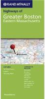
Highways of Greater Boston Street Map. Rand McNally. The map covers Boston and eastern Massachusetts. The map shows main roads and streets throughout a much larger area than, but is not as detailed as, the 'Boston' map above. Map size is 28 x 40 inches unfolded.
$5.99
62-7392BD
1 sheet, folded.
Waterproof! Boston Street Map & Northeast USA Road Map. ITMB. Travel map of Boston, Massachusetts, shows roads from expressways and Mass. Turnpike to minor roads; pedestrian paths and bicycle routes; commuter train, high-speed train, and other rail lines; bus terminals; tourist information; points of interest; parks; theaters and cinemas; museums and galleries; shopping; post offices; police stations; accommodations; more. With street index; maps of Boston transit system and greater Boston area. Main map scale 1:10,000. Distances in meters and feet. The reverse side has a detailed regional map of the northeastern States - New England and the eastern portions of New York State and Pennsylvania. Essentially, this is a map that would prove useful for a visitor perhaps landing in the USA at Boston's Logan Airport, seeing the city, and wishing to drive to Washington or Philadelphia or spend a few days exploring the New England States without needing to purchase a second map.
Sample detail from the Boston street map Sample detail from the NE USA road map
$10.95
62-20913-NE
1 sheet, folded.
Greater Boston Street Map. American Map. This full-color street map of Greater Boston, MA includes: Brookline, Cambridge, Milton, and Somerville; and features: Airports, Colleges and Universities, Commuter Rail Stations, Downtown Boston, Parks and Gardens, Places of Interest, Rapid Transit Stations, and ZIP Codes.
$5.99
62-7392B
1 sheet, folded.
Boston and Cambridge Street Map. 1:11,000. Global Graphics.
This full-color street map covers Central Boston with street index, including "T" System map and places of interest, plus Cambridge and Harvard University.
$5.95
62-7392BOS
1 sheet, folded.
Massachusetts City Maps other than Boston - Paper Maps.
Massachusetts Street Maps, other than Boston - Paper Maps. Various publishers.
$5.95
62-7372-BE
(MA) Berkshire County & Pittsfield Map. Also covers North Adams, Lee, Lenox, /Williamstown, Stockbridge, Great Barrington, Adams. 1:36,000 & 1:96,000. (Jimapco).
$5.99
62-7392CAL
Cape Cod Lower and Outer City Map. (American Map).
$4.95
62-7392LE
Lexington City Map. (GM Johnson).
$4.95
62-7392LO
Lowell City Map. (GM Johnson).
$4.95
62-7392NEB
New Bedford City Map. (GM Johnson).
$5.95
62-7392NOR
North Shore Street Map. (GM Johnson).
$4.95
62-7392PL
Plymouth City Map. (GM Johnson).
$4.95
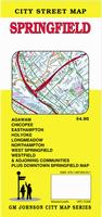
62-7392SPR
Springfield Street Map. (GM Johnson).
$4.95
62-7392WOR
Worchester City Map. (GM Johnson).
Massachusetts City Maps - Laminated Maps.
Boston City Maps - Laminated Maps.
Laminated Boston Streetsmart® Map. Van Dam. VanDam's award winning Boston StreetSmart maps all of Boston's attractions, neighborhoods, museums, hotels and more at an immensely legible scale with 3D buildings. Includes detail of Freedom Trail, Back Bay Cambridge and Harvard Square plus all transportation.
This sexy laminated city map package refolds easily to 4" x 9" (24" x 9" open) and snuggly fits into your pocket. "The Map" to Boston is updated anually! Buy this map to become as instant StreetSmart Bostonian.
Sample detail from the Boston Streetsmart map Front of the Boston Streetsmart map
$7.95
62-73921BV
1 sheet, folded.
Laminated Boston Street Map. Red Map.
The Essential guide to the best of Boston. Highlighting the historical neighborhoods of South End, Back Bay, Beacon Hill and Cambridge. Serving as the ultimate guide to cultural institutions, museums, parks, the designer boutiques of Newbury Street and Copley Plaza, as well as the tourist destinations of Boston and an easy to use "T" subway map. Map size is 24 x 9 unfolded.
Sample detail from the Boston RedMap street map
Laminated Boston Street Map. Borch Verlag.
Our soft-laminated folded map of Boston in the 16th edition shows: Boston Downtown 1:11 000, Eastern Massachusetts 1:600 000, Boston and Region 1:200 000, Logan International Airport 1:33 000, Public Transport Boston, Top 30 Sights and USA administrative and time zones. Borch maps are easy to fold, durable and water-repellent with a wipeable surface. Borch Maps show hotels, museums, monuments, markets, top sights and points of interest, useful statistics, conversion charts for temperatures, weights and measurements, climate charts showing temperatures, sunshine hours, precipitation and humidity, overview maps, time zones, and much more...
Sample detail from the Boston Streetwise map Front of the Boston Streetwise map
$9.95
62-7392BB
1 sheet, folded.
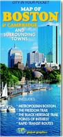
Boston Destination Street Map. National Geographic Maps.
The Boston Destination City Map features detailed city information, richly layered with tourist and business travel locations. 3D styled drawings show famous buildings and landmarks for easy orientation. In addition to the easy-to-read map on the front, the back includes: Regional map; Subway map (The "T"); Airport diagram; Points of interest; Information on transportation, museums, guided tours, and more; Multi-language legend. Printed on waterproof, tear-resistant paper. Map size is 18 x 25 inches unfolded.
Sample detail #1 from the Boston Destination street map Front of the Boston Destination street map Reverse of the Boston Destination street map
$7.95
62-7392BT
1 sheet, folded.
Laminated Boston Street Map. American Map.
This map of Downtown Boston is durably laminated and contains extensive coverage. Laminated maps are easy to fold, write on, and wipe off. Coverage includes: Beacon Hill, Downtown Cambridge, East Boston, Cambridgeport, Chinatown, the Financial District, a Subway Lines Commuter Rail Map, South Boston Seaport, the Theater District, and the Waterfront.
Now out of print - limited stock left.
$8.99
62-73921BOL
1 sheet, folded.
Massachusetts City Maps, other than Boston - Laminated Maps.
Lawrence Quickmap, laminated. Includes Methuen, Andover. 1:26,147. (Jimapco).
$7.95
62-73921NE
Newton Quickmap, laminated. Also covers Wellesley, Needham. 1:26,147. (Jimapco).
$7.95
62-73921QU
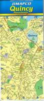
Quincy Quickmap, laminated. (Jimapco).
Massachusetts Street Atlases.
Massachusetts spiral-bound street atlases.
$32.99
62-73904
Boston & Eastern Massachusetts Street Atlas. (Universal Map).
$24.99
62-73922WO
Worcester & Central Massachuseetts Atlas. (American Map).
Massachusetts City Wall Maps
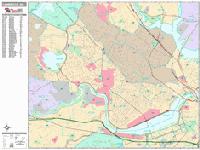
Massachusetts City Wall Maps.
When it comes to general planning, defining delivery areas, planning direct marketing and delivering products, our city wall maps are perfect to get the detailed information you need.
These maps offer clear mapping by showing all major streets and roads and many of the smaller streets, but leaving out the smallest streets. If you want a clear map for easy planning, then these are the maps for you; if you want a map showing every little back alley, these are not for you.
We offer wall maps for Boston, Brockton, Brookline, Cambridge, Chicopee, Fall River, Framingham, Haverhill, Lawrence, Lowell, Lynn, Malden, Medford, New Bedford, Newton, Peabody,
Quincy, Revere, Somerville, Springfield, Taunton, Waltham, Weymouth, and Worcester.
Click here to order and to see sample images, prices, sizes, and mounting options.
Massachusetts Bicycling Maps. There is one popular long-distance trail in Massachusetts - the Atlantic Coast Trail that crosses Massachusetts. We also stock several other cycling maps for Massachusetts.
Click here for our Massachusetts cycling maps list.
Appalachian Trail Maps for Massachusetts and the entire Trail. We stock all of the ATC maps and guides for the Appalachian Trail.
Click here for our complete Appalachian Trail listings.
New title Massachusetts and Rhode Island Lighthouses Map. Bella Terra, 2015.
This map takes the original Massachusetts map and adds coverage of all of the Rhode Island lighthouses and updates the Massachusetts data.
Detailed shaded relief map
Locations of all 100+ standing & "lost" lighthouses in
Shipwrecks of the Northeast USA Chart. 1:700.000. National Geographic Maps, 2011. "Shipwrecks of the Northeast" is a stunning new map illustrating more than 5,400 known shipwrecks on the untamed Atlantic coast of New England (Maine, Massachusetts, New Hampshire and Rhode Island). From Rhode Islands' Narragansett Bay to Maine's St. Croix River, the shipwrecks are clearly marked atop beautiful bathymetric and coastal detail. Each wreck site is symbolized to define the class, type and name of vessel accompanied by the date of sinking. Icons also indicate whether a ship was lost due to conflict or natural causes. Size is 28 x 36 inches.
Image of the Shipwrecks of the Northeast USA map Sample of the Shipwrecks of the Northeast USA map
$19.99
62-1718
1 sheet flat
$29.99
62-1718L
Laminated.
Cape Cod National Seashore Hiking Map. 1:45,000. Trails Illustrated/National Geographic Maps #250. Detailed topographic hiking/canoe map showing trails, beaches, scenic view, campgrounds, and much more. Printed on waterproof, tear-resistant synthetic paper.
$14.95
63-2100-250
1 sheet, folded.
Massachusetts Hiking Maps. Christopher Ryan. This is a series of hiking/topo maps covering several popular state parks, including the highest mountain in Massachusetts. The maps show hiking and ski trails, trail difficulty, land ownership (state vs. private), and usually extensive text on the reverse side.
$6.95
62-7371-01
Mt. Greylock (MA) Topographic/Hiking Map. 1:31,680. Christopher Ryan, 1995.
$6.95
62-7371-02
Holyoke Range State Park (MA) Map. 1:15,000. Christopher Ryan, 4th ed. 1996.
Wachusett Mountain & Leominster State Forest (MA) Topographic/Hiking Map. 1:18,000. Christopher Ryan, 4th edition, 1998.
$6.95
62-7371-05
Wapack Trail Topographic/Hiking Map (MA & NH). 1:24,000. Friends of Wapack, 1993.
$6.95
62-7371-06
Mt. Tom Reservation Topographic/Hiking Map. 1:15,000. Christopher Ryan, 3rd edition, 1994.
$6.95
62-7371-07
Quabbin Reservation Topographic/Hiking Map. 1:45,000. Christopher Ryan, 2nd edition, 1986.
$6.95
62-7371-08
Connecticut River Guide in Massachusetts. 1:39,000. Christopher Ryan, 1st edition, 1991.
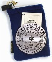
Mt. Greylock benchmark paperweight, lapel pin, and zipper pull. Geo-Situ.
Mt. Greylock rises to 3491 feet. Whether you're a climber, hiker, geography buff, or armchair traveler, you'll love to collect or give these unique bench mark paperweights that celebrate the spirit of exploration, athletic challenge, and personal achievement. Cast in pewter these summit marker paperweights are exact replicas of official USGS benchmark markers. Please click the "sample" button below to see an enlargement of the paperweight. Each marker has a soft felt pad on the bottom so these can be used on glass, wood, or any surface. Supplied in a soft fleece drawstring pouch, 3¼" diameter.
The lapel pin and the zipper pull - pendant are a 1" replicas, all cast in pewter.
Larger image of the Mt. Greylock paperweight.
$59.95
62-7397GR
Mt. Greylock Benchmark Paperweight.
$9.95
62-7397GRL
Mt. Greylock Benchmark lapel pin.
$11.95
62-7397GRZ
Mt. Greylock Benchmark Zipper pull / pendant.
Massachusetts Wall Maps.
Massachusetts State and County Wall Maps. Intelligent Direct.
We offer state and county wall maps for all of the USA. The maps come in sizes from 24 x 36 to 108 x 144 inches. They are available in variety of mounting and framing options. The maps are ideal for business applications, sales territory, delivery planning, direct mail targeting and hundreds of other applications.
Click here to order county wall maps and to see sample images, descriptions, and prices.
Click here to order state wall maps and to see sample images, descriptions, and prices.
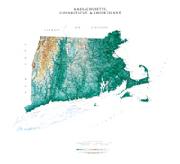
Massachusetts & Connecticut & Rhode Island Shaded Relief Wall Map. 1:500,000. Raven Maps.
Our map of southern New England places three historic states together. Elevations are represented by color, and this, in combination with our relief shading technique, gives the map a 3-dimensional look. Size is 81 x 91 cm (32 x 36").
Thumbnail of the map. Sample of the detail.
$40
62-7351
Each, rolled
$65
62-7351L
Laminated
Massachusetts, Connecticut, and Rhode Island Topographic Map. 1:500,000. 1971. USGS.
This is he official topographic map of the state. The map has contours, rivers, roads, cultural sites, etc. Map size is 76 x 61 cm.
Thumbnail of the Massachusetts topographic map.
$12.95
62-7350
Contoured topographic map
$24.95
62-7350L
Topographic map, laminated
Massachusetts Geologic Map.
Massachusetts Bedrock Geology Map. 1:250,000. 1983. USGS. Three sheets show the bedrock geology, the cross sections and tectonics, and legend. Map size is 147 x 107 cm.


 Sample detail #1 from the New England Road Atlas.
 Sample detail #2 from the New England Road Atlas.
 Sample detail from the Massachusetts Atlas and Gazetteer

 Sample detail #1 from the Massachusetts road map
 Sample detail #2 from the Massachusetts road map
 Sample detail from the Central Massachusetts road map
 Sample detail #1 from the Eastern Massachusetts road map
 Sample detail #2 from the Eastern Massachusetts road map
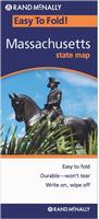 Laminated
 Laminated
 Sample detail from the Massachusetts Guidemap
 Front of the Massachusetts Guidemap
 Reverse side of the Massachusetts Guidemap

 Sample detail #1 from the Boston PopUp map
 Sample detail #2 from the Boston PopUp map
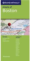
 Waterproof!
 Sample detail from the Boston street map
 Sample detail from the NE USA road map
 Laminated
 Sample detail from the Boston Streetsmart map
 Front of the Boston Streetsmart map
 Sample detail from the Boston RedMap street map
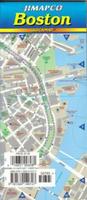
 Sample detail #1 from the Boston Quickmap street map
 Sample detail #2 from the Boston Quickmap street map
 Laminated
 Sample detail from the Boston Streetwise map
 Front of the Boston Streetwise map
 Sample detail #1 from the Boston Destination street map
 Front of the Boston Destination street map
 Reverse of the Boston Destination street map
 Laminated
 Laminated
 Sample detail #1 from the Quincy street map
 Sample detail #2 from the Quincy street map
 Sample detail from the Cambridge wall map.

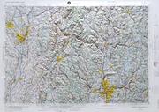 Massachusetts Raised Relief Maps. We have 1:250,000 sectional raised relief maps for eastern and western Massachusetts.
 Appalachian Trail Maps for Massachusetts and the entire Trail. We stock all of the ATC maps and guides for the Appalachian Trail.
 New title
 Front of the Massachusetts Lighthouses map
 Reverse of the Massachusetts Lighthouses map
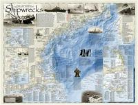
 Image of the Shipwrecks of the Northeast USA map
 Sample of the Shipwrecks of the Northeast USA map
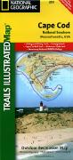

 Larger image of the Mt. Greylock paperweight.
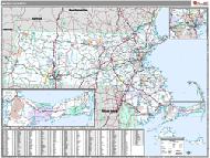 Massachusetts State and County Wall Maps. Intelligent Direct.
 Thumbnail of the map.
 Sample of the detail.
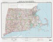
 Thumbnail of the Massachusetts topographic map.
 Massachusetts Flags