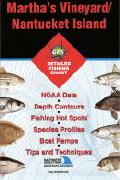
Massachusetts Saltwater Fishing Maps by Fishing Hot Spots are superb maps showing the lake bottoms for hundreds of lakes and rivers across the USA as well as near-shore saltwater fishing areas. These maps are printed on either kimdura or Hop-syn (both tear-resistent waterproof synthetic materials), making them nearly indestructible. The maps show lake bottom contours, shoreline features, roads leading to the lakes, boating facilities along the lake shore, and much more.
Fishing Map sample Enlargement
62-7393-MA0103
Cape Cod Bay.
$19.95
Massachusetts River Fishing Maps by Wilderness Adventures Press. An essential tool for a successful fly-fishing trip is a detailed map of the water. One that will give you the access points, boat launches, campgrounds, public areas, roads, and GPS coordinates to pinpoint your location.
 Massachusetts Saltwater Fishing Maps by Fishing Hot Spots are superb maps showing the lake bottoms for hundreds of lakes and rivers across the USA as well as near-shore saltwater fishing areas. These maps are printed on either kimdura or Hop-syn (both tear-resistent waterproof synthetic materials), making them nearly indestructible. The maps show lake bottom contours, shoreline features, roads leading to the lakes, boating facilities along the lake shore, and much more.
 Fishing Map sample
 Enlargement
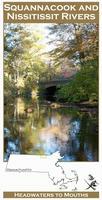
 Front of the Squannacook River fishing map
 Sample detail from the front of a river map from this series (Deschutes River)
 Sample detail from the back of a river map from this series (Truckee River)