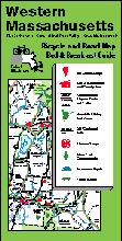
Regional Bicycle Maps & Recreation Maps. Rubel BikeMaps. This series of maps shows the various rideable roads in the area, plus such things as the location of the all-important homemade ice cream shops!
Also includes locations of bed & breakfasts, mountain biking trails, bike shops, recommended routes, swimming spots, and more. The map scale of 2 miles to the inch permits showing all those "connecting roads" that go through and are often desirable for cycling. The maps show far more detail than typical "state" maps and cover much more area than city maps.
General and recreation features include:
Detailed regional road network including street names;
Ice Cream Shop locations and guide;
Bed & Breakfast locations and guide including features and price range;
Parks, forests, and reservations locations and guide;
Many other parks and picnic areas;
Swimming spots (both fresh- and salt-water) locations and guide;
Hostels;
Points of interest;
Visitor information centers;
Commuter rail lines and stations.
Bicycle-specific features include:
Recommended roads for cycling highlighted;
Hill arrows point uphill; thicker arrows indicate longer or steeper hills;
Martha's Vineyard and Nantucket Island Recreation Map.
$1.95
62-73862
Eastern Massachusetts Bicycle Map.
$5.95
Massachusetts Bicycling Map. American Bike Trails. Covers over 85 trails in Massachusetts. This series of maps and journals offers full state coverage of several mid-western & eastern states.
Trail to Map index
City to Trail index
County to Trail index
Trail Facts: Length, surface, biking type (road or mountain bike)
Trail settings - wooded, prairie, open, wetlands, etc.
Alternate trail uses - hiking, in-line skating, equestrian, etc.
Trail facilities - water, toilets, food, camping, etc.
Massachusetts Bicycling Trails & Ride Journal. American Bike Trails. Covers over 85 trails in Massachusetts. This series of journals and maps offers full state coverage of several mid-western & eastern states.
Easy to use log for recording and referencing your rides
Trail Facts: Length, surface, biking type (road or mountain bike)
Trail settings - wooded, prairie, open, wetlands, etc.
Alternate trail uses - hiking, in-line skating, equestrian, etc.
Trail facilities - water, toilets, food, camping, etc.
Trail coordinates - latitudes/longitudes
Trail notes - general descriptions
62-73851
Journal.
$9.95
Massachusetts' Bicycle Trails Guide. American Bike Trails. Over 50 trails throughout Massachusetts, both surfaced and mountain biking.
Illustrated, easy to use reference and use section
Directions to trail sites and access points
Locations and distances to nearby communities
Trail distances, general setting, conditions and facilities
Points of interest
Sectional overviews
Contacts for additional information.
62-73852
Guide
$16.95
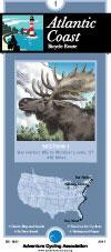
Atlantic Coast Route Series. Adventure Cycling Association. 2,525 miles -- Adventure Cycling's Atlantic Coast
route, from Bar Harbor, Maine, to Ft. Myers Beach, Florida, takes you through a region rich in history. The route passes directly through Washington, D.C. and Richmond, and is linked with spurs to Boston,
New York, Philadelphia, Baltimore, Charleston and Savannah. The Florida Connector map offers a tranquil side trip from St. Augustine to Ft. Myers Beach via the Orlando area, then on to Ft. Lauderdale, bypassing the busy A1A coastal route.
Route map.
62-2230-AC
Bar Harbor, ME to Ft. Myers Beach, FL. Set of 8 maps. 10% discount!
$120.60
62-2230-AC1
Bar Harbor, ME to Windsor Locks, CT
$16.75
62-2230-AC2
Windsor Locks, CT to Norristown, PA
$16.75
62-2230-AC3
Norristown, PA to Richmond, VA
$16.75
62-2230-AC4
Richmond, VA to Wilmington, NC
$16.75
62-2230-AC5
Wilmington, NC to Statesboro, GA
$16.75
62-2230-AC6
Statesboro, GA to St. Augustine, FL
$16.75
62-2230-AC7
St. Augustine to Key West, FL
$16.75
62-2230-AC8
Florida Connector map - St. Augustine, DisneyWorld, Ft. Myers Beach, to Ft. Lauderdale.
 Sample of the map detail.
 Sample of the map detail from the Iowa map in the same series.

 Route map.