Contact information. Includes contact e-mails, telephone and fax numbers, and mailing address.
US Forest Service
U.S. Forest Service Maps - new editions.
$15.99
62-53792
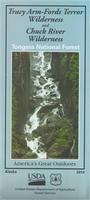
Tongass NF - Tracy Arm-Fords Terror Wilderness & Chuck River Wilderness map. 1:168,960. 2014. The fjords of Tracy Arm and Endicott Arm comprise a primeval sanctuary where the ageless cycles of rock and ice, and seals and eagles expand our perceptions of wilderness. ISBN 9781593519407.
(GA) Atlanta Metro Street Atlas. ADC. Size 8.5 x 11", spiral-bound. ISBN 9780762587988. The Atlanta, GA Metro Atlas is a full-color street atlas, including: Alpharetta, Austell, Chamblee, College Park, Decatur, Duluth, Dunwoody, East Point, Fairburn, Forest Park, Johns Creek, Kennesaw, Lake City, Lilburn, Marietta, Morrow, Norcross, Riverdale, Roswell, Sandy Springs, Smyrna, Stone Mountain, Union City, and Woodstock; and features: Airports, Block Numbers, Colleges and Universities, Downtown Atlanta, Golf Courses, Hospitals, Parks and Rec Areas, Places of Interest, Schools, and ZIP Codes.
$22.99
62-7290
Maryland & Delaware Road Atlas. ADC. Size 8.5 x 11", spiral-bound. ISBN 0762590351. The Maryland and Delaware State Travel Atlas is a full-color street detail atlas, including street-detail insets of: Annapolis, Bowie, Cheverly, Cumberland, Frederick, Frostburg, Gaithersburg, Glenarden, Greenbelt, Hagerstown, Laurel, New Carrollton, Ocean City, Rockville, Salisbury, Severn, Silver Spring, Waldorf, and Westminster, in Maryland; and Dover, Middletown, Milford, Newark, Seaford, Smyrna, and Wilmington, in Delaware; and features: Andrews Air Force Base, detailed Attractions, Golf Courses, a Mileage Chart, Museums, and Parks and Rec Areas.
$19.99
62-84922NA
(NY) Nassau County Street Atlas. Hagstrom. Size 8.5 x 11", softbound. ISBN 0762585145. The Nassau County, NY Atlas is a full-color street atlas and features: Airports, Block Numbers, Colleges and Universities, Golf Courses, Marinas, Parks and Rec Areas, Places of Interest, Regional Maps, and ZIP Codes.
$21.99
62-90921CH
(PA) Chester County Street Atlas. ADC. Size 10.25 x 13.25", softbound. ISBN 9780762591336. The Chester County, PA Atlas is a full-color street atlas, Airports, Block Numbers, Colleges and Universities, Golf Courses, Marinas, Parks and Rec Areas, Places of Interest, Regional Maps, and ZIP Codes.
$24.99
62-9890RI
(VA) Richmond Metro Street Atlas. ADC, 2017. Size 10.25 x 13.25", spiral-bound. ISBN 0762590971. The Metro Richmond, VA Atlas is a full-color street atlas, including: Colonial Heights, Hopewell, Petersburg, and Williamsburg; and features: Airports, Block Numbers, Colleges and Universities, Downtown Richmond, Golf Courses, Hospitals, Parks and Rec Areas, Places of Interest, Regional Maps, Schools, and ZIP Codes.
(FL) Miami Street Map. American Map. ISBN 0762588314. This full-color street map of Miami, FL includes: Aventura, Coral Gables, Hialeah, Key Biscayne, Miami Beach, Miami Gardens, Miami Shores, Miami Springs, North Miami Beach, Opa-Locka, Pinecrest, Surfside, and West Miami; and features: Airports, Block Numbers, Colleges and Universities, Golf Courses, Hospitals, Marinas, Parks and Rec Areas, Places of Interest, and ZIP Codes.
$9.99
62-7390
Massachusetts Road Map. American Map. ISBN 9780762587988. The Massachusetts State fold map is a full-color, regional map, including Detail insets of: Boston & Vicinity, Downtown Boston, Lowell, New Bedford, Pittsfield, Springfield & Worcester; and featuring: Campgrounds, , Ferry Routes, Interstate Exit Numbers, Longitude & Latitude Information, Massachusetts Facts, Mileage Table, Parks & Rec Areas, Places of Interest, Scenic Routes & Ski Areas.
$6.99
62-74904
Michigan Road Map. Universal Map, 2017. ISBN 0762590238. The Michigan fold map is a full-color, regional map, including detailed insets of: Battle Creek, Detroit, Flint, Grand Rapids, Jackson, Kalamazoo, Lansing, Marquette, Saginaw, Sault Saint Marie, Traverse, and Isle Royale National Park; and features: Airports, Interstate Exit Numbers, Latitude and Longitude information, Michigan facts, Parks and Rec Areas, Places of Interest, and Ski Areas.
Armenia Road Map
Waterproof Armenia Road Map. 1:250,000. Reise Know-How, 2015.
Road and rail networks are easy to see on a clear base which shows the countrys topography by altitude coloring with contours, spot heights, mountain passes, and names of mountain ranges. National parks and other protected areas are marked. Road network includes minor local roads, indicates border crossings, and shows intermediate driving distances on main and on selected secondary roads. Double-sided, printed on waterproof and tear-resistant synthetic paper.
Sample detail from the Armenia road map.
$14.99
65-62900
1 sheet, folded.
Azerbaijan Road Map
Waterproof Azerbaijan Road Map. 1:400,000. Reise Know-How.
The map covers Azerbaijan and its Nakhchivan enclave; the armistice boundary of Nagorno-Karabakh is clearly marked, indicating open or closed border crossings, and where appropriate both Azeri and Armenian names of location are shown. Coverage includes eastern Armenia and south-eastern Georgia with Tbilisi. Double-sided, printed on waterproof and tear-resistant synthetic paper. ISBN 9783831773329.
Sample detail from the Azerbaijan road map.
$14.99
65-63902
1 sheet, folded.
Denmark Maps and Atlases
New edition Denmark Road Atlas. 1:200,000. Legind, 2017.
Detailed road atlas of Denmark. In Danish only. Spiral-bound in a small slip-case. ISBN 9788771553758.
Sample detail from the Denmark road atlas.
$37.95
64-47895
Atlas.
New edition Denmark Tourist Road Map. 1:500,000. Nordisk Korthandel, 2017.
Good overview road map of Denmark. Multilingual, including English. ISBN 9788779671225.
$12.99
64-47902
1 sheet, folded.
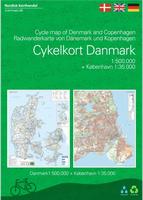
New edition Denmark Cycling Map with Copenhagen Regional Cycling Map. 1:500,000 & 1:35,000. Nordisk Korthandel, 2017.
This map contains national and regional cycle routes, cycle paths, hostels, campsites, tourist information etc. Information about Danish traffic rules for bicycling is included. There are more than 160 regional and 11 national cycle routes on the map, and new routes like Kulturringen (East Jutland) and Vestegnsruten (Copenhagen) are included.
The Cycle Map is a planning map, giving an overview of the possibilities for bicyclists.
New maps! Denmark Regional Cycling Maps. 1:100,000. Nordisk Korthandel, 2016.
These three maps complete the set of eight maps that offer complete coverage of Denmark, showing national, regional, and local cycling routes, cycle paths, hostels, campgrounds, tourist information, and more. The maps are trilingual English, Danish, and German.
Sample detail from the southern Jutland cycling map.
$28.99
64-4771-5
Northern Jutland Cycling Map. 2016. ISBN 9788779671096.
$28.99
64-4771-6
West Jutland Cycling Map. 2016. ISBN 9788779671072.
$28.99
64-4771-7
Southern Jutland Cycling Map. 2016. ISBN 9788779671065.
Northern Zeeland Cycling Map. 2017. ISBN 9788779671164.
$28.99
64-4771-2
Southern Zeeland Cycling Map. 2017. ISBN 9788779671171.
New title Denmark Regional Cycling Guides. Nordisk Korthandel, 2017.
There are new cycling guides available to accompany sheets 1 and 2 in the regional cycling series.
Guidebook with 12 tour suggestions for cycling in Northern Zealand. The tour suggestions describe, in a poetical way, the landscape and attractions you will see along the way. The book contains descriptions in English, Danish, and German, and has small overview maps of the routes and attractions for each tour. The tours can be used as day trips or be composed into a bicycle vacation of your choosing.
$28.99
64-4771-1G
Northern Zeeland Cycling Guide. 2017. ISBN 9788779671188.
$28.99
64-4771-2G
Southern Zeeland Cycling Guide. 2017. ISBN 9788779671195.
Faroe Maps
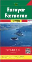
Faroe Islands Map. 1:100,000. Freytag/Berndt & Solberg, 2017.
This is a very detailed map of the Faroe Islands. In cooperation with Solberg, a local map maker, Freytag und Berndt has made a very good map with hiking trails, highways, the complete road network and an inset map of Torshavn. The campsites and the youth hostels are marked. With a multilingual legend, including English. ISBN 9783707915129.
Sample detail #1 from the Faroe Islands hiking map. Sample detail #2 from the Faroe Islands hiking map.
$32.99
64-47541
1 sheet, folded.
France Maps
Greenways and Cycle Routes of France. 1:1,000,000. IGN, 2015.
Greenways and Cycle Routes of France map highlights numerous international, national and regional cycling routes, indicating their official number and the type of road surface. The map includes QR codes for downloading descriptions of individual routes as well as for the EuroVelo and the Grand Itineraires Nationaux.
The base map is IGN's general road map of France with railway stations added. Map legend and a general description of the Greenways (voies vertes) network are in English and French languages. The map also provides brief descriptions in French of the EuroVelo routes and selected National Trails.
Sample detail from the france Greenways and cycle routes map.
$13.99
64-5664-924
1 sheet, folded.
(Italy) Dolomites Road Maps
Dolomites UNESCO Tourist Map. 1:150,000. Tabacco, 2016.
On the front, the map shows information on the formation of the Dolomites. On the back is a 1:150:000 road map illustrating the nine areas of the Dolomites that are now a UNESCO World Heritage Site. Coverage extends from the Austrian border to just past Trento and Feltre, and west/east from the Ortles Massif to well east of Belluno.
Sample detail from the france Greenways and cycle routes map.
$15.99
64-8274-DO
1 sheet, folded.
Japan Hiking Maps
New editions
Japan hiking maps. 1:50,000. Shobunsha,2017.
These are superb topographic hiking maps for the most popular areas in Japan. The maps listed below were updated in 2017. Each map comes with an English translation of the map legend.
#42 - Mt. Kita-dake hiking map. Mt. Kita-dake is the second highest mountain in Japan (after Mt. Fuji).
$13.99
64-8575-43
#43 - Mt. Shiomi & Mt. Akaishi hiking map.
$13.99
64-8575-47
#47 - Kitayama Mountains hiking map. Popular area just outside Kyoto.
$13.99
64-8575-51
#51 - Mt. Omine, Mt. Hachigyogatake, and Mt. Shakagatake hiking map. Includes Yoshino-Kumano National Park on the Kii Peninsula.
$13.99
64-8575-57
#57 - Mt. Aso hiking map. Includes Aso-Kuju National Park on Kyushu.
$13.99
64-8575-59
#59 - Mt. Kaimondake hiking map. Spectacular active volcanos in southern Kyushu.
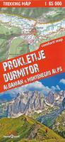
Montenegro Maps
Waterproof Prokletije National Park map. 1:65,000. TerraQuest, 2017.
The Prokletije (Cursed Mountains) trekking map in the border region of Albania, Montenegro and Kosovo covers the area of the highest and most beautiful sections of the Dinaric Alps. The map covers the Prokletije Mountains, Lumi and Gashi National Parks, Lugina and Valbona, Thethi and an insert on the Durmitor Mountains in northwest Montenegro. ISBN 9788361155430.
Sample detail #1 from the Prokletije National Park map. Sample detail #2 from the Prokletije National Park map.
$20.99
65-88751
1 sheet, folded.
Pyrenees Maps
Pyrenees Road Map. 1:400,000. France IGN, 2016.
This map replaces the old France IGN Pyrenees map at the same scale. This Rando Editions version covers the Pyrenees from coast to coast and with good coverage on both sides of the France - Spain border. Coverage extends from Auch, Toulouse and Béziers in France to Bilbao, Logrono, Zaragoza, Lleida and Barcelona in Spain; plus prominent highlighting of the regions national amd regional parks. The map does not have any geographic coordinates unfortunately. The map legend includes English, but the descriptive text is in French only. ISBN 9782344013403.
Sample detail from the Pyrenees map.
$14.99
64-56870
1 sheet, folded.
Pyrenees Road Maps. 1:200,000. France IGN, 2013.
These two maps offer excellent detail of the topography through contours and shaded relief, numerous names of topographic features, long-distance GR hiking routes, places of interest, etc. The maps have 100m contours, legends which include English, etc.
The eastern map offers coverage of the eastern part of the Pyrenees together with much of Languedoc-Roussillon region, extending along the coast to Montpellier and north to Toulouse. The overprint highlights both the GR10 and the GR 11 on the Spanish side. ISBN 9782758530497.
Stockholm City Map. 1:25,000. Norstedts, Sweden.
The map shows road names, bike trails, bathing places, swimming pools, park playgrounds, nature reserves and much more. Coverage area from Sollentuna / Täby in the north to Tumba / Huddinge to the south. Map legend is trilingual, including English.
Sample detail from the Stockholm map. Sketch map showing coverage of the Stockholm map.
$19.99
65-3895SM
1 sheet, folded.
Visiting North Carolina? Like to visit Omni? Please click here for a Mapquest map to our offices. If you are passing through central North Carolina, we would be pleased to have you visit our store and warehouse. We are located about 30 minutes east of Greensboro, 60 minutes west of Raleigh, and 2 hours northeast of Charlotte. We are open Monday-Friday 8am - 5:30pm and weekends by prior arrangement.
Contact information: For information on a map or other product: [email protected] To place an order or check on an order: [email protected] For questions on an invoice: [email protected] Phone: (1) 336-227-8300
Fax: (1) 336-227-3748

 Laminated
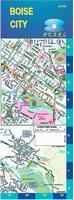
 Sample detail from the Boise map.
 Thumbnail of the front of the Boise map.
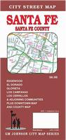
 Sample detail from the Santa Fe map.
 Thumbnail of the front of the Santa Fe map.
 Thumbnail of the reverse of the Santa Fe map.
 Sample detail from the Chester County Street Atlas.
 Sample detail from the Massachuseetts road map.
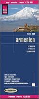 Waterproof
 Sample detail from the Armenia road map.
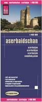 Waterproof
 Sample detail from the Azerbaijan road map.
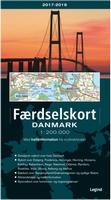 New edition
 Sample detail from the Denmark road atlas.
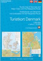 New edition
 New edition
 Sample detail from the Denmark cycling map.
 Thumbnail of the Denmark cycling map.
 Sample detail from the Copenhagen cycling map.
 New maps!
 Sample detail from the southern Jutland cycling map.
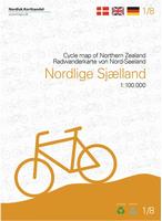 New edition
 Sample detail from the Northern Zeeland cycling map.
 Sample detail from the Southern Zeeland cycling map.
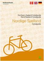 New title
 Sample detail #1 from the Faroe Islands hiking map.
 Sample detail #2 from the Faroe Islands hiking map.
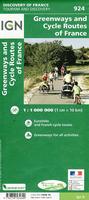
 Sample detail from the france Greenways and cycle routes map.
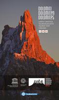
 Sample detail from the france Greenways and cycle routes map.
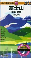 New editions
 Sample detail from the Mt. Fuji map.
 Sample detail from the Central Japanese Alps map.


 Waterproof
 Sample detail #1 from the Prokletije National Park map.
 Sample detail #2 from the Prokletije National Park map.
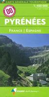
 Sample detail from the Pyrenees map.
 Sample detail from the Pyrenees map.
 Sketch map showing coverage of the Pyrenees East sheet
 Sketch map showing coverage of the Pyrenees West sheet
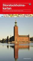
 Sample detail from the Stockholm map.
 Sketch map showing coverage of the Stockholm map.